The twelfth chapter of the Book of Joshua contains a list of thirty-one cities or petty kingdoms whose kings were slain by the Israelites during Joshua’s Conquest of Canaan:
And these are the kings of the country which Joshua and the children of Israel smote on this side Jordan on the west, from Baalgad in the valley of Lebanon even unto the mount Halak, that goeth up to Seir; which Joshua gave unto the tribes of Israel for a possession according to their divisions; In the mountains, and in the valleys, and in the plains, and in the springs, and in the wilderness, and in the south country; the Hittites, the Amorites, and the Canaanites, the Perizzites, the Hivites, and the Jebusites:
The king of Jericho, one; the king of Ai, which is beside Bethel, one;
The king of Jerusalem, one; the king of Hebron, one;
The king of Jarmuth, one; the king of Lachish, one;
The king of Eglon, one; the king of Gezer, one;
The king of Debir, one; the king of Geder, one;
The king of Hormah, one; the king of Arad, one;
The king of Libnah, one; the king of Adullam, one;
The king of Makkedah, one; the king of Bethel, one;
The king of Tappuah, one; the king of Hepher, one;
The king of Aphek, one; the king of Lasharon, one;
The king of Madon, one; the king of Hazor, one;
The king of Shimronmeron, one; the king of Achshaph, one;
The king of Taanach, one; the king of Megiddo, one;
The king of Kedesh, one; the king of Jokneam of Carmel, one;
The king of Dor in the coast of Dor, one; the king of the nations of Gilgal, one;
The king of Tirzah, one: all the kings thirty and one. (Joshua 12:7-24)

Several of the cities in this Summary List have already been mentioned (eg Jericho and Ai), while others have not (eg Hormah and Tappuah). What makes this roster of slain kings particularly interesting, however, are the discrepancies between it and the preceding account of the Conquest. For instance, Joshua 10:3 referred to Debir king of Eglon, whereas Joshua 12:12-13 refers to The king of Eglon ... The king of Debir. Assessing the historicity of this list is further compounded by the uncertainty surrounding the identities of many of these Canaanite cities:
This list includes more than twice as many cities as those mentioned in the preceding narratives, indicating how selective the narratives are. Of the total of thirty-one cities, only twenty have been securely identified with excavated sites. (Berlin & Brettler 485)
Ai and Bethel
In an earlier article—Part 61—we examined the archaeological evidence relating to Ai, an ancient city close to Bethel, and we hypothesized that the account of Joshua’s conquest of this city (Joshua 7:1-8:29) is a corrupt account of the actual conquest of Bethel. Ai, itself, was already an abandoned ruin in Joshua’s day. The narrative account of the Conquest (Joshua 5-11) does not mention the capture of Bethel, but the Summary List (Joshua 12) does include Bethel. This supports the hypothesis that Bethel and Ai have been confused.

Debir, Eglon and Adullam
In Part 64, we discussed the discrepancies surrounding the names Debir and Eglon: Are these the personal names of kings or are they the toponyms of Canaanite cities?
In Joshua 10, the King of Eglon is called Debir. But Debir was also the name of a city, and Eglon was also the name of a Moabite king. In fact, the place Eglon is not mentioned anywhere else in the Bible, and the personal name Debir only occurs in Joshua 10:3. This curiosity has led some scholars to suspect that the source for Joshua 10:3 was corrupt and the phrase ought to read Eglon King of Debir:
The name ‛Debir king of Eglon’ (Joshua 10.3) appears very odd, since Debir is a familiar city name and Eglon prominent as a king’s personal name. Moreover, the LXX has the city name Adullam where MT has Eglon. Various explanations are reviewed. It seems likely that Debir was indeed the city name and that it was transformed into a personal name in the course of redactional processes. (Barr 68)
To sum up: the phrase ‛Debir king of Eglon’ is, most probably, not the product of mere scribal miswriting but the product of a complicated process of combination, harmonization and revision of traditions, a process of which this part of the book of Joshua shows many signs, as commentators have seen. There were more relevant cities than the scheme of ‛five kings’ had room for. There was probably a serious tradition that took Adullam rather than Eglon as the place referred to several times. The variety of traditions still existing in the time of the LXX is shown by the list of (just over or under) thirty kings in ch. 12. The activity of creating names for persons of past history, sometimes using names of places for the purpose, is very likely. The very peculiar phrase ‛Debir king of Eglon’ is a result, and a sign, of these processes. (Barr 66)
All three names are included on the Summary List, where they are identified as royal cities which were conquered by Joshua and whose kings were slain. This leads me to doubt the historical accuracy of the Summary List.

Geder
Geder has been identified with the city of Gedera, which is mentioned in Joshua 15:36 and 1 Chronicles 4:23, and with the Gader of Eusebius’s Onomasticon. The Biblical Gedera is currently identified with Khirbet Judraya, which lies about 20 km southwest of Jerusalem and 26 km southeast of the modern Gedera, but this is far from certain. Tel Qatra, in the northern outskirts of the modern Gedera, has also been identified with the ancient Canaanite city. The name means Stone Pen and it now appears probable that there were several different settlements with this name or some variant of it:
Gederah: Khirbet Judraya? Tel Qatra? Khirbet Jedîreh? Tell Judeideh?
Gederoth: Khirbet el-Ḥamideh? Tell el-Akraʿ?
Gederothaim: Beit Nattîf? A dittography for Gederah?
Gederah has been identified with several different ruins. Albright identified the site with Tell Judeideh ... and Cross and Wright pointed to Khirbet Jedireh in the Aijalon Valley ... However, most scholars have identified the site with Khirbet Jûdraya in the Elah Valley just east of modern Kibbutz Netiv HaLamed Heh following Alt’s initial suggestion ... The presence of Iron Age (IIB) remains at the site over an area of 10 dunams ... and its close proximity to the large amount of Iron II sites surrounding Beit Nattîf ... would seem to make this identification probable. (McKinny 184)
I place Joshua’s Conquest of Canaan at the very beginning of the Late Bronze Age, so Iron Age remains are too late to support the claim that Joshua conquered this city. But there is one city of similar name that has Bronze Age remains:
Gederoth (תוֹרֵדְ ג; Γαδηρωθ) may be mentioned in the Philistine attack against Ahaz in 2 Chronicles 28:18, although this is likely a reference to a different Gederah or Gederoth in the northern Shephelah ... The site can hardly be associated with Qâtra, the location of modern Gederah, since this is located well north of the district in question ... There are several significant ruins located south of Lachish that would have been most likely included in the Zenan district. One such ruin is Tell el-Akraʿ (Tel Agra). Investigations at Tell el-Akraʿ revealed remains from the Early Bronze II (majority), Late Bronze, Iron II, Roman and Byzantine ... Dagan describes the ruin as being badly eroded, but showing evidence of a fortification wall 4-8 m high that surrounds the tell. (McKinny 202)
Tel Qatra was also settled throughout the Middle and Late Bronze Ages, but hitherto the only significant archaeological excavations carried out at the site have concentrated on the much later Byzantine settlement.

Hormah
Hormah is another site of uncertain identity, making it virtually impossible to confirm or refute the account in the Book of Joshua:
The enigmatic town of Hormah (הָמ ְרָח; Ερμα) is one of the more prevalent towns mentioned in association with the southern part of the country ... The town has been identified with various sites including Tell el-Khuweilfeh ... and Tell el-Meshash ... Using the same logic one might be able to identify Hormah with the unidentified Tell Beit Mirsim, which is 8 km north of Tell el-Khuweilfeh ... In any case, Tell Beit Mirsim is the only significant Canaanite and monarchical site in the region that has not been positively identified, which makes it a plausible candidate for biblical Hormah. Although it should be noted that scholars have noted the possibility that Hormah may be related to multiple sites in connection with the process of “abandonment and resettlement” in the Negeb ... Tell Beit Mirsim, like Tell el-Ḥesi, is one of the foundational excavations for the modern archaeological method. Albright’s excavations from 1926-1932 revealed a Bronze-Iron Age site with no later activity after the Babylonian destruction (Iron IIC) of the site. Albright uncovered a series of strata spanning from the Late Bronze Age (Stratum C) to the Iron I (stratum B) to the Iron II (stratum A). Albright and Greenberg identified Shishak as the destroyer of the stratum B fortified town. (McKinny 101-102)
There is nothing here that is particularly supportive of Joshua 12, though McKinny’s Table 3-6 confirms that Tell Beit Mirsim was settled during the Middle Bronze Age (McKinny 132). The situation is further complicated by the relationship between Hormah and Arad (see below).
Curiously, Numbers 14 relates a story is which the Israelites disobey Moses and try to invade Canaan from the south immediately after the return of the spies sent out by Moses to reconnoitre the land:
And Moses said, Wherefore now do ye transgress the commandment of the Lord? but it shall not prosper. Go not up, for the Lord is not among you; that ye be not smitten before your enemies. For the Amalekites and the Canaanites are there before you, and ye shall fall by the sword: because ye are turned away from the Lord, therefore the Lord will not be with you.
But they presumed to go up unto the hill top: nevertheless the ark of the covenant of the Lord, and Moses, departed not out of the camp. Then the Amalekites came down, and the Canaanites which dwelt in that hill, and smote them, and discomfited them, even unto Hormah. (Numbers 14:41-45)
In the opening chapter of the Book of Judges, we are further told that after the death of Joshua, the Tribe of Judah conquered and destroyed the Canaanite city of Zephath, which then became known as Hormah—“broken rock”. Clearly, the authors of the Hebrew Bible were drawing on competing and contradictory sources.
Not surprisingly, the various candidates identified with Hormah are all in southern Canaan. We have already had reason to doubt the historicity of Joshua’s Southern Campaign. In my opinion, it is more likely that Hormah was first conquered by the Judahites sometime after the death of Joshua.
Arad
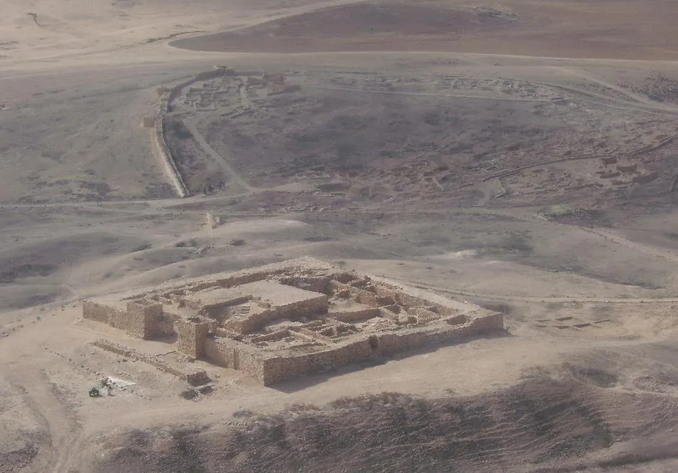
The identity of the Biblical Arad with Tell ‘Arad seems secure. It is also thought that the Eder of Joshua 15:21 refers to the same place:
Most scholars consider Eder (רֶדֵ ע; Εδραι) to be a misspelling of Arad (דָרֲע) ... In fact, the reading of Αραδ is a variant of the LXX. The site of Iron Age Arad is perfectly preserved in the Arabic name Tell ‘Arad. Tell ‘Arad has a stratigraphic sequence from the Iron I until the destruction of the kingdom of Judah at the end of the Iron IIC. On account of this, it would seem very unlikely that such an integral site in the Beersheba Valley would be absent from the Judahite town list. (McKinny 113)
No Bronze Age strata have been discovered at Tell ‛Arad. This has called into question the identification of Tell ‛Arad with the Canaanite city of Arad:
The findings unearthed by the excavations again raise the question of whether this site is to be identified with ancient Arad. Since no remains of the city were found dating from the Middle and Late Bronze ages, it is impossible to identify the site with Canaanite Arad. Two theories have been proposed to solve this problem, one by B. Mazar and one by Y. Aharoni.
It has been suggested by Mazar that Canaanite Arad was not a city but rather the name of the entire district, which would account for the designation “in the south of Arad” in Judges 1:16. We are also told that the king of Arad smote the children of Israel in Hormah. According to Mazar, Hormah was the city where the “king of Arad” resided. It should probably be identified with Tel Malḥatah (Tell el-Milḥ), 12 kilometers ... southwest of Tell ‛Arad ...
Aharoni assumes, however, that Canaanite Arad was situated on Tel Malḥatah. Hormah is to be identified with Tel Masos (Khirbet el Meshash), 6 kilometers ... west of Tel Malḥatah. (Avi-Yonah & Stern 1:88)
Yohanan Aharoni, the Israeli archaeologist who wrote the above account, believed that Tell ‛Arad is the later Israelite city of Arad and that it is to be distinguished from the older Canaanite city (Avi-Yonah & Stern 1:89). The archaeology of Tel Masos does not support a Joshuan Conquest at the end of the Middle Bronze Age, but the current uncertainty surrounding the identity of Arad makes it impossible to draw any firm conclusions.

Adullam
As we have seen, in Joshua 10:3, where the Hebrew Bible speaks of the Canaanite city of Eglon, the Greek Septuagint has Adullam. The Summary List in Joshua 12 includes both. Adullam is now identified with Tell Sheikh Madkhur (Khirbet esh-Sheikh Madkur), ... Another tell, Khirbet ‘Id el Minya (Khirbet ‘Eid al-Miah), lies at the foot of the mountain on which Tell Sheikh Madkhur is located. It is thought that ‘Id el Minya is an Arabic corruption of the Hebrew Adullam (עֲדֻלָּם), but the Biblical Adullam is still identified with the upper tell:
Eusebius describes the site as a “very large village” that he locates ten Roman miles from Eleutheropolis (Onom. 24.12) near Chasbi (Onom. 172.3) ... Adullam has been positively identified with a tell based upon an Arabic toponymic connection. In this case, Adullam is related to Khirbet Tell Sheikh Madhkûr, which sits beside ʿîd el-Mâ or ʿîd el-Mîyā whose name preserves Adullam ... Dagan’s survey of the site produced remains from the Chalcolithic, Early Bronze, Middle Bronze, Late Bronze, Iron IIA (10 dunams), Iron IIB, Iron IIC, and Persian-Byzantine ... The archaeological, toponymic, and geographic (Tell Khirbet Sheikh Madhkûr is about 10 Roman miles from Eleutheropolis) evidence make this identification certain. (McKinny 178)
Adullam, then, existed at the beginning of the Late Bronze Age, but more than this we cannot say. The Septuagint’s confusion between Eglon and Adullam is also found in Eusebius’s Onomasticon, as McKinny notes:
Eusebius seems to have confused Adullam with Eglon (Onom. 84.7) and Eglaim (Isa 15:8) (Onom. 140.8).

Tappuah
Tappuah is another city of uncertain identity:
Tappuah is absent from the LXX tradition, which lists Ραμεν [Ramen] after Ashnah [in Joshua 15:34]. It is unclear which name represents the ancient site. For toponymic reasons, several scholars have favored Tappuah and suggested identifying the site with Beit Nattîf ... This toponymic connection can probably be ruled out, since Beit Nattîf is clearly a slight corruption of Beth-letepha the Roman-Byzantine headquarters of the Judean toparchy ... Others have suggested Artûf between Beth-shemesh, Zorah and Eshtaol, due to a similar sounding toponym ... In light of this connection, which has a positive example at Beth-tappuah (Taffuh) (Josh 15:54) in the Hebron district, it seems logical to look for Tappuah in this vicinity. Artûf/el-Rujm (modern Hebrew Har Tuv) is known primarily for the large Early Bronze I site that was excavated there by Mazar and Miroschedji (1996). Unfortunately, the two surveys at the site showed conflicting data. Dagan’s survey revealed remains from the Early Bronze I, Middle Bronze, Iron II (IIB only), and Byzantine periods ... On the other hand, Lehmann et al.’s survey (Gebel Artûf) suggested occupation only from the Byzantine, Medieval, and Ottoman periods ... In light of this, it is difficult to determine if Artûf has the necessary Iron II remains to be Tappuah, however, the toponymic connection and the general suitability of the region suggests that the site was at least in this vicinity. (McKinny 175-176)
There is not much here to go on. Even if Tappuah is Artûf, it is still unclear whether this settlement existed at the beginning of the Late Bronze Age.
An alternative candidate is Sheikh Abu Zarad, a tell located in central Palestine, between the villages of Yasuf and Iskaka. This site was settled continuously from the Early Bronze Age until Ottoman times:
| Period | Description | Stratigraphy |
|---|---|---|
| Period I | Early Bronze Age rural (unfortified) settlement | EB II-III |
| Period II | Intermediate Bronze Age (tombs on the nearby hills) | EB IV |
| Period III | Middle Bronze Age fortified city | MB II-III |
| Period IV | Late Bronze Age town | LB I-III |
| Period V | Iron Age settlement and city | IA I-II |
| Period VI | Hellenistic-Roman garrison | 2nd century BCE |
| Period VII | Byzantine installation | 4th - 7th century CE |
| Period VIII | Islamic rural installation | Umayyad, Ayyubid, Mamluk |
| Period IX | Ottoman monument | 17th - early 20th century CE |
| Period X | 20th century | before Second World War |
(Nigro et al 143)
The Middle Bronze Age II-III is thought to represent the most important occupational period of the site (Nigro et al 150). The subsequent decline of the town in the Late Bronze Age might be cited in support of Joshua 12, but there is no concrete evidence of a violent disruption to the settlement pattern.

Hepher
This is another Canaanite city of unknown or doubtful identity:
HEPHER (Heb. חֵפֶר). (1) A royal Canaanite city mentioned in the list of kings defeated by Joshua (12:17); it appears between Tappuah (Sheikh Abu Zarad in the hill country of Ephraim) and Aphek (Ras al-ʿAyn at the sources of the Yarkon). The “land of Hepher” is included in one of Solomon’s administrative districts together with Aruboth and Socoh (Raʾs al-Shuwayka near Tulkarm; 1 Kings 4:10). On the basis of these topographical details, most scholars locate Hepher in the northern Sharon, in the area formerly known as the Wadi Ḥawārith, a region sparsely populated in antiquity, containing mostly swamps and woods. The Israelites were apparently unable to subdue the few Canaanite cities in this area until the time of David. (Encyclopedia.com)
Several sites in this area have been identified with the Canaanite city:
Hepher was believed to be situated in the coastal plains at et-Taiyibe (1514.1859) or Tell Ibšār (1415.1975). But the land of Hepher must have spanned the Manasseh hill country because the tribal allotment of the granddaughters of Hepher was located there (Num 26:33). Sometimes Tell el-Muḥaffar (1707.2054) has been identified as being the city of Hepher, a large tell with remains of the Late Bronze and Iron Ages, but Hepher could also be the name of a region. Jerome provides no information exceeding the biblical description (Sit. 141.23). (Encyclopedia of the Bible and Its Reception, Volume 11)
Aphek
There were several Canaanite cities with this name or the similar Aphekah:
Aphek or Aphekah (הָקֵפֲא; Αφακα) means “source” in the sense of a water source ... The name is a prevalent site name in the Bible, with as many as five separate towns named Aphek or Aphekah, most of which are located near perennial water sources ... Aphekah in the Arab district (Josh 15:52-53, cf. Onom. 26.9) has been alternately related to sites near the spring systems of ‘Ain Fâwâr and ʿAyyûn el-Fureidîs ... Both of these spring systems are near the watershed route as it continues south to Debir (Khirbet Rabûd). Above these perennial springs sit Khirbet el-Marajim and Tell el-Ḥadab. These two fortified sites were inhabited throughout the Iron Age II. Khirbet el-Marajim has remains from the Iron I (9 dunams), early Iron IIA (13 dunams), late Iron IIA (12 dunams), Iron IIB (25 dunams), Iron IIC (23 dunams) and Persian-Byzantine remains ... and Tell el-Ḥadab showed remains from Early Bronze (I, III), early Iron IIA (13 dunams), late Iron IIA (12 dunams), Iron IIB (20 dunams), Iron IIC (16 dunams) and Persian-Byzantine ... Both of these sites are located c. 6 km south of Beth-tappuah (Taffûḥ) within the vicinity of Adoraim/Rumah(?) (Dûrā). Tell el-Ḥadab is c. 3 km to the east of Khirbet Marajim. According to the surveyors, the remains of fortifications seemed to be visible at both sites.
Aphekah ... could possibly be related to Khirbet el-Marajim and Humtah (הָטְמֻח; Χαμματα, cf. Onom. 26.10) could be identified with Tell el-Ḥadab. Aphekah was first identified with Khirbet el-Marajim by Kochavi ... who was followed by several others ... Ofer was the first to suggest an identification of Humtah with Tell el-Ḥadab ... Both of these site identifications match the geographic and archaeological requirements for Aphekah and Humtah. (McKinny 248-249)
No Bronze Age Strata have been excavated at either Khirbet el-Marajim or Tell el-Ḥadab (McKinny 250).
Another candidate for Aphek is Tel Rosh ha’Ayin (Tell Ras el’Ain), which lies close to the source of the River Yarkon, about 40 km west of Khirbet el-Marajim (Avi-Yonah & Stern 1:70). Unlike the latter, this site was settled in the Middle and Late Bronze Ages. During the MB-II, the city was fortified with a brick wall about 4 m wide. There is some evidence of a disruption in the settlement pattern at the end of MB-II. An excavation carried out in 1935-1936 under the direction of J Ory failed to uncover any strata from the Late Bronze Age or the Iron Age. Another excavation, undertaken in 1961 by A Eitan on behalf of the Israel Department of Antiquities & Museums, did uncover some artifacts from LB-II and the Iron Age:
The Late Bronze Age II and Iron Age pottery from areas I and II, although not found on the mound proper, indicate some occupation at the site during these periods. The conclusion reached from the previous excavation—that there was a gap from [Middle Bronze Age II] to the Hellenistic period—should be corrected accordingly. (Avi-Yonah & Stern 1:72)
At the very least, this is not inconsistent with Joshua 12—assuming that Joshua’s Conquest took place at the end of MB-II or the beginning of LB-I.

Lasharon
This is another unidentified city. Its very existence has been called into question. In some manuscripts of the Septuagint Greek translation, Joshua 12:18 reads:
βασιλέα Ἀφὲκ τῆς Σαρών.
The king of Aphek in Sharon.
(Joshua 12:18)
Sharon is the coastal plain that lies roughly between Tel Aviv (Jaffa) and Haifa (Mount Carmel). Other manuscripts have βασιλέα Ὀφὲκ τῆς Ἀρώκ, where Ἀρώκ is thought to be a corruption of Σαρώκ, which in turn is ultimately derived from the Hebrew שָׁרוֹן [Sharon], “plain” (Holmes 54).
With no definite site to excavate, and even the possibility that there never was any Canaanite city called Lasharon, there is little more that can be said. The inclusion of this toponym casts doubt on the historicity of the Summary List.

Madon
In Joshua 11, Jobab King of Madon is listed among the allies of Jabin King of Hazor. In the Septuagint, Joshua 11:1 has Μαρρὼν [Marrōn], leading some scholars to identify the place with either the Waters of Merom (the lake near which Joshua defeated Jabin and his allies) or Merom (a Canaanite city now identified with Meiron, about 17 km southwest of the Waters of Merom. In Hebrew, the letters daleth (ד) and resh (ר) were frequently confused.
Madon is also identified with Qarn Hattin, which lies to the west of the Sea of Galilee, about 8 km from Tiberias. A tell to the south of Qarn Hattin has the Arabic name Khirbet Madin, which is thought to preserve the Biblical name, but this identification has been questioned. In 1925, William Fox Albright visited the site of Qarn Hattin, which he described as: the site of the ancient Canaanite royal city of Madon, characterized by massive basalt masonry and Bronze Age pottery (Albright 10).
Tel Qarnei Hittin, as an old volcano, is a really very distinct landmark in the region and the summit was the largest ancient city in the area. It was located by the main road from the Jordan River towards Acco [Acre] and the Mediterranean in Lower Galilee. No archaeological excavations have taken place at Qarnei Hittin. The survey at the site has shown remains from Late Bronze Age II and from Iron Age I ... In Josh. 12:19a there is מדון. The name Madon appears in the Bible only twice, in Josh. 11:1 and 12:19. The Septuagint does not mention Madon at all, but adds into the verse 12:20 the words βασιλεα Μαρρων [basilea Marrōn]. In Josh. 11:1 it also reads Μαρρων.
Madon has been identified with Khirbet Madin, based on the similarity of the names. If the reading “Maron” is preferred, the site can be the same as Merom. Merom has been studied in connection with Thutmosis III’s list [of towns captured during his first campaign into Palestine]. The conclusion was that Merom is Tell el- Khirbeh (map reference 190.275) close to Hazor. The third suggestion for Madon is Tel Qarnei Hittin (map reference 193.245) and this site has also been identified with Adamah/Shemesh-edom.
The name Madon does not occur in any other context of Canaanite towns. Given that Thutmosis III has Merom (no. 85) previously in the list, another location for Madon should be pursued. The name may have been preserved at Khirbet Madin, which is close to Tel Qarnei Hittin (map reference 193.245) as mentioned previously.
The survey at Qarnei Hittin has revealed remains from Late Bronze Age II and from Iron Age I, and that the site was abandoned or destroyed in the middle of the 13th century. There is a clear difference in settlement pattern between the Late Bronze Age and Iron Age I indicting that the new settlers were not directly related to the preceding Canaanite culture, which, according to Gal, may be a sign that the clan of Zebulun settled there.
Accordingly, similar to Tappuah and Hepher, the break in the material culture is to be seen at the beginning of the Iron Age. The new inhabitants are not the followers of the Late Bronze Age people. (Junkkaala 157 ... 262-263)
There is nothing here that corroborates Joshua 12, if we persist in placing Joshua’s Conquest at the very beginning of the Late Bronze Age.

Shimronmeron
In Joshua 11, the King of Shimron is listed as one of the allies of Jabin King of Hazor. Presumably, this is the same city. The use of a slightly different name suggests that the compiler of the Summary List in Joshua 12 was drawing upon an independent source.
As we saw in the previous article, Shimron is generally identified with Tel Shimron (Tell Samunia, Khirbet Sammuniyeh), which lies about 8 km west of Nazareth, in northern Israel. This is about 50 km southwest of the Waters of Merom, where Joshua is alleged to have defeated Jabin and his allies. The archaeological evidence, however, does not permit us to corroborate the claim that the King of Shimron was slain by Joshua:
Tell Shimron has not been excavated systematically but surface surveys have been carried out. The oldest surveys have found remains from all the periods from the Middle Bronze Age to the Iron Age. According to the following archaeologist to survey the site, there were only early settlements in Middle Bronze Age II and the subsequent ones were in Iron Age I and II. However, Goren et al. note in their report that “in addition to the geological mapping we also conducted a limited survey of the site, collected Late Bronze Age sherds from surface and prepared thin-sections from them.” This discrepancy shows that different surveys may arrive at different conclusions because they may find pottery from different periods.
Many inscriptional references show that Shimron must have been an important city during the Middle and Late Bronze Ages. It was one of the three important cities (Megiddo, Jokneam and Shimron) in the western Jezreel Valley.
Indeed, there is an exceptional amount of textual evidence from Shimron and extremely scanty archaeological evidence concerning the occupation in the periods in question. In point of fact, this is the situation in several other sites, too. The remains may have been lost or the archaeologists have not found them because they were not present on the surface. Thus, concerning Shimron, there is enough evidence to testify to there being a settlement in the Late Bronze Age. (Junkkaala 144-145)
And that is as far as the evidence takes us.
Achshaph
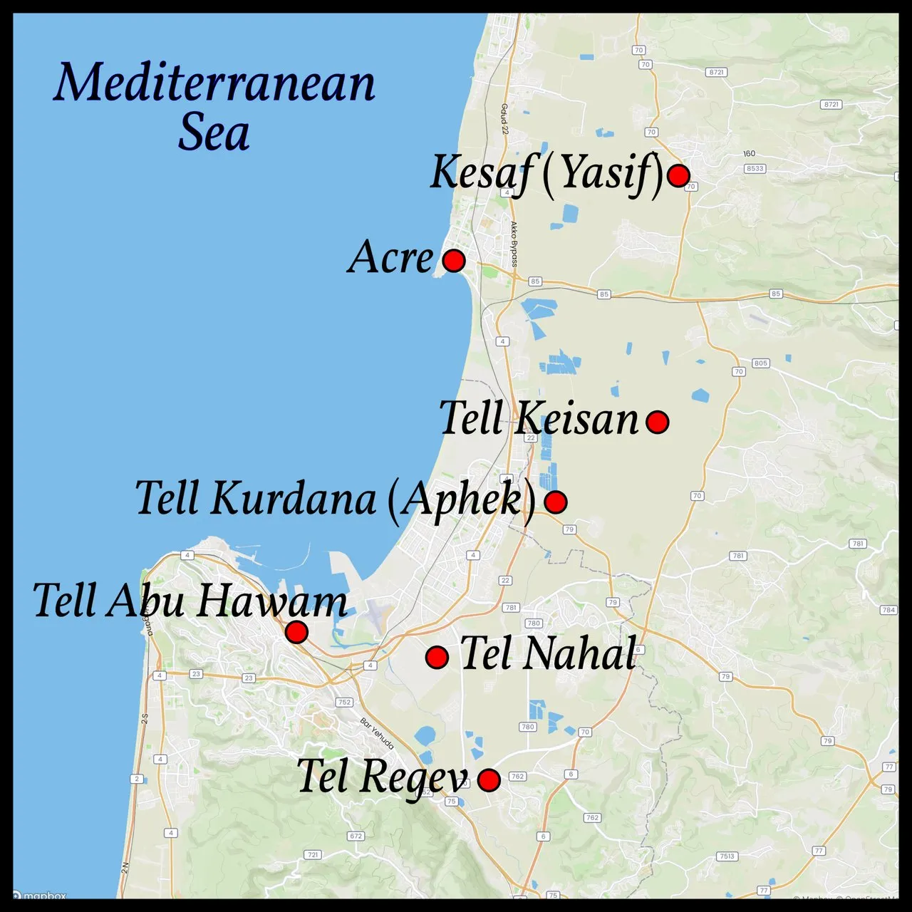
The royal Canaanite city of Achshaph lay somewhere in northern Canaan. It too is listed in Joshua 11 among the allies of Jabin King of Hazor. As we saw in the previous article, its identity is still a matter of scholarly debate. The four principal candidates are Tell Keisan, Tell Regev, Tell Harbaj and Tell an-Nakhl, all of which lie in the traditional territory of the Tribe of Asher. According to Egyptian sources, it lay somewhere in the vicinity of Acre (Accho or Akko) (Avi-Yonah & Stern 3:712):
Late Bronze Age texts mention the independent city of Achshaph (Akshapa) in the vicinity of Akko ... This city is also mentioned in the Bible and is situated within the area of the tribe of Asher. According to the papyrus Anastasi I, Achshaph seems to have been immediately south of Akko. Since both Tell Keisan and Tell Kurdana (Aphek) were apparently part of the city-state of Akko it is difficult to identify them with Achshaph. Benjamin Mazar and Yohanan Aharoni located Achshaph at Tell Harbaj ... Lipinski looks for this site in the immediate hinterland of Tell Abu Hawam, at Tell an-Nakhl ... or in its vicinity ... Both Tell Harbaj (25 dunam) and Tell an-Nakhl (14 dunam) seem to be rather small even for a tiny Late Bronze Age city-state, but there are no other larger tells in the southern Akko plain. However, if one assumes with Mazar, Aharoni, Bunimovitz and Lipinski that Achshaph was at the southern edge of the Akko plain, then this state encompassed only a very small territory ...
Apparently, there were two harbours at both edges of the Akko bay, Akko and Tell Abu Hawam. These harbours are specialized sites in the settlement hierarchy of the Akko plain ... Since Tell Abu Hawam is situated at the extreme southern edge of the plain, it was probably already outside of the territory of Akko and may have been the harbour of the city state of Achshaph. (Lehmann 85 ... 86)

Tell Keisan (Tel Kisson)
This was once the leading candidate, though it has recently fallen down the list. William Fox Albright favoured Tell Keisan, which lies about 8 km southeast of the coastal port of Acre or 42 km southwest of Hazor (Albright 33). It is now thought that this settlement was part of the small polity of Akko, so it is unlikely to have been the Biblical Achshaph (Lehmann 85). Some scholars, however, continue to regard it as the most probable candidate for Achshaph (Junkkaala 121).
Michael Avi-Yonah & Ephraim Stern’s account is from the 1993 edition of The New Encyclopedia of Archaeological Excavations in the Holy Land:
Most scholars locate the biblical city of Achshaph at Tell Keisan. This city is mentioned in three passages in the Bible, all in the Book of Joshua. Joshua 19:25 mentions Achshaph among the possessions of the tribe of Asher, but without giving its exact location ... Achshaph is mentioned eight times in Egyptian texts ... From [these texts] we can conclude that Achshaph and Accho were close to one another, with the former situated somewhat to the south. (Avi-Yonah & Stern 3:711 ... 712)
The archaeology of Tell Keisan is not of much use to us:
The history of the site is still virtually unknown ... At the mound itself, apart from a city of the Hyksos period (Middle Bronze Age II-B-C), two periods in particular appear to have been important: Late Bronze Age-Early Iron Age, and the Hellenistic period. (Avi-Yonah & Stern 3:711)
In 2018, the remains of a Persian military outpost were discovered at the site.
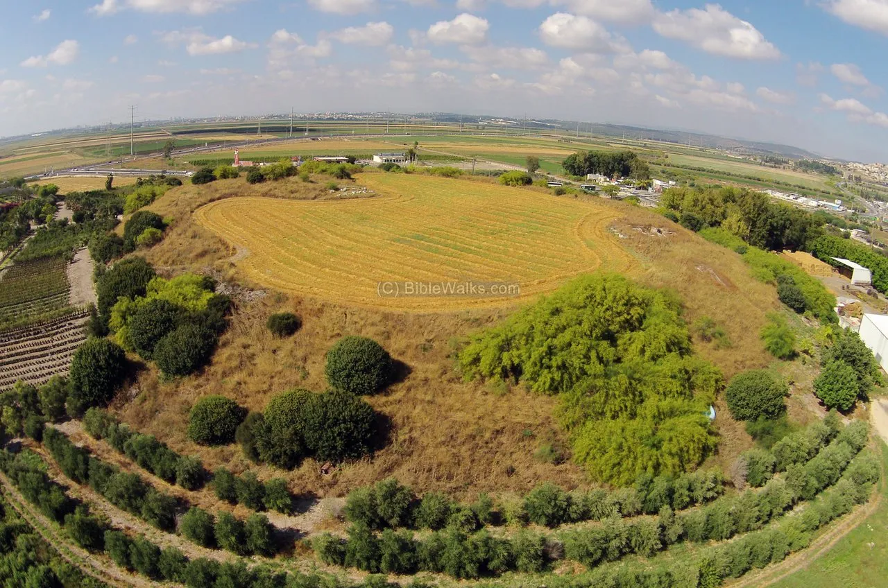
Tel Regev
This site lies about 14 km south-southwest of Tell Keisan, in the southern part of the Plain of Acre. It is also known as Tell al-Harbaj and Khirbat Harbaj:
On the strength of the pottery finds, the fortifications, and other remains, the settlement can be ascribed to Early Bronze Age III, Middle Bronze Age I, Late Bronze Age I-II, and Iron Age I. (Avi-Yonah & Stern 1:24)
Was this site even settled at the end of the Middle Bronze Age, when—according to my hypothesis—Joshua and the Israelites invaded Canaan?
Tell an-Nakhl (Tel Nahal)
Tell an-Nakhl, or Tel Nahal, also lies in the southern part of the Plain of Acre, about 5 km north-northwest of Tel Regev, close to Haifa International Airport. This site is now dated to the Late Bronze Age-Iron Age I-Iron Age II-Persian Period (Lehmann 104). It has also been identified with the Canaanite city of Mishal, which does not appear on the Summary List in Joshua 12, but which is mentioned later in Joshua 19 as one of the border towns of the territory of the Tribe of Asher.

Kesaf (Yasif)
The identification of the Canaanite city of Achshaph with this ruined village, which is located about 10 km east-northeast of Acre, was first made by Edward Robinson in the middle of the 19th century:
This name corresponds to the Achshaph of the book of Joshua, a city on the border of the tribe of Asher; whose king is twice mentioned in connection with the king of Hazor. As Hazor was situated somewhere on the west of the Hûleh and overlooking it, there is nothing improbable in the idea, that the true site of Achshaph may have thus been perpetuated under the name Kesaf. (Robinson 55)
As far as I am aware, the site has never been excavated.
Tell Abu Hawam
This mound is located in the modern city of Haifa, about 800 m from the coast. It is believed that this tell conceals the remains of an ancient harbour city, which was founded on the coast, near the mouth of the Kishon River. But the earliest strata that have been excavated at the site are dated to the Late Bronze Age (Avi-Yonah & Stern 1:9-11). If it was the port that served Achshaph, it must have been founded after the arrival of the Israelites.
In summary, there is little archaeological evidence relating to Achshaph that either refutes or corroborates Joshua 12.

Taanach
The ruins of the ancient Canaanite city of Taanach lie under Tell Ta’annek (Tell Ti’innik), a 40-metre-high mound about 21 km SSW of Nazareth, in the Plain of Jezreel. The city was substantial and fortified during the Early Bronze Age, but this was followed by a long gap in occupation. The city was rebuilt and fortified in the latter part of the Middle Bronze Age (MB IIC), but the transition into the Late Bronze Age was marked by violence:
Selective destruction marks the end of the Middle Bronze Age on the site. (Stern 4:1146)
This supports our dating of Joshua’s Conquest. The LB I period was the most prosperous in the city’s history, but at its end the city was destroyed and abandoned for over a century (Junkkaala 122-123):
Taanach in Late Bronze Age I was a prosperous city, and it was destroyed at the end of that period and this is in accordance with the historical information about Thutmosis III and his campaign towards these regions. (Junkkaala 123)

Megiddo
The Canaanite city of Megiddo was _already in the Early and Middle Bronze Ages ... a fortified city of major importance (Stern 3:830). It is identified with Tel el-Mutesellim—now renamed Tel Megiddo—which lies about 8 km NNW of Tell Ta’annek.
Strata X and IX represents MB IIC and LB IA respectively. There is no indication that the transition between these two periods was violent or destructive. Stratum X is marked by the building of a large palace, outstanding in its size and the strong construction of its walls (Stern 3:845). Stratum IX does preserve signs of violent destruction, but it is thought that this was wrought by the Egyptian forces of Thutmose III during his first campaign.
There is nothing here that supports the Biblical claim that the King of Megiddo was slain by Joshua.

Kedesh
This city can hardly be the same place known in the Pentateuch as Kadesh-Barnea, though this identification is commonly made when the same name occurs in Joshua 15:23. Perhaps this would be a reasonable assumption if Kadesh-Barnea were a city in southern Canaan, as many scholars believe it to be (McKinny 354). According to this view, Kadesh is identified with Tell el-Qudeirât in the Negeb. But in an earlier article, we identified Kadesh-Barnea with Petra, which is located in Edom (in modern Jordan), far from the theatre of Joshua’s Conquest of Canaan.
Kedesh occurs in the Summary List between Megiddo and Jokneam of Carmel, both of which are located in Northern Canaan. Similarly, Achshaph, Taanach, Dor, Tirzah and Gilgal are all northern cities. This suggests that this particular Kedesh is to be identified with the so-called Kedesh Naphthali, about 25 km north of the Sea of Galilee—but this is not at all certain:
In Josh. 12:22a there is קדש. The place name Kedesh occurs 12 times in the Bible, but not all of them are to be identified with the same location ... At least three different sites with the name Kedesh have been suggested. The first is Khirbet el-Kidish/Qedish (map reference 202.237), on the south-western shore of the Sea of Galilee. The second is Tell Qades/Tel Kedesh (map reference 200.279), in northern Galilee, approx. 10 kilometres northwest from Hazor. The third is Tel Abu Kudeis (map reference 170.218), a small mound in the Jezreel Valley between Taanach and Megiddo.(Junkkaala 294 ... 295)

The nomenclature of these different sites can be quite confusing. For example, Junkkaala uses Tell Qades and Tel Kedesh to refer to the northern site, which is located roughly 10 km NNW of Tel Hazor, and Tel Abu Kudeis to refer to the southern site, between Taanach and Megiddo. But Avi-Yonah & Stern refer to the northern site as Tel Qedesh (Avi-Yonah & Stern 2:406) and to the southern site as Tel Kedesh or Tell Abu Qudeis (Avi-Yonah & Stern 3:702). They do not mention the site on the southwestern shore of the Sea of Galilee. (Note: Junkaala’s map references are to James Monson & H T Frank, Student Map Manual (Jerusalem 1979)).
Kedesh Naphthali is located at the northern site—or possibly at Khirbet el-Kidish (Cleave 502). This site comprises two mounds. The principal mound, on the west, was a prominent city during the Middle Bronze Age, but little remains from the Late Bronze and Iron Ages. This may be because occupation of the site during the Late Bronze and Iron Ages was confined to the other mound, which lies about 800 m to the east (Avi-Yanah & Stern 406). Nevertheless, this state of affairs does suggest that there was a significant disruption to the settlement pattern at the end of the Middle Bronze Age, which might have been caused by Joshua’s Conquest.
The archaeology of the other Kedesh, the one between Taanach and Megiddo, is not nearly as supportive of our hypothesis:
In 1968, excavations were conducted on the mound by E. Stern on behalf of Tel Aviv University. The purpose of the excavations was to examine the stratigraphy of the site and to establish its identification ... Stratum VIII. This was the lowest level excavated. It yielded sherds of local and imported Mycenaean ware, which dated the stratum to the fourteenth-thirteenth centuries B.C. [conventional chronology]. (Avi-Yonah & Stern 3:702 ... 703)
This is too late for the time of Joshua. Stern did not dig any deeper, so we do not know anything of the archaeology of the site prior to the Mycenaean era (ie the final phase of the Late Bronze Age).
The Student Map Manual identifies Khirbet el-Kidish on the Sea of Galilee as Kadesh Naphthali. The territory of the Tribe of Naphthali lay mainly to the northwest of the Sea of Galilee. On some maps, Khirbet el-Kidish is placed in the territory of the Tribe of Zebulon, and on other maps it is in Issachar. But there is still much uncertainty surrounding the extent of the various tribal territories in ancient Israel, and some maps place the southern border of Naphthali beyond the southern extremity of the sea of Galilee.
Jokneam of Carmel
The Canaanite city referred to as Jokneam of Carmel is now identified with Tel Yokneam, which is located about 20 km southeast of Haifa. Archaeological excavations have confirmed that this was a fortified city throughout the Middle Bronze Age, but that it was unfortified from before the end of the Middle Bronze Age and until well into the Iron Age. Relevant to our thesis—that Joshua’s Conquest of Canaan took place at the very beginning of the Late Bronze Age—is the transition from the Middle Bronze Age to the Late Bronze Age. Although there is evidence that the city was devastated during the early part of the Late Bronze Age, with a subsequent hiatus in occupation, this occurred at the end of LB I, not its beginning, and was probably caused by Thutmose III:
The interruption in the stratigraphic sequence between Strata XXI [MB IIC] and XXb is not paralleled by the ceramic assemblages, which display continuity between these two strata. Moreover, in neither area did the excavation reveal any sign of a violent destruction that might explain the stratigraphic break and overall change in the nature of the architectural elements attributed to each stratum. Together with the ceramic evidence mentioned above, this phenomenon is of great significance for the character of the transition between the Middle Bronze Age and the Late Bronze Age.
A massive destruction terminated the LB I settlement at Yoqne’am (Stratum XXa), which was followed by an occupational gap. Stratum XIX marks the recovery of urban life at the site during the second half of the Late Bronze Age. This recovery is characterized by the reoccupation of the abandoned LB I site and the establishment of a new settlement on top of it. This stratum, like the one preceding it, ended with a violent destruction (Ben-Tor et al 3-5).

While there is evidence of a disruption to the settlement pattern at Tel Yokneam at the end of the Middle Bronze Age, there is nothing to suggest that this disruption was violent:
The stratigraphic and ceramic evidence does not attest to a violent end for the Middle Bronze Age at Yoqne’am. A fill, which in some places reaches a depth of one meter or more, separates the latest MB II stratum (XXI) from Stratum XXb (termed by us “transitional MB IIC/LB I”). Yoqne’am may thus, for some unknown reason, have been deserted for some time after Stratum XXI before being resettled by the inhabitants of Stratum XXb. This occupational gap could not have lasted for long, as indicated by the affinity between the ceramic assemblages of Strata XXI and XXb. (Ben-Tor et al 241)
So, although there was not a violent transition between the Middle and Late Bronze Ages, there was a clear cultural change, marked largely by the appearance of new ceramic families (Ben-Tor et al 241). Was this related to the Israelite Conquest? The authors of this paper surmise that at least some of the abandonments or destructions ... in the late MB IIC may be attributed to the Egyptian Asiatic campaigns in the late 17th and early 18th Dynasties (Ben-Tor et al 242).
The destruction at the end of LB I is now attributed to Thutmose III, who campaigned in this region in the 21st year of his reign.

Tirzah
The ancient city of Tirzah is generally identified with Tell el-Far’ah (North), 11 km northeast of Nablus (the Biblical Shechem). This city was settled during the Bronze Age:
Tirzah (12:24), if at Tell el-Far’ah North (as often accepted). Here the Late Bronze Age remains (period VI) are scrappy and unsatisfactory, and are stated to cover “about three centuries into the sixteenth century BCE.” As the Middle Bronze Age only ends in the sixteenth century [conventional], the Late Bronze’s three centuries would have to extend down in time from it, into the thirteenth century, not “into” the sixteenth. In that case a local ruler in Tirzah (if at Tell el-Far’ah North) would be possible then. The first Iron Age remains (period VIIa) were built upon a Late Bronze wall. (Kitchen 185)
The city was walled in the latter part of the Middle Bronze Age, but the Late Bronze Age is not well represented. The archaeology could be interpreted as being supportive of my thesis—that Joshua conquered the city at the beginning of the Late Bronze Age—but this may be wishful thinking on my part. Nevertheless, there does appear to have been a significant break in occupation at the beginning of the Late Bronze Age:
No remains were uncovered from the Middle Bronze Age I. The site was resettled only during the early part of Middle Bronze Age II. The new settlement was quite small and poor ... Still later ... the population of the site increased, and the town was encircled by a new wall ... A large stone pile in the northwestern corner is almost certainly the remains of foundations of a demolished citadel ...
LATE BRONZE AGE
Strata of this period are not well preserved. Its structures present a shoddy appearance. It is possible to detect a few places where the wall was repaired or additions made to it, but a reconstruction of the town plan is impossible ... Tombs are fewer in this period than in the Middle Bronze Age. (Avi-Yonah & Stern 2:399-400)

Shechem
Is it significant that the nearby city of Shechem is not on the Summary List? According to I Kings 12:25, this was the first capital city of the Kingdom of Israel. In fact, Jeroboam is credited with building the city, although the archaeology indicates that a substantial Canaanite city existed here since at least the Middle Bronze IIA. A city wall was first constructed in MB IIB, and the site was greatly fortified during MB IIC. At the end of the Middle Bronze Age, the eastern and northern parts of the city were destroyed in two violent conflagrations. These have been blamed on the first two Pharaohs of the 18th Dynasty, Ahmose I and Amenhotep I, though no Egyptian inscriptions record any campaigns in this area (Avi-Yonah & Stern 4:1086-1090).
Shechem was a well-fortified and substantial city at the end of the Middle Bronze Age. It would surely have presented Joshua with an irresistible target, and the violent conflagrations in this period do support the timeline of the Short Chronology. In Joshua 24, the Israelites convene at Shechem after the successful conclusion of the Conquest. So why is it not on the Summary List?
Conclusion
The Summary List in Joshua 12 appears to be a late compilation deriving from disparate sources. Its uncertain provenance makes it an unreliable source for the Conquest of Canaan. It can hardly be cited as proof that the Conquest actually occurred. On the other hand, its flaws do not prove that the Conquest never occurred:
Joshua 11:1 and 12:20 are lists of cities of the Israelite conquest. The second of these lists, according to literary criticism, has been reworked by a later (Deuteronomic) redactor under the influence of a roster of cities fortified by Solomon. (Stern 3:711-712)
And that’s a good place to stop.
References
- William Fox Albright, Bronze Age Mounds of Northern Palestine and the Hauran: The Spring Trip of the School in Jerusalem, Bulletin of the American Schools of Oriental Research, Number 19, Pages 5-19, American Schools of Oriental Research, University of Chicago Press, Chicago (1925)
- Michael Avi-Yonah, Ephraim Stern (editors), The New Encyclopedia of Archaeological Excavations in the Holy Land, Volumes 1, 2, 3, 4, Prentice-Hall Incorporated, Englewood Cliffs, NJ (1975)
- Ian Barnes, The Historical Atlas of the Bible, Quantum Publishing, London (2014)
- James Barr, Mythical Monarch Unmasked? Mysterious Doings of Debir King of Eglon, Journal for the Study of the Old Testament, Volume 15, Issue 48, Pages 55-68, Sheffield Academic Press Limited, Sheffield (1990)
- Amnon Ben-Tor, Doron Ben-Ami, & Ariella Livneh, Yoqne’am III: The Middle And Late Bronze Ages—Final Report of the Archaeological Excavations (1977–1988), Qedem Reports, Volume 7, Pages 1-436, Institute of Archaeology, Hebrew University of Jerusalem, Jerusalem (2005)
- Adele Berlin & Marc Zvi Brettler (editors), The Jewish Study Bible, Jewish Publication Society TANAKH Translation, Oxford University Press, Oxford (1999)
- Alan E. Brooke & Norman McLean (editors), The Old Testament in Greek: According to the Text of Codex Vaticanus, Volume 1, Part 4, Joshua, Judges and Ruth, Cambridge University Press, Cambridge (1917)
- Samuel Holmes, Joshua: The Hebrew and Greek Texts, Cambridge University press, Cambridge (1914)
- Saint Jerome, Liber De Situ Et Nominibus Locorum Hebraicorum, Patrologia Latina, MPL023, Jacques-Paul Migne, Paris (1845)
- Eero Junkkaala, Three Conquests of Canaan, Åbo Akademi University Press, Turku (2006)
- Kenneth A Kitchen, On the Reliability of the Old Testament, William B Eerdmans Publishing Company, Grand Rapids MI (2003)
- Ferdinand Larsow, Gustav Parthey (editors), Eusebii Pamphili Episcopi Caesariensis Onomasticon Urbium et Locorum Sacrae Scripturae [A Gazetteer of Cities and Places in Holy Scripture by Eusebius Pamphili], Friedrich Nicolai, Berlin (1862)
- Gunnar Lehmann, Phoenicians in Western Galilee, in Amihai Mazar (editor), studies in the Archaeology of the iron Age in Israel and Jordan, Journal for the Study of the Old Testament, Supplement Series 331, Sheffield Academic Press, Sheffield (2001)
- Chris McKinny, A Historical Geography of the Administrative Division of Judah, Bar-Ilan University (Dissertation), Ramat Gan (2017)
- James Monson, H T Frank, Student Map Manual: Historical Geography of the Bible Lands, Pictorial Archive (Near Eastern History) Est, Jerusalem (1979)
- Lorenzo Nigro, Chiara Fiaccavento, Mohammed Jaradat, Jehad Yasine, Archaeology from A to Z: Abu Zarad, an Ancient Town of Palestine, Vicino Oriente, Issue 19, Pages 139-183, Sapienza Università di Roma, Rome (2015)
- Edward Robinson, Eli Smith and Others, Later Biblical Researches in Palestine and the Adjacent Regions: A Journal of Travels in the Year 1852, John Murray, London (1856)
- Ephraim Stern (editor), The New Encyclopedia of Archaeological Excavations in the Holy Land, Volume 2, Simon & Schuster, New York (1993)
Image Credits
- Joshua and the Vanquished Kings (Marc Chagall): Marc Chagall (artist), Josué et les Rois Vaincus, Heliogravure on Paper, Fair Use
- The Conquest of Canaan: © Quantum Publishing, Cartographica Press (cartographers), Ian Barnes (author), The Historical Atlas of the Bible, Page 61, Quantum Publishing, London (2014), Fair Use
- Hilltop Ruin at Adullam: © Davidbena, Creative Commons License
- Tell Beit Mirsim: Excavations at Tell Beit Mirsim (Kirjath-Sepher), 1926, Great High Place, Library of Congress, Matson Collection, Public Domain
- Tell ‛Arad (Israelite Fortress and Lower City): Assaf.C (photographer), Public Domain
- Gedera from Tel Qatra: © Ori~, Creative Commons License
- Tel Adullam: © Davidbena, Creative Commons License
- Tell Abu Zarad: © Lorenzo Nigro et al, Fair Use
- Nahal Alexander (Wadi Ḥawārith): © David Ichenhausen (photographer), Fair Use
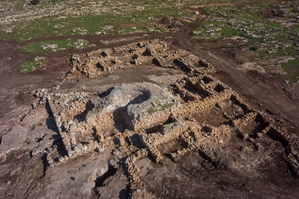
- 2700-Year-Old Farmstead at Rosh Ha’Ayin: © Griffin Aerial Photos, Fair Use
- The Sharon Plain: IsraelMap360°, Public Domain
- Qarn Hattin: © AVRAMGR, Creative Commons License
- Tel Shimron: Adam B Prins (videographer), © Tel Shimron Excavations, Fair Use
- Acre and Its Environs: © MapBox, © OpenStreetMap contributors, Open Data Commons Open Database License
- Tell Keisan: © Ivgeni Ostrovski (photographer), Israel Antiquities Authority, Fair Use
- Tel Regev: © BibleWalks.com, Fair Use
- Tel Nahal: © Aaadir (photographer), Public Domain
- Tell Abu Hawam: William Henry Bartlett (artist), Ford of the River Kishon, Bay of Acre, Israeli National Maritime Museum, Haifa, Public Domain
- Plan of Tell Ta’annek: G Schumacher, Ephraim Stern, Volume 4, Page 1140, Public Domain
- Tel Megiddo: © Avram Graicer (photographer), Creative Commons License
- The Twelve Tribes of Israel: © Janz, Creative Commons License
- Tel Yokneam: © Emmanuel Cohen, Creative Commons License
- Tell el-Farah (North): © BiblePlaces.com, Fair Use
- Tel Shechem (Tell Balata): © Avi1111 (photographer), Creative Commons License