This is my first post to hive apart from my introduction, so please let me know if I'm making any beginner mistakes here :-)
One of the topics I'd like to write about is hiking. Specifically, I'd like to share with you all my favorite pictures from my hikes so far, and of course from my future hikes. I was thinking I'd go in chronological order, starting with the hike where I tried my first real camera, because all pictures before were taken on my phone camera and aren't all that much to look at. Though do tell me if you'd like to see my older stuff too :-)
I do already have a hiking blog that I started before I learned of hive, where I include a lot of additional information, interactive maps, detailed slideshows of the hiking route, useful links, etc. that would frankly just look very messy here without all the plugins and widgets I use to bring order into the chaos, so I will limit these posts to my favorite pictures and the description of the hike, in order to keep it neat and readable. I'll link to the blog post at the end, in case someone would like to check out the orbiting info and stats, as well as the less impressive pictures that just show what to expect from the route.
So without further ado, let's start with:
Switzerland | 2021-04-23
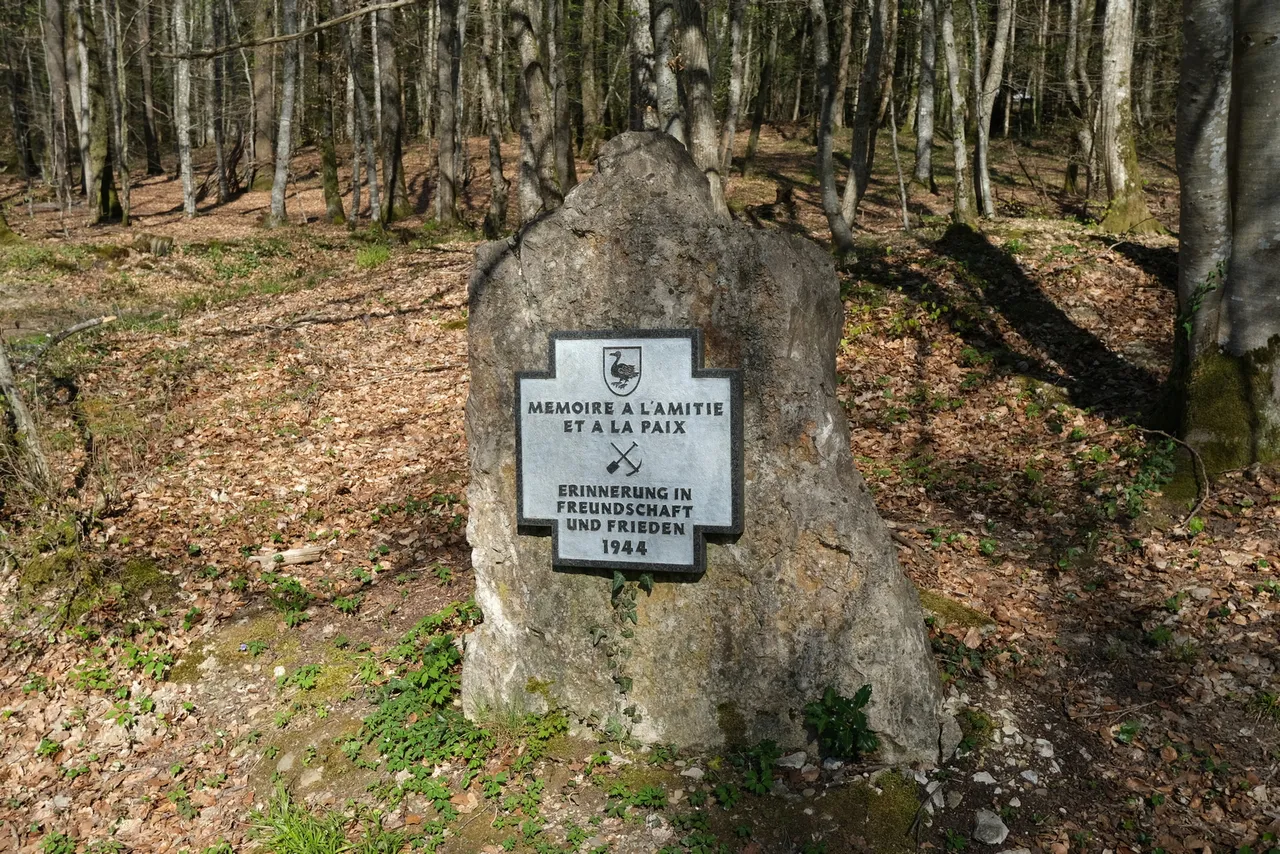
“Kilometer 0” was the beginning of the German/French WW1 front that stretched from Switzerland to the north sea.
It is this small area around the Swiss border, in which German, French and Swiss soldiers faced off, on which this “hike” is focused.
The quotation marks were necessary because you could debate over the definition of a hike, and whether it just needs to be longer than two hours or needs to incorporate certain terrain, etc. Assuming you’re not that interested in discussing semantics, let’s move on.
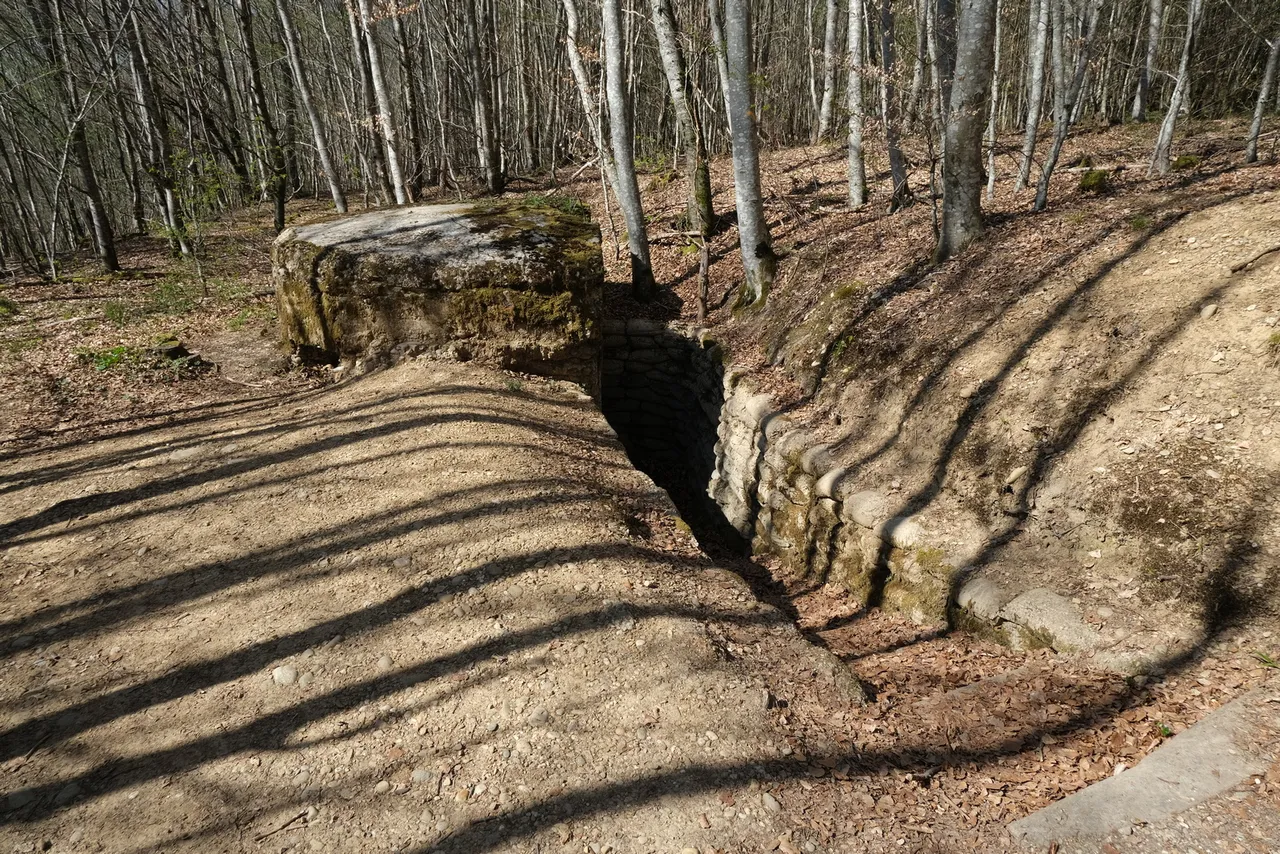
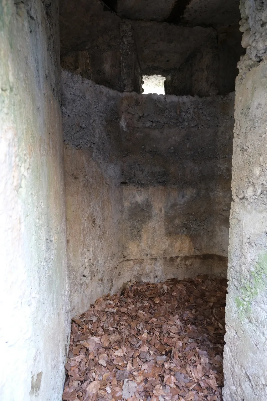
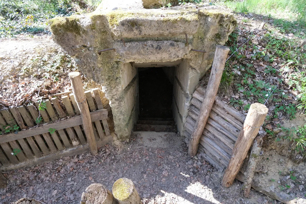
The… long walk from Bonfol to the front with its remaining bunker ruins, destroyed railway bridge, and various small signs that at one point in history not too long ago, a war raged here, is certainly historically interesting.
The now calm forests and fields make for a relaxing Sunday afternoon walk, though you can’t really wax lyrical about the beautiful views. It’s… nice.
As this was my first hike with my new camera, I was of course a bit preoccupied with trying it out, finding a comfortable way of carrying it and similar concerns. My trusty and beloved HTC 10's battery had recently given up on life after four years of service, and since none of the current flagship phones really excited me, something ethically appealing like Fairphone was just too expensive for meh hardware (and repair wasn't feasible), and I really don't like huge screens and glass backs, I decided to go with a cheap phone (Nokia 6.1 with an aluminum case, yay) and a real camera (Fujifilm X-T30) instead of a flagship phone this time.
I'm very happy with that decision, because I discovered my love for photography as soon as I held that camera in my hands.
In German, we have a saying: "Es ist noch kein Meister vom Himmel gefallen." which roughly translates to "No master has fallen from the sky yet."Meaning of course my first few pictures aren't all that great, so please bear with me :)
Back to the "hike":
Apart from being my cameras first hike, it was also one of our first of this year's hiking season, which had started a bit late due to the stubbornly low temperatures way into late spring. As such, a long but flat and easy route wasn't the worst option to get back into it after winter hibernation mode. Also, the historic nature of the location was very interesting (to me).
After looking at all the bunkers and having a simple lunch of tofu sandwiches, we took a wrong turn on the way back, resulting in us missing out on about a third of the route. Luckily, none of the historic bits were affected.
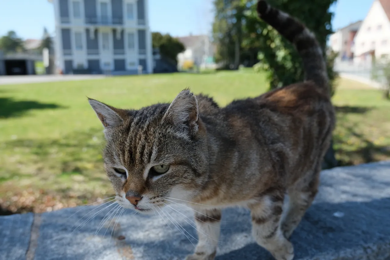
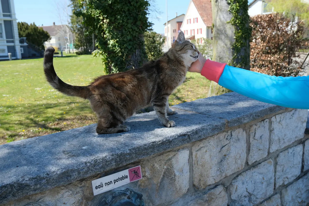
We did try to enlist the help of a local guide, but alas, he wasn’t interested in showing us the way as much as in getting some scritches...
Bonfol itself is a neat little village, sometimes bordering on the picturesque.
The historical ruins, and the signs detailing key events along the way were certainly interesting.
All the rest… well, it’s a long walk in the forest. There’s not much to say apart from “It was nice.”
A moment that stuck with me was this abandoned van under a bridge:
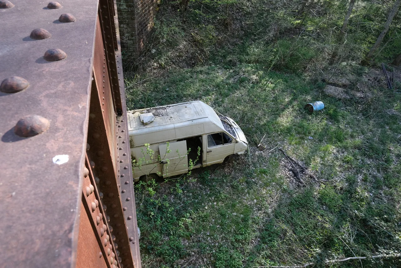
I can’t really say why, there was just something beautiful about it. [Cue the plastic bag dancing in the wind, from American Beauty].
As promised, here is the link to the roman-hikes blog post.
Thank you for reading and if you have any questions about this hike, I will do my best to answer them in the comments :-)
Have a great day!