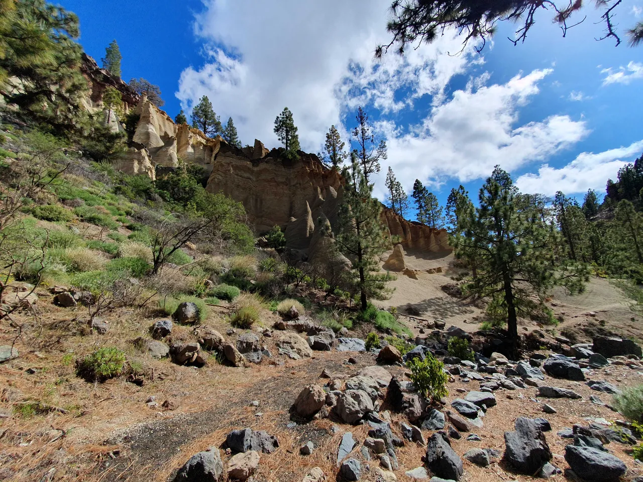
Usłyszałem od kogoś, że Teneryfa, mimo, że w sumie to jedna wyspa, podzielona jest na wiele światów. Cała wyspa ma niewiele ponad 2000km², to niedużo, cztery Warszawy. Czasem wystarczy przejechać 15km, aby znaleźć się w zupełnie innym otoczeniu. Wczoraj chciałem iść w góry, takie prawdziwe, dość leniwie przejrzałem najbardziej polecane trasy i szybko wybrałem tę, która akurat była najbliżej. Hike prowadził do ciekawego miejsca nazwanego Paisaje Lunar - Krajobraz Księżycowy.
Podjechałem autem tam, gdzie kończy się asfalt, ugotowałem sobie na kuchence turystycznej pół tuzina jajek na twardo i wkrótce ruszyłem w górę. Tak się złożyło, że akurat organizowany był jakiś bieg na przełaj i co chwila jakiś zasapany zawodnik biegnący w dół pytał mnie o drogę, tak mi się przynajmniej wydawało, bo zrozumiałem niewiele.
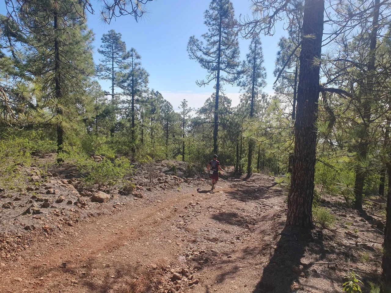
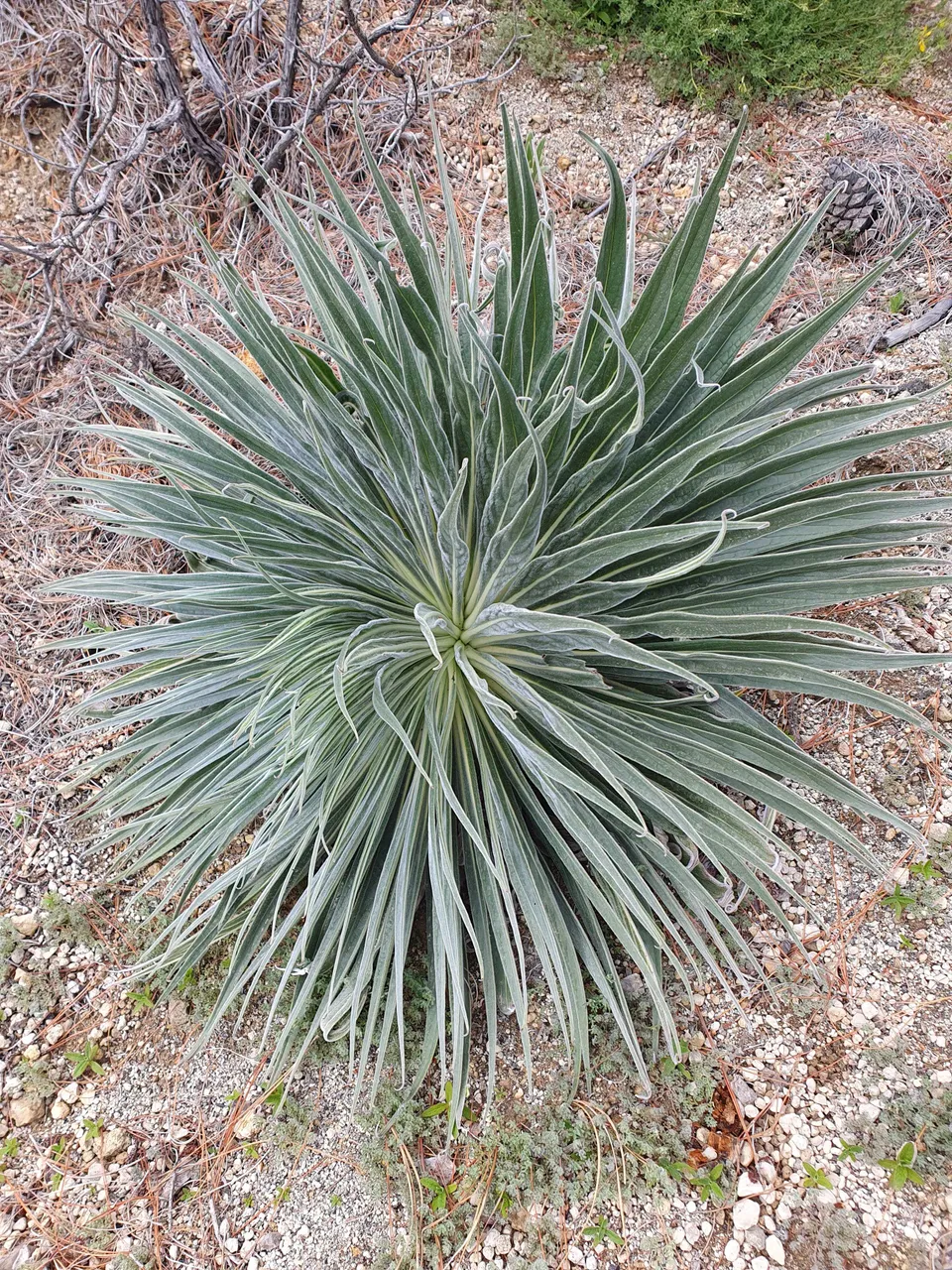
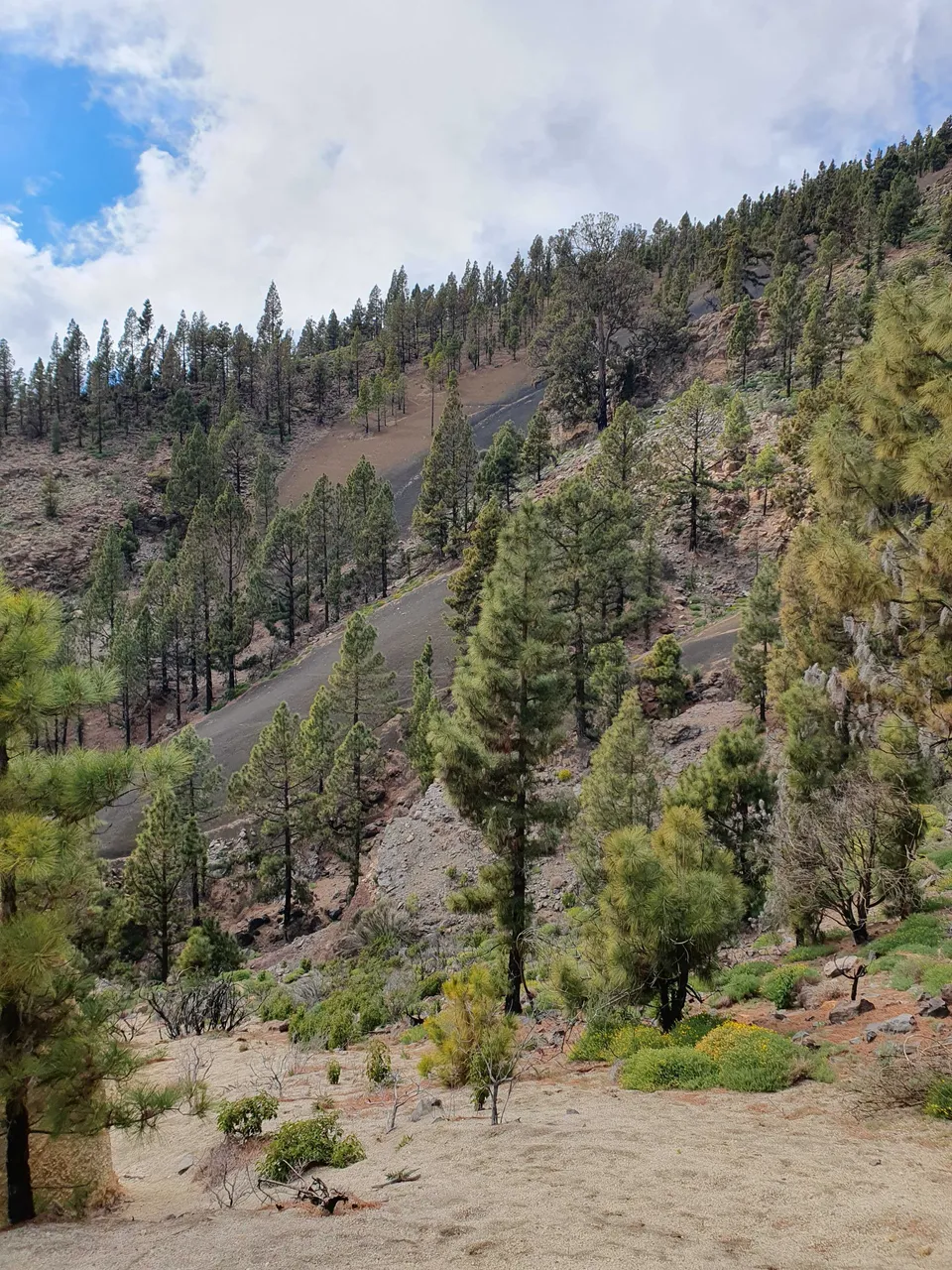
Pierwsze co zwróciło moją uwagę to leśna monokultura, wszystkie drzewa tego samego gatunku. Później dowiedziałem się, czemu tak to wygląda. Temperatura sięgała maksymalnie 14stopni na wysokości 1700m n.p.m. Przygotowałem się na to i nie zmarznąłem.
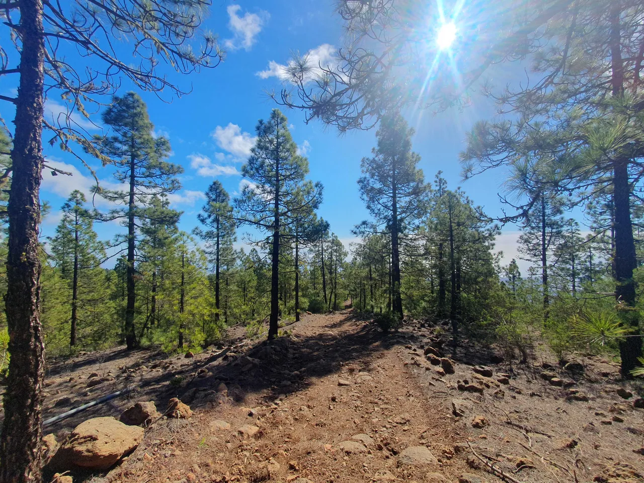
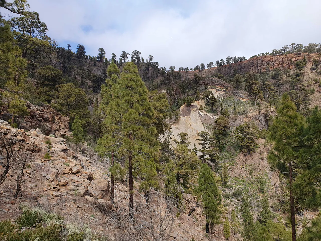
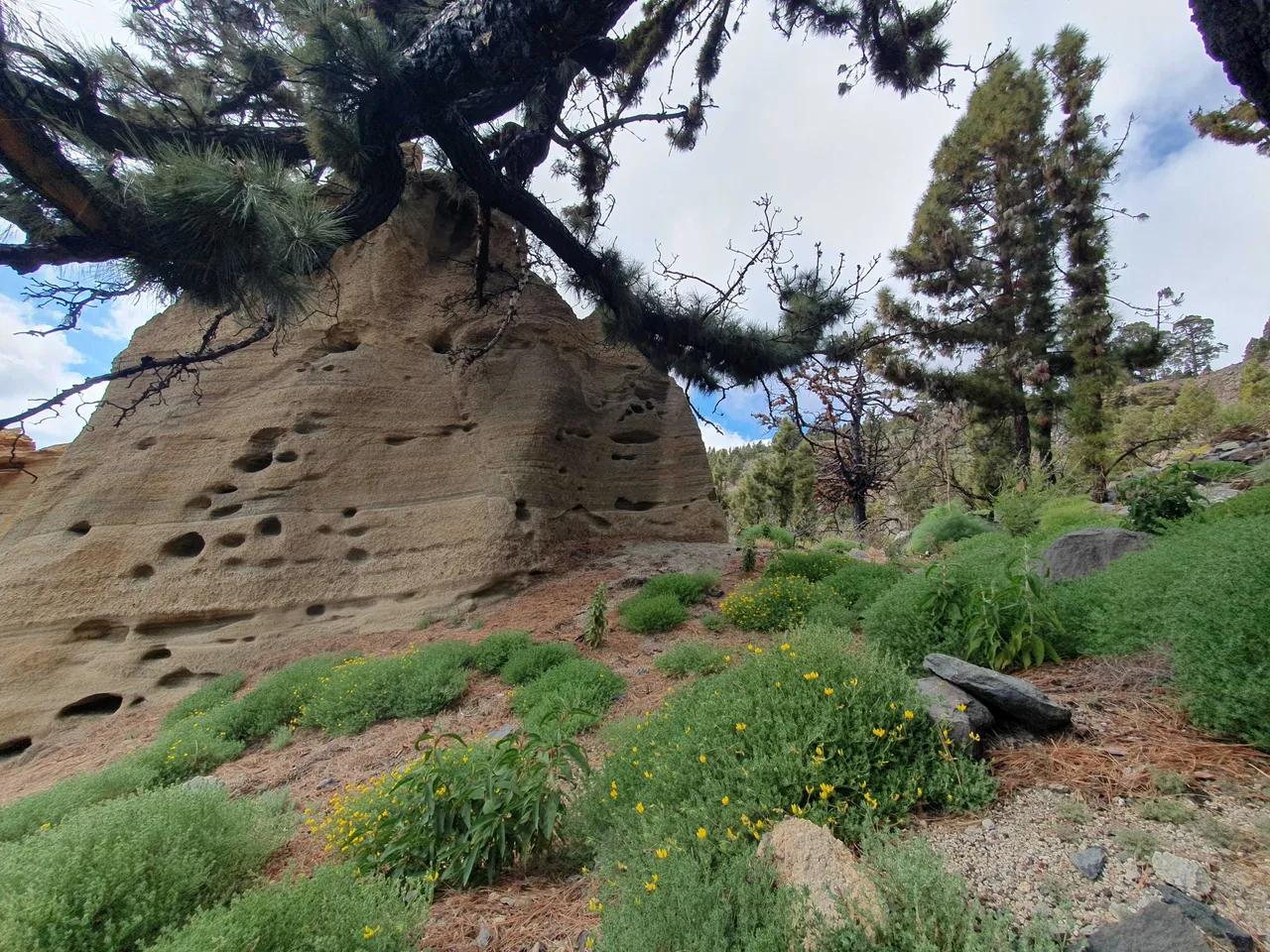
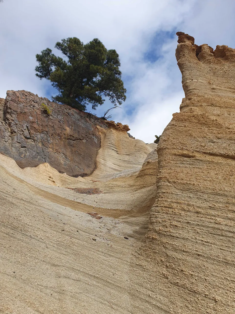
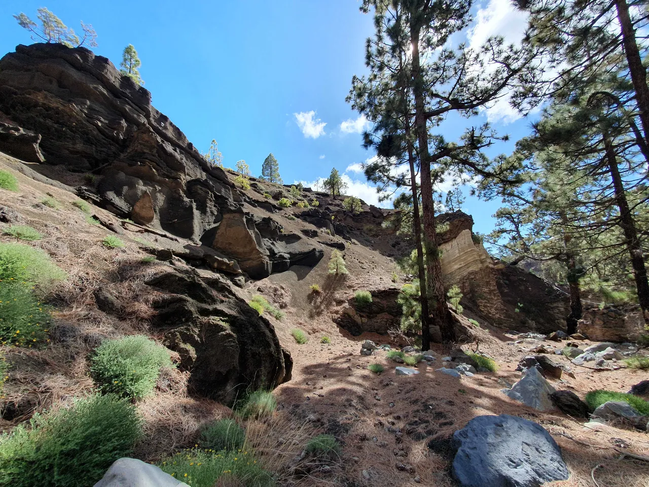
Popełniłem za to zasadniczy błąd i w tę trasę założyłem sobie nowe buty trekingowe, myślałem, że już zdążyły się rozbić. Otóż, nie zdążyły. Trochę pokombinowałem, próbowałem iść boso, aż w końcu wpadłem na pomysł, żeby wsadzić sobie do buta paczkę chusteczek higienicznych. But był ciaśniejszy, ale obdarte miejsce nie było drażnione przy każdym kroku. Po mniej więcej 3 godzinach las zaczął się przerzedzać i już wkrótce moim oczom ukazał się księżycowy krajobraz.
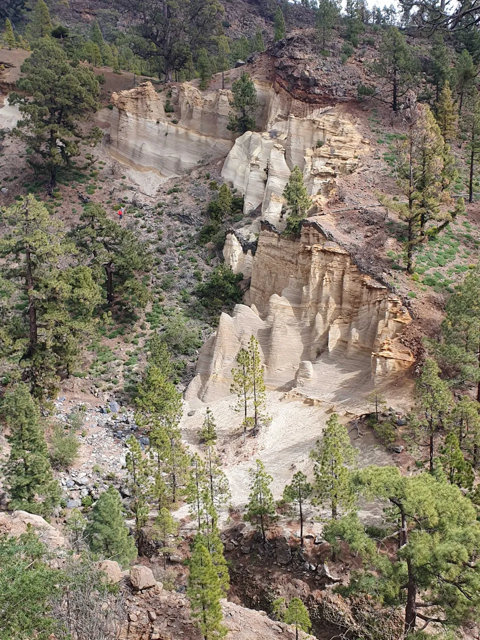
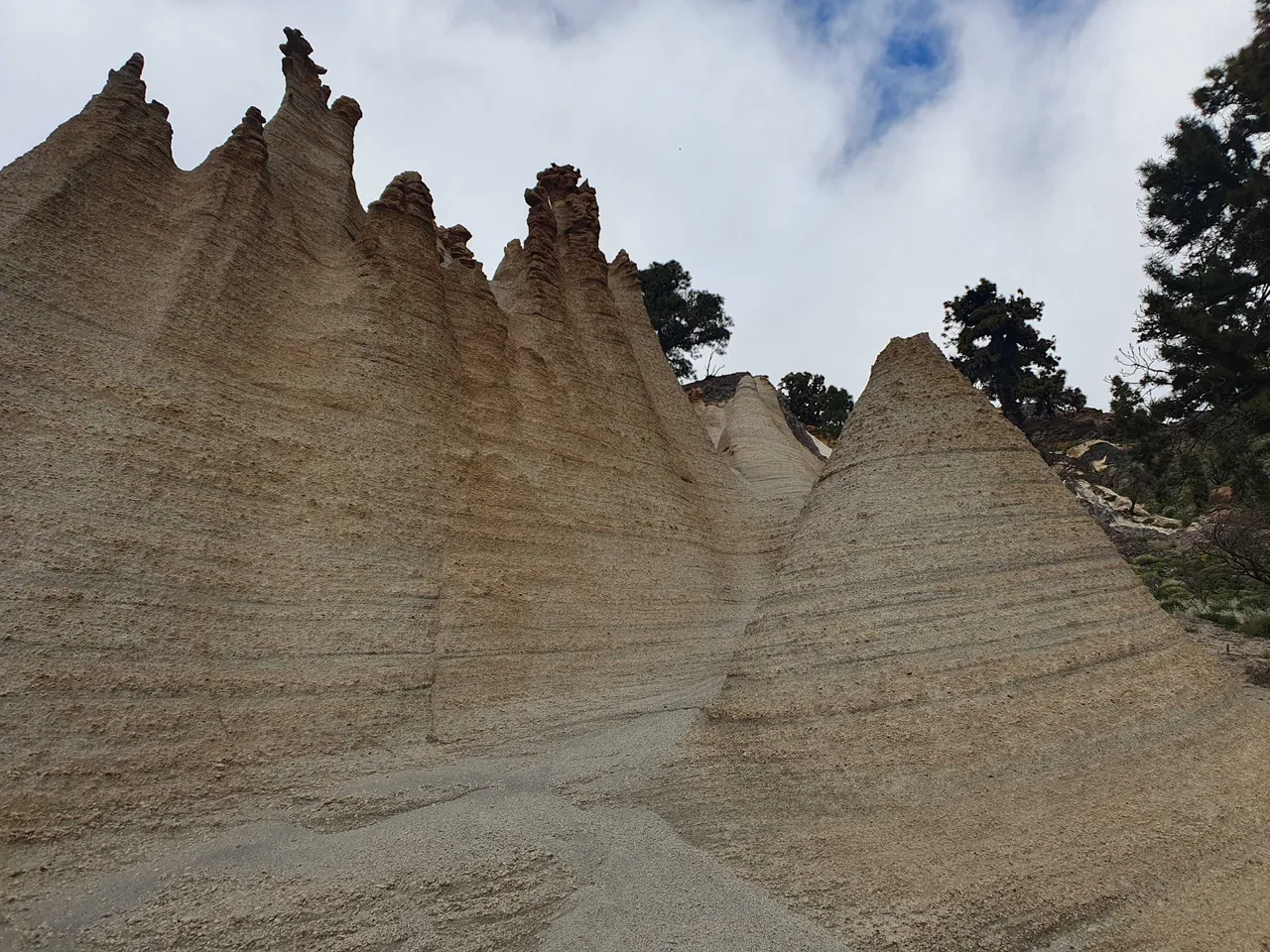
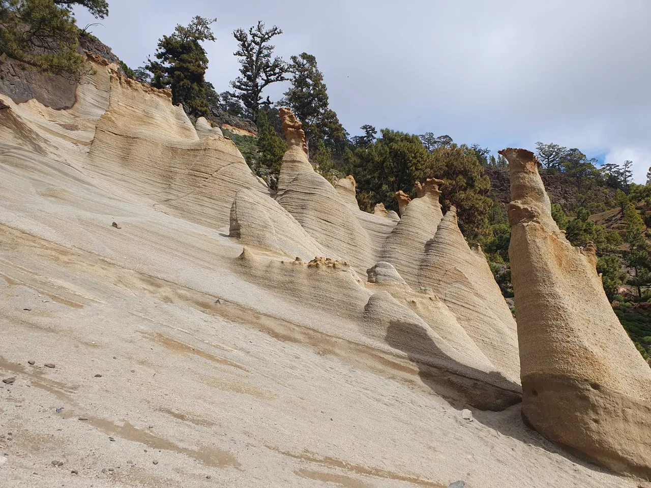
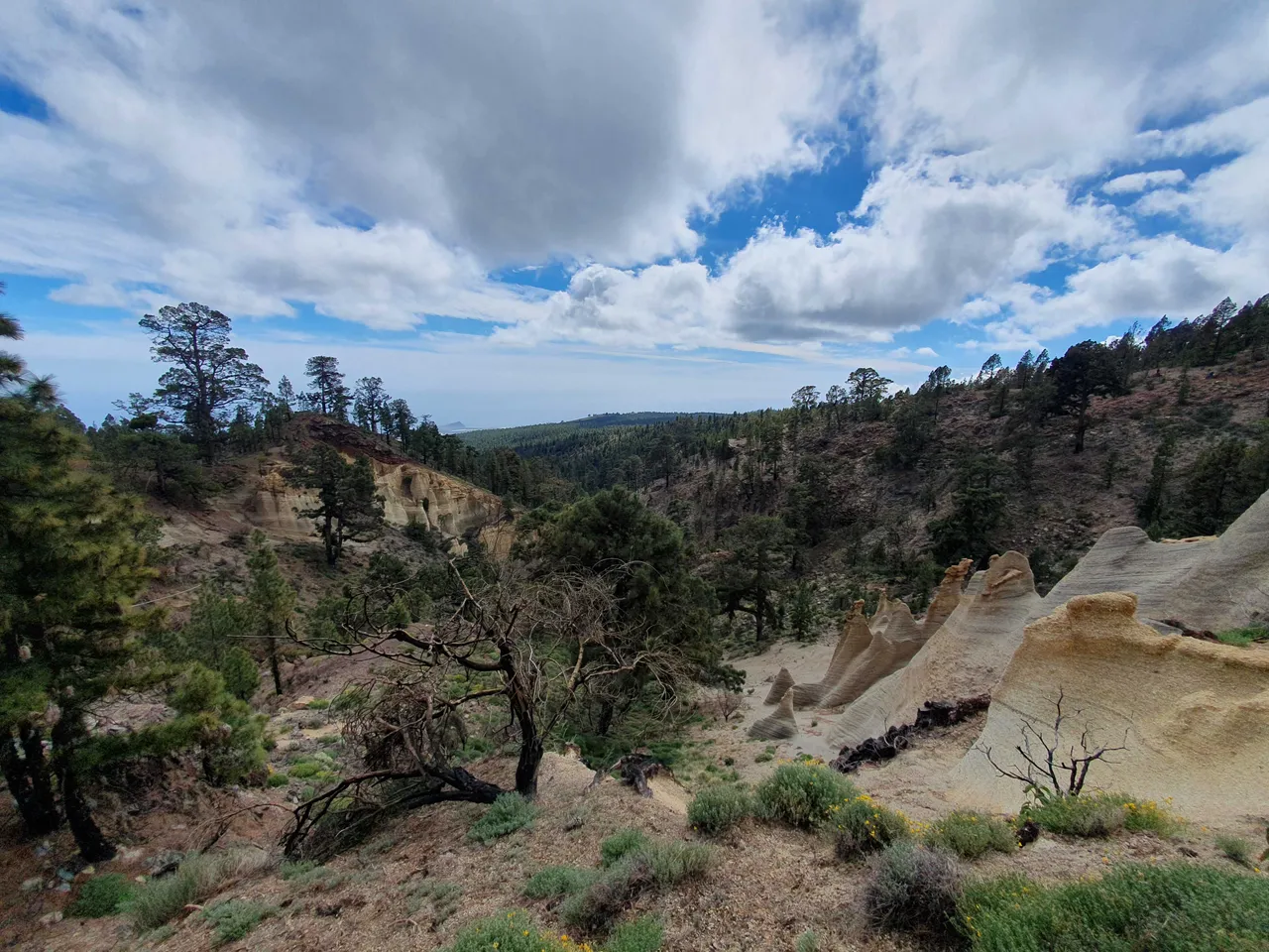
Specyficzne jasnożółte skały to wulkaniczne spływy piroklastyczne poddane kompresji na gorąco przez kolejne warstwy materiału. Wulkan wyrzucił popiół, popiół spłynął w dół wulkanu, po popiele spłynęły następne partie materiału wulkanicznego, pod wpływem temperatury i ciśnienia popiół się "zespawał". Z czasem deszcz i wiatr odsłoniły skały i uformowały te wyjątkowe kształty. Powierzchcia jest dość wrażliwa i kruszy się nawet pod naciskiem stopy, nic więc dziwnego, że tylko tak niewielkie formacje ostały się przez miliony lat erozji.
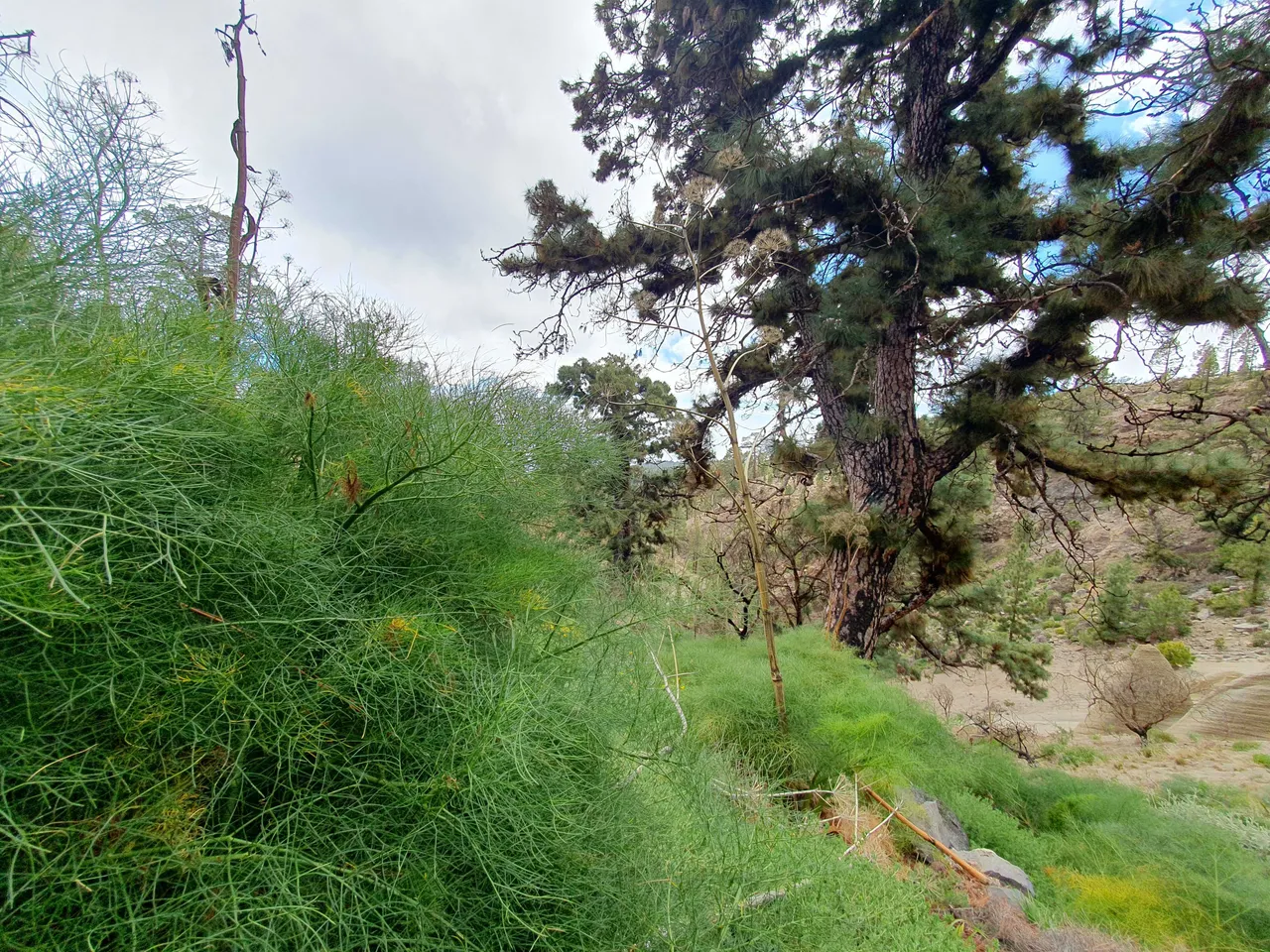
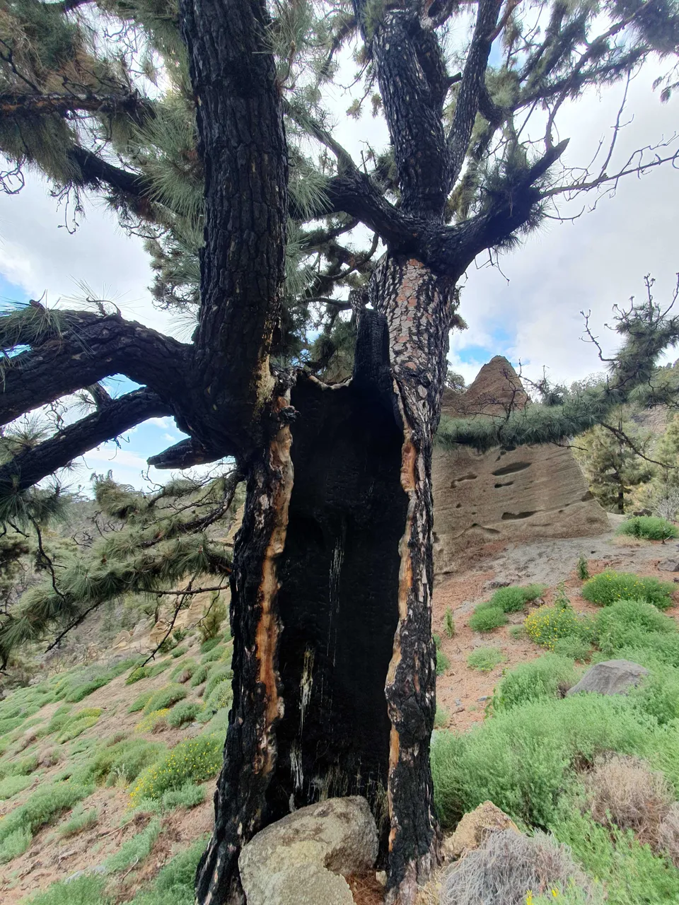
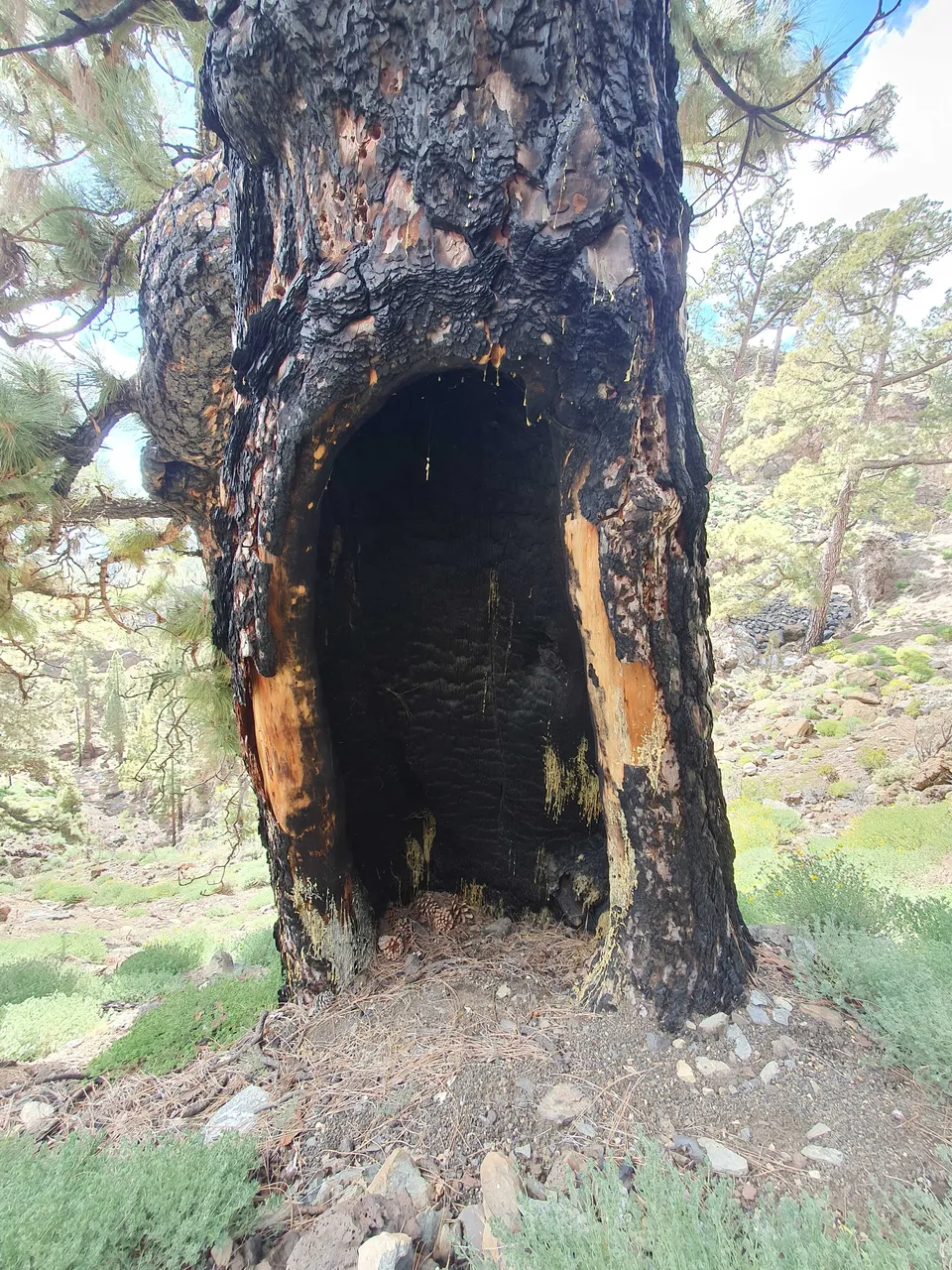
Osobliwego uroku tej okolicy dodaje otaczająca skały wegetacja. Sosny w tym miejscu są dużo starsze, wiele okazów może poszczycić się obwem pnia powyżej trzech metrów! Kiedy podszedłem bliżej zauważyłem, że kora drzew pokryta jest spalenizną. Całe okoliczne wzgórza musiały płonąć relatywnie niedawno. I rzeczywiście, przeczytałem w Internecie, że w roku 2007 tę okolicy nawiedził pożar. Drzewa jednak wydawały się radzić sobie całkiem nieźle, nawet mimo, że niektóre z nich miały wypalone od wewnątrz wnęki!
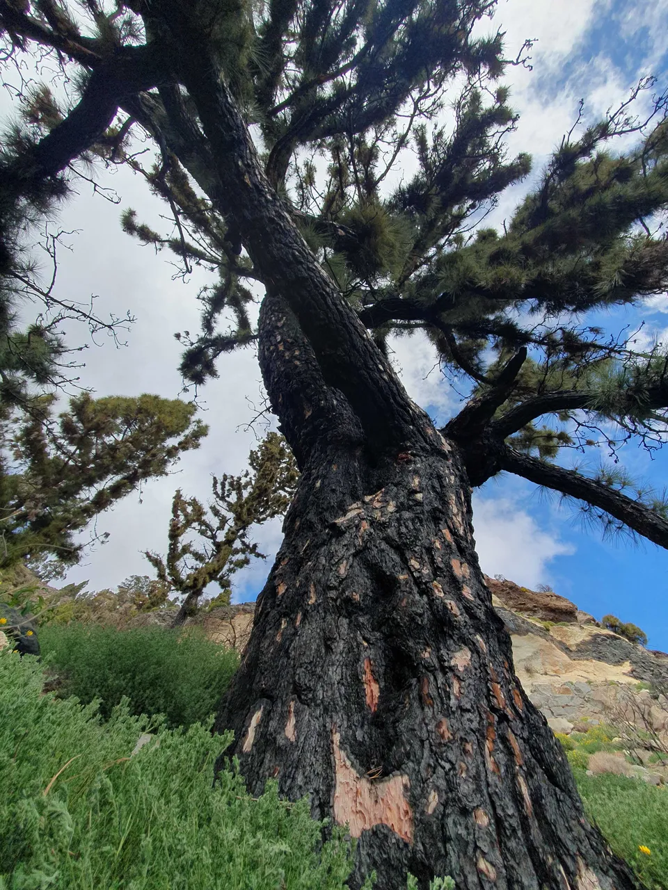
Dało mi to do myślenia i po zejściu z gór poszukałem informacji. Szybko wszystko złożyło się w logiczną całość. Jesteśmy na wyspie wulkanicznej, sosny poddane były więc ewolucyjnej presji na zaadoptowanie się do warunków, w których zdążają się pożary i ekstremalnie wysokie temperatury. Dodatkowo wegetacja jest skąpa, co przekłada się na niską wilgotność. Co zrobiły sosny? Sosny kanaryjskie wykształciły grubszą korę, grube potężne szyszki, które otwierają się pod wpływem wysokiej temperatury. Nasiona wyposażone są w skrzydełko, a więc mogą polecieć kawałek na wietrze i wykorzystać pustkę, która pojawiła się na skutek wypalenia innych roślin.
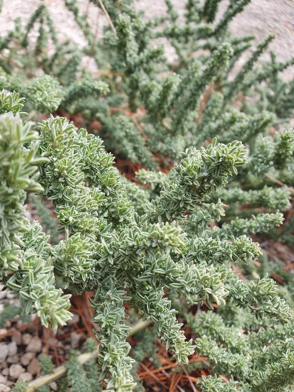
Co prawda, po spaleniu kory drzewo przestaje dalej rosnąć, natomiast sosna przystosowała się i do tego. Drzewo wykształciło unikalną umiejętność do wypuszczania młodych pędów bezpośrednio z pnia i grubych konarów, ale tylko wtedy, gdy te zostaną uszkodzone. Na zdjęciach widać nadzwyczajnie gęste fragmenty korony blisko konarów. Rośliny przystosowane do ognia nazywane są pirofitami. Dzieła dopełniają gęste i długie igły przyczyniające się do absorbcji wilgoci z atmosfery. W surowych warunkach drzewa te właśnie w taki sposób zapewniają sobie cenną wodę. Sosnowe lasy Wysp Kanaryjskich odpowiadają zresztą za większość wody wyciąganej z powietrza atmosferycznego. Nic dziwnego, że nie spotkałem zbyt wiele drzew innych gatunków.
W ciągu ostatnich stuleci większość pożarów wywołana jest jednak przez ludzi i zdążają się one dużo częściej niż dawniej, drzewa są więc pod dużo większą presją, a lasy kanaryjskich gór są zagrożone. Tym bardziej, że podczas mojej wycieczki wielokrotnie widziałem ciągnące się przez setki metrów rury odprowadzające wodę z chronionych przecież gór.
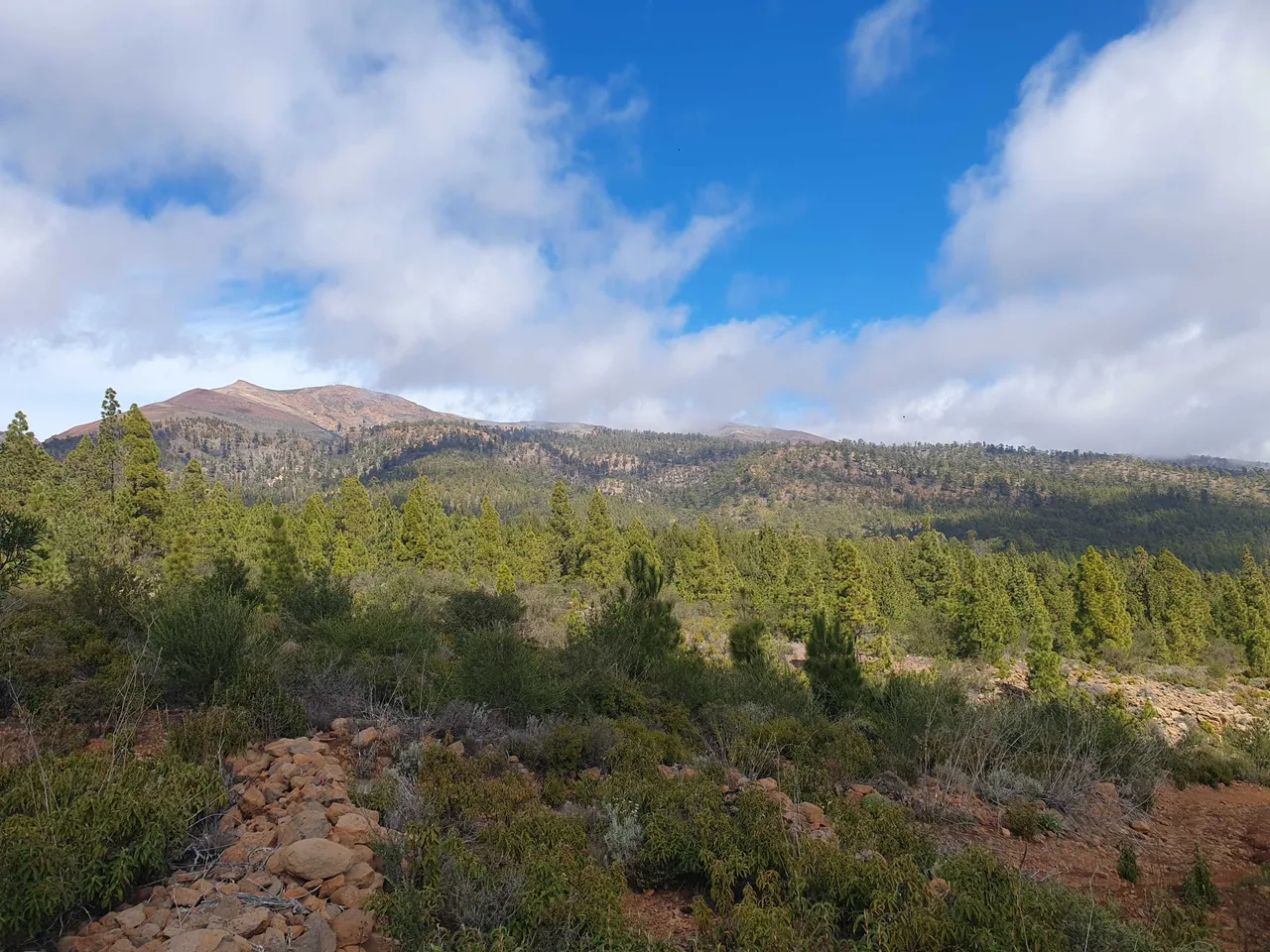
Widzicie tę maleńką kopkę wyłaniającą się ze mgły pośrodku kadru? To Czerwona Góra, na której byłem dzień wcześniej.
ENG
I heard from someone that Tenerife, despite being technically one island, is divided into many worlds. The entire island is just over 2000 km², which is not much, only four times the size of Warsaw. Sometimes you just have to drive 15 km to find yourself in a completely different environment. Yesterday, I wanted to go to the mountains, real ones, I looked at the most recommended routes and quickly chose the one that was closest. The hike led to an interesting place called Paisaje Lunar - Lunar Landscape.
I drove to the end of the asphalt road, prepared a half dozen of hard-boiled eggs on a camping stove, and soon set off up the mountain. As it happened, there was some cross-country race going on, and every now and then a panting runner running down asked me for the way, at least that's what it seemed like, because I understood little.
The first thing that caught my attention was the monoculture forest, all the trees of the same species. Later I found out why it looked like that. The weather was great and although the sky was cloudless, the temperature reached a maximum of 14 degrees at an altitude of 1700m above sea level.
I made a major mistake and put on new hiking shoes for this route, thinking that they had already broken in. Well, they hadn't. I tried a few things, tried to walk barefoot, and finally came up with the idea of putting a pack of sanitary napkins in my shoe. The shoe was tighter, but the scraped place on ma foot was not irritated with every step. After about 3 hours, the forest began to thin out and soon the lunar landscape appeared before my eyes.
These distinctive yellow-light rocks are volcanic pyroclastic flows subjected to compression while hot by subsequent layers of vulcanic material. The volcano threw ash, the ash flowed down the volcano, another material flowed after the ash, and under the influence of temperature and pressure, the ash "welded" together. The rock is quite delicate and crumbles even under the pressure of a footstep, so it's no wonder that only such small formations have remained after millions of years of erosion.
The unique charm of this area is added by the surrounding vegetation on the rocks. The pine trees in this place are much older than at lower altitude, with many specimens boasting a trunk circumference of more than three meters! When I approached, I noticed that the bark of the trees is covered with burn marks. The entire surrounding hills must have burned relatively recently. And indeed, I read on the internet that a fire visited this area in 2007. However, the trees seemed to be doing quite well, even though some of them had hollowed out from the inside! This is peculiar.
This gave me some food for thought and after leaving the mountains, I searched for information. Everything quickly fell into a logical whole. We are on a volcanic island, so the pines were subjected to evolutionary pressure to adapt to conditions where fires and extreme temperatures occur. Additionally, vegetation is scarce, which translates into low humidity. What did the pines do? Canary pines have developed a thicker bark, thick, powerful cones that open under high temperature. Seeds are equipped with wings, so they can fly a little on the wind and take advantage of the void that has emerged due to the burning of other plants.
Although once burned bark stops growing, the pine has adapted to this. The tree has developed a unique ability to release young shoots directly from the trunk and thick branches, but only if they are damaged. In the photos, you can see remarkably dense crown fragments close to the branches. The dense and long needles also contribute to absorbing moisture from the atmosphere. In harsh conditions, these trees provide themselves with valuable water in this way. The pine forests of the Canary Islands are also responsible for most of the water absorbed from the atmospheric air. It's no wonder that I haven't encountered many trees of other species. These conifiers rock! Species like this are called pyrophytes.
However, in recent centuries, most fires are caused by humans and they occur much more frequently than before, so the trees are under much greater pressure and the forests of the Canary Mountains are endangered. This is especially true since during my trip, I often saw pipes stretching for hundreds of meters, draining water from the protected mountains.
Can you see that tiny mound in the middle of picture? This one bathed in a fog. This is a red mountain I climbed a day before.
This report was published via Actifit app (Android | iOS). Check out the original version here on actifit.io