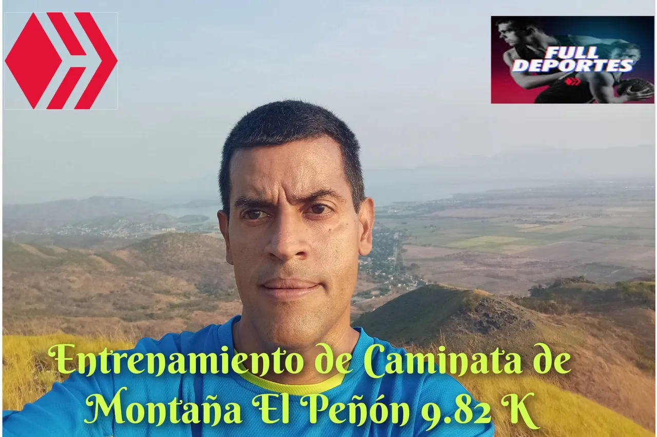
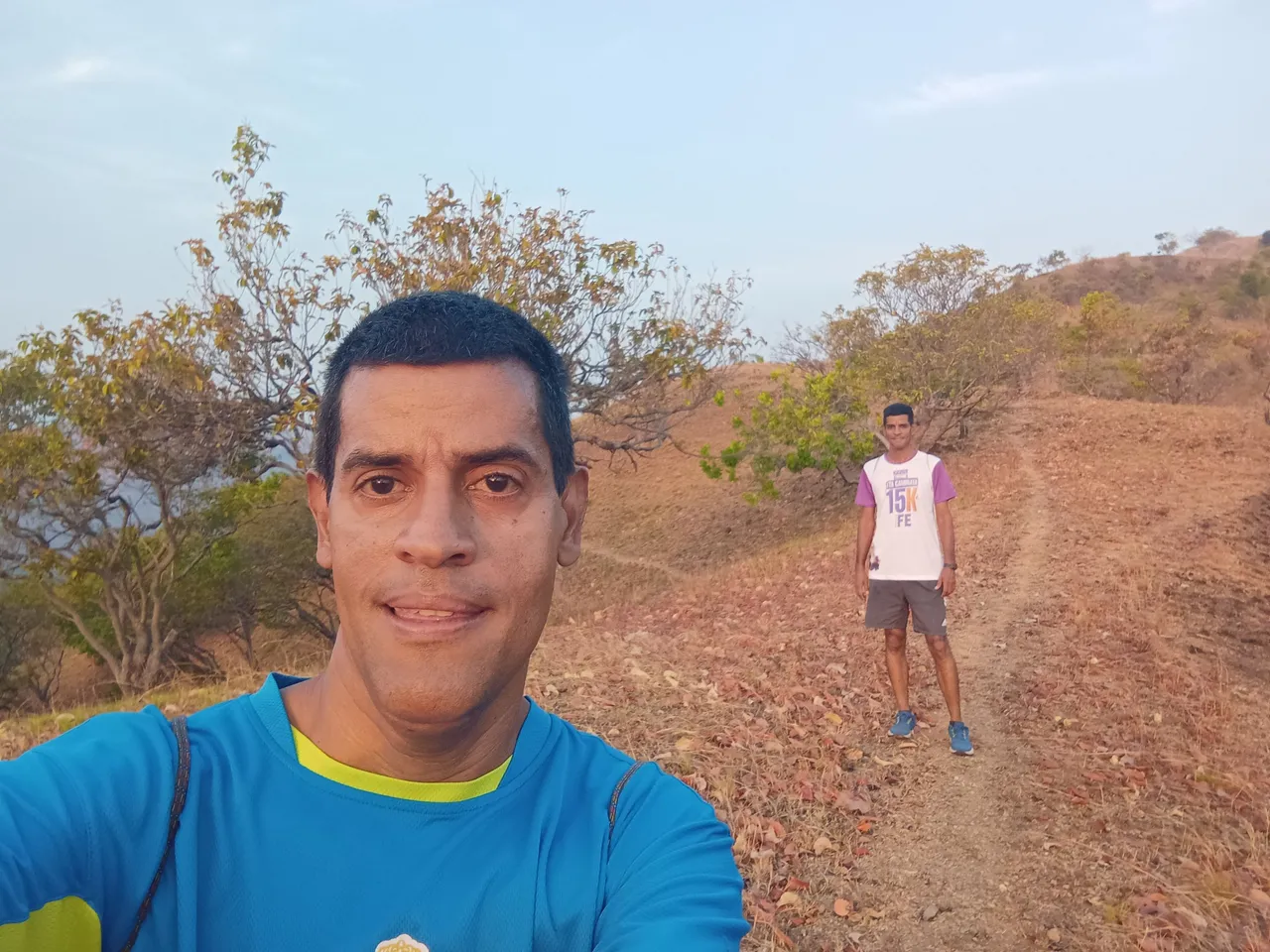
Greetings friends of Hive and @fulldeportes, today I am going to share with you my mountain walking training on the El Peñón - La Bandera - Nueva Ruta route, in the community of San Francisco de Asis, Aragua state, Venezuela.
class="text-justify">Greetings friends of Hive and @fulldeportes, today I am going to share with you my mountain walking training on the El Peñón - La Bandera - Nueva Ruta route, in the community of San Francisco de Asis, Aragua state, Venezuela.
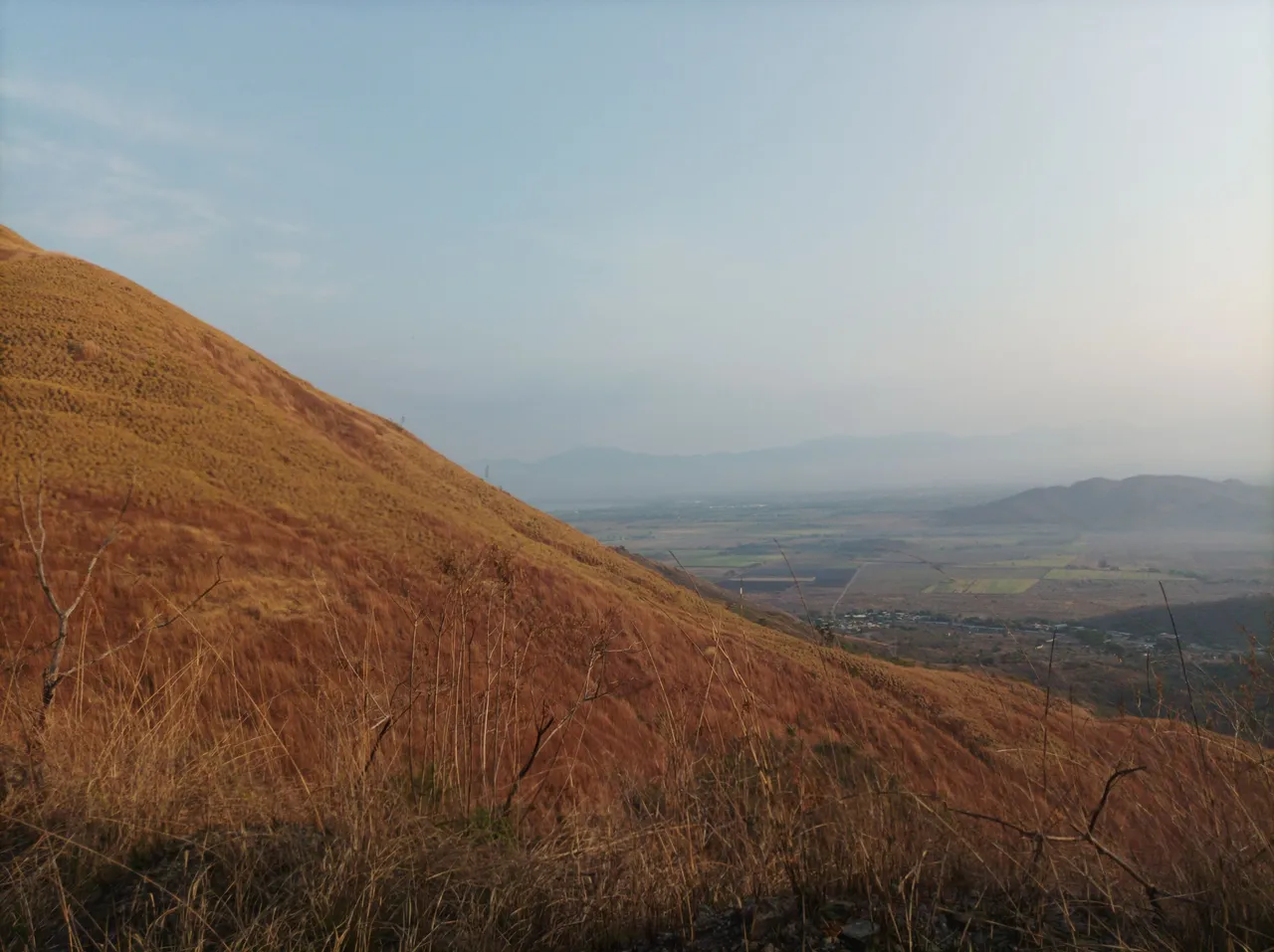
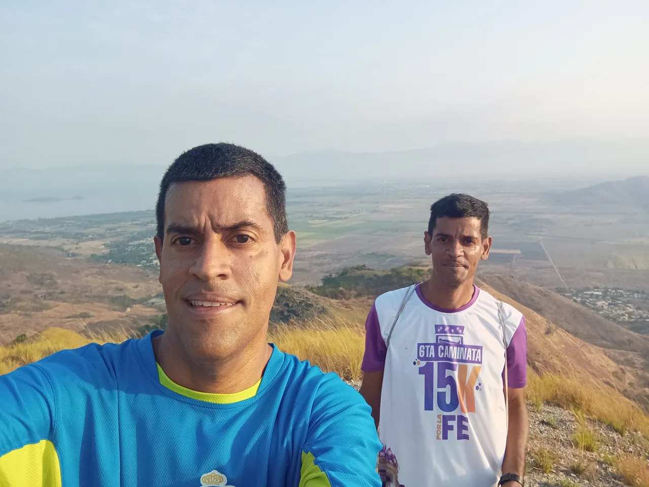
Desde hace dos meses que no subía esta montaña, y me levanté bien temprano para trasladarme en autobús hacia esta comunidad, iniciando mi recorrido a la 6:26 am junto con mi hermano, desde la avenida Bolívar, activando la aplicación Strava para llevar el registro de este entrenamiento. Después de caminar la avenida Bolívar, continúe por el sector de Rancho Grande, para comenzar a subir la montaña con un tiempo de 11:00 minutos.
I had not climbed this mountain for two months, and I got up very early to take the bus to this community, starting my journey at 6:26 am together with my brother, from Bolívar Avenue, activating the Strava application to keep track. of this training. After walking Bolívar Avenue, continue through the Rancho Grande sector, to begin climbing the mountain with a time of 11:00 minutes.
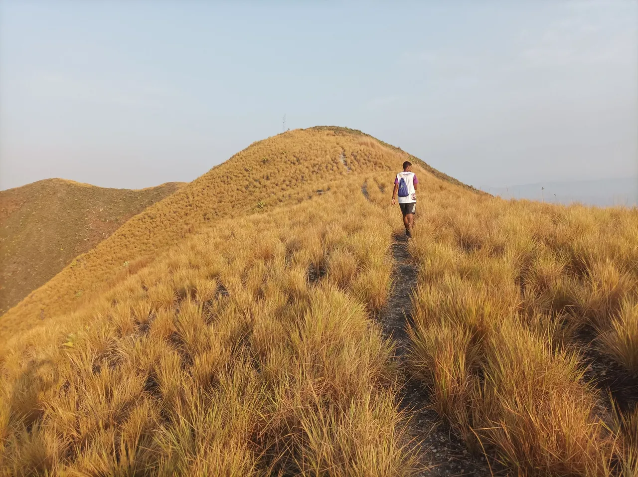
Cabe destacar que continúe caminando, el recorrido a medida que avanzaba se hacia más fuerte las subidas, en los 2.7 K, con un tiempo de 33 minutos, esta parte es una de las pendientes más exigentes de esta ruta. Llegamos a la parte plana con un tiempo de 40 minutos, y un distancia de 3.12 K, en esta parte de la ruta mi hermano tiene su mejor tiempo de 32 minutos, a un ritmo de tipo competencia.
It should be noted that I continued walking, as the route progressed the climbs became steeper, at 2.7 K, with a time of 33 minutes, this part is one of the most demanding slopes of this route. We reached the flat part with a time of 40 minutes, and a distance of 3.12 K, in this part of the route my brother has his best time of 32 minutes, at a competition type pace.
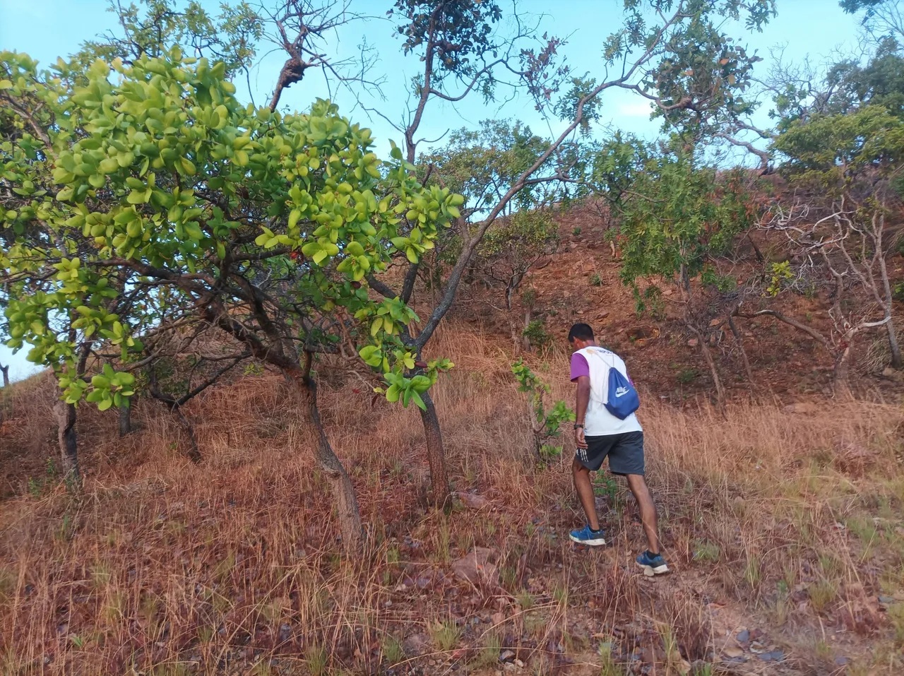
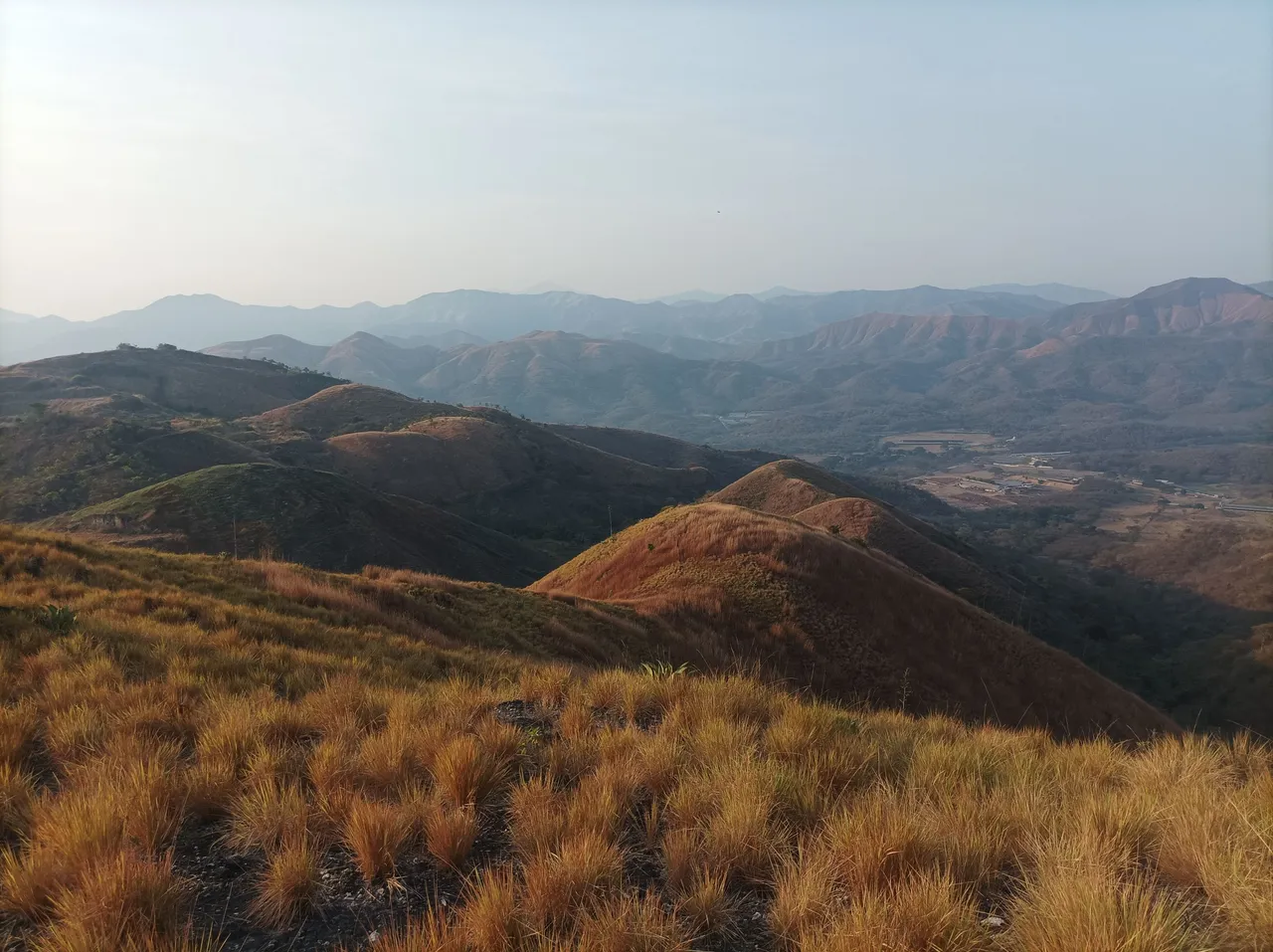
En este trayecto nos detuvimos unos segundos para hidratarnos un poco y mi hermano les coloco agua a tres matas de mamón que sembró recientemente, desde aqui podemos visualizar la montaña más alta donde está la bandera, es la subidas más empinada de esta ruta, marcando una distancia de 4K y un tiempo de 51 minutos.
On this route we stopped for a few seconds to hydrate ourselves a little and my brother put water on three mamón bushes that he recently planted, from here we can see the highest mountain where the flag is, it is the steepest climb on this route, marking a distance of 4K and a time of 51 minutes.
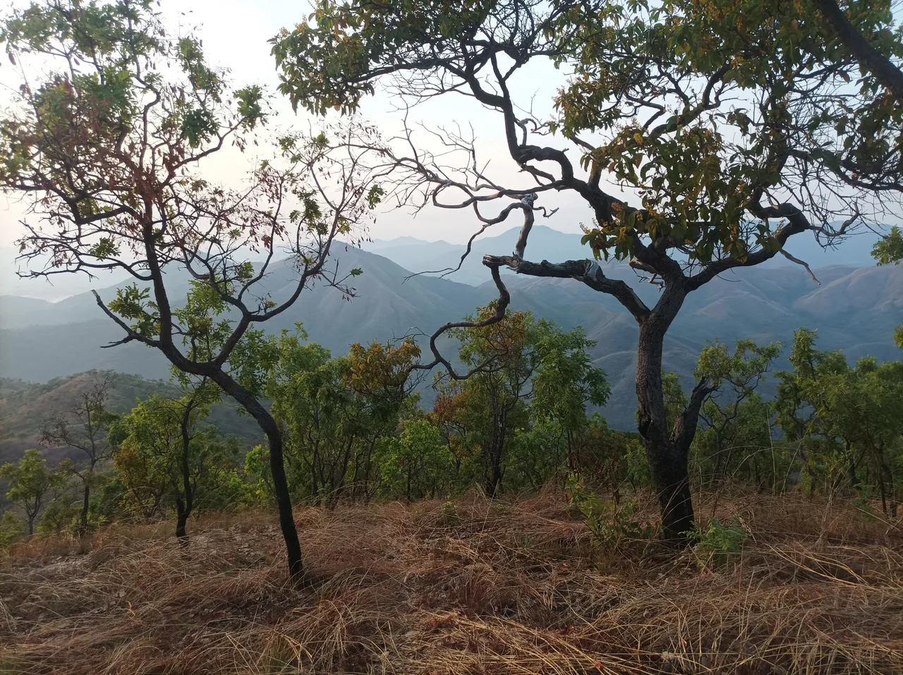
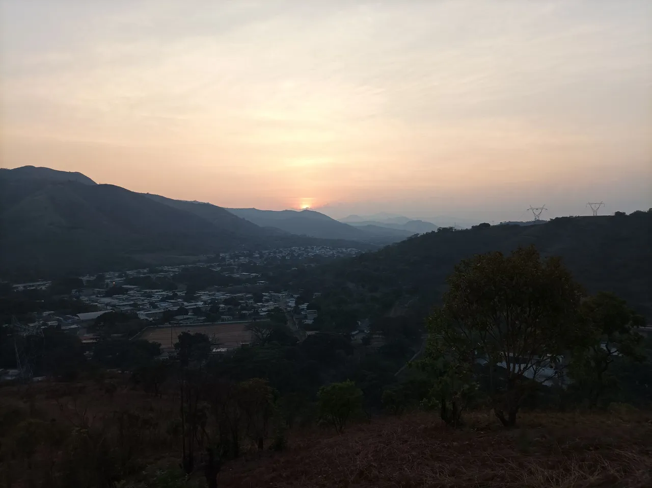
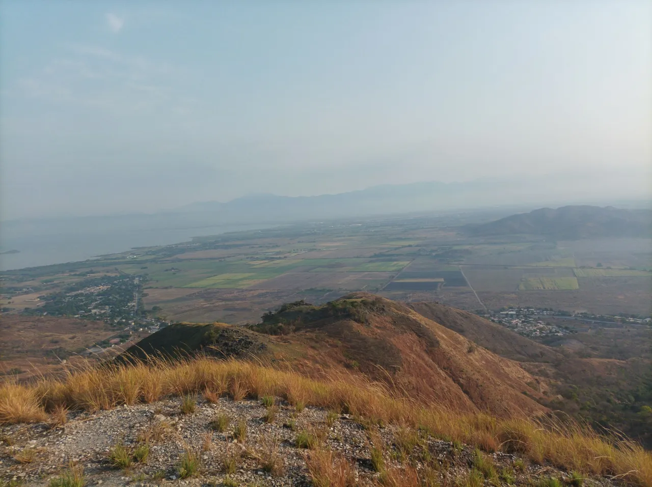
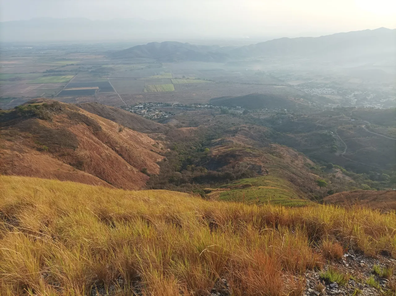
Asimismo comenzamos nuevamente a subir, se sentía la brisa en esta parte alta de esta montaña, continuamos avanzando y llegamos a la cima con un tiempo de 1 hora 3 minutos con 57 segundos, desde aquí se ve el lago de Valencia, la comunidad de San Francisco de Asis, Tocoron, y la siembra de caña de azúcar que resalta desde esta montaña.
Likewise we began to climb again, the breeze was felt in this upper part of this mountain, we continued advancing and reached the top with a time of 1 hour 3 minutes and 57 seconds, from here you can see the lake of Valencia, the community of San Francisco de Asis, Tocoron, and the sugar cane planting that stands out from this mountain
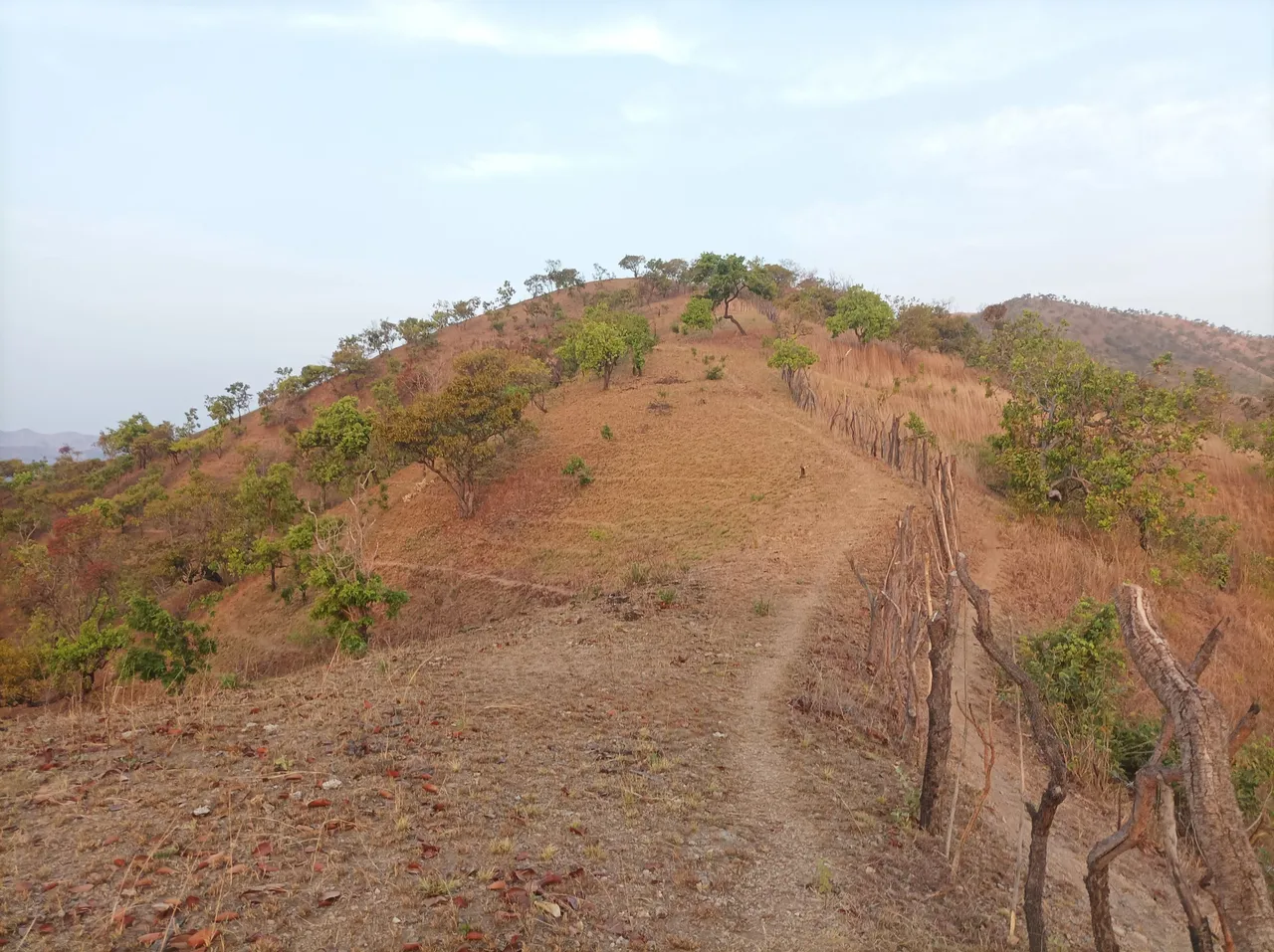
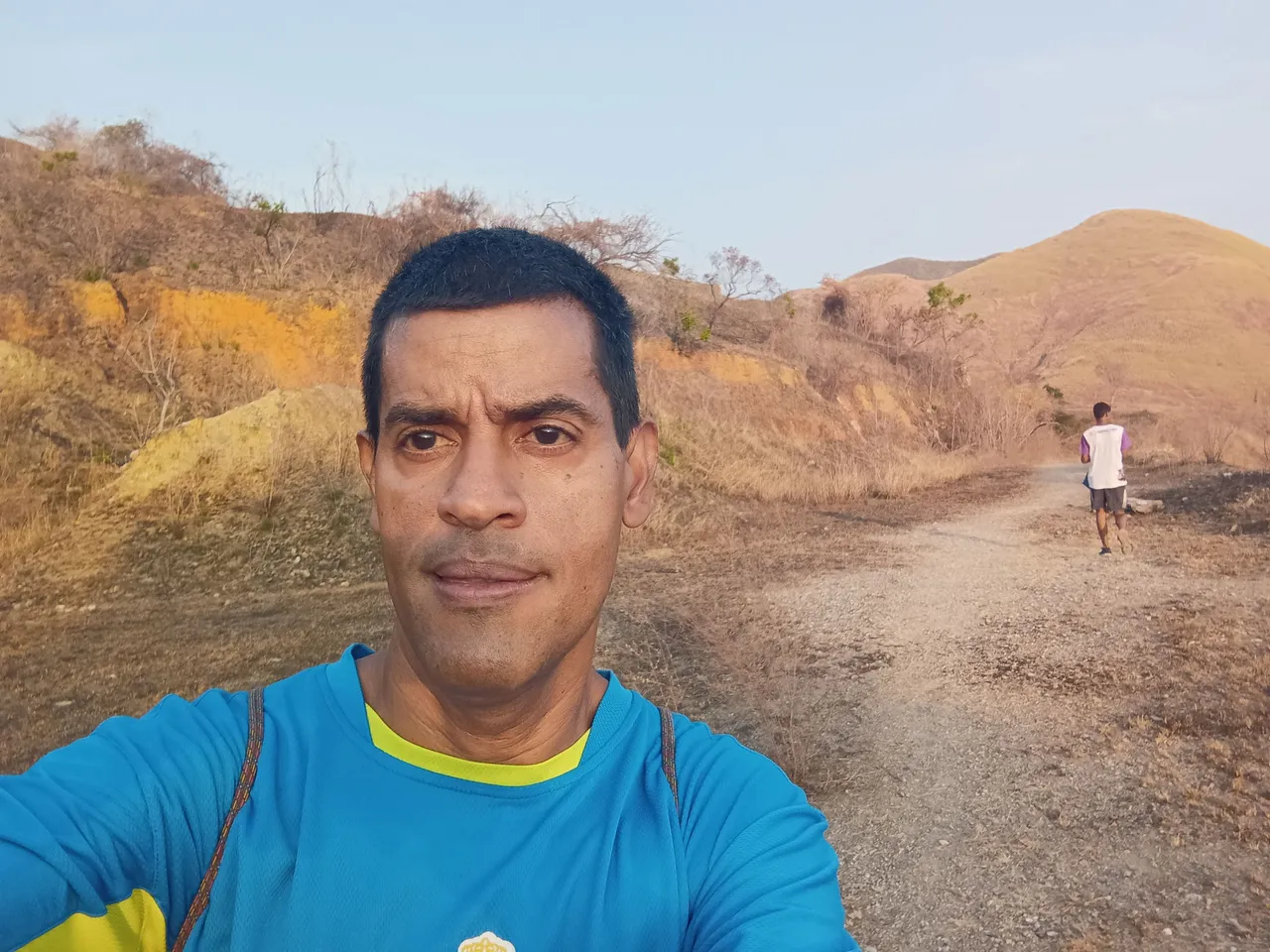
Después de tomar algunas fotografías y hidratarnos, empezamos a descender de la montaña, en la parte posterior podemos ver el cerro que va al sector campesino de Cogoyal, al llegar a la cantera El Peñón, no desviamos por una carretera de tierra que nos llevará a las Antenas, luego tomamos un camino por la montaña que es bastante exigente y llegamos a la parte final, para regresarnos y continuar bajando, esta nueva ruta fue un recorrido de 1Km más y completamos 8Km.
After taking some photographs and hydrating ourselves, we began to descend from the mountain, in the back we can see the hill that goes to the peasant sector of Cogoyal, when we reach the El Peñón quarry, we do not detour along a dirt road that will take us to Las Antenas, then we took a path through the mountain that is quite demanding and wer reached the final part, to return and continue descending, this new route was a further 1Km of travel and we completed 8Km.
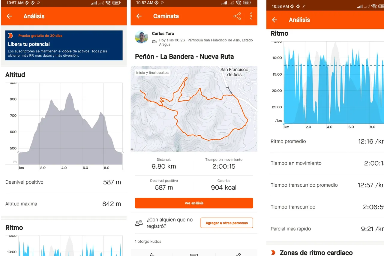
La idea de tomar esta ruta, fue con el fin de hacer más distancia, al llegar a la avenida Bolívar, hicimos un tiempo final de 2 horas 6 minutos con 59 segundos, y una distancia de 9.8K, con una altura máxima de 842 metros registrado en Strava y 13.215 pasos en la aplicación Actifit.
The idea of taking this route was in order to cover more distance. When we reached Bolívar Avenue, we made a final time of 2 hours 6 minutes and 59 seconds, and a distance of 9.8K, with a maximum height of 842 meters. logged on Strava and 13,215 steps on the Actifit app.
Espero que les haya gustado este entrenamiento de caminata de montaña, nos vemos ven una próxima publicación.
I hope you liked this mountain walking training, see you in the next post.
Fotografías: Teléfono Redmi Note 10
Portada realizada en APP GridArt
Logos utilizados de Hive y de fulldeportes
Traductor utilizado: Traductor de Google
Photos: Redmi Note 10 Phone
Cover made in The APP GridArte
Used logos of Hive and fulldeportes
Translator used: Translator used: Google Translate

Vote la-colmena for witness By @ylich