Formentera is the smallest island of the Balearic archipelago, and the most southerly, very close to the Levantine coast of the Iberian Peninsula. It is known for its pristine waters, thanks to the immense meadows of posidonia seaweed. Apart from its beaches of transparent waters, it has not very high, but spectacular cliffs.
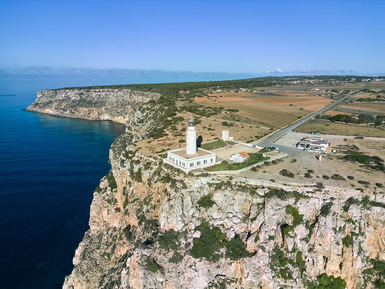
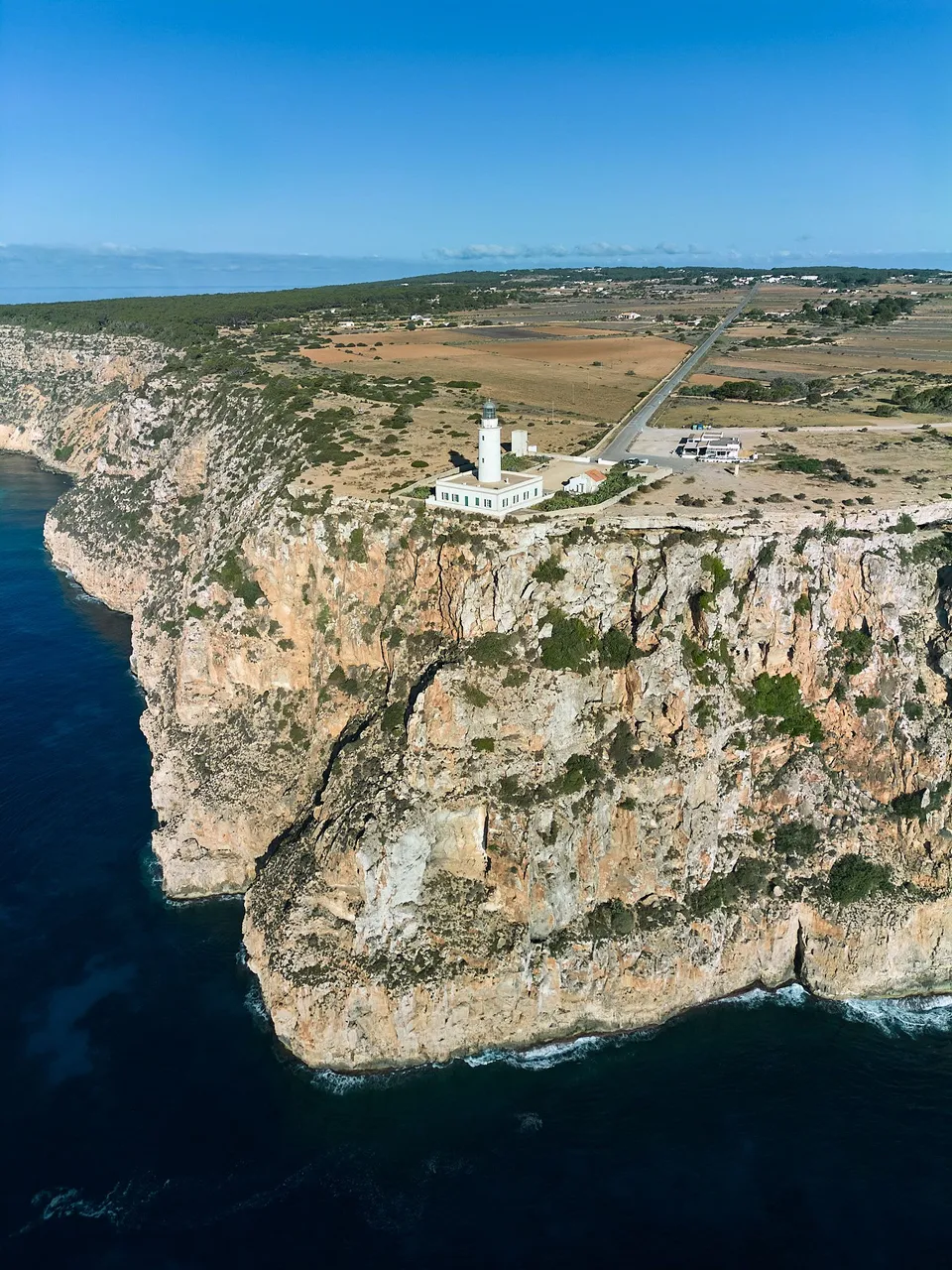
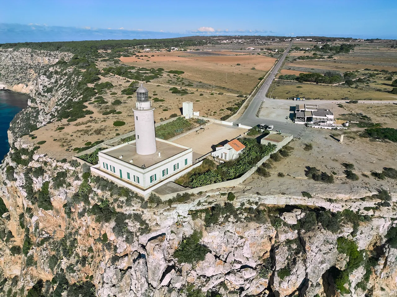
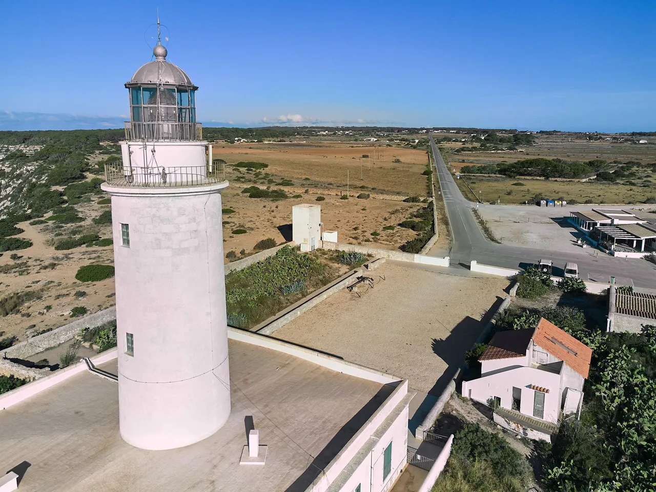
At the most easterly point is the highest point on the island at 190 metres above sea level, the plain of La Mola, where the lighthouse of the same name stands. These shots show this construction presiding over the east of the island.
ESP
Formentera es la isla más pequeña del archipiélago Balear, y la más al sur, muy cerca de la costa levantina de la península ibérica. Es conocida por su aguas pristinas, gracias a las inmensas praderas del alga posidonia. Aparte de sus playas de aguas transparentes, tiene acantilados no muy altos, pero espectaculares.
En el punto más al este se encuentra la máxima elevación de la isla con 190 metros sobre el nivel del mar, la planicie de La Mola y en ella el faro del mismo nombre. Estas tomas muestran esa construcción que preside el este de la isla.
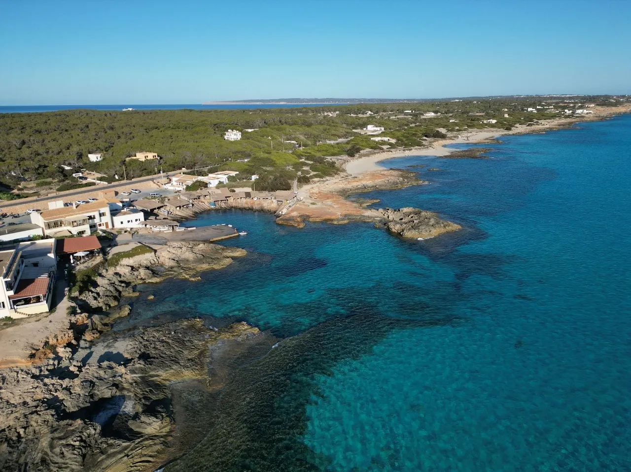
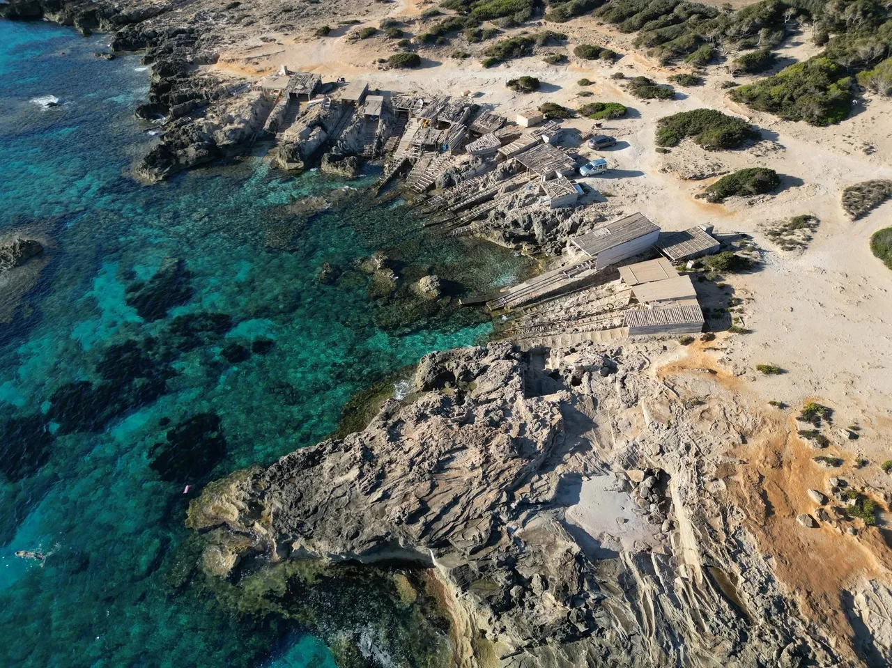
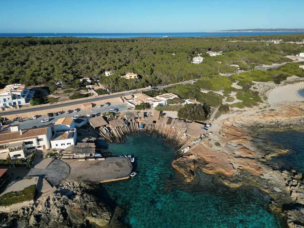
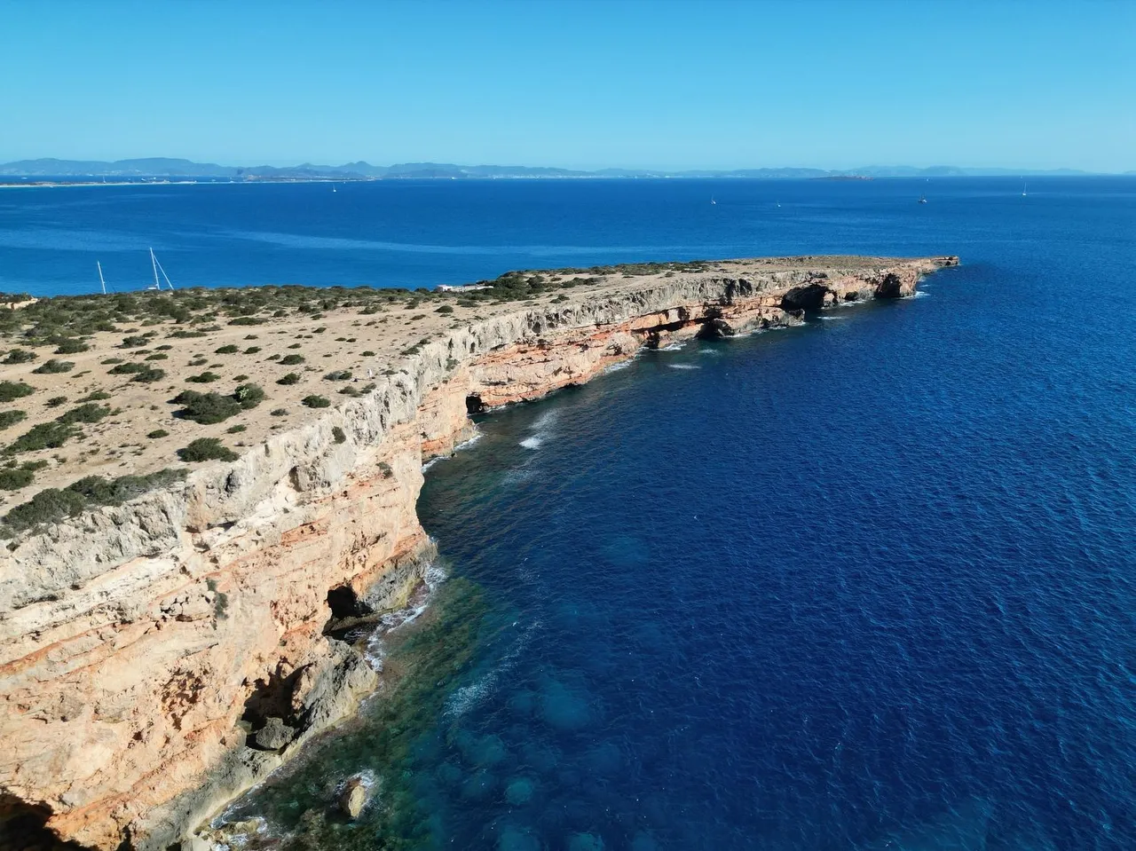
Just before starting the ascent to La Mola is the small village of Es Caló, which had its origins in the tiny harbour of small fishing boats, called llauds in the local language. These boats were taken out of the sea every time they went out to fish, normally every day, and were sheltered from the inclemency and storms in the rustic fisherman's huts that can be seen in the following images.
ESP
Justo antes de empezar el ascenso a La Mola se encuentra la pequeña localidad de Es Caló, que tuvo su origen en el minúsculo puerto de pequeñas embarcaciones pesqueras, llamadas llauds en el idioma local. Estas barcas se sacaban del mar cada vez que salían a pescar, normalmente todos los días, y se resguardaban de las inclemencias y temporales en las rústicas casetas de pescador que se pueden ver en las siguientes imágenes.
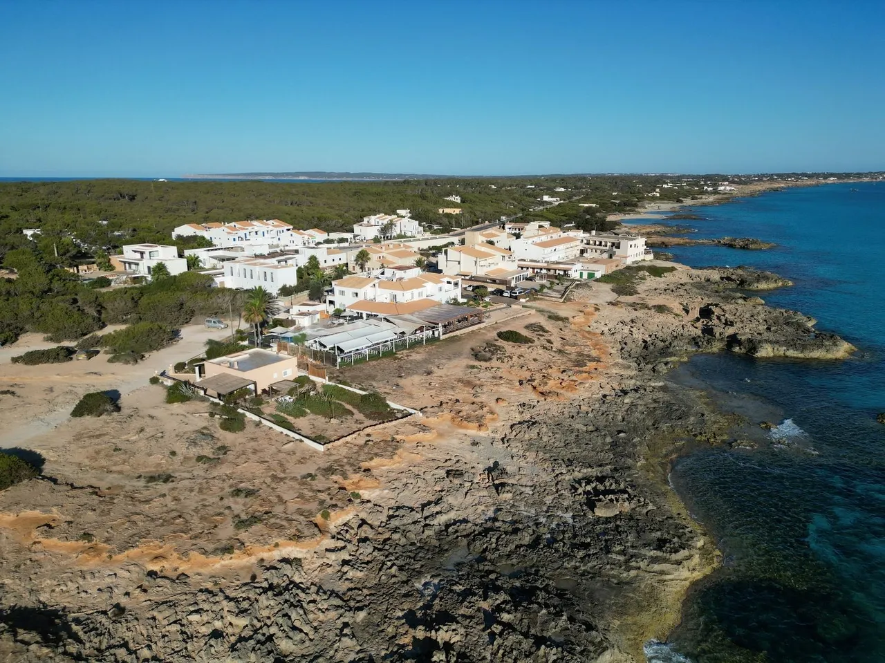
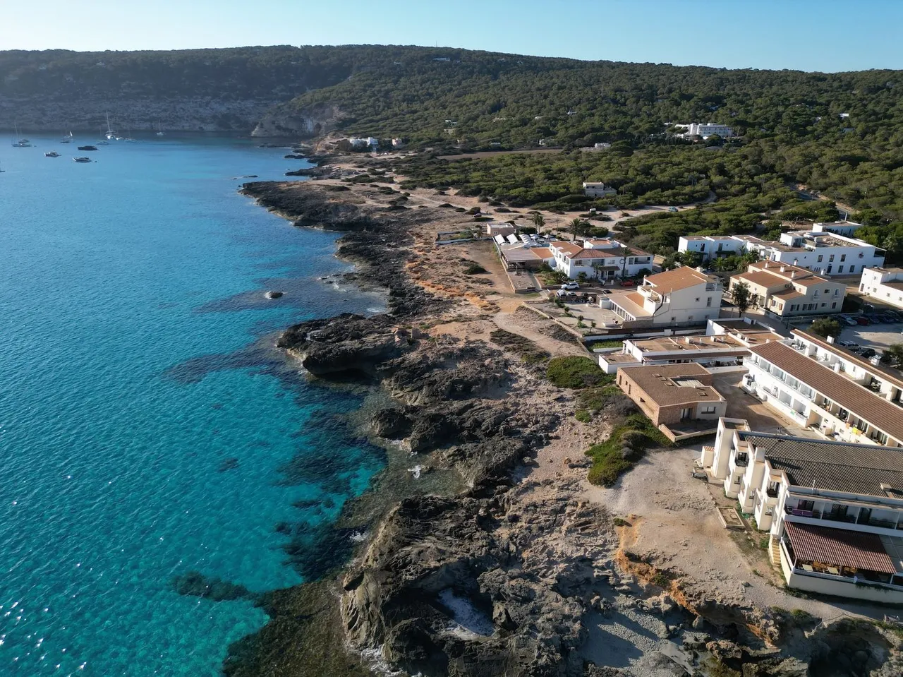
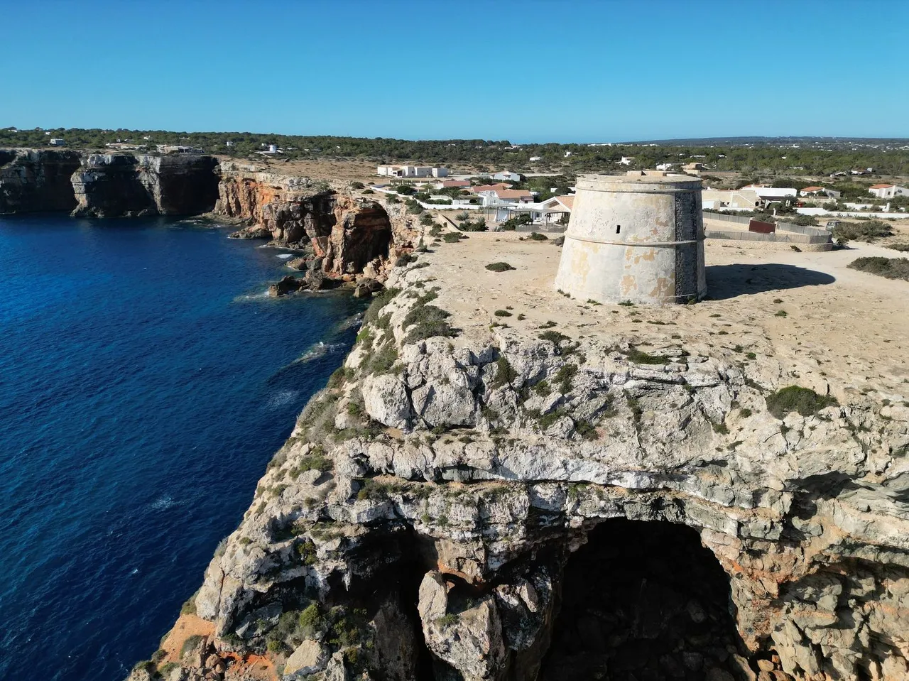
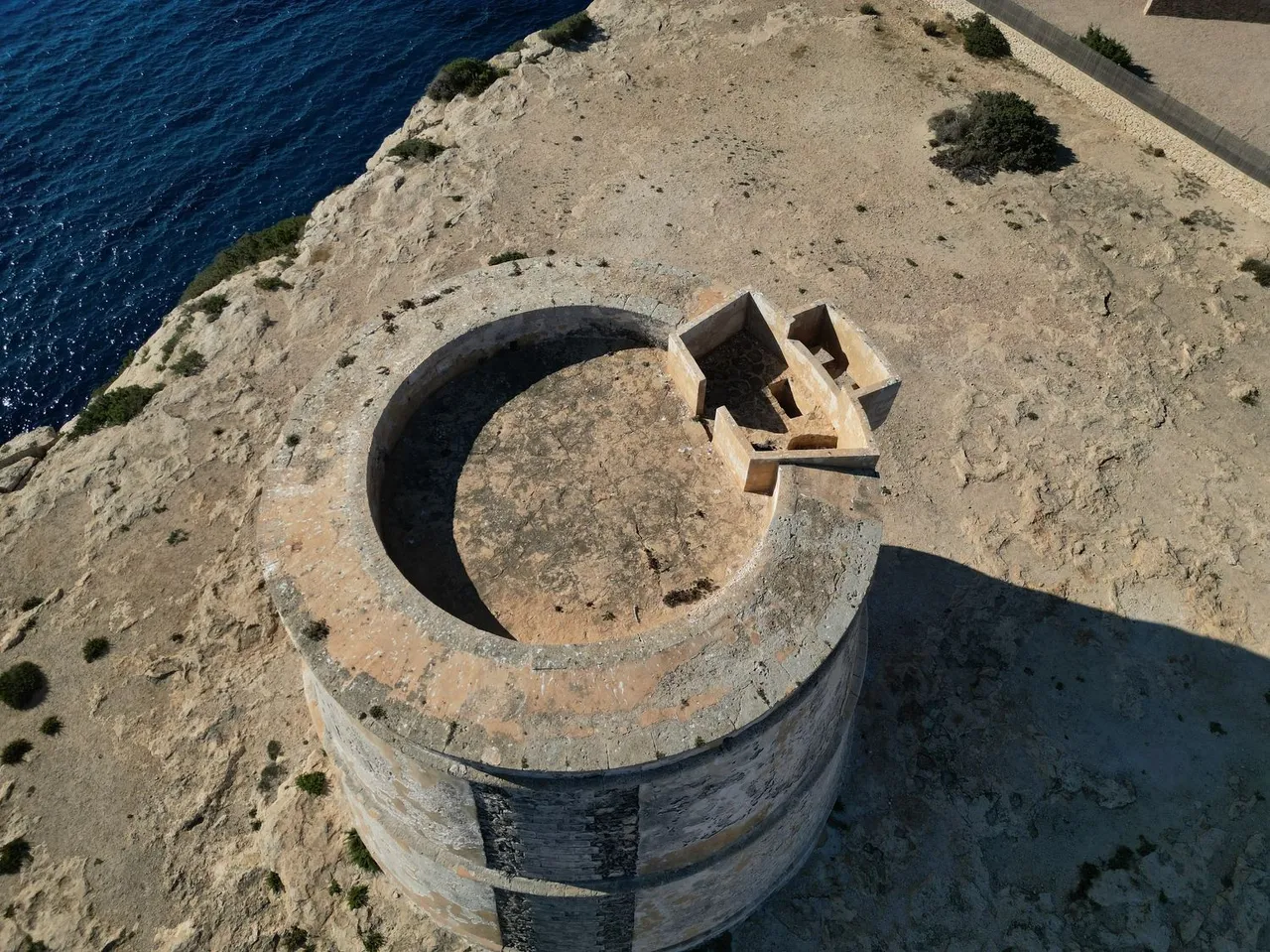
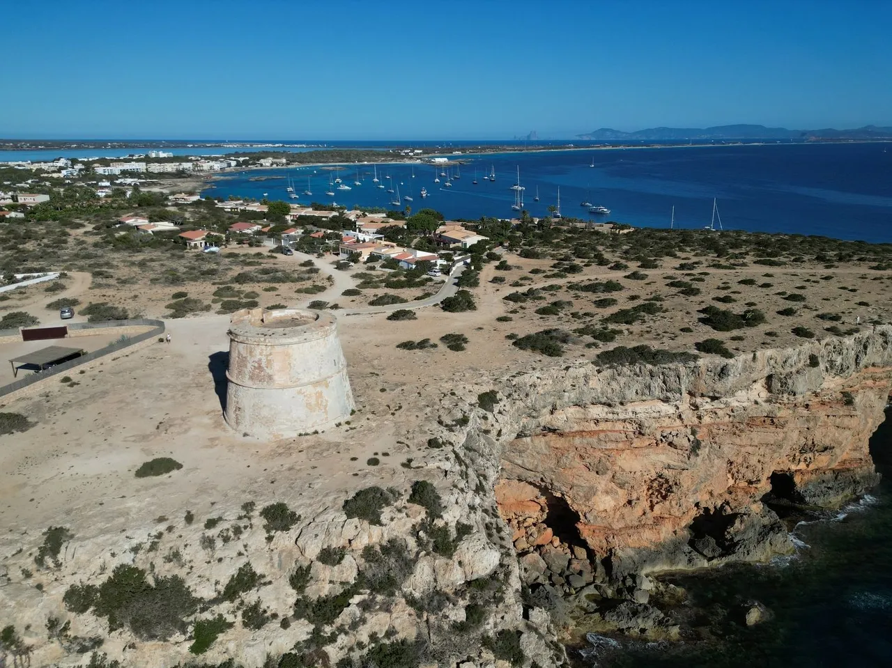
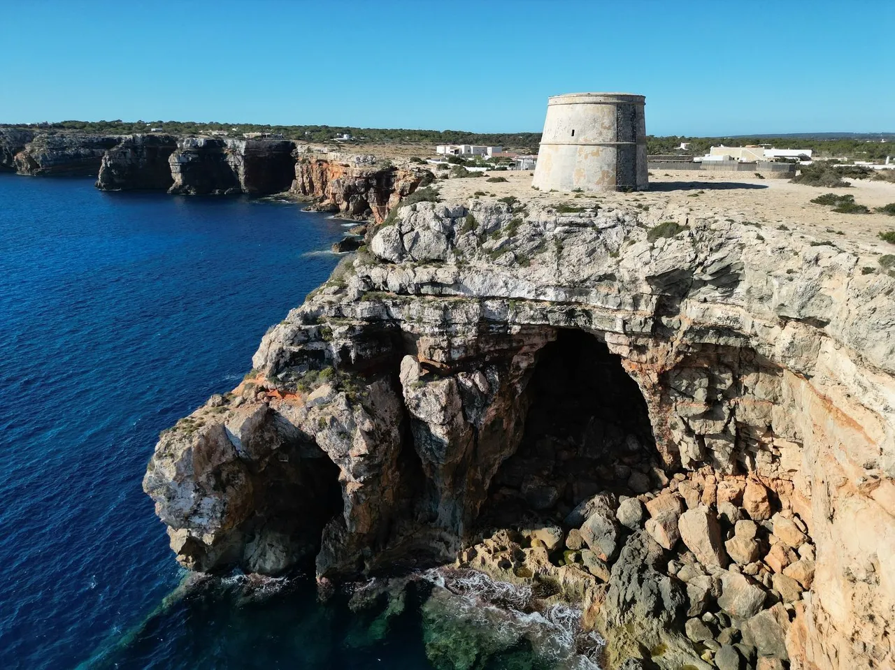
Following the coastline to the northwest we come across over the cliff the tower of Sa Punta Prima. From the four fortified towers that were built on the island in the 17th century, this is the largest and it controlled the arrival of the Barbary pirates coming from the east. These towers had a dual function: on the one hand, to keep watch and, on the other, to serve as a refuge in the event of a siege. In the images you can also see the tourist town of Es Pujols in the background.
ESP
Siguiendo la linea de costa hacia el noroeste nos encontramos sobre el acantilado con la torre de Sa Punta Prima. De las cuatro torres de defensa fortificadas que se construyeron la isla en el siglo XVII, esta es la más grande y controlaba la llegada de los piratas berberiscos que provenían del este. Estas torres tenían una doble función, por un lado de vigilancia y por otro servían de refugio en caso de asedio. En las imágenes se puede ver también la turística localidad de Es Pujols al fondo.
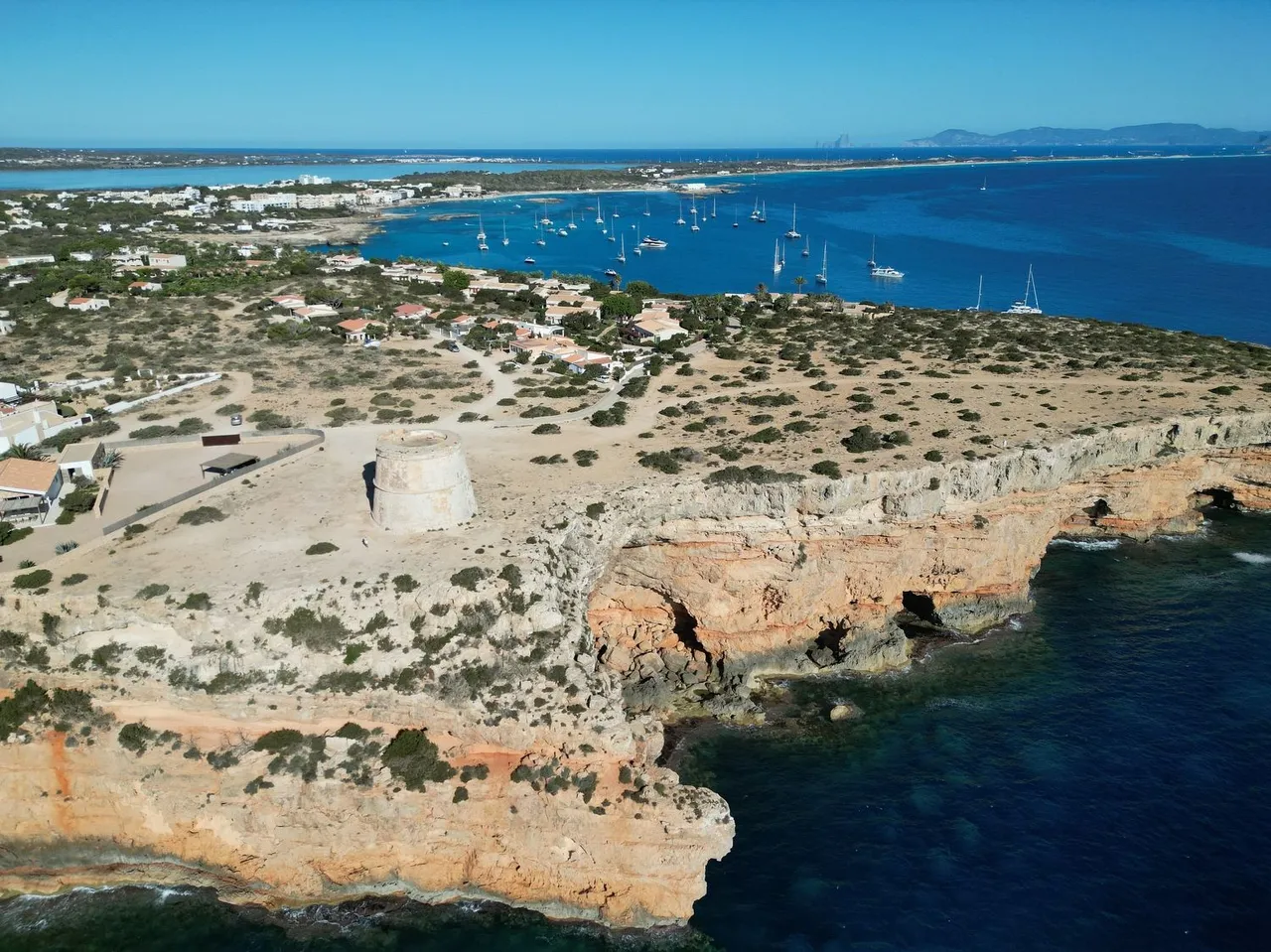
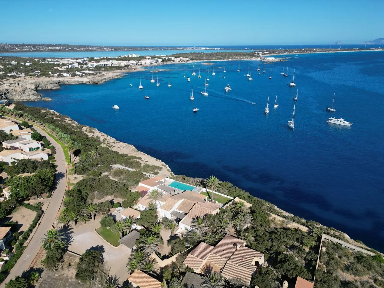
The cape of Punta Prima, which gives its name to the tower.
ESP
El cabo de Punta Prima, que da nombre a la torre.
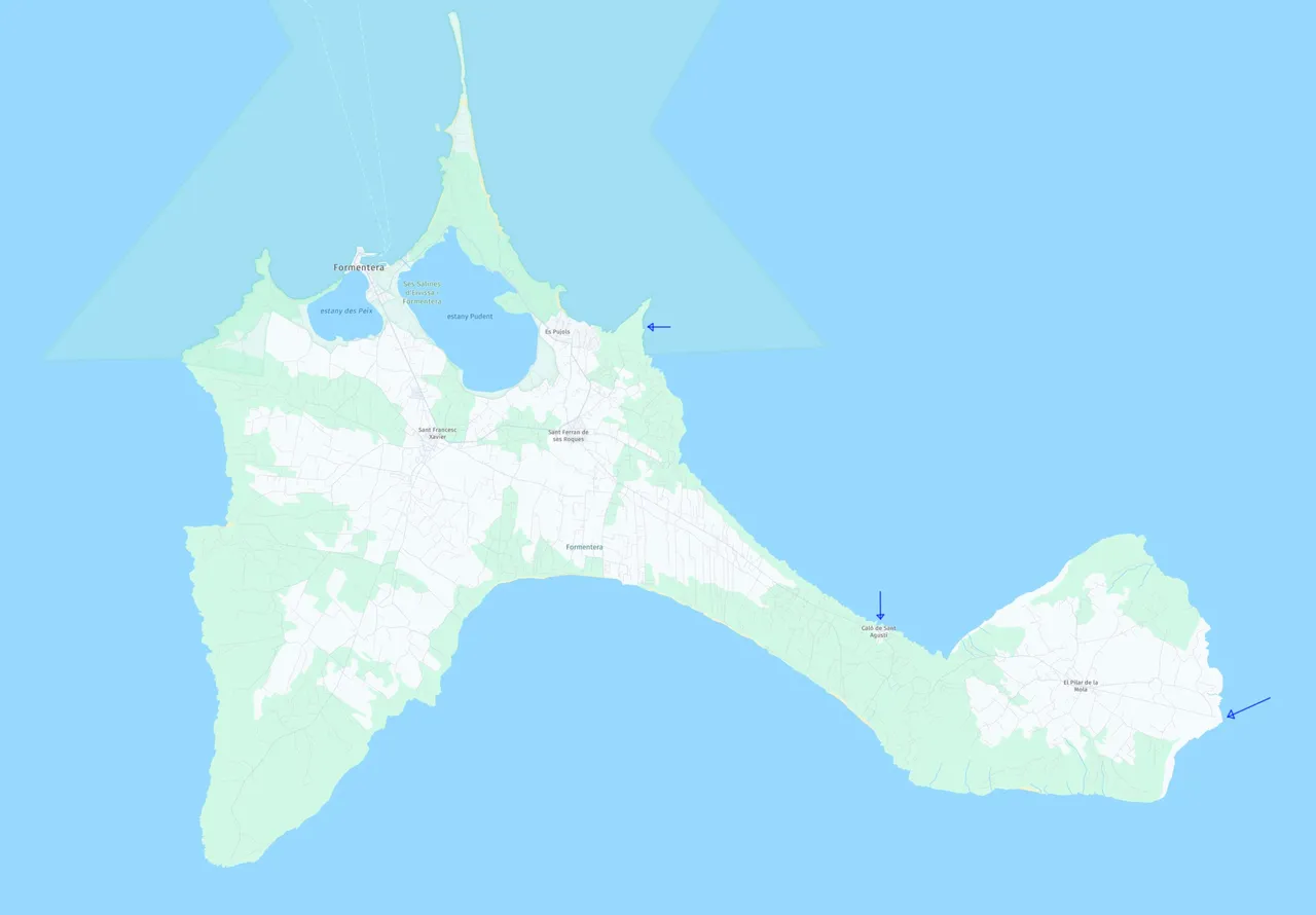
The map of Formentera with the three spots reported in the article.
ESP
Mapa de Formentera con los tres puntos mencionados en el artículo.
Unless stated otherwise, all the pictures and the words are mine.
Do not use this image without my written permission.
Proudly free of AI.
Thanks for stopping by and taking a look.
Lens: DJI 24mm equivalent f:1.7
Drone: DJI mini3 Pro
Processed with Capture One
Translated with DeepL.com plus little adjustments made by me.