The Long Range Traverse was the last thing on our Newfoundland bucketlist. The day before our hike we had to go to the Canada Parks office to sit for an introductory meeting on the “trail”, if you can call it that. This is an hour long meeting where Parks try and scare you out of doing it, and rightly so. This isn't your regular backcountry hike and they want to prevent any unnecessary rescues. There are no trails and it is mostly route-finding. The weather can change suddenly and you must be prepared to extend your hike at a moments notice. You must also have a locator beacon and be able to use a GPS.
Day One
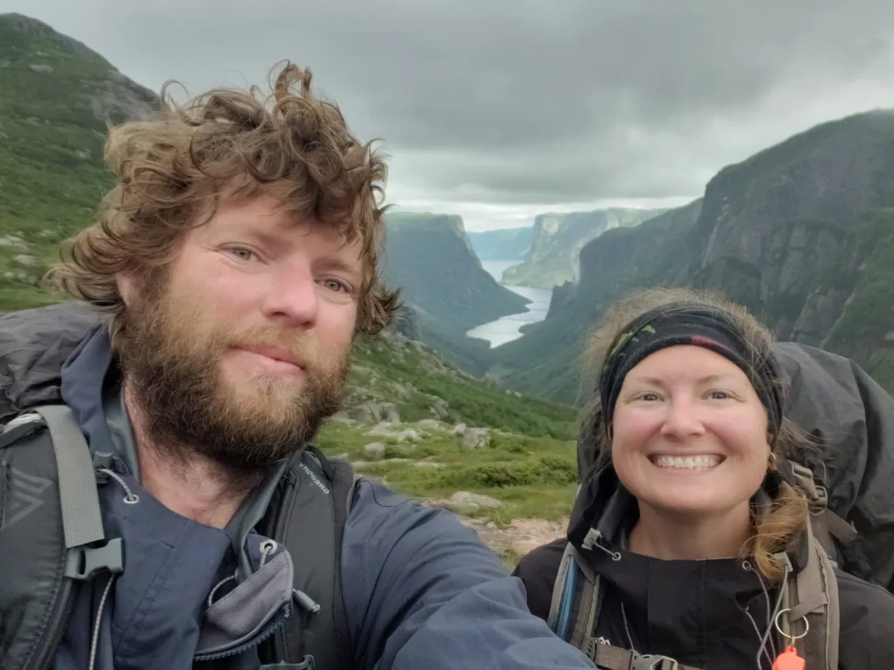
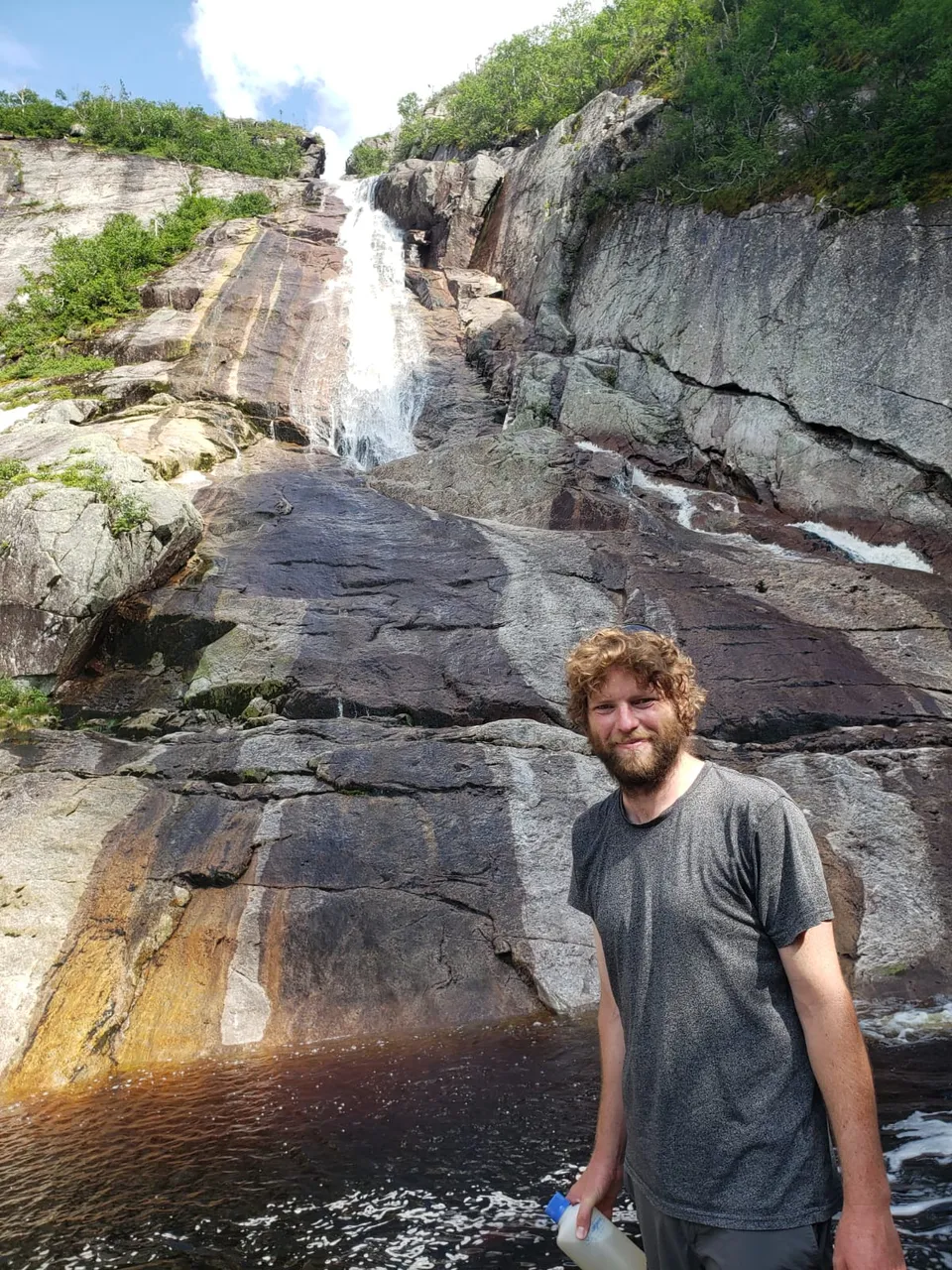
Now, the trailhead itself is interesting. First you have to hike 3km in to a tourist boat. The boat then takes you up the Western Brook Pond and drops you off at the end. That’s the easy part… then it gets interesting. So, the parks officer described the first day as scrambling. You had to “scramble” up a cliff face to the top of the plateau. Now, I would not describe what we did as a scramble. I would describe it as rock climbing! There were points where we had to actually take our packs off and push it up crevices or through holes! Anyway, the view at the top was well worth the sweat and pain. We could see all the way down the fjord and see the massive Pissing Mare Falls (yes, that is its name). It was beautiful. We decided to find a spot near the viewpoint to camp the night. There wasn’t really anywhere entirely flat so we found the flattest spot we could. We were lucky we arrived when we did because we got the tent set up just before the rain arrived. We were lucky to have a beautiful sunny day, but the night was definitely not so nice. We had torrential rain and gale force winds. We spent a restless night worrying about whether the tent would hold up… then we would’ve been in trouble because not even a rescue mission could have saved us in that weather.
Day Two
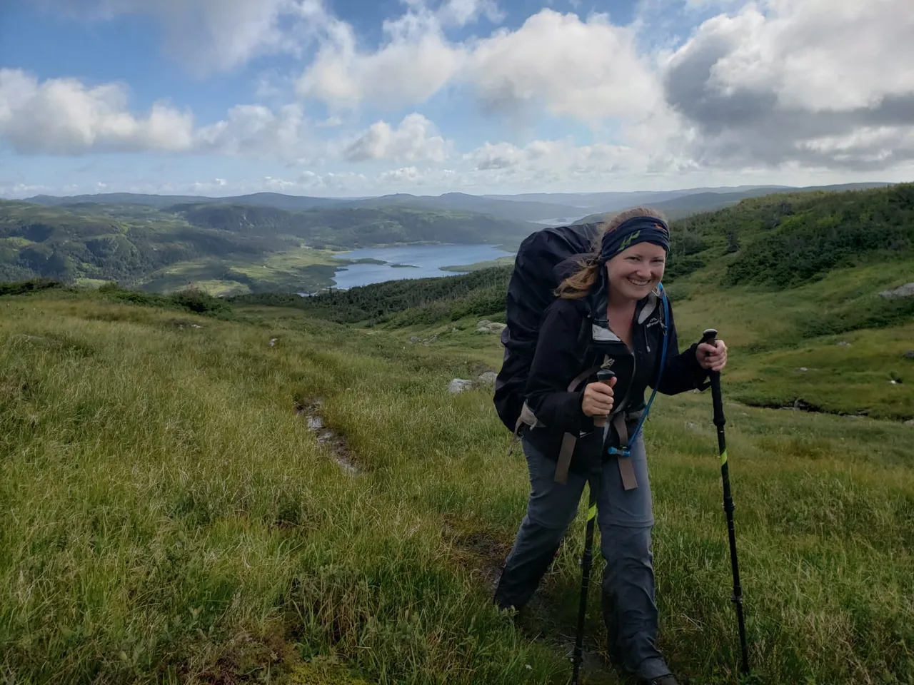
Thankfully we woke the next morning all in one piece. However, the fog had set in. It was so thick it would be impossible to navigate so we took the opportunity to catch up on some sleep. By 11am the fog had cleared enough for us to navigate. So we packed up and set off for day 2. After the fog fully cleared the day ended up being nice and sunny and with a cool breeze most of the time to keep the bugs away. But the "trail" was a wet one. The Parks officer didn’t lie about that! The whole hike was navigating through bogs, and we even had a small river crossing. Our shoes were definitely wet by the end of the day, and they would now be wet for the rest of the trip. We camped at another unprotected spot and the wind and rain started up again just as we settled in to bed. Finding a protected campsite where we were was hard. The trees are so stunted they offer no protection from the wind. While it was still a restless night we still slept better than the night before, and we had a tent pad this time too, which was lucky because the campground was mostly just water. Honestly, it was like being on a boat. haha!
Day Three
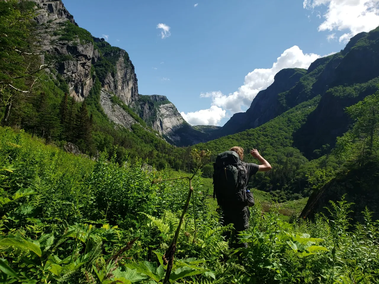
The day was lovely again and we were able to get started a bit earlier. But, it was the most challenging day of hiking. While this hike wasn't as high in elevation as some of the hikes we were used to in The Canadian Rockies, we were not prepared for the constant up-and-down. There was also another river crossing. The water in this one was waist height! Ryan had to come back when I was halfway across to get my pack so it didn’t get wet.
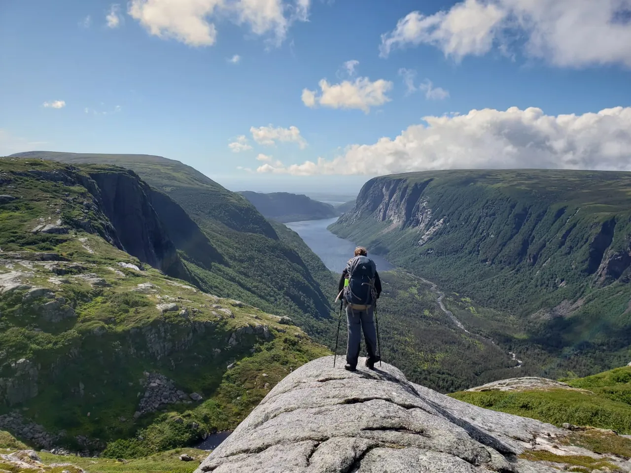
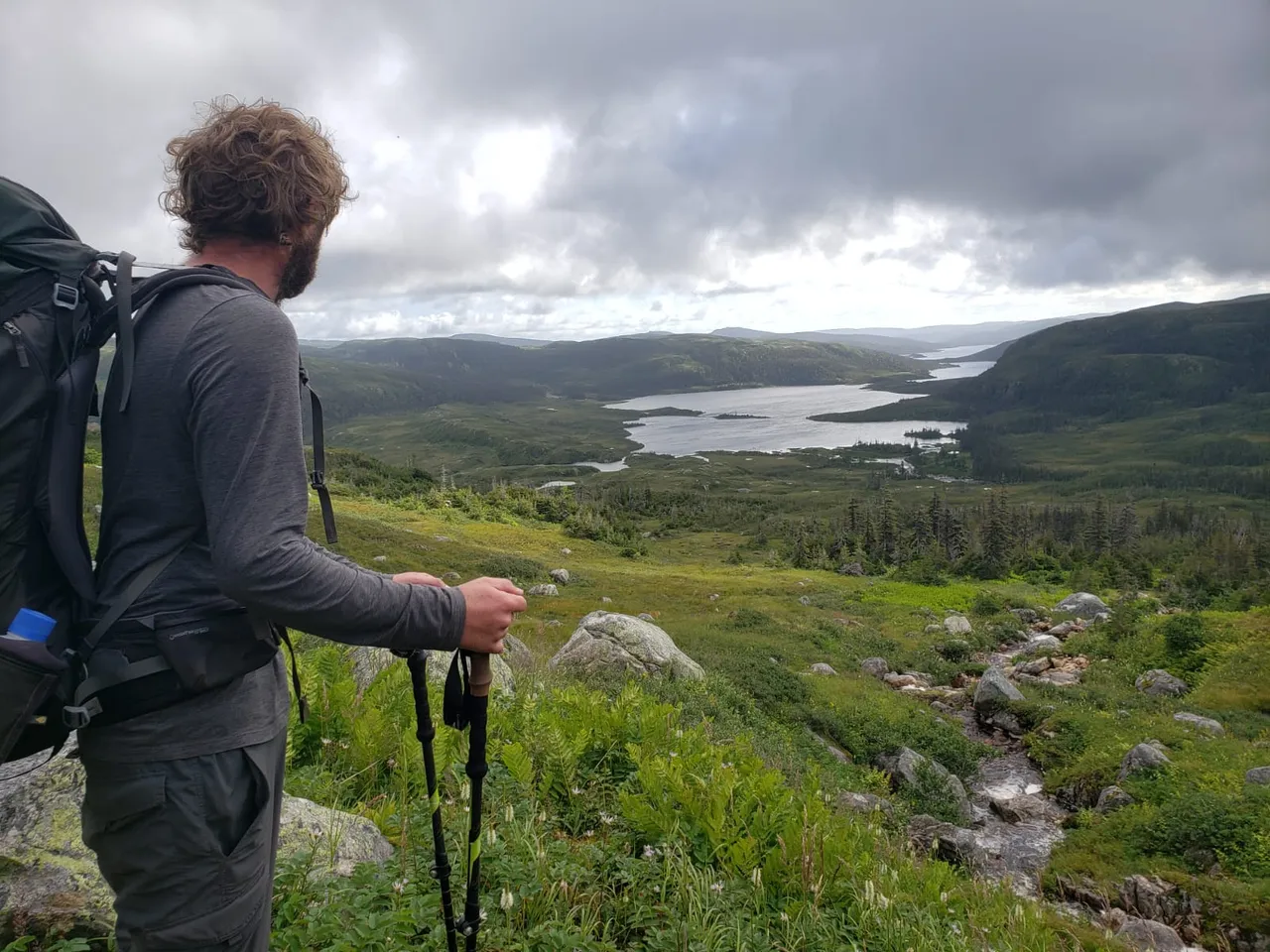
Just before the campsite we were treated to a spectacular view of Ten Mile Pond. It was another fjord similar to the one we caught the boat from on day one.
The hike down to our next campsite was another "scramble" but it was so relieving to see it at the end of the day, and after constantly thinking it would be just over the next hill.
We did consider hiking all the way out (a further 8km), but after a stop for dinner we decided not to as it could be dark by the time we got back. We stayed on another tent pad, this one was more sheltered in trees as we had now dropped in elevation enough for the trees to be bigger. We slept really well that night.
Day Four
We packed up our tent and gear, had breakfast and got ready to go. The rest of the hike was on the Gros Morne Mountain Trail (the trail that connects to Gros Morne Mountaine) so it was all maintained. We hiked the 8 or so kilometres back down to the van in just a few hours. We were stopped by almost everyone on our way down. It was pretty early in the morning so everyone was shocked we had made it up and down Gros Morne Mountain already. We had to tell everyone that we didn’t actually go up the mountain haha. We came across a group of teens who said they were on the boat that dropped us off four days prior, they were really excited to see us.
We finally got back to our van after continuously thinking it would be just around the corner. It was such a relief to see it after four days in the backcountry.
We spent the afternoon at a local campground washing our clothes and showering before getting celebratory burgers for dinner.
All images in this post were taken by and remain the Copyright of Ryan Sault unless stated otherwise.
You can see more photos at: If you'd like to learn a bit more about the photography featured on our page you can read an interview we did with Photofeed here.
website: https://saultphotography.com/
Instagram: @roaming.rammie and @saultphotography
Twitter: @sault_photo