UPDATE: Looks like the data from the QA server is/was influenced by a bug. Look at the comment from @tobetada, who discovered a response on this matter on Discord by Nate Aguilla.
Yesterday, I wrote a post about Splinterlands, and in the comments section, I offered incorrect information based on what I understood from the town hall.
@tobetada commented that there is an 85% dominant terrain type at the region level, while I, based on what I understood from the town hall, said it is at the tract level.
The correct information is "at the region level", as @tobetda mentioned. It becomes obvious when you use the QA server. When I provided the initial information I hadn't had the chance to use the QA server yet because it was in-between builds and I couldn't make any surveys. But now that I had, let's take a look at how things are.
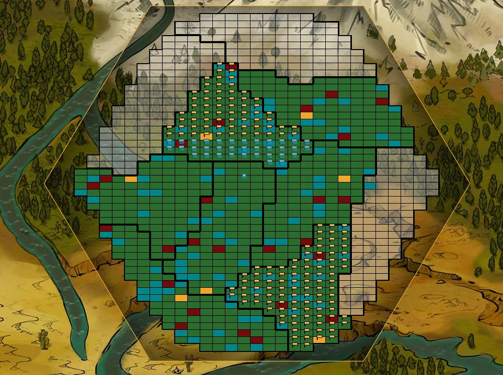
This is a region on the QA server (102) where I have surveyed two tracts (the ones with yellow flags on them). Other people surveyed the rest of the colored ones. The ones that are transparent and you can see the terrain image below are unsurveyed yet, so 3 tracts are in this situation.
Still, after having 7/10 tracts surveyed in this region, this is the geography breakdown:
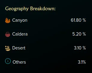
I'm not sure what the final breakdown would be, but it's clear the Canyon terrain type will be highly dominant at the region level.
On my own tracts, I received 7+7 Caldera, 6+5 Desert, and the rest Canyon (200-14-11=175, which is 87.5% of total plots).
Why haven't I presented the information on a fully surveyed region? I actually claimed a full region on the QA server for this purpose, but apparently, there is no way to select 100 plots at once (individual tracts) from the region, or I couldn't find it. And 100 is the maximum number of plots that can be surveyed at once. For the region, one can select all the plots from the region, but that doesn't help with surveying.
Something else to remark on. There may be a disconnect between the map appearance and the actual type of terrain that will be received. That's something to keep in mind when you will claim your plots basing your decision on the likely terrain type you will receive.
Here's what the same region looks like if we only look at the map:
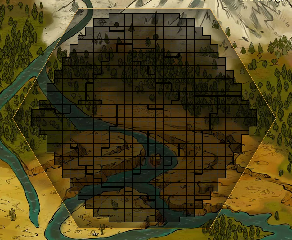
One could say there is some forest there, maybe a river, but no, I don't know what's with the "others" type of terrain listed on the geography breakdown, but when you filter the region map by all 14 terrain types, the only 3 terrain types you get are the ones I have on my tracts too: Canyon, Caldera, and Desert. And yes, we can see the terrain types of the other players who surveyed them.
Obviously, this is the QA server, and there is still time to make some changes. Some things can be rolled out later (filters, views, etc.), but anything that is related to the surveying phase which has an irreversible effect on the NFTs should be fixed/changed/updated before this phase is released, if this decision is taken.
What are the effects of having entire regions with one dominant terrain type?
The economy on land will be based mainly on trading since regions will produce mostly one type of resource.
Trading comes with a flat 12.5% transportation fee in 1.5, and with a potentially lower fee in 2.0, if certain upgrades are made. The resources taken as transportation fees are burned.
There is also a 10% fee distributed to LPs where the exchange happens. This doesn't mean much in 1.5, since everyone will be able to produce Grain, but in 2.0, I expect LPs to earn a good deal of DEC from this.
While I see people don't like how one terrain type will be dominant at a region level - and I was surprised about that too -, to me it seems that's how they designed the land economy.
What I am a bit intrigued about is why the 85% dominant terrain type thing isn't in the whitepaper, since we are talking about the surveying phase, not land 2.0?