Thailand has plenty of camping opportunities, some remote and out of the way, while others tend to turn into popular camping hotspots or camp type resort regions.
Phu Tab Boek in Phetchabun is one of these 'go to' camping regions. The mountains are big, views good and temperatures are usually quite chilly, especially if you go during the cold season.
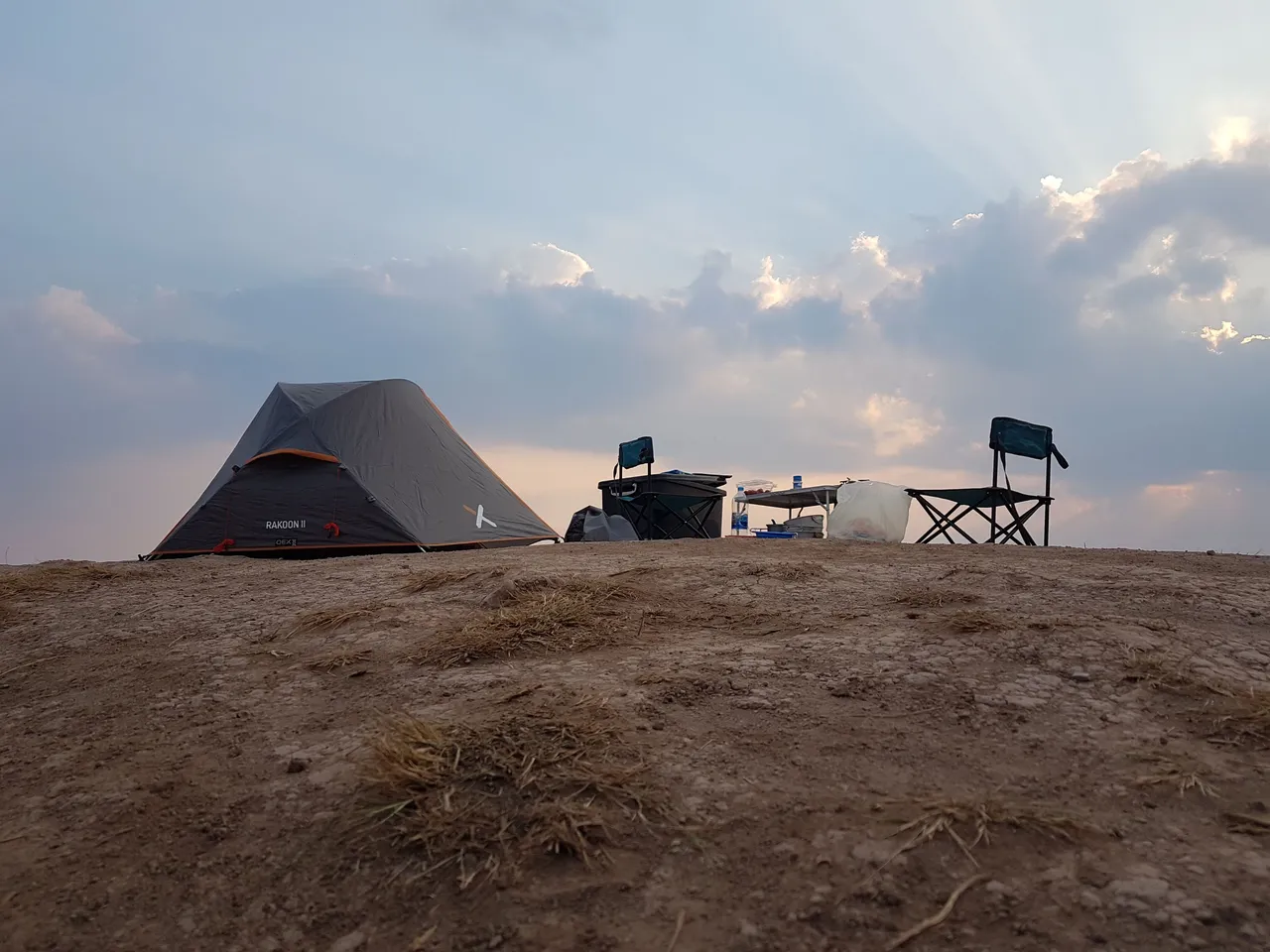
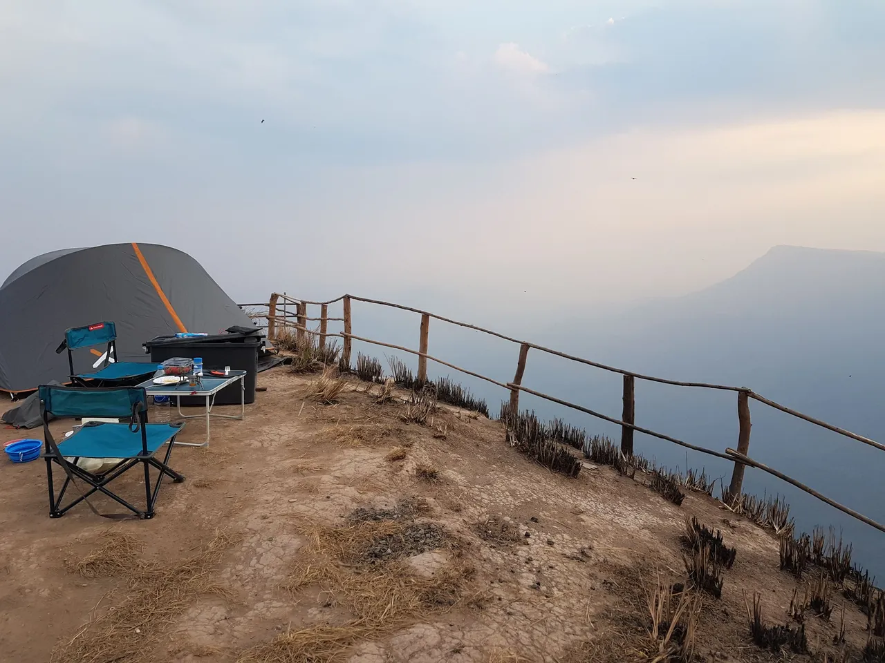
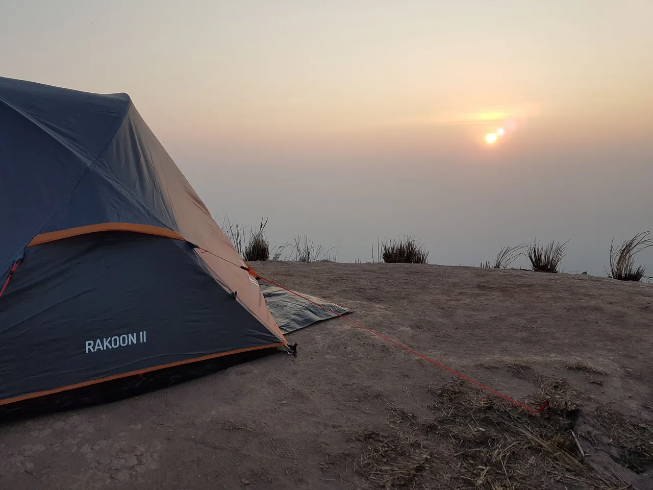
Our camp setup was just a simple 2 man tent, 2 camping chairs and a small foldable table but we had planned our trip during mid week in hope of avoiding the weekend crowds.
We knew that this particular area had been stripped of nearly all vegetation to make way for flat campground and that some areas were restricted to only walking, photography and viewing. After all who would want to set up camp at the end of one of the viewpoint spots and have a constant flow of visitors throughout the day tripping over your tent and gear.
Having said that, that is exactly where we set up but only because we were literally the only people there and had it all to ourselves.
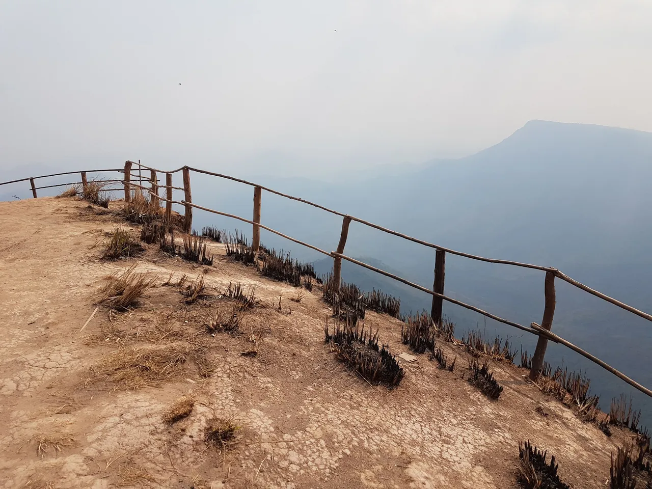
A narrow dirt track followed a small ridge out to a cleared viewpoint. It made an excellent camp ground with 360 views all the way round but did leave us very exposed to the wind. Luckily the tents design held up against the constant wind.
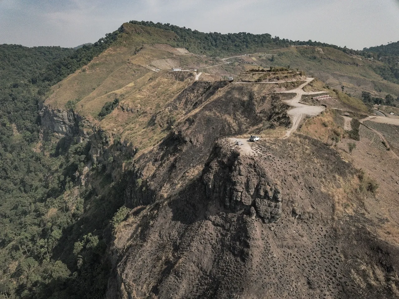
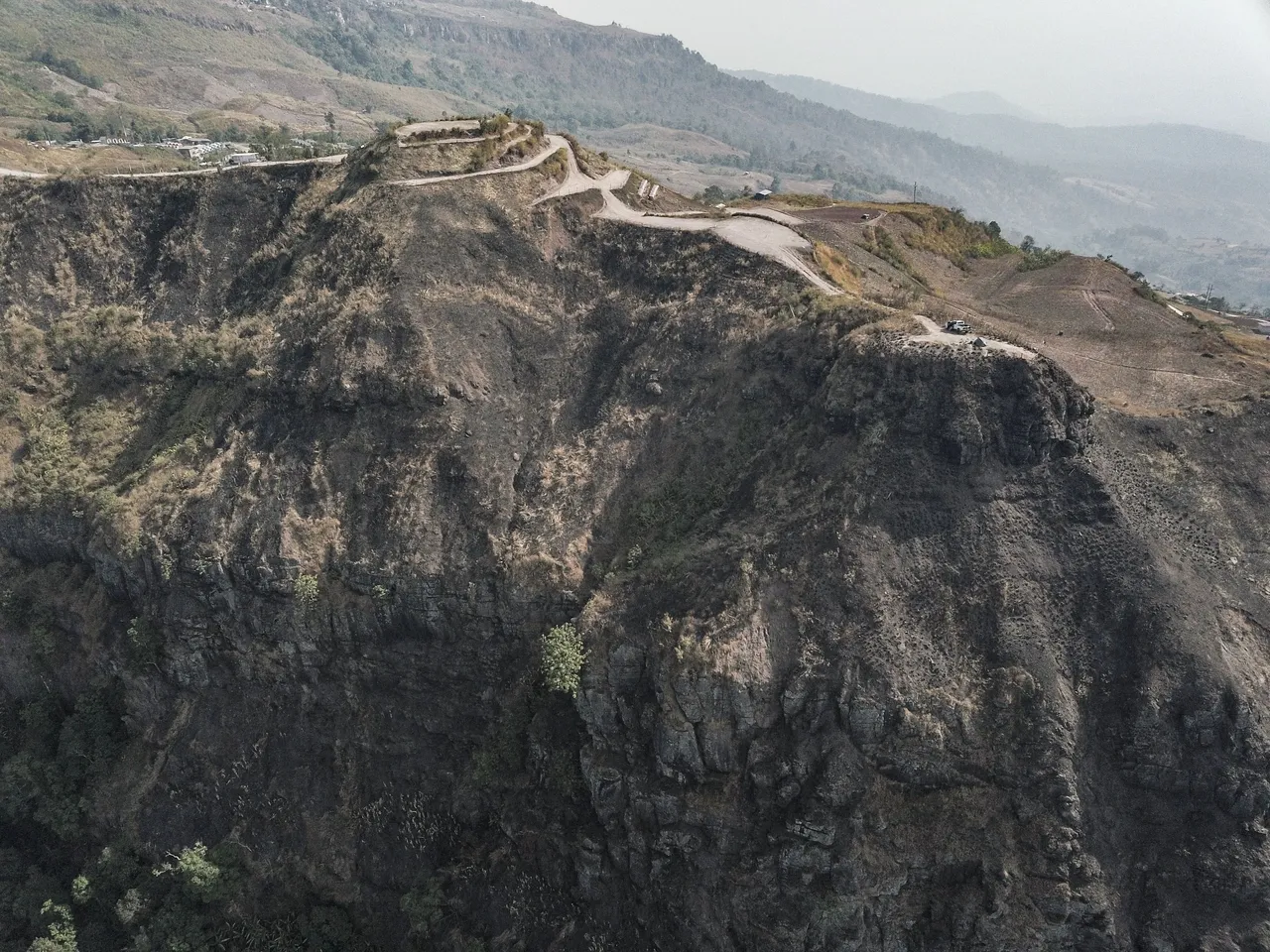
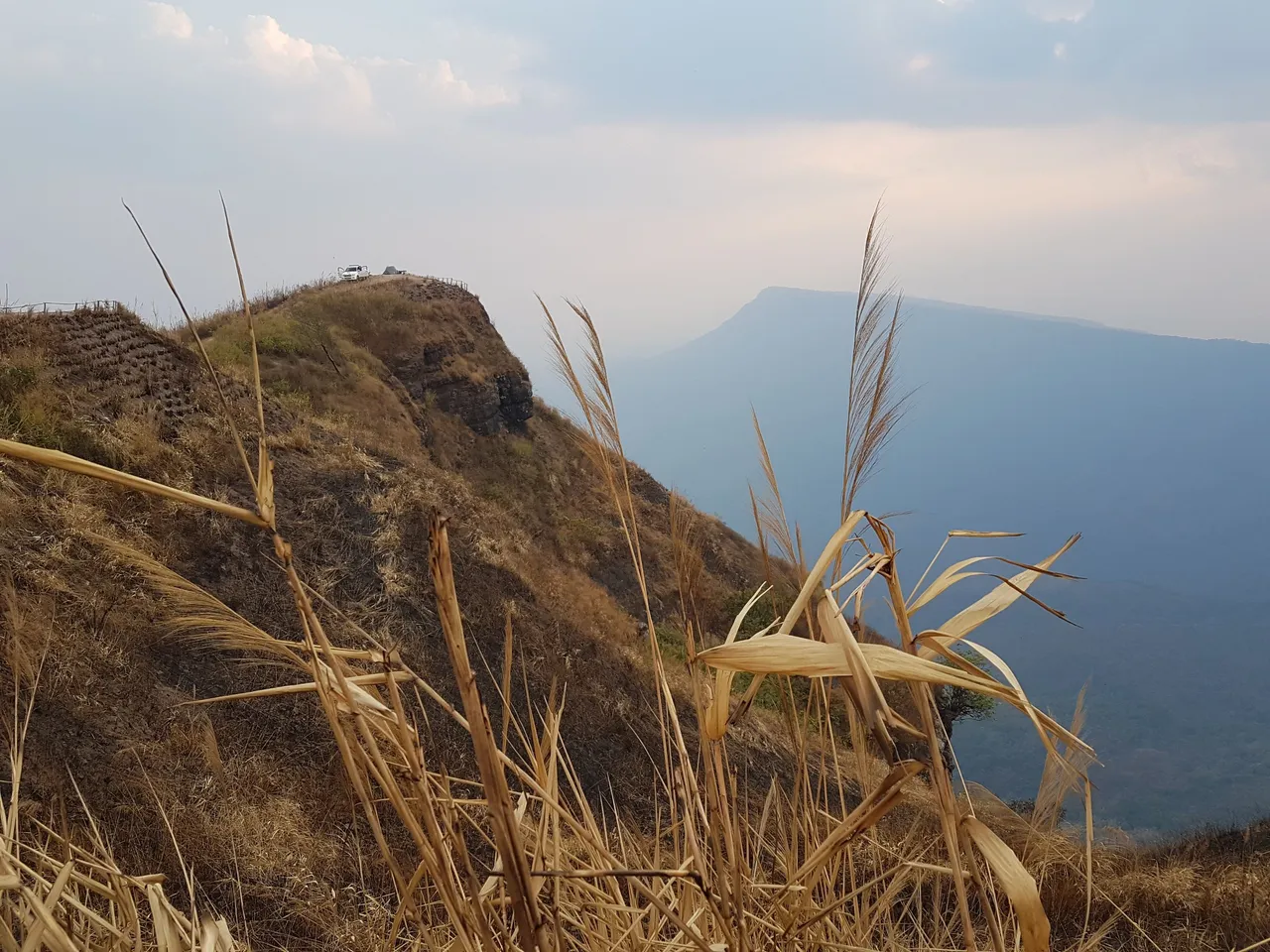
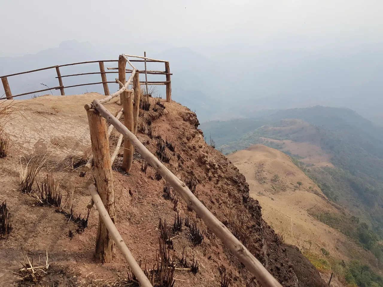
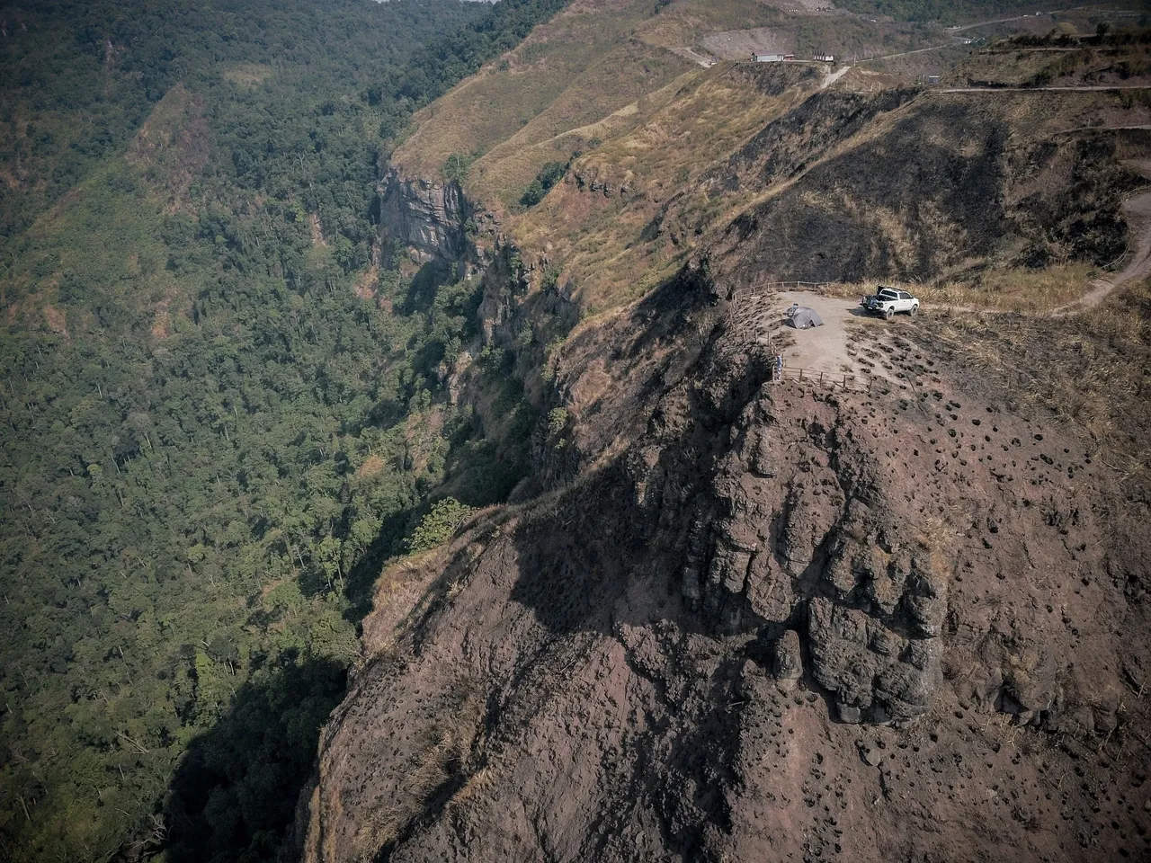
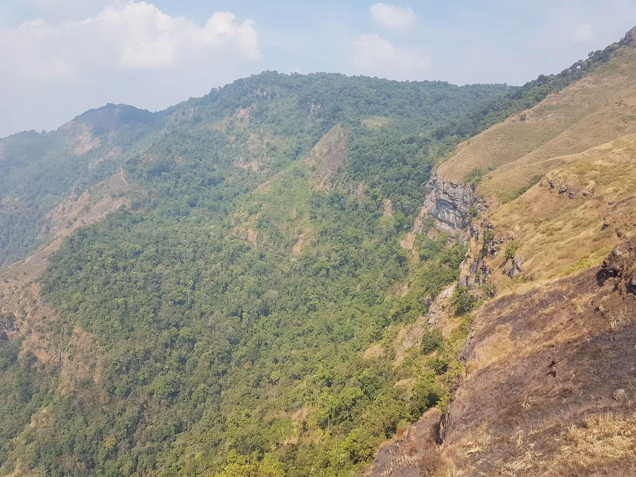
You can see in the photo above how many ledges and cut outs have been carved into the mountainside. These were the designated campgrounds, allowing everything one to have a front row view out across the valley in front. There were other areas further up the mountain that had dozens of terraces carved out and semi permanent tents set up ready for tourists just to turn up and camp.
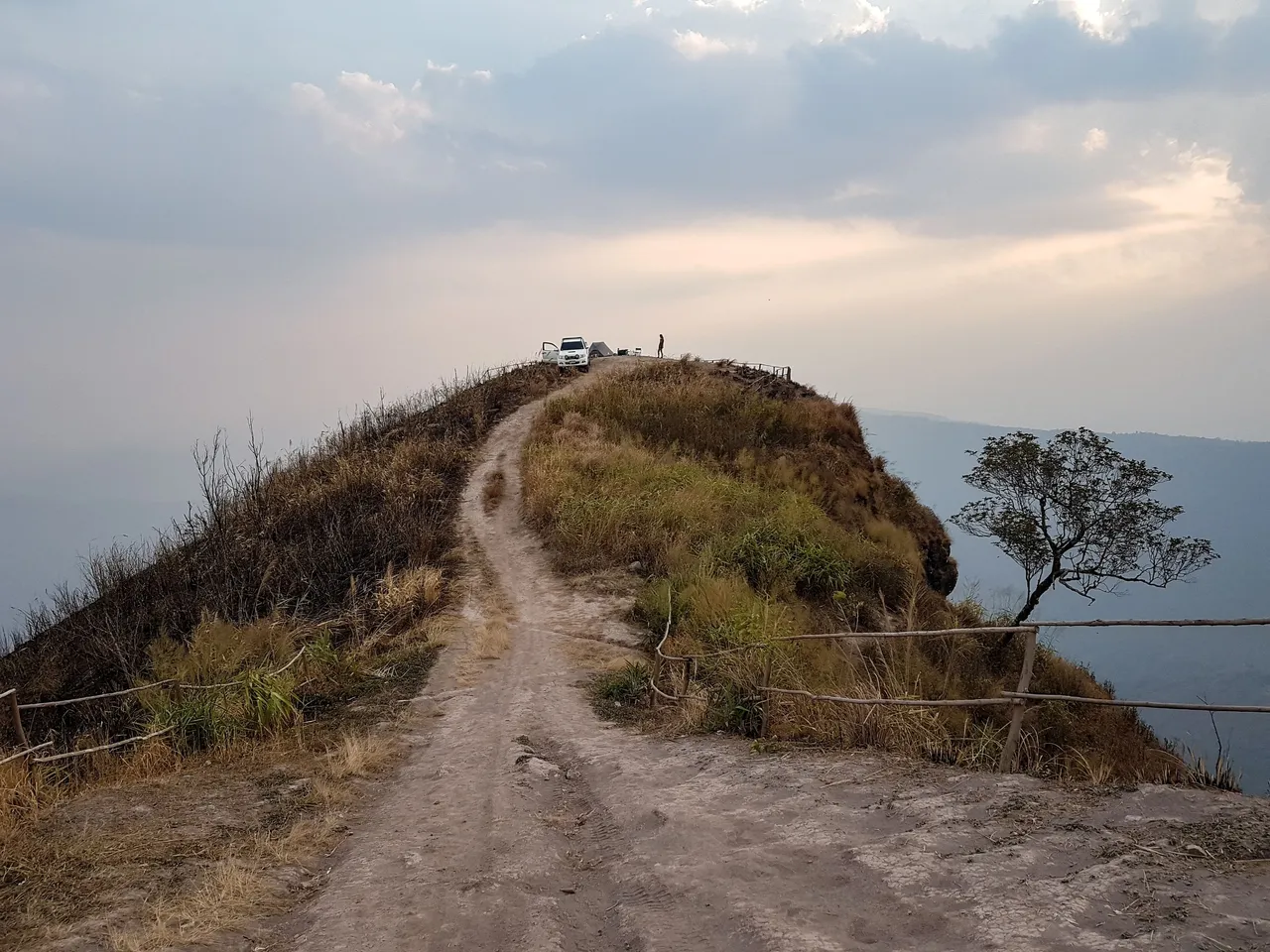
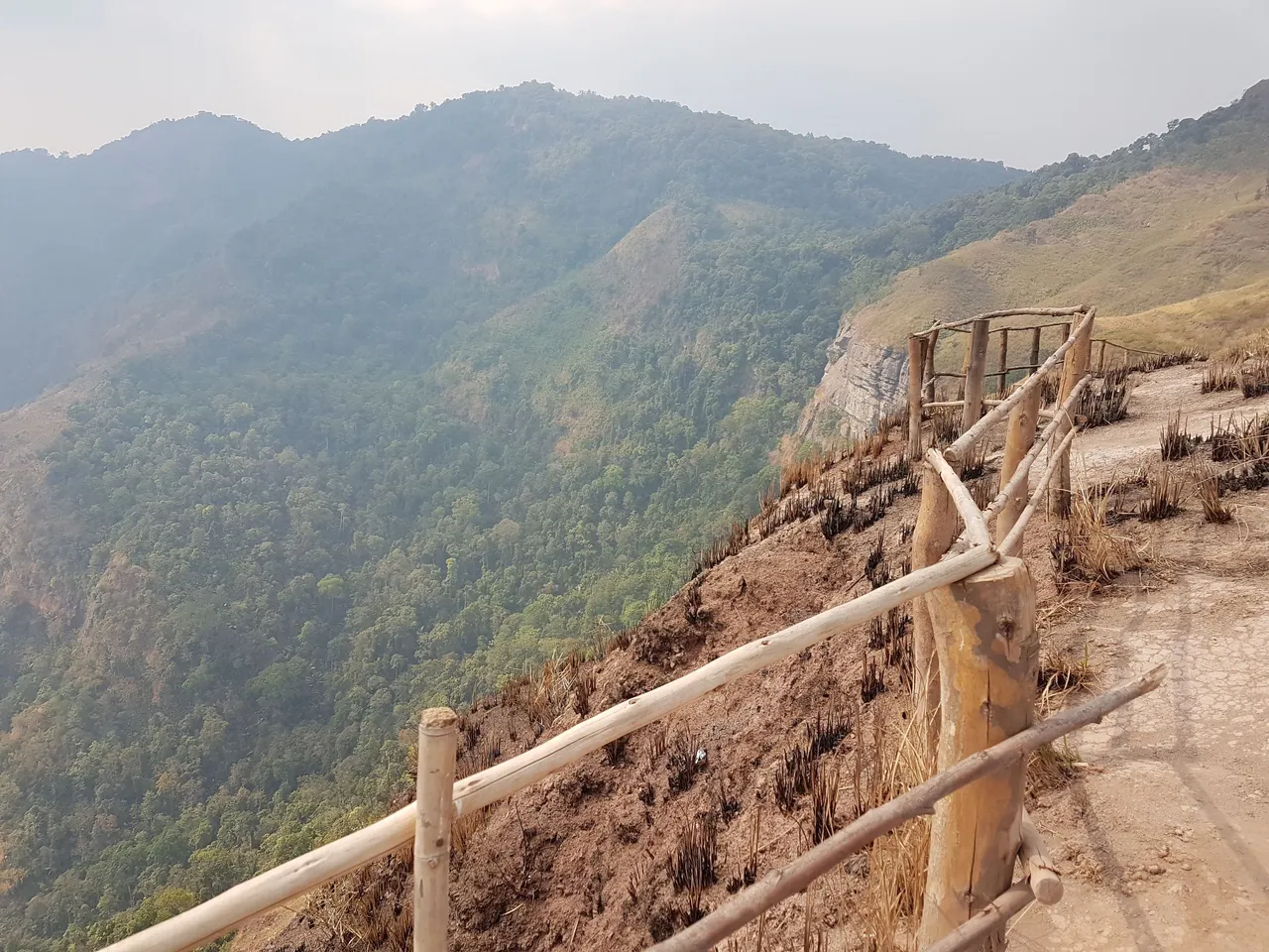
As no one else was there, we were free to walk around wherever we wanted. Walking off onto the next ridge allowed us to look back onto our camp spot and see just how small we were placed on the end of the ridge.
We spent the latter part of the afternoon setting up, cooking and relaxing but were disappointed by the amount of pollution. We could barely see the valley floor below us and the sunlight, even with only a bit of cloud, it just seemed very dull.
Many of the mountainsides in the area were charred from slash and burn fires, including the mountain we has camped on, no doubt contributing to the smog.
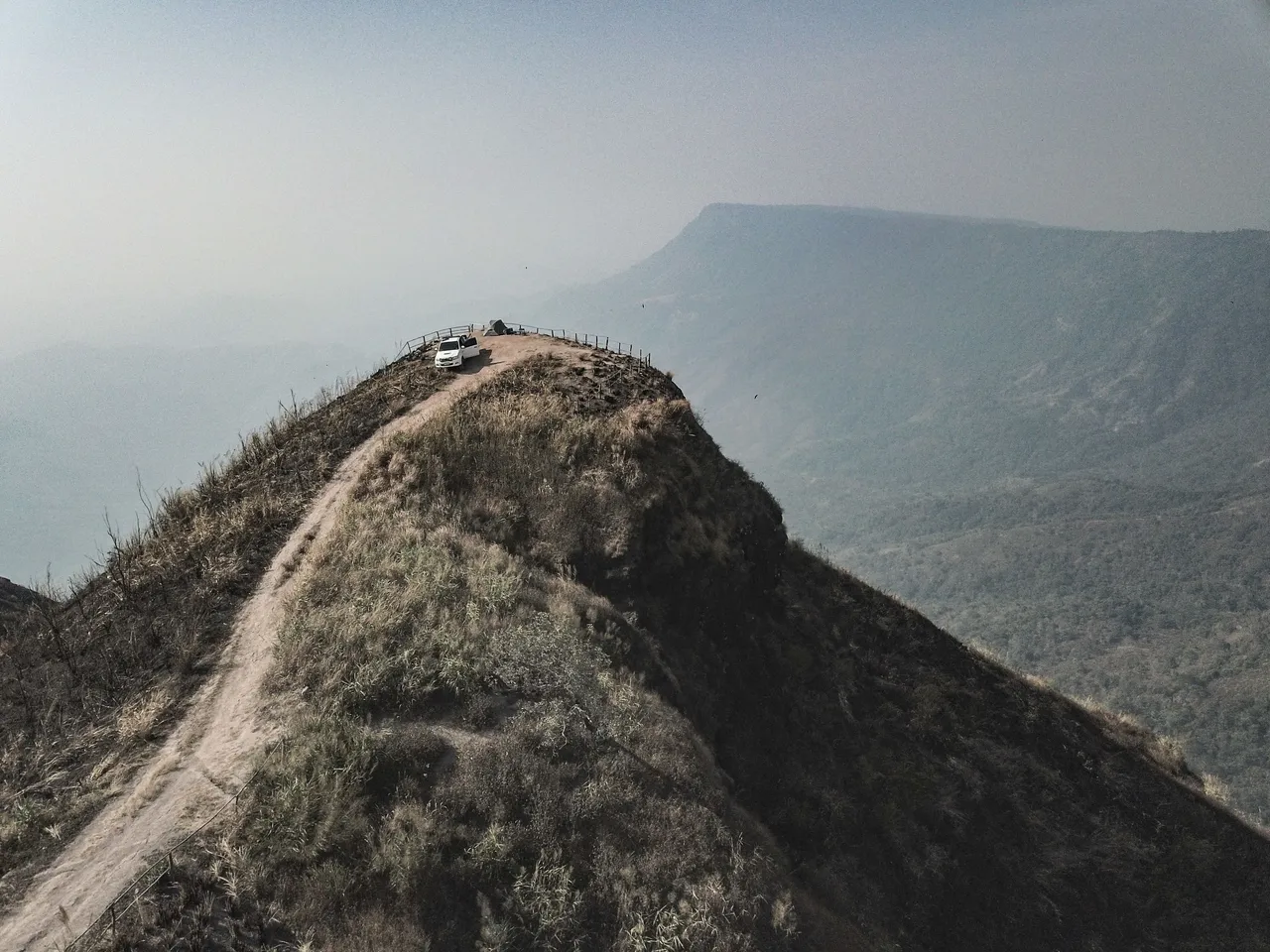
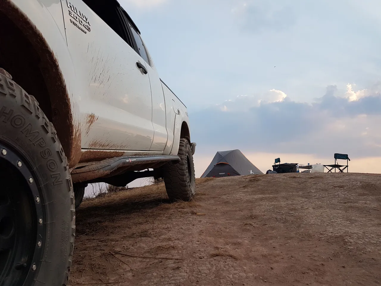
The truck was parked on a slight slope and with sheers drops either side of the track I was wary of the handbrake failing or slipping. I parked with it in gear and also bricked the tyres on the far side as a safety measure.
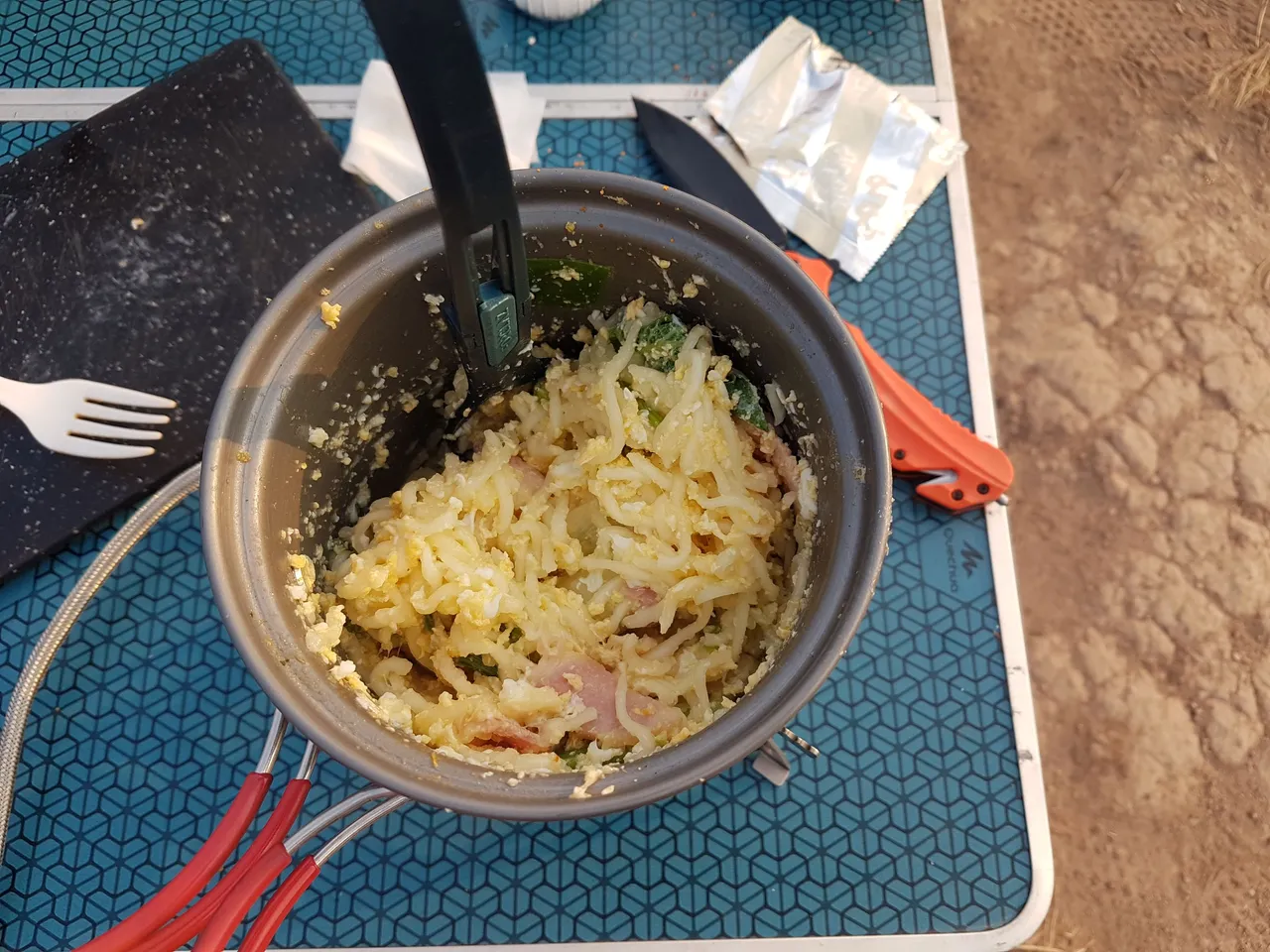
We opted for a rather basic meal, a mix of noodles, 2 eggs, ham and some spare veg. It was quick and easy to prepare and meant we had more time to sit back and enjoy the hazey view!
As we watched the sunset through the pollution, we could look directly at it without having to squint. The temperature started to drop fast and the wind began to pick up. Our altitude was roughly 1,500 meters as the highest viewpoint stood at 1,768 meters slightly further up the mountain
As the last bit of evening sun shone, the villages, roads and farmland in the valley below disappeared under the smog. We did question whether or not it was the right time to come camping and at the top of a mountain right in the middle of it all but answered it but saying, there isn't really anywhere else in the country that currently offers better air quality - even in coastal areas (apart from the south of Thailand) and that it is just made much more obvious with such an open view.
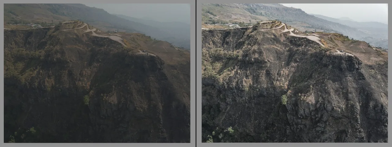
I flew my old DJI Mavic Pro 1 drone at different times of the day hoping to get some nice shots but with soft flat shadows, dull colours and hazy light I was forced to heavily photoshop them after. Even with careful editing the results aren't that great, images seem grainy and are washed out - or perhaps that's my edit!
I usually use Lightroom to colour correct my photos. In the 2 examples below you can see the original RAW files taken from the drone compared to the after edit.
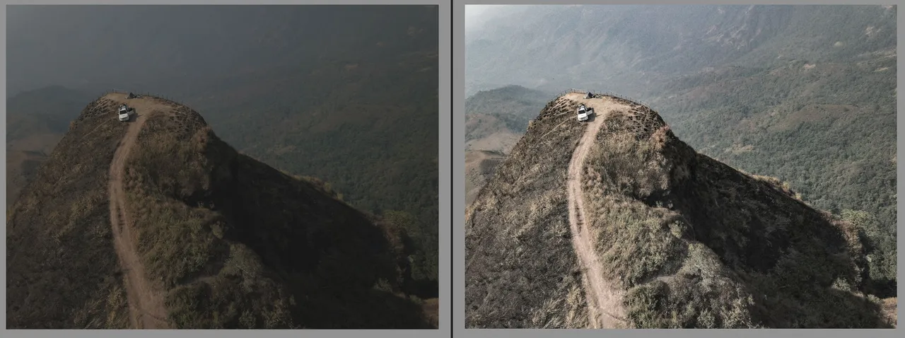
Pushing up the Clarity, and Dehaze of the photos brings back some of the depth on contrast but can also deteriorate the image by crushing the pixels.
Thinking that we would have a good night star gazing, we instead spent more time trying to spot even 1 star. The haze had come down thick and left us in a smoggy cloud. We decided to zip up for the night and get out of the cold wind.
The tent took a constant battering all night until about 3am when the wind just stopped. The eerie silence was what woke me up but then seemed very peaceful.
We woke to a somewhat bright and sunny morning but still, there were no strong shadows being cast across the cliffs or mountain ridges for those dynamic looking photos.
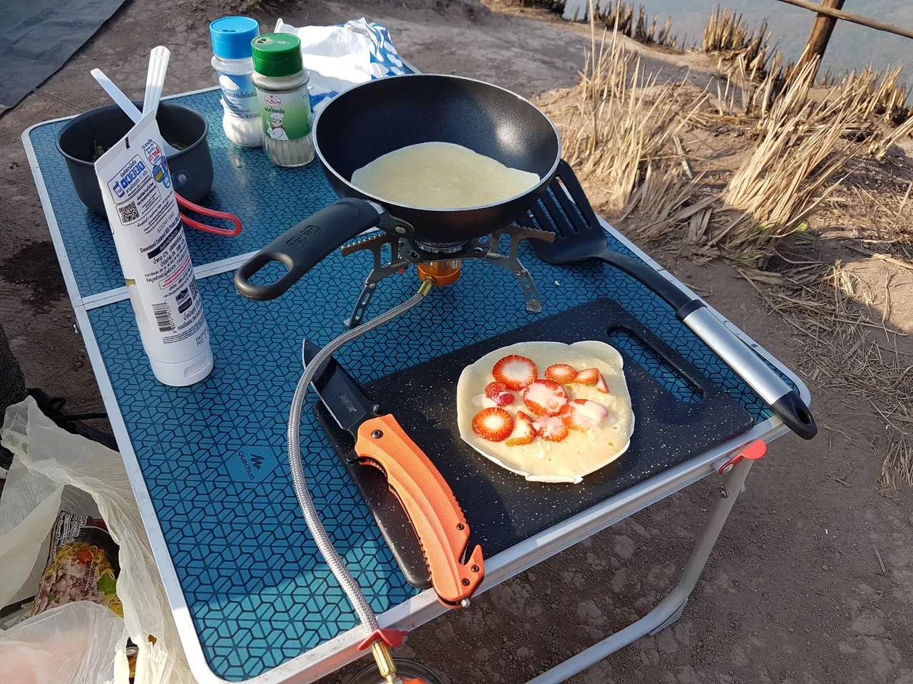
We set up the gas stove, mixed some flour, milk and a couple of eggs and flipped some pancakes. We had bought some local strawberries from a roadside stall on the drive up the previous day so added them to the final result. Not bad for a camp breakfast!
I hope you enjoyed this post and please follow for more like it in the future.
All content is original: the photos (unless stated), the writing and the adventure!