Continuing with my quest to find gems in my local area, this time I'm going to Brean Down. This is a clifftop along the Somerset coast, facing the Bristol Channel. It's said to have signs of human occupation since the late bronze age, and in 1958 archaeologists excavated remains of a Roman temple that existed since AD340.
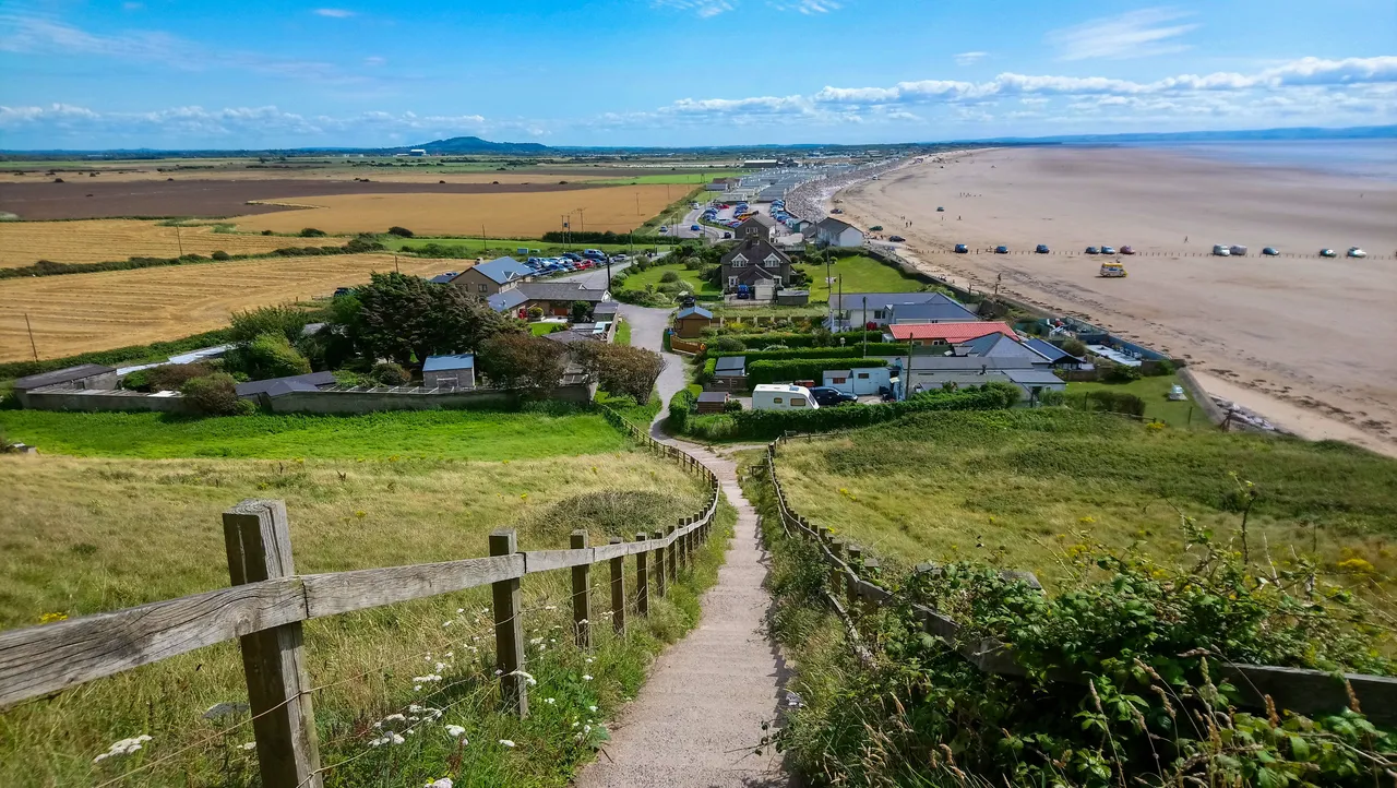
This is the view looking back down from the way up to the cliff. The view at the top is even more mesmerizing. Let's go and take a look!!!

THE ONLY WAY IS UP (or I thought)
The Brean Down clifftop is owned and managed by the National Trust. They're a charity organisation in UK responsible for preserving heritage sites. I parked at the car park, and like my visit to Kilve Beach the meters only accept cash!!! Luckily, with the National Trust, they're a bit more organised. They have a cafe next to the car and visitors can pay for parking there with credit card.
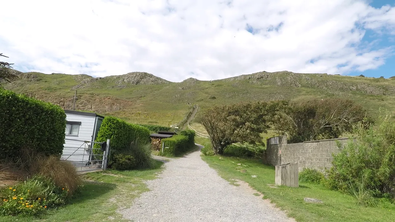
With the parking problem solved, I headed towards the cliff for my climb up to Brean Down. The cliff top is around 320 feet / 97 meters high. It's a very pleasant ascend for the family, though if you have a walking disability, it can be a problem. However, I did see a cyclist, and a lady at the clifftop with one of those walking frames with wheels. Apparently, there's another way up (which is actually the way down) and it takes a bit longer.
Brean Down operate a one way policy for the hike up. I don't think it has anything to do with Covid and social distancing. It's probably more due to the fact that Brean Down gets very busy during summer times. The whole area is very beautiful so it makes sense to encourage people to walk an alternative route back down. However, as usual, there are always people who never follow the rules and I passed by a few groups of people coming down this way.
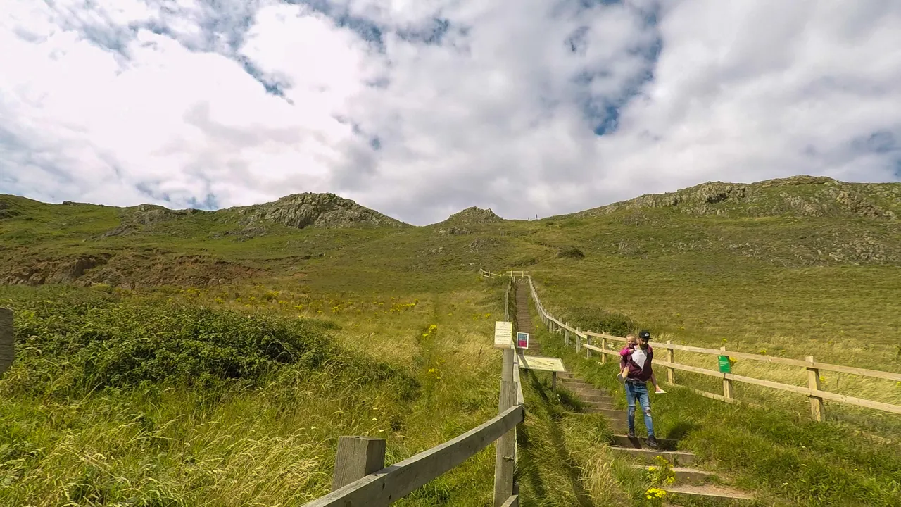
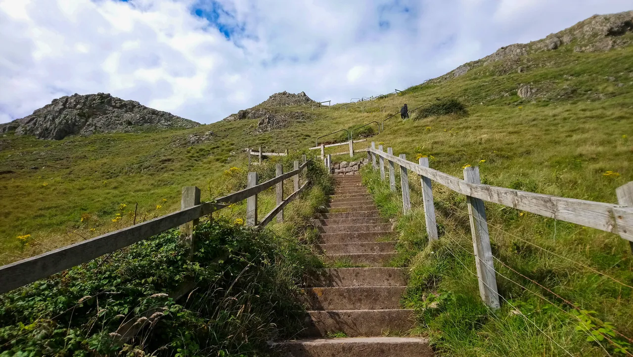
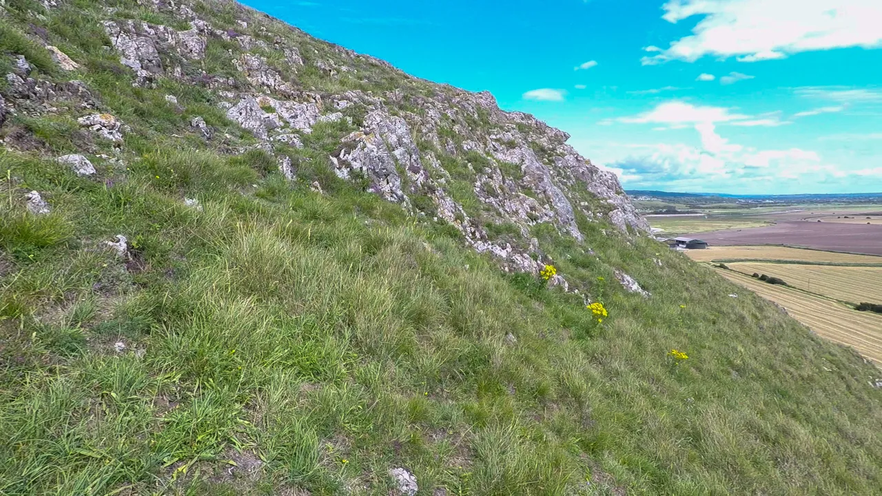
Here's the hike up, I'm about half way at this point. It's quite steep, but nothing beyond a normal healthy person's capability. If you're sporty and do a lot of exercises, you'll get to the top in no time.
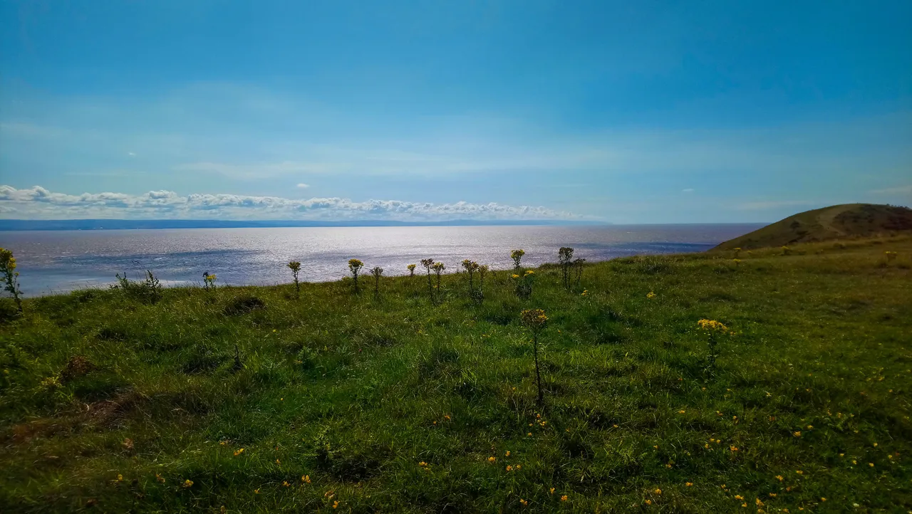
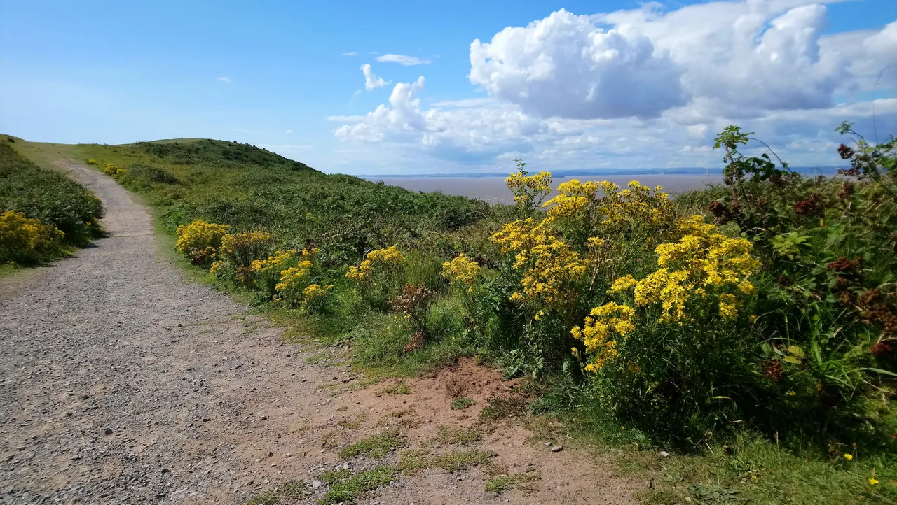
Walking up, I didn't feel tired at all as I couldn't resist to stop every now and then to admire the uninterrupted panoramic views. Ahead of me is the side of the clifftop. To the right the carboniferous limestone grassland and an array of plants growing on the warm south facing cliff.
Brean Beach and the Bristol Channel beyond is on my right. Some cars had driven onto the beach to get as near to the sea as possible. You have to be very careful with this especially if you're not familiar with the area. This area is famous for having the one of the worlds biggest tidal range, ie the difference between high and low tide. If you're not careful, the tide can come in very quick before you can get away in time .
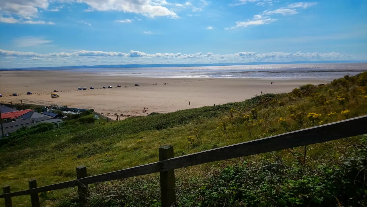
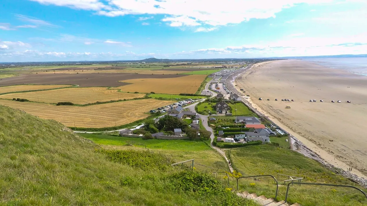
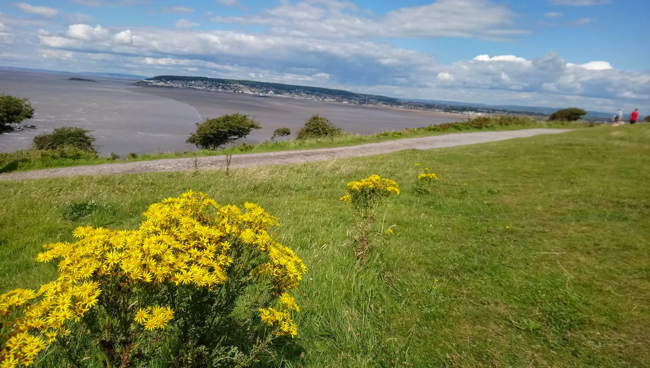
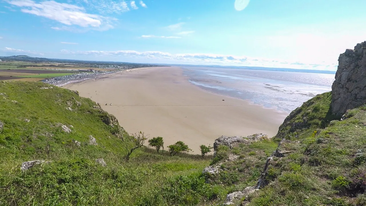
And here's the view looking back down as I approach the top of the climb. The car park is on the left side of the road by the fields. That's where I parked. The buildings on the right by the beach are the holiday camps. There are many of these dotted along the coast as I drive here. This area relies heavily on tourism and this year has hit them really badly. Imagine your normal holiday season lasts for six months a year, and you lose half of that due to covid this year. That depressing reality aside, this view is one of the reasons why the area draws in so many visitors, national and local alike.
ON THE CLIFF TOP
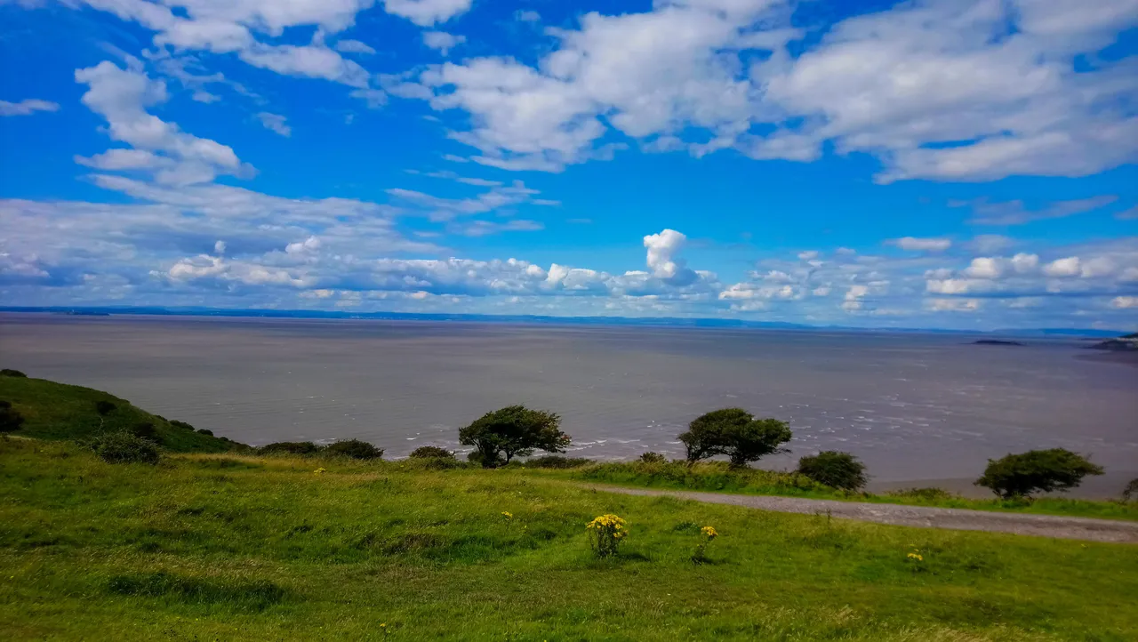
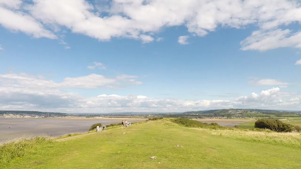
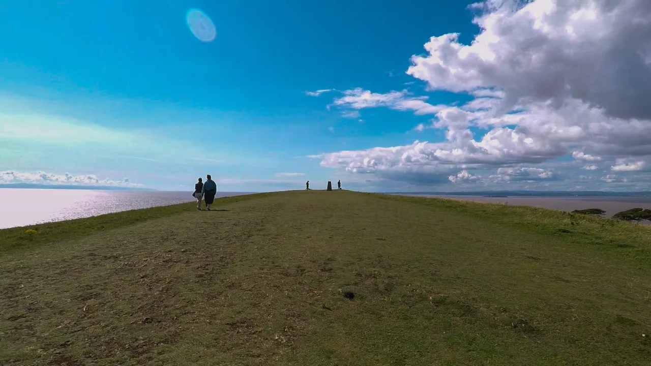
After a bit of hard work, you're rewarded well for your climb up the 320 feet / 97 meters cliff. This is the first thing I see as I come up from the steps. A wide grassland spanning from east to west that extends for 2 km. The Bristol Channel is ahead of me, and although I've only risen less than 100 meters, it seems like I'm so close to the sky and clouds already.
Brean Down is a promontory, a raised landmass that has resisted erosion over the years. The east end here connects to the lowland which is part of the Mendip Hills. The fields you saw earlier on by the car park and to the coast line is all part of the Mendip Hills.
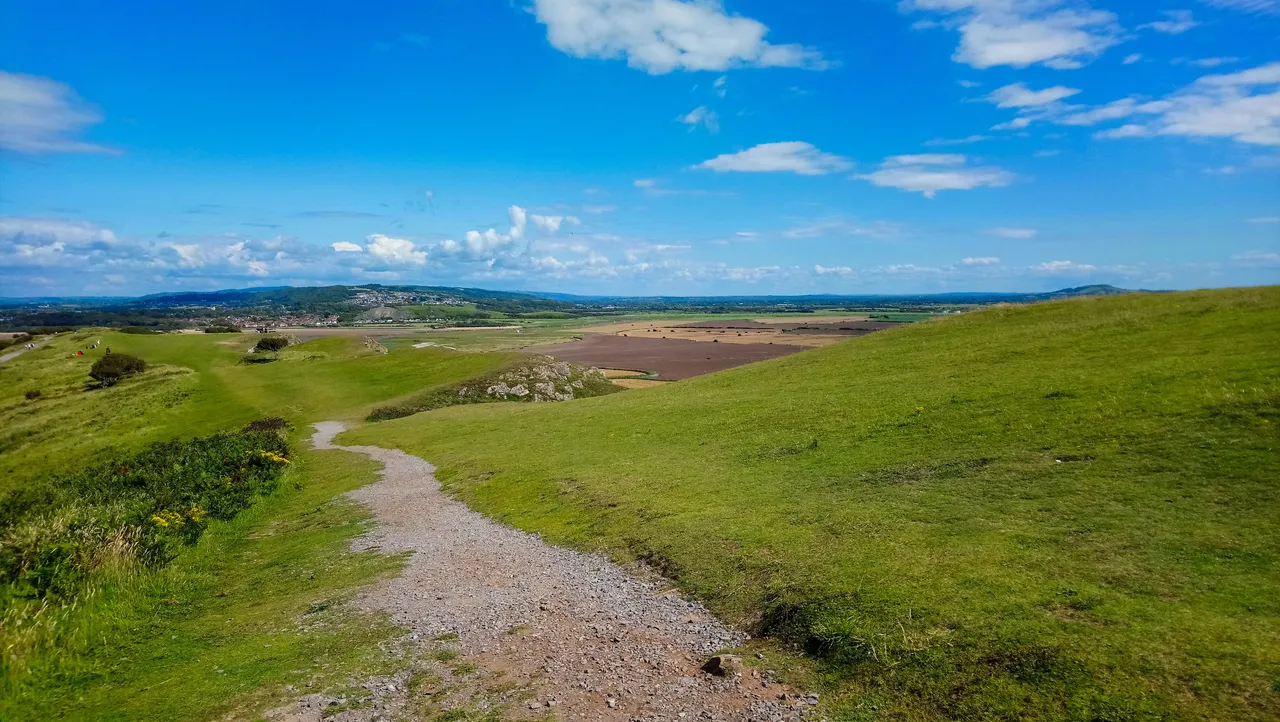
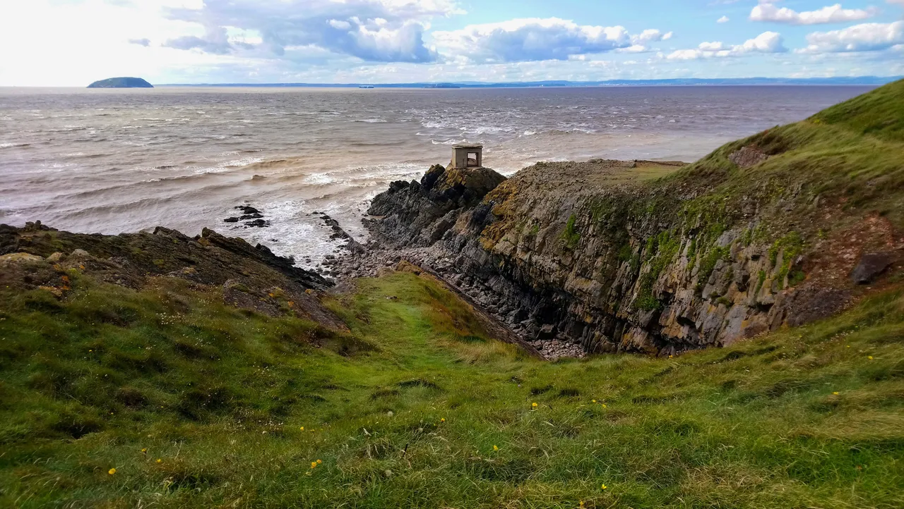
From here, the headland extends towards the west into the Bristol Channel and becomes a peninsula. This beautiful path leads to a stretch of barren like passageway and towards the peninsula. If you want to know what's at the end of the peninsula, you'll have to wait for the next part .....
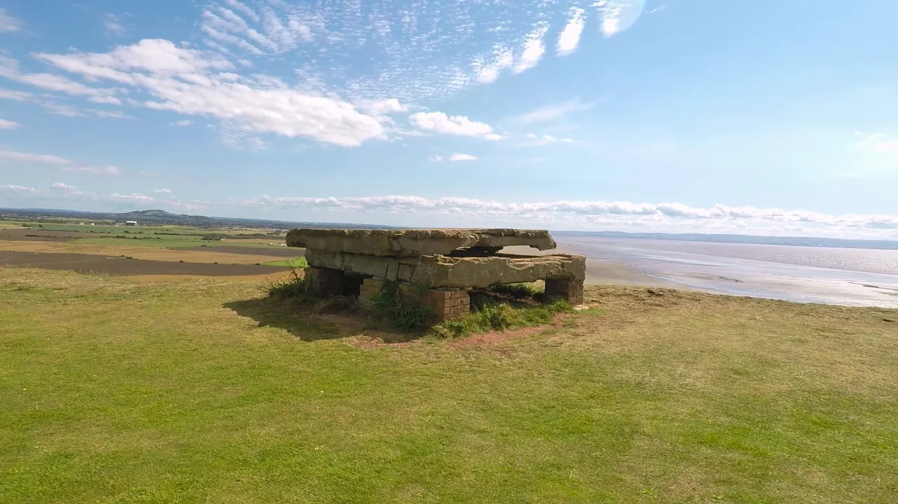
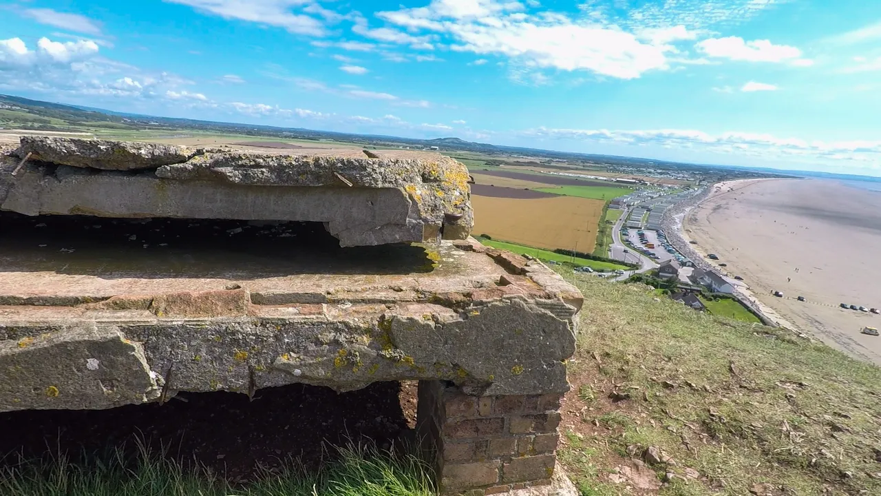
Bearing in mind Brean Down is 2km long, if you don't want to walk to the peninsula, you can head back down via another route from here. The clifftop is quite windy and exposed but is a great place to just hang around, and get near to nature. I saw an odd looking structure at one side of the cliff. I couldn't work out what it was. It looked too new to be part of the Roman temples, and anyway, they had all been excavated long ago. And it was too small to be any type of building. It looked like some sort of platform, but I had absolutely no idea what it was. It was certainly quite mind boggling.
As usual, I've gone over board with my images. I just can't resist, as it's so beautiful up here. I'm going to leave you with one last one. This is the view of Brean Beach as I'm walking towards the peninsula.
Next time I'm going to show you what's at the end of the peninsula. Let me show you a teaser first. I know! I know! I did say the last image just now, but there's always room for just one more 😊

You can checkout all my travel post on the Pinmapple here or click on Mr Pinmapple below