The Last of its Kind
The Blanchisseuse Spring Bridge is one of the only two spring bridges left on the Caribbean island of Trinidad and is more than 100 years old! A newer bailey bridge was built alongside it (to the left of it) in 2012 as the structure was no longer suitable for reliable crossing. It was not demolished so as to preserve the historical structure and it is a great attraction for tourists and locals that takes them all the way to the end of the officially paved road on that side of the island! Today, we take the almost 3 hour drive to the mid northern coast to the bridge surrounded by magical north coast forest!
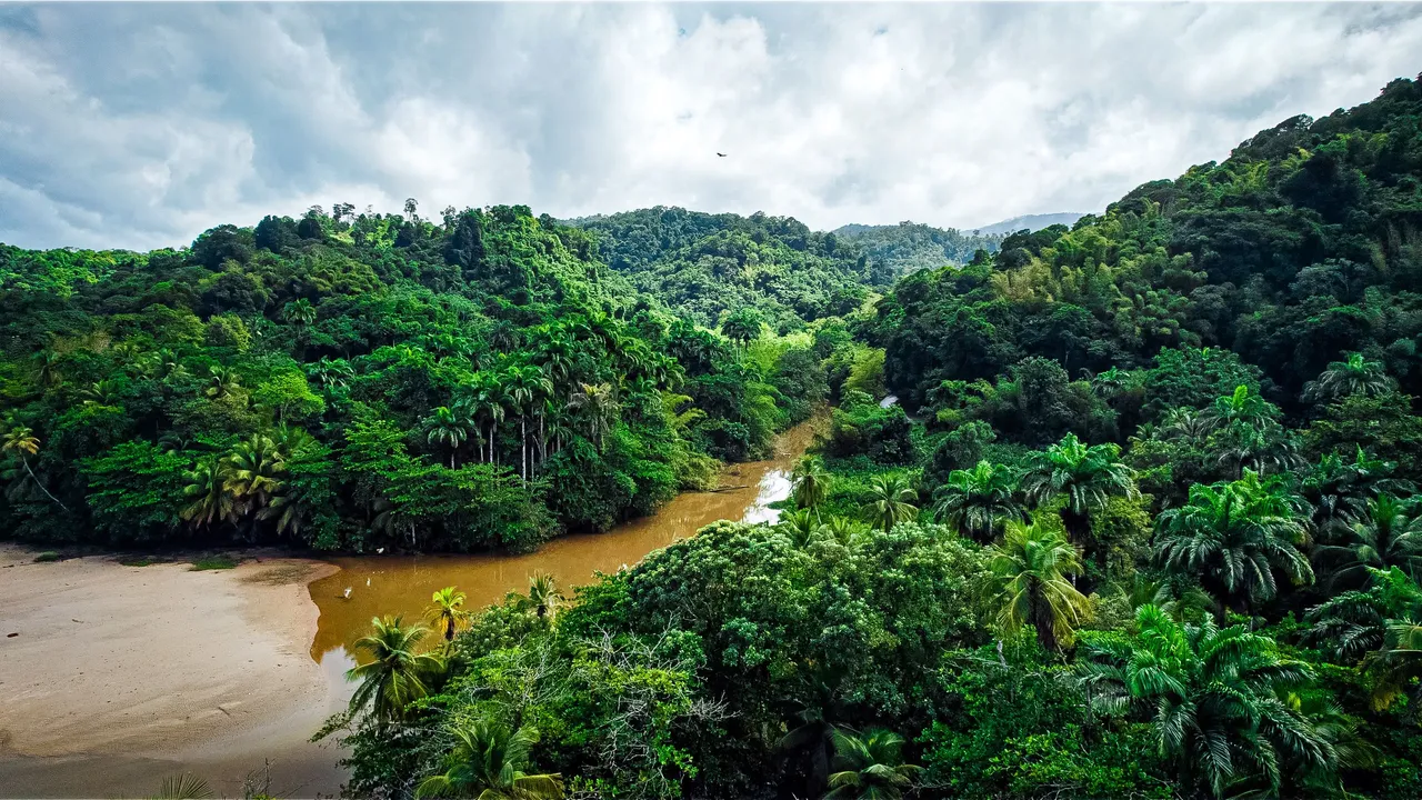
I wanted to fly the drone upriver first to the bridge from the nearby beach just to get the full experience of amazing views that you would normally have to kayak there to get. The beach was first on way anyway so we stopped off and got the drone up amidst the rainy weather. It was not that far away and the rain made the photos even more magical!
There were so many amazing new trees that I normally do not see on the more frequented parts of the island. The river waters are not usually this brown color but that of a clear variety but because of the rain and the subsequent run off from the northern range of mountains, the river turned out to be a bit brown but that still did not detract from the beauty.
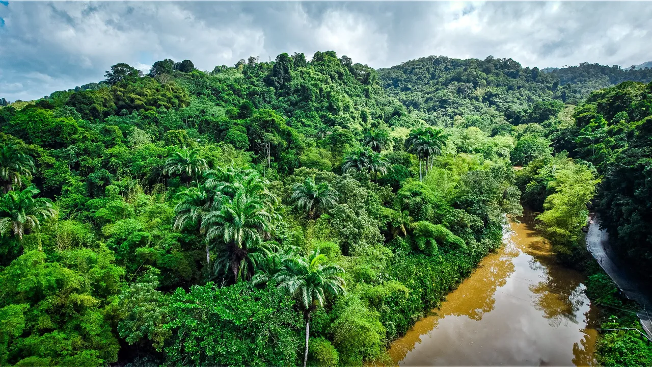
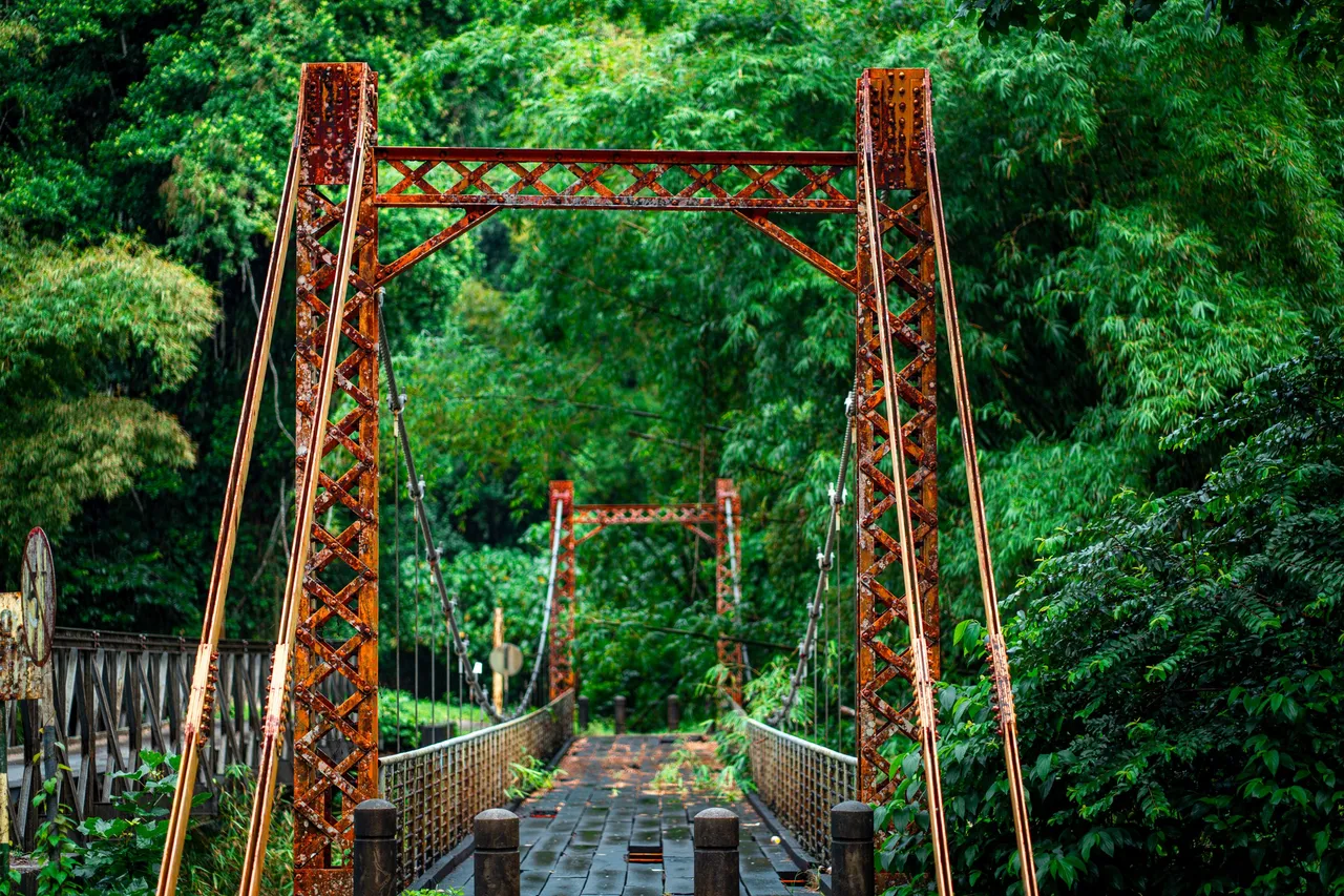
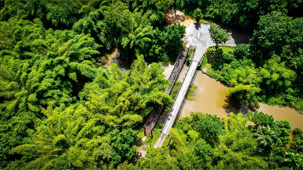
It was not that long of a flight upriver before the new and old bridges came into view. You can tell which one is the 100+ years old one because of its bright orange paint and brown wooden flooring. I just loved the dense vegetation that sometimes gave way to the road down below giving a raw sense of Trinidad's northern coast!
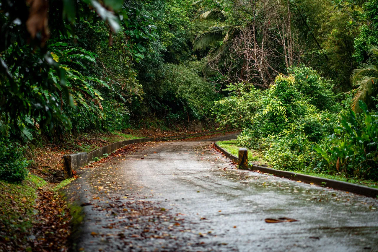
Feeling satisfied with the flight and the shots gathered, I hopped back into the car and continued on the visit the bridge physically. The rainy weather turned the thick forest canopies that covered the road as well as the fallen dried leaves into an amazing moody scene, perfect for me, an avid pluviophile!
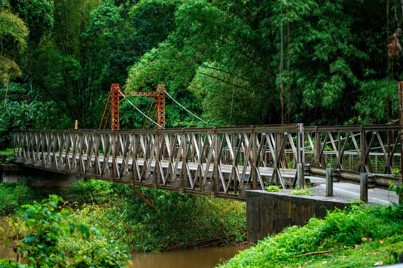
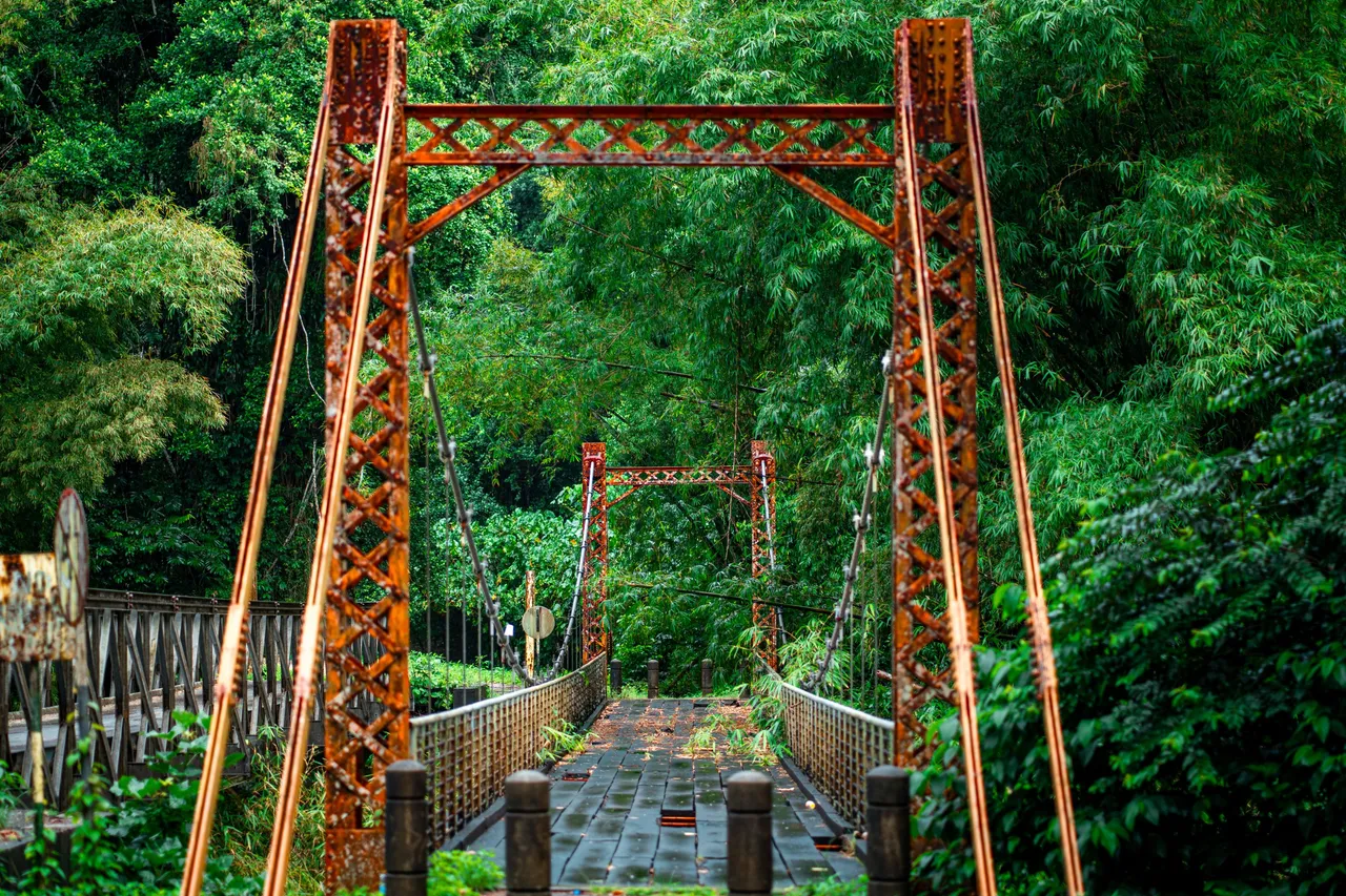
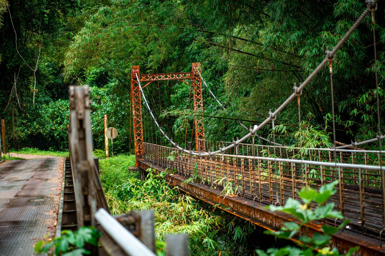
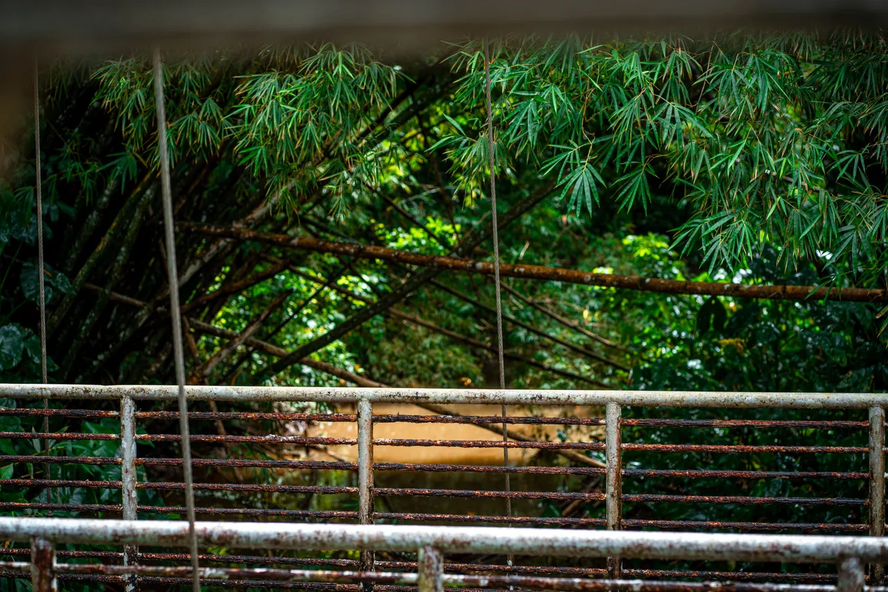
The two bridges popped into view just as the road began to swing sharply to the left and we could see the Marianne river running below them just as seen from the aerial views previously. There were huge bamboo trees in the background with branches cascading magically over the orange struts contrasting very nicely and looking amazing!
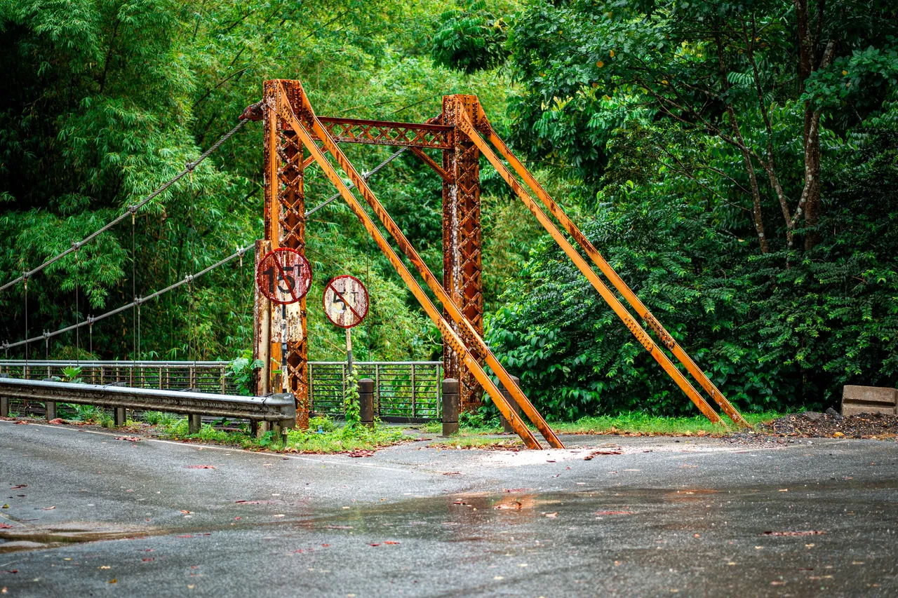
Getting closer on foot, the green backdrop of Blanchisseuse beauty and the orange spring bridge came into a more amazing view. The moody weather made the colors more deep and meaningful! Imagine the history and stories that this bridge would be able to tell if it could speak.
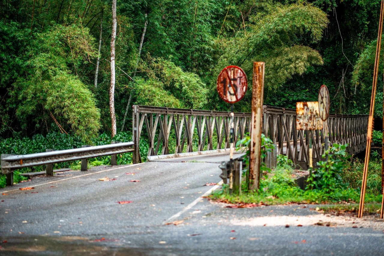
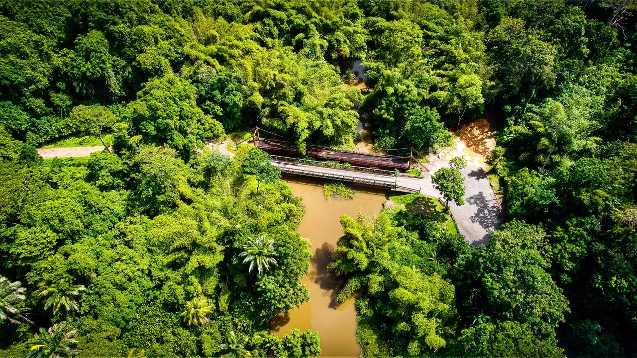
The newer bailey bridge to the left looked just as old and weatherd for some reason. This is a rural part of the island and the traffic is not all that present as the other side of the bridges is just a gravel road that only certain people take for hikes and to get to Arima (a borough directly on the other side of the mountains) for fun and sight seeing with the appropriate off road capable vehicles.
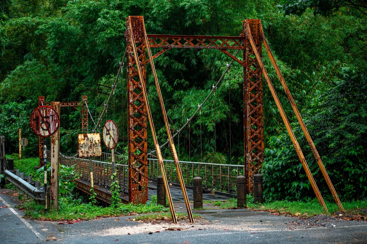
I could not get enough shots of the spring bridge! Who knows how long this would be up for and knowing that it was only one of the two left on the island made the shots even more valuable. The other one is located deep south interestingly enough as this one is located far north!
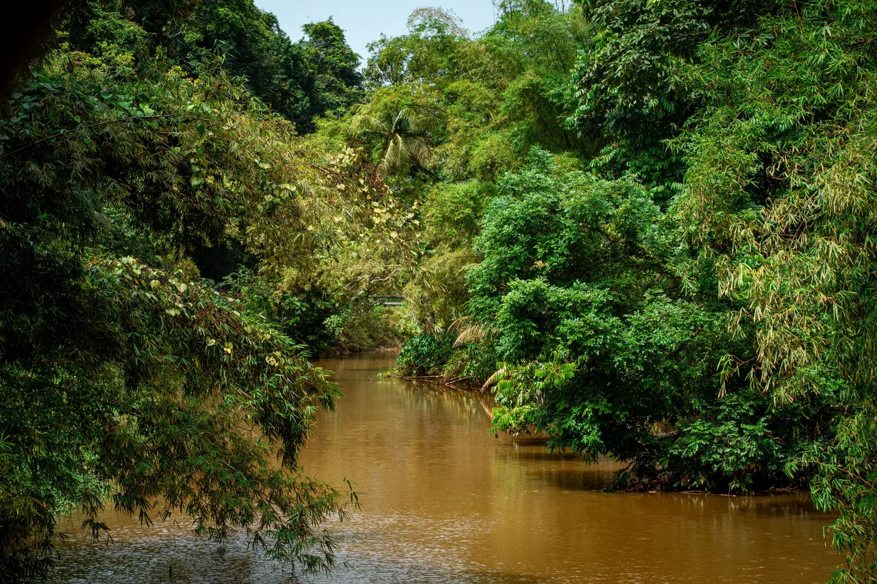
I decided to cross on foot to explore the other side to see what its like. The shot above shows what facing down river looks like. I thought you would be able to see the ocean from here but I guess the river meandered too much to have a straight line of sight which was not at all apparent from the aerial views.
This is what upriver looks like with even more dense vegetation and huge bamboo trees. I can just imagine how magical it would have been to kayak on a clear day with clean waters and enthralling forest surrounding you.
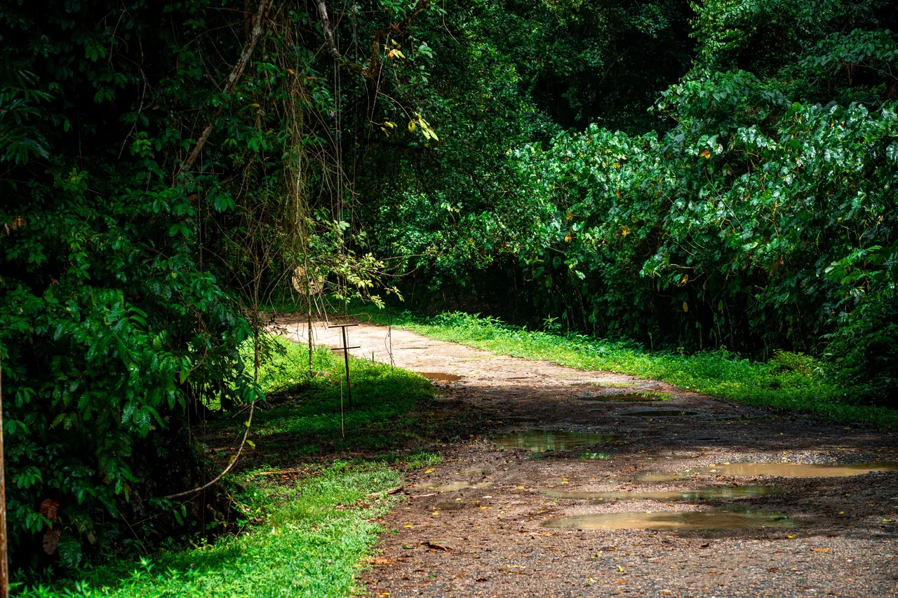
This is what the other side of looks like. If you recall, the road was fully paved before and on this side it was just rainforest and a crude gravel pathway if you can't classify it as a road. It was breathtaking nonetheless as the sunlight filtered through the canopies!
It was an amazing experience to be able to document this historical structure located so far away from everything on the island. This was indeed my first time at Blanchisseuse and the area is one of the most beautiful places on the island in terms of forestry and beaches! The bridge seems to be intended by the government to be upkept and maintained as it should! Thanks a lot for coming along, cheers!