May 29, 2022
Another week has come and gave us the opportunity to travel again. Despite the gloomy weather, we pursued our plan to hike beautiful hills and visit other trails and attractions near the area. This is what I love hiking here in Hong Kong, as you will be able to visit different trails in just one day. Connecting hills and mountains are accessible and can be hiked in just one day. Moreover, you can visit beaches or villages down the mountains to relax after an arduous hike.
In today's travel blog, I'll share with you our adventure to Violet Hill and Tai Tam Reservoir while passing through different trails in this country park.
How to get there?
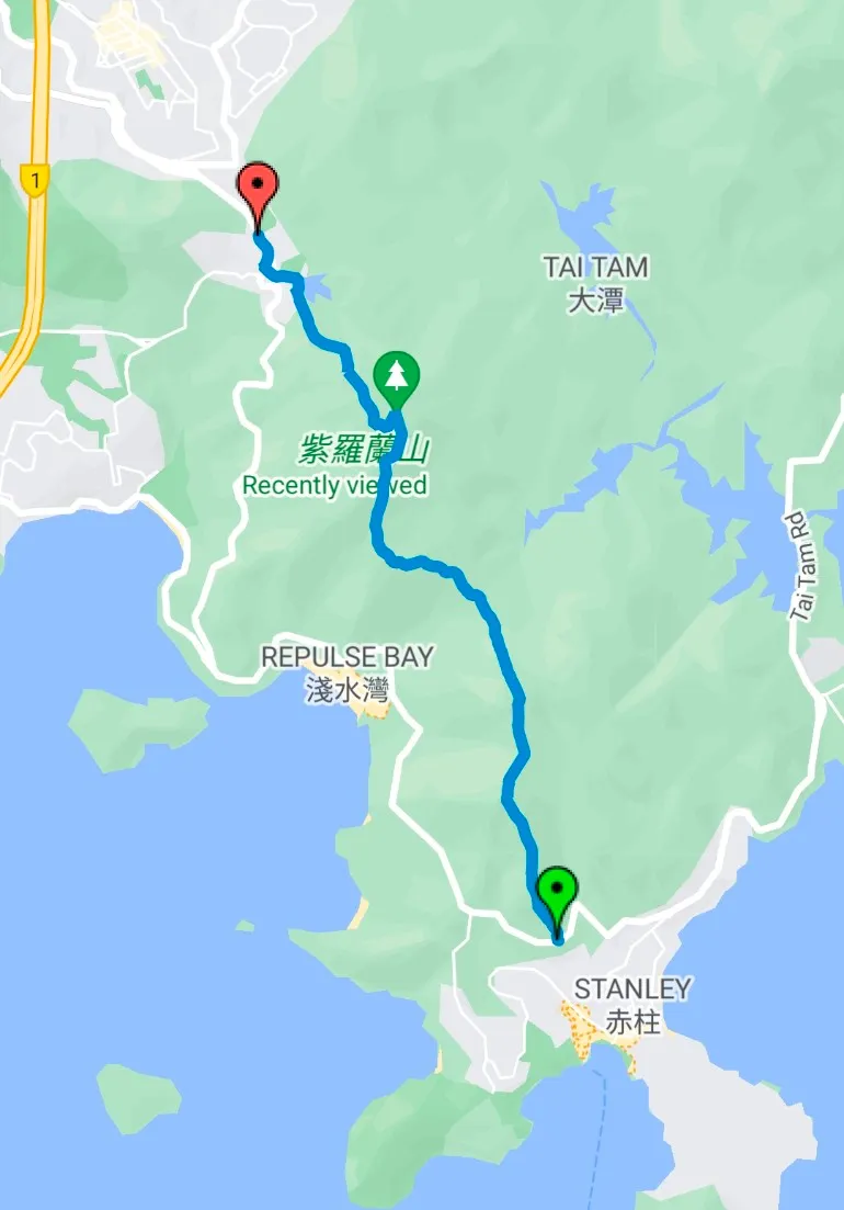
There are different ways to get to this trail and you can start at either end. From Central Hong Kong, we went to Exchange Square bus terminus and looked for bus 6 bound to Wong Nai Chung Gap Road. There are other buses that go to this place too. You better search it online before starting your journey.
We rode bus 6 and alighted at a gas station. From there, we followed the sign to the reservoir where we started the trails up to the hills.
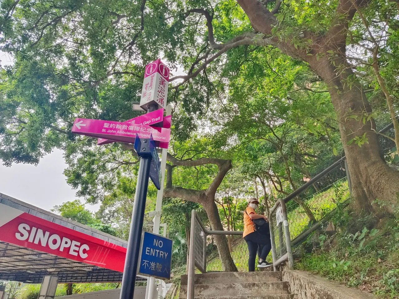
Just near the private residential area is the starting point of the reservoir. Since it was just a part of the reservoir, we opted to went down the staircase and looked for the trail to the hill.
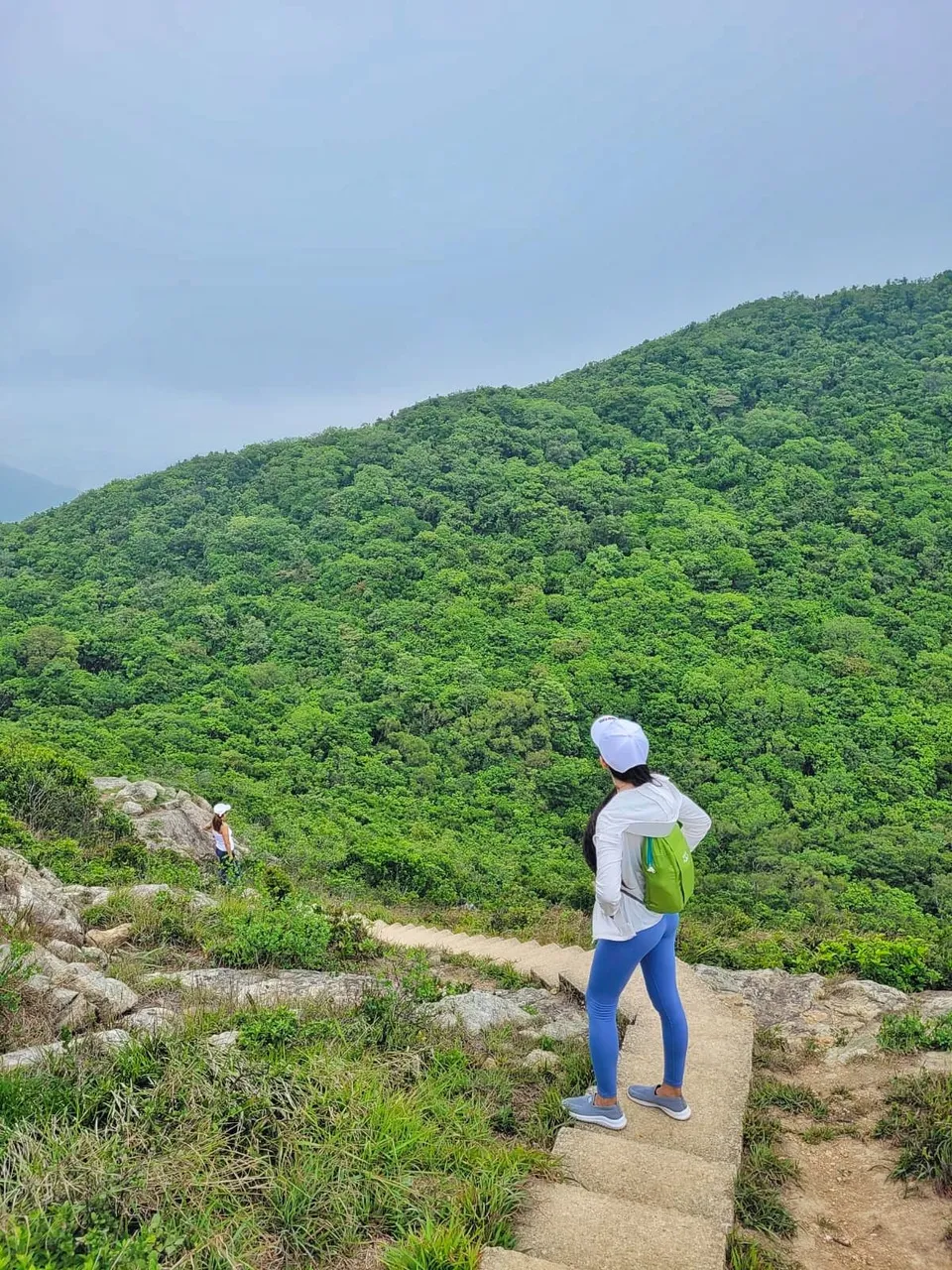
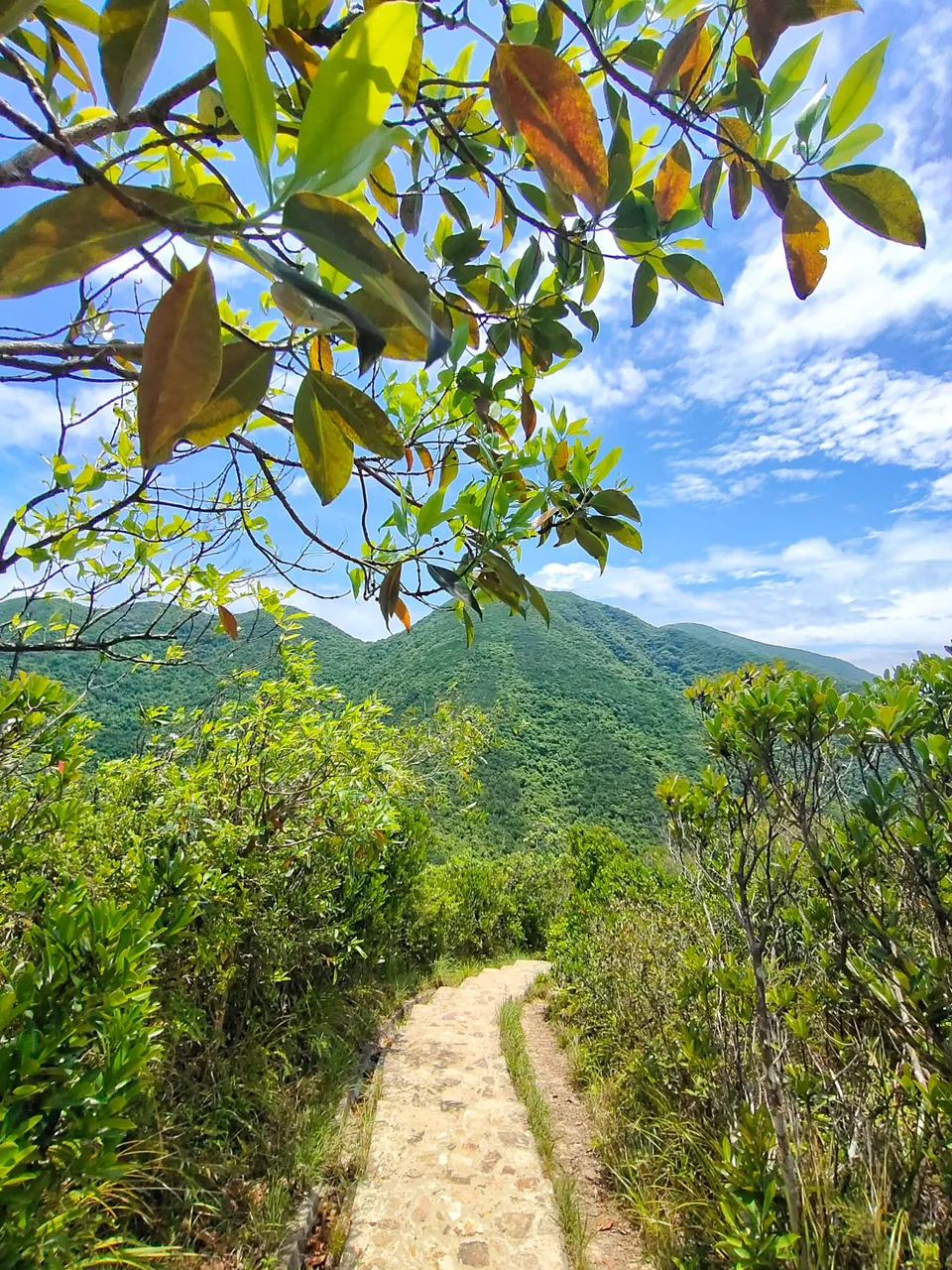
Believe me, if you'll ask about its difficulty, I would say that trails were quite DIFFICULT! In fact, going to this hill is one of the most difficult trails in Hong Kong because of its endless inclined stairs. So if you are a person who loves adventure, this place is truly perfect for you. Just a pretty reminder, you will pass through steep stairs and dirt paths that can be slippery, so make sure to wear suitable footwear, and, bring enough water because you will truly feel exhausted sooner or later.
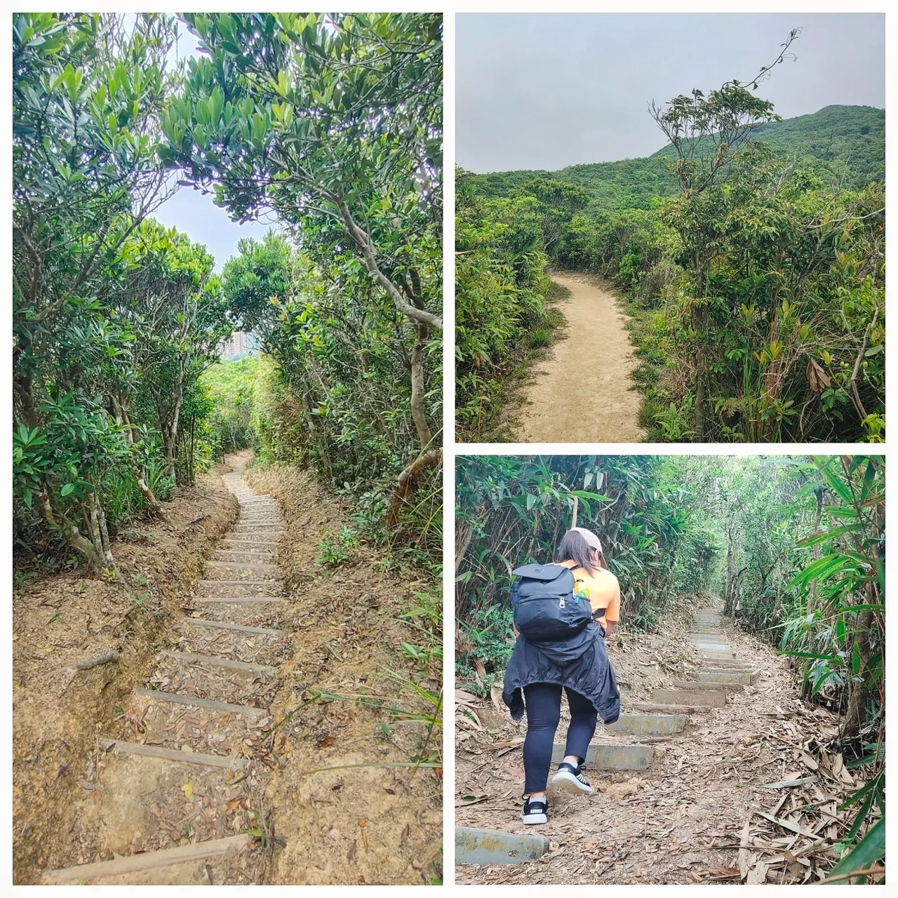
We started at a stair and went down through stairs as well. We call the trail a stairway to heaven, of course, don't ever let yourself fall to heaven, lol, be careful.
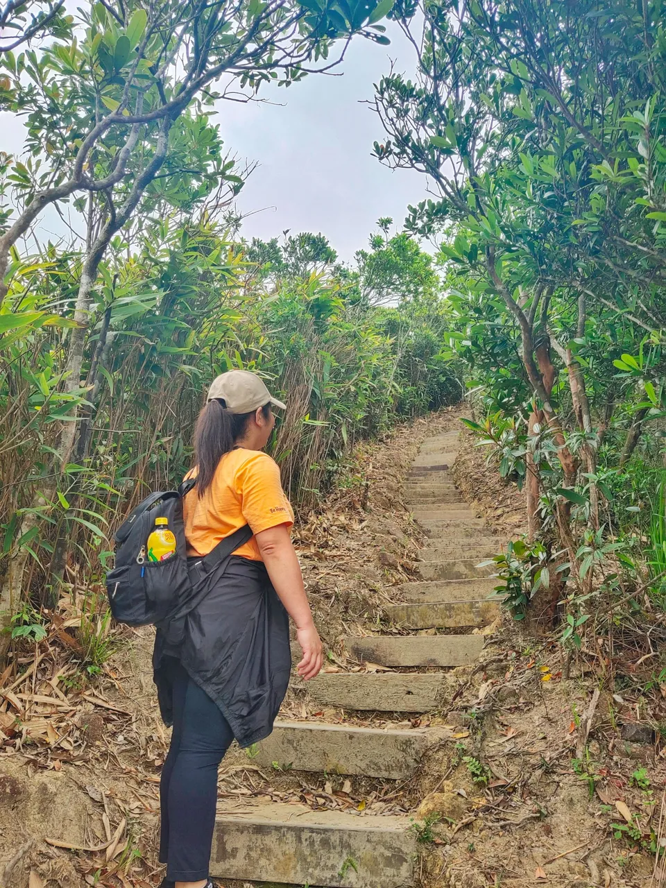
She looks like questioning herself if she could make it through the end of the trail, lol. There are a set of stairs that are 400 steps in a row. Just imagine that exhaustion.
There were actually two options, the easy trail and the difficult one. Of course, we chose the difficult one because the more arduous the trail is, the more stunning the view and worth the experience.
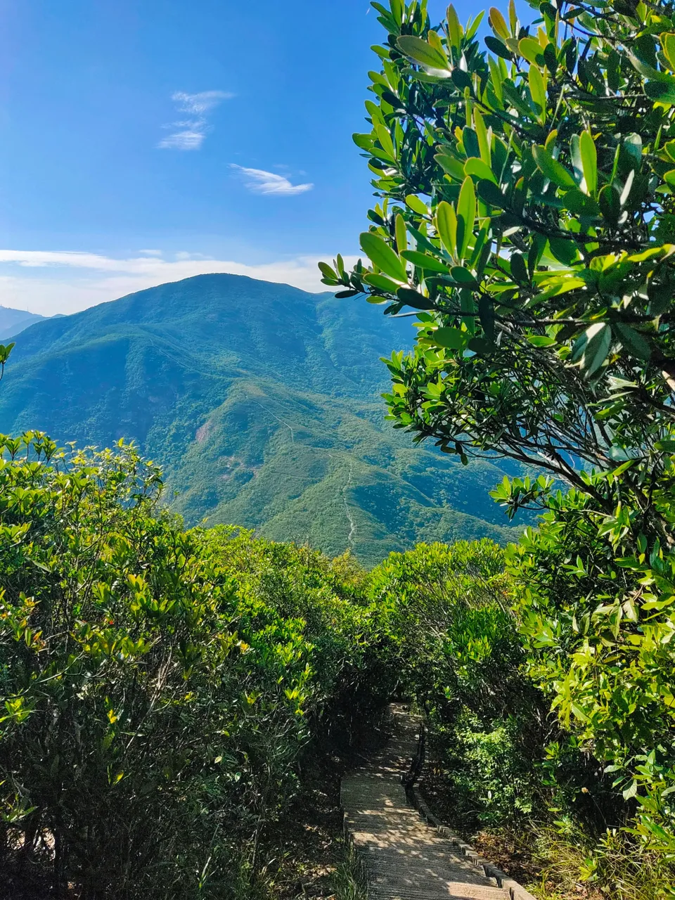
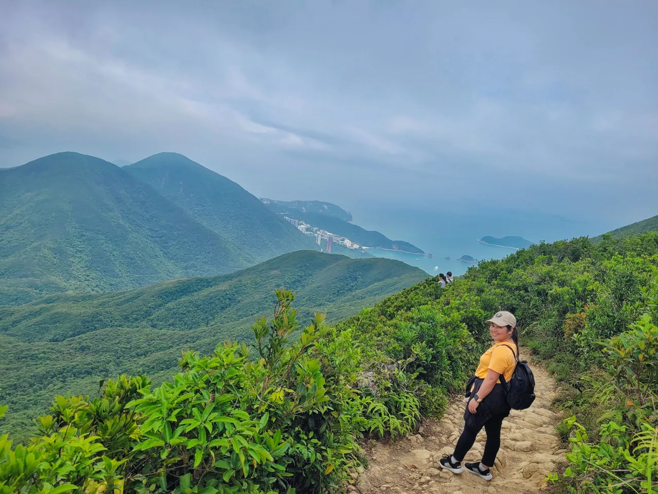
After more than half an hour from our starting point, we reached the viewing point of the Violet Hill and saw the stunning view of the Hong Kong skyline.
The city seem to be covered with fog as the weather that day was gloomy. The fog may have obscured the view, yet it offers a scenic view and the chilly breeze gave us a better hiking experience.
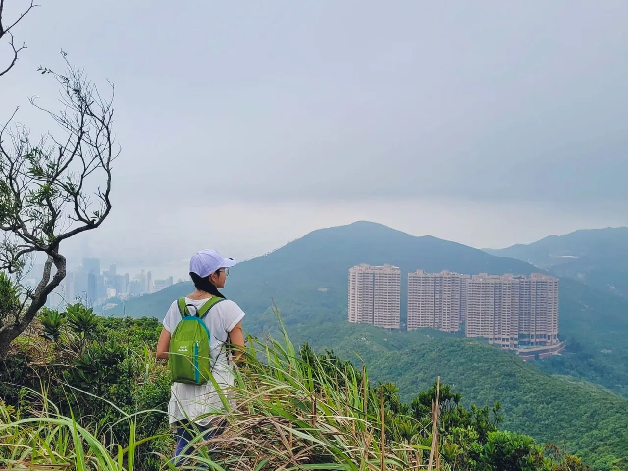
You can see the famous high-end residences from the top of the hill. It's one of HK's largest estates that offers a stunning view of a country park.
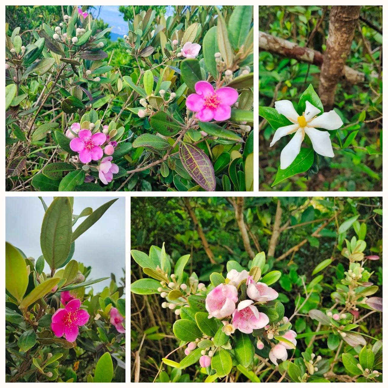
We wondered why the hill is called Violet, yet, we didn't see anything that would resemble the color violet. We thought we might miss something, so I opted to look about it online and I found out that Hong Kong Iris flower can be found on the hill. Unfortunately, we didn't see any violet-colored flowers, probably not its blooming season. But we did see other pretty flowers around the area.
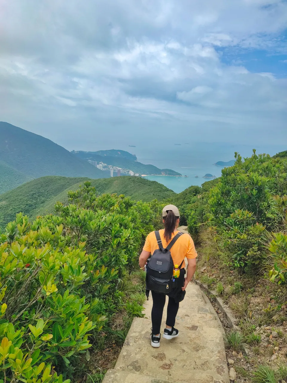
From the viewing point, we descended to the next hill, through stairs again.
And there I saw a lady with the same white cap and shirt like mine, lol.
The surrounding hills and valleys with the foggy horizon view make the day look more dramatic and overcast.
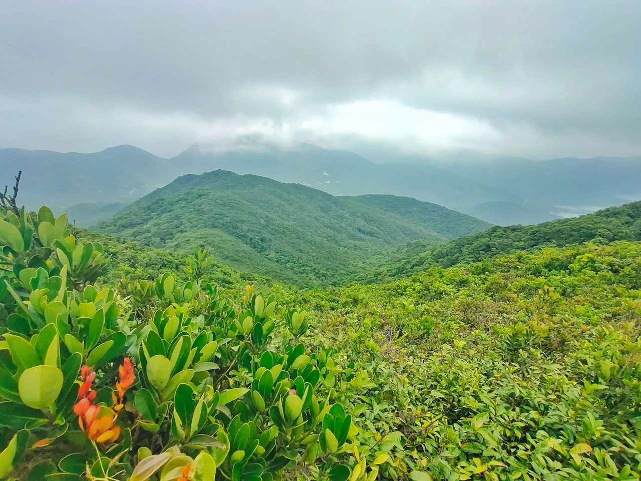
From this point, there are two trails to follow. But since we wanted to visit the twin hills, we followed the direction to where we saw the hills from the distance.
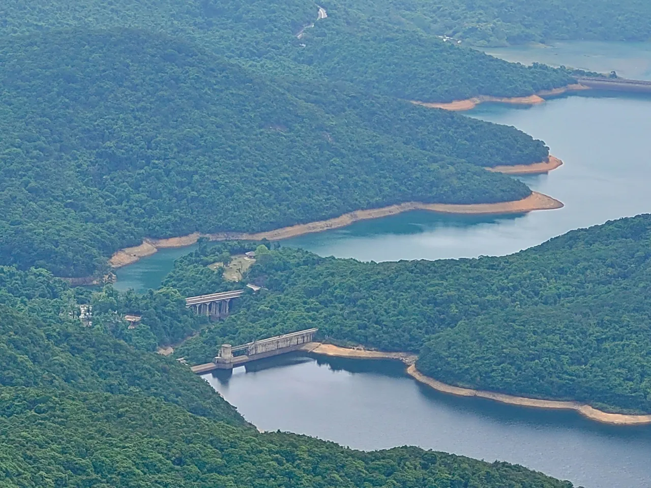
We stopped in the middle of our journey as we came across the stunning view of the reservoir.
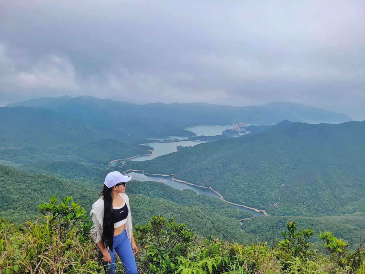
As we zoomed out the camera, a bridge and the main reservoir dam can be seen and we planned to visit them first before going to another hill.
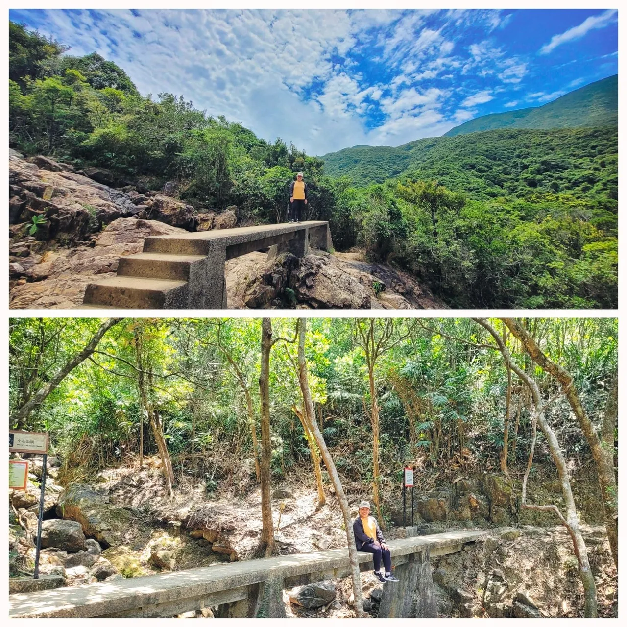
We passed through paved paths, descended, and ascended windy stairs and dirt paths.
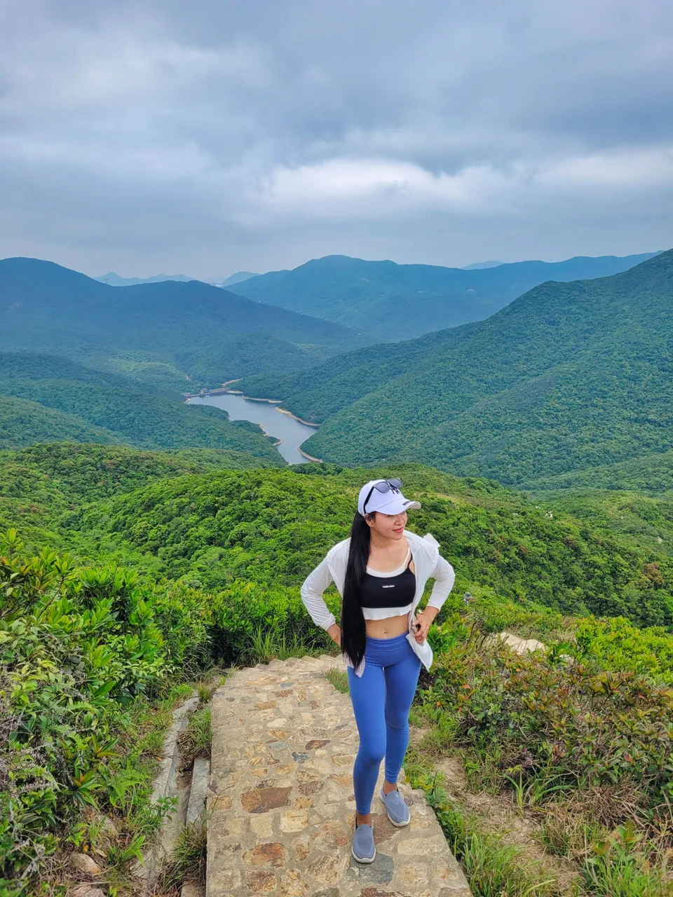
Stunning view, isn't it? That's the twin hills that we want to hike next
The further we got, the more stunning the view was, and the more excited we were to follow more trails.
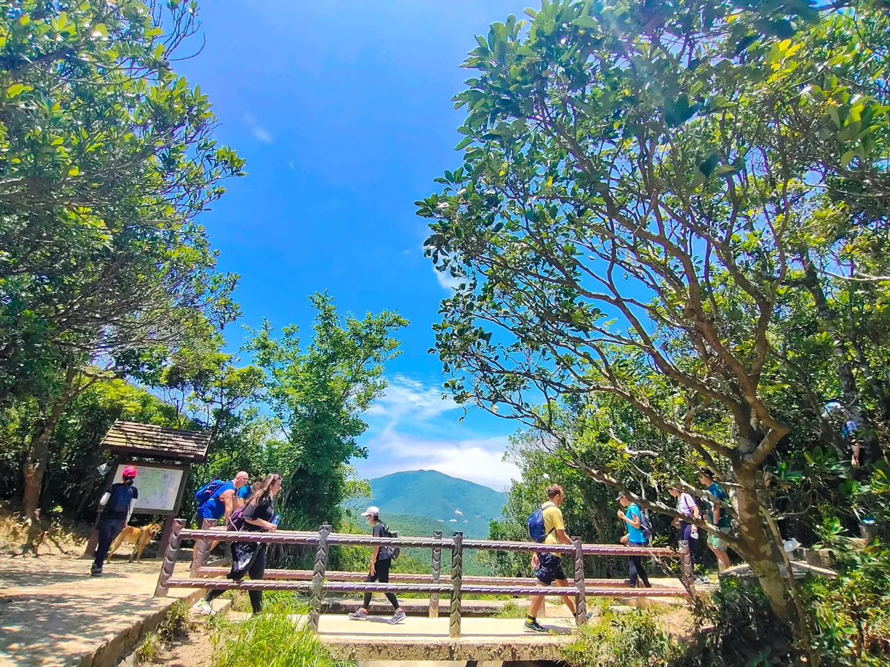
The set of stairs seemed to be never-ending, but we didn't mind because of the scenic view. We descended the stairs to the next stop and more hikers were showing up from both sides. Some seemed exhausted, probably from passing through the set of stairs throughout the trail.
The sun showed up at noon making the view more scenic and dark clouds paved way for the blue sky.
We descended these stairs pretty fast and came across a bridge which is the center point between the teo hills. We rested at this point to eat our lunch before we proceeded to our next destination.
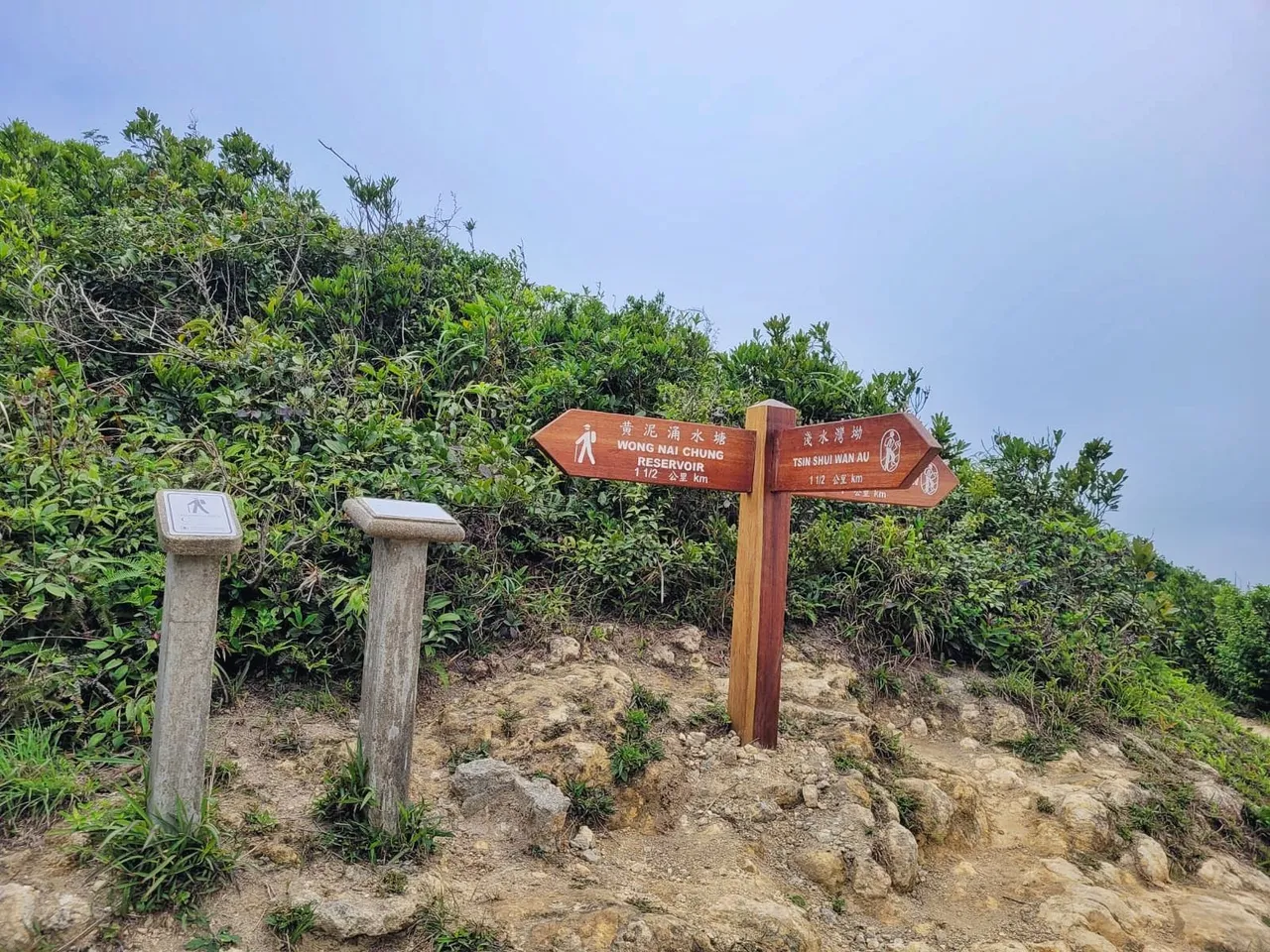
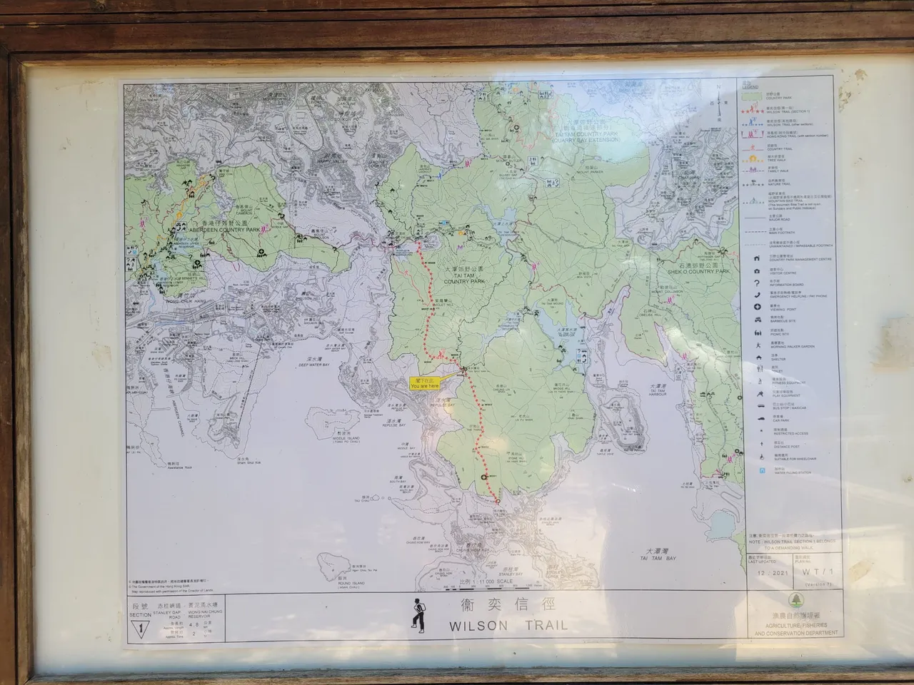
all the trails we passed through were part of a big trail that span across Hong Kong. And from this point, there are two options to follow again. You can choose to either head to Stanley road to the right or go down to the reservoir to the left and exit to another side of the country park.
Since we planned to visit both, we opted to go down the left side to the reservoir which is 2 Km far from the bridge and it took us more or less half an hour to reach the reservoir including the time we spent taking photos of the view along the way.
The trail wasn't difficult and there were no windy stairs, but rather dirt and stony paths and more concrete bridges that span through streams connecting one side to another. It probably was a beautiful view if there was more water on the streams, but they were almost dry.
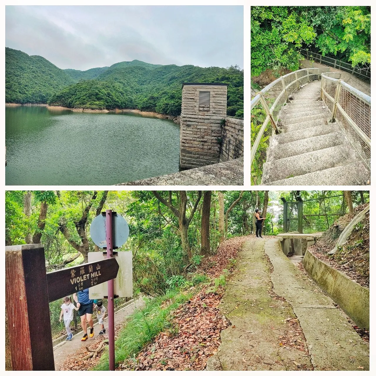
The Tai Tam Intermediate Reservoir Dam is located down the trail which is one of the four reservoirs in this country park, based on the information on the board.
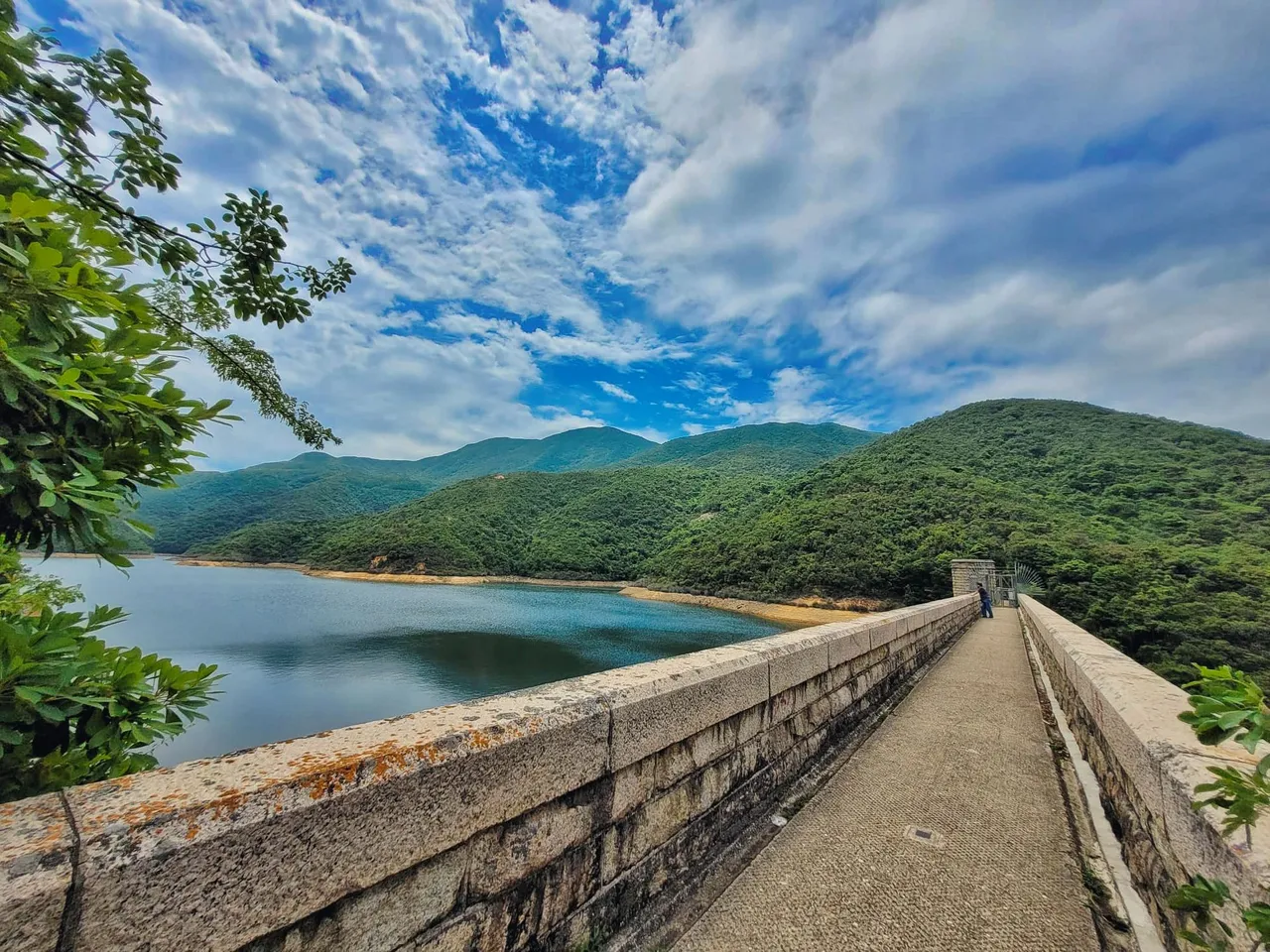
The construction of this reservoir dam started in early 1900s and was completed after three years. Based on the information on the board, the spillway was lowered for safety purposes, making the dam crest form a deep notch on the surface.
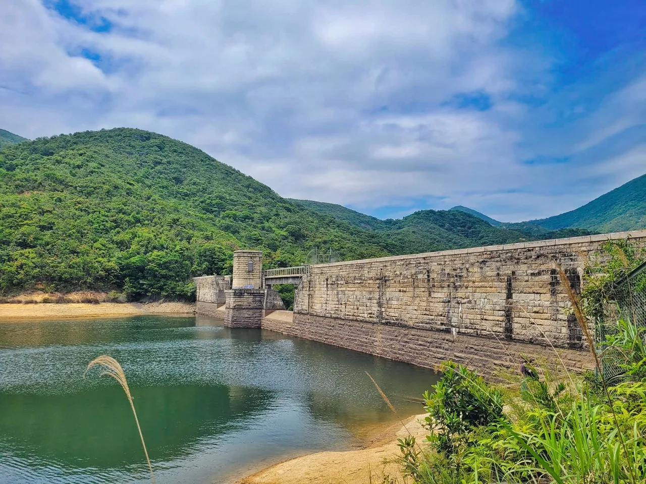
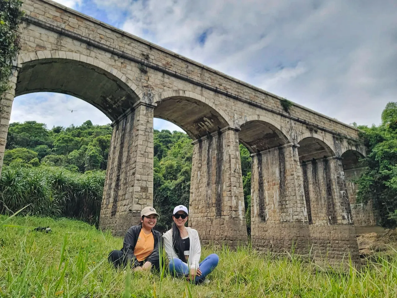
About the midway along the dam is the valve house which looked stunning because of its masonry construction. It can be reached through the footbridge over the dam.
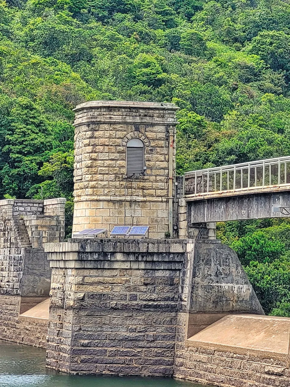
Adjacent to it is a European-inspired masonry bridge. This is just one among four bridges in this country park. The bridge looked spectacular as it casts reflections on the water. The water rises and falls in different seasons, but this probably looks more beautiful if the water level is higher.
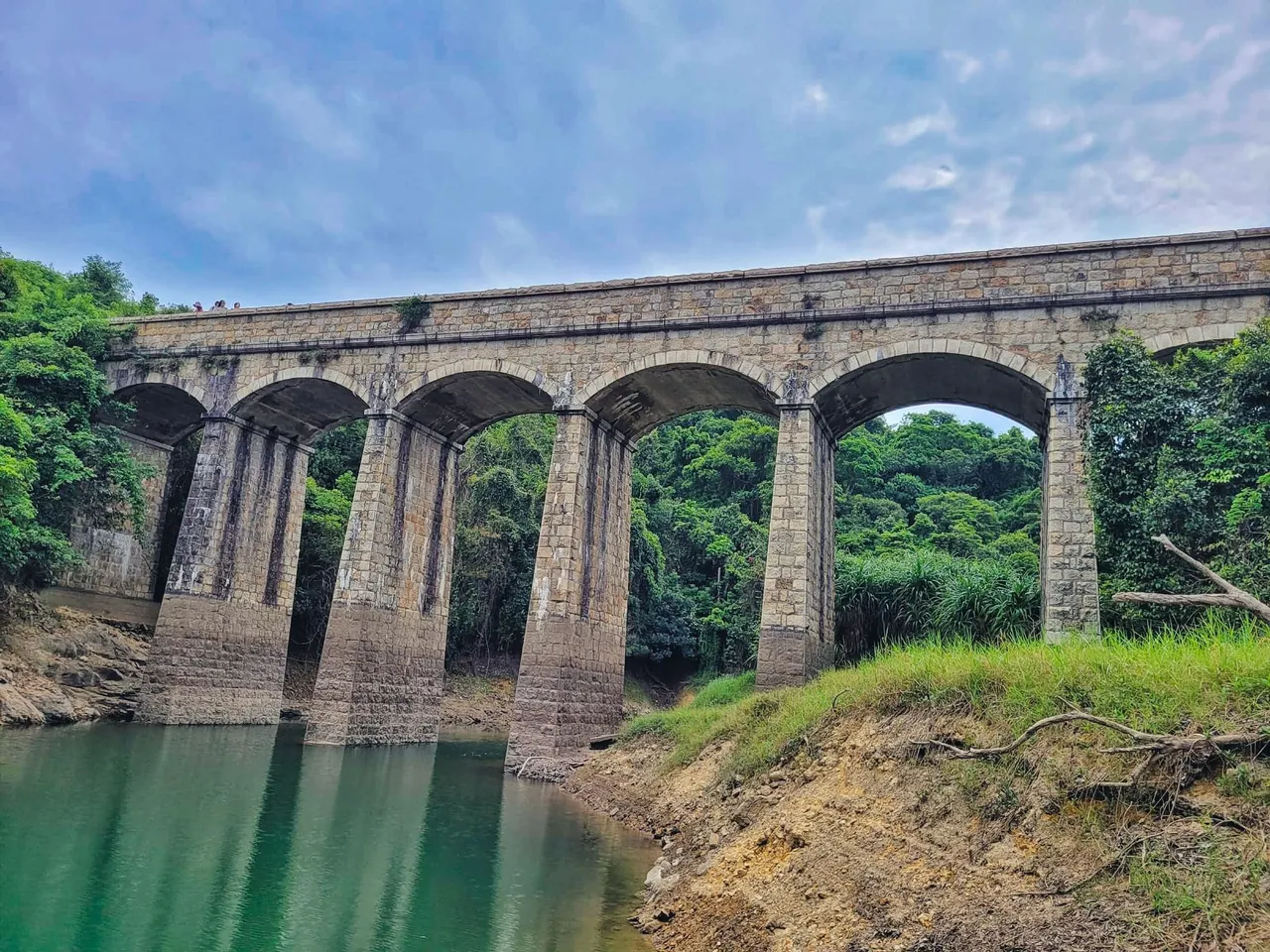
The bridge, the valve house, the reservoir dam, and other bridges and dams of Tai Tam Reservoir are declared monuments in 2009 based on the information on the board posted next to this bridge.
Going down to the bottom was pretty worrying as there might be snakes or other dangerous animals that might pop out on the way. Fortunately, we reached the bottom safely, and surprisingly, there was a Chinese couple catching fish by the dam and we heaved a sigh of relief as we were not alone at all.
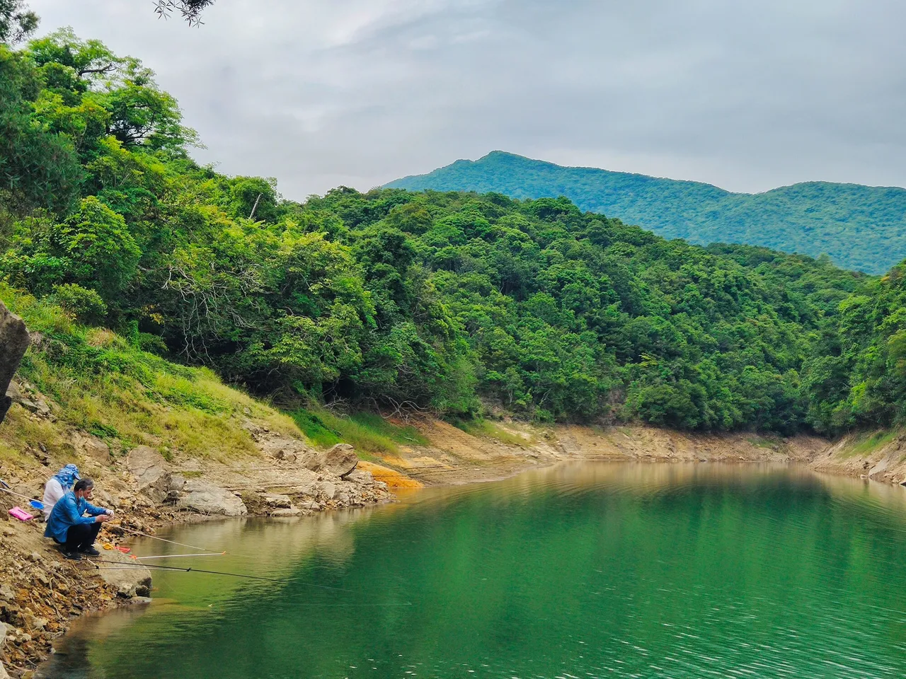
People wondered how we get down the bottom of the bridge as there isn't a stair or any path going down. Unbeknownst to them, we trespassed the closed small gate at the end of the bridge and went down passing through the side of the canal and tall bushes.
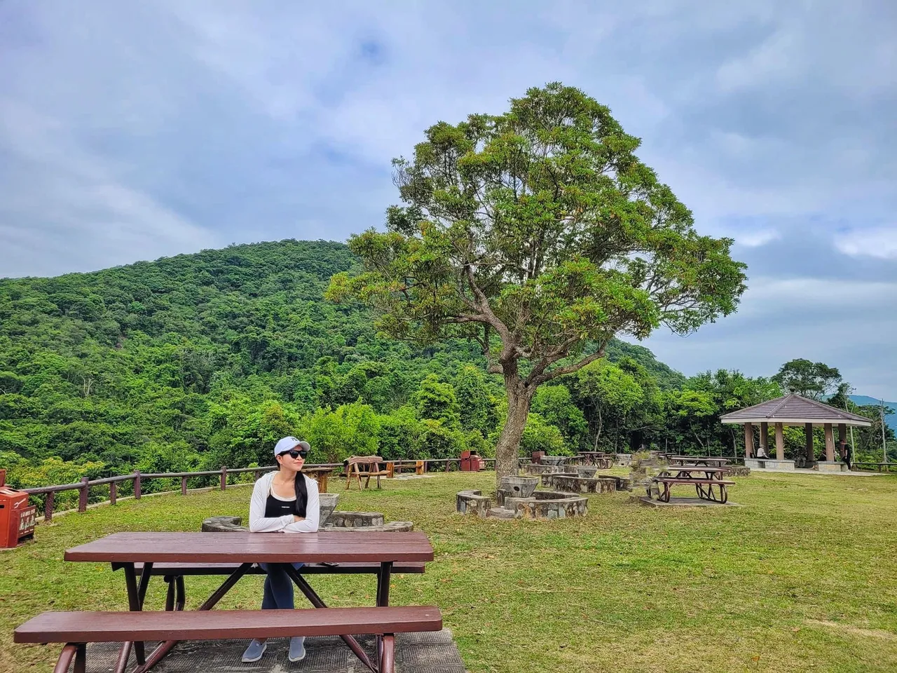
On both ends of the bridge are a picnic site and a barbecue area. The picnic site was closed for some reason, but then again, we trespassed the closed entranceway after seeing some people resting on this site. So on this day, we became trespassers, lol.
Our exhilarating and fat-burning adventure to the Twin Peak a.k.a. Terrible Twin is next. Wanna join us? See you in my next travel blog.
This will be my entry to @qurator Photo Quest contest.
(All photos are mine)

Follow me on: