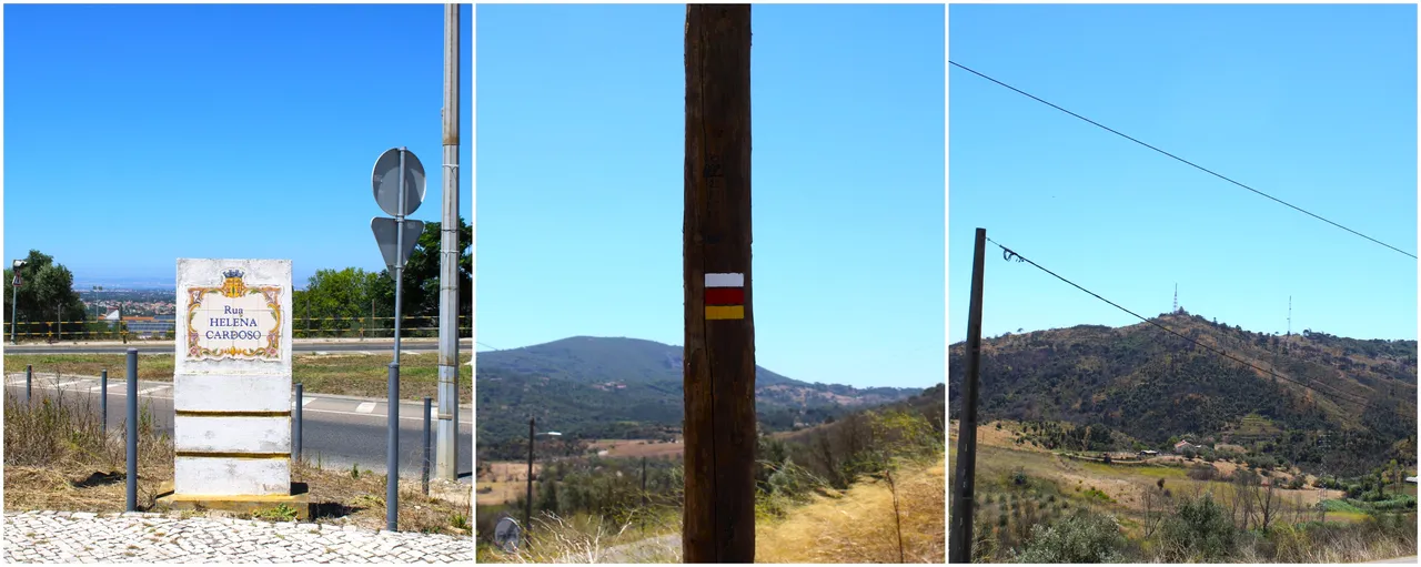
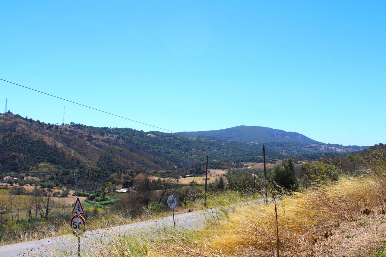
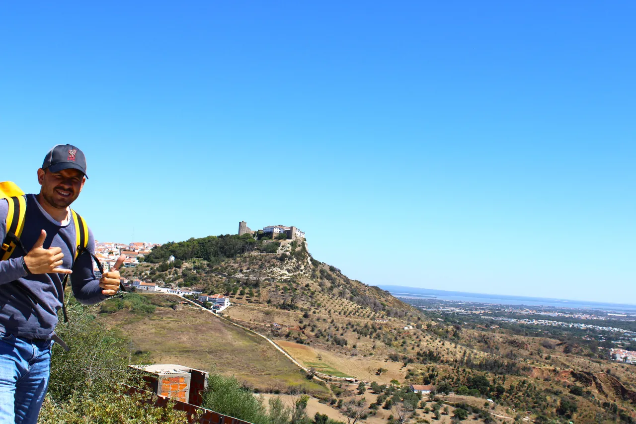
Hello good morning adventurous friends, today I am quite excited to bring you a post full of adventures and beautiful images of the picturesque landscape and Palmela, today I drove 23km from my house to the center of the city of Palmela exactly where the castle is to start the trail (PR1 PLM), the trail has the peculiarity of showing you a set of windmills typical of the area, in addition to enjoying the Palmela castle as a background of the landscape and observing the geological formation of the "Barris, Alcube" mountain range at more than 300 meters high. It was an incredible experience and I share it withyou.🚵🏻♀️🚩
Hola buenos dias amigos aventureros, hoy me encuentro bastante emocionado por traer un post lleno de aventuras y lleno de hermosas imagenes del paisaje pintoresco y Palmela, para hoy conduje 23km desde mi casa al centro de la ciudad e Palmela exactamente por donde esta el castillo para iniciar el sendero (PR1 PLM), el sendero tiene la particularidad de mostrarte un conjunto de molinos de viento tipicos de la zona, ademas de disfrutar del castillo de palmela como fondo del paisaje y observar la formacion geologica del la sierra de "Barris, Alcube" a mas de 300 metros de altura. Fue una experiencia increible y la comparto contigo.🚵🏻♀️🌎
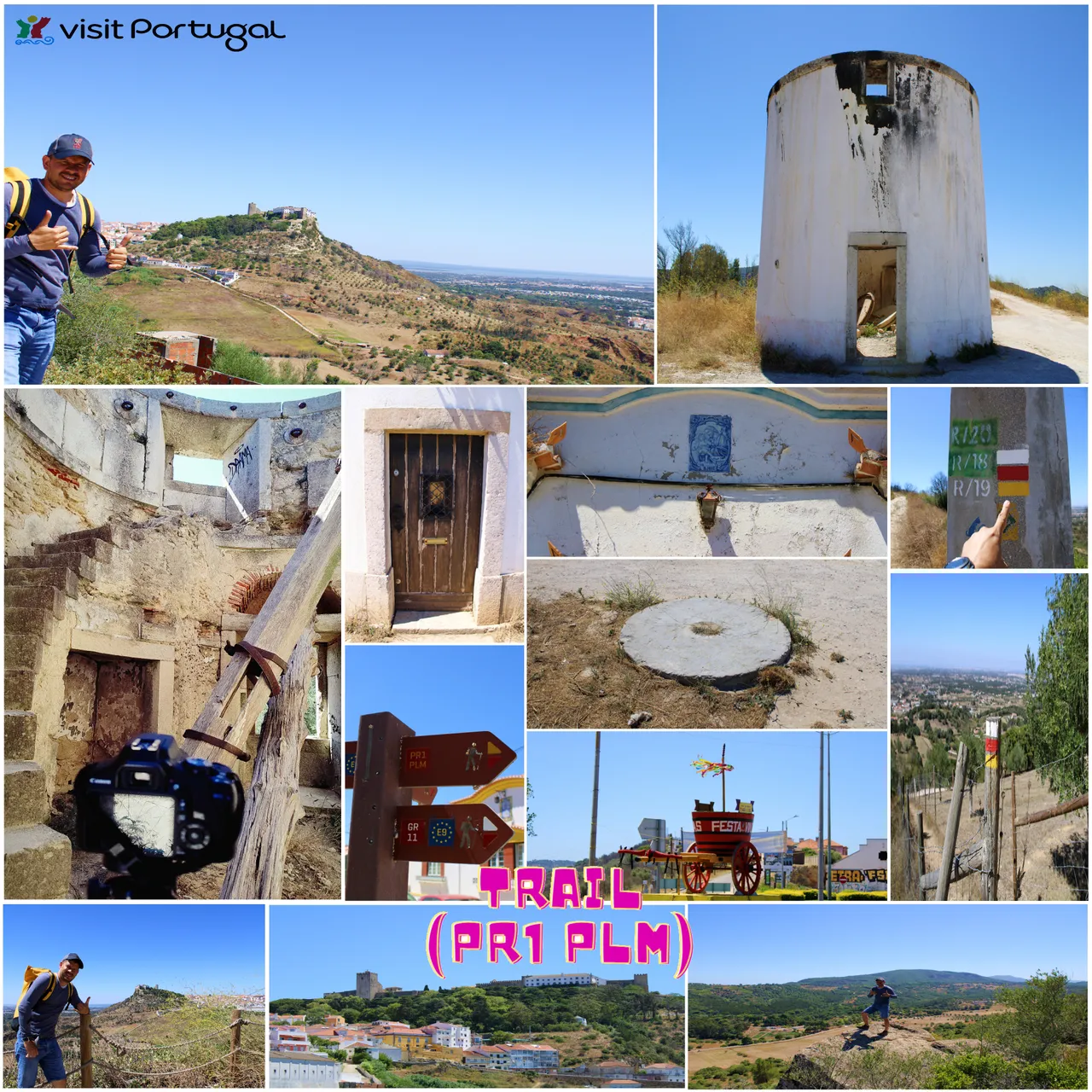
Trail Features📸🚩 /Caracteristicas del sendero🌎🚩

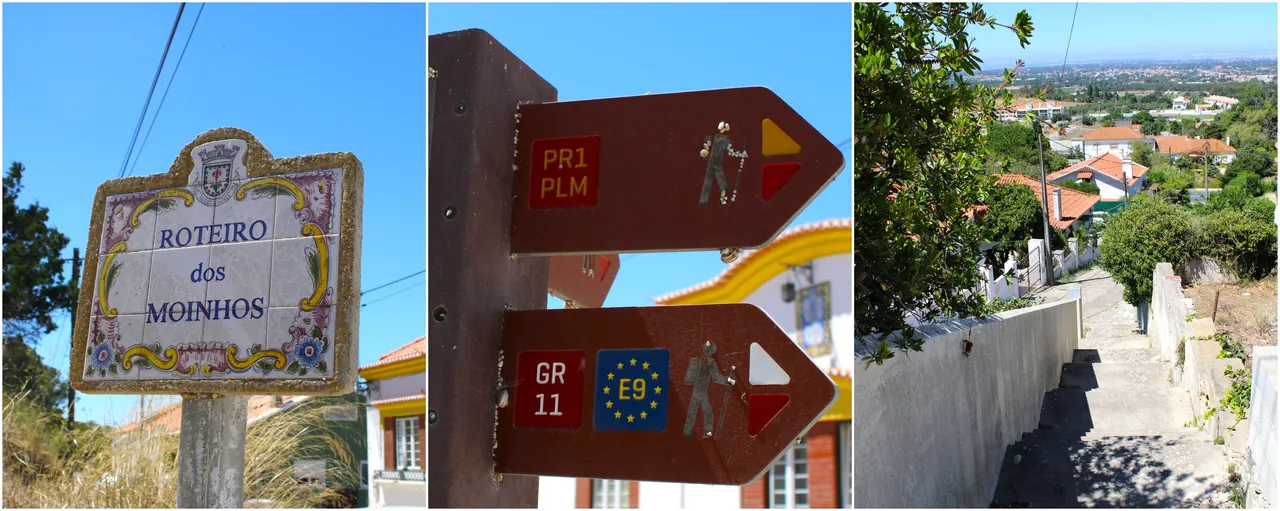
https://www.trilhosecaminhadas.com/percursos/pr1-percurso-pedestre-nos-vales-de-barris-e-alcube-plm/
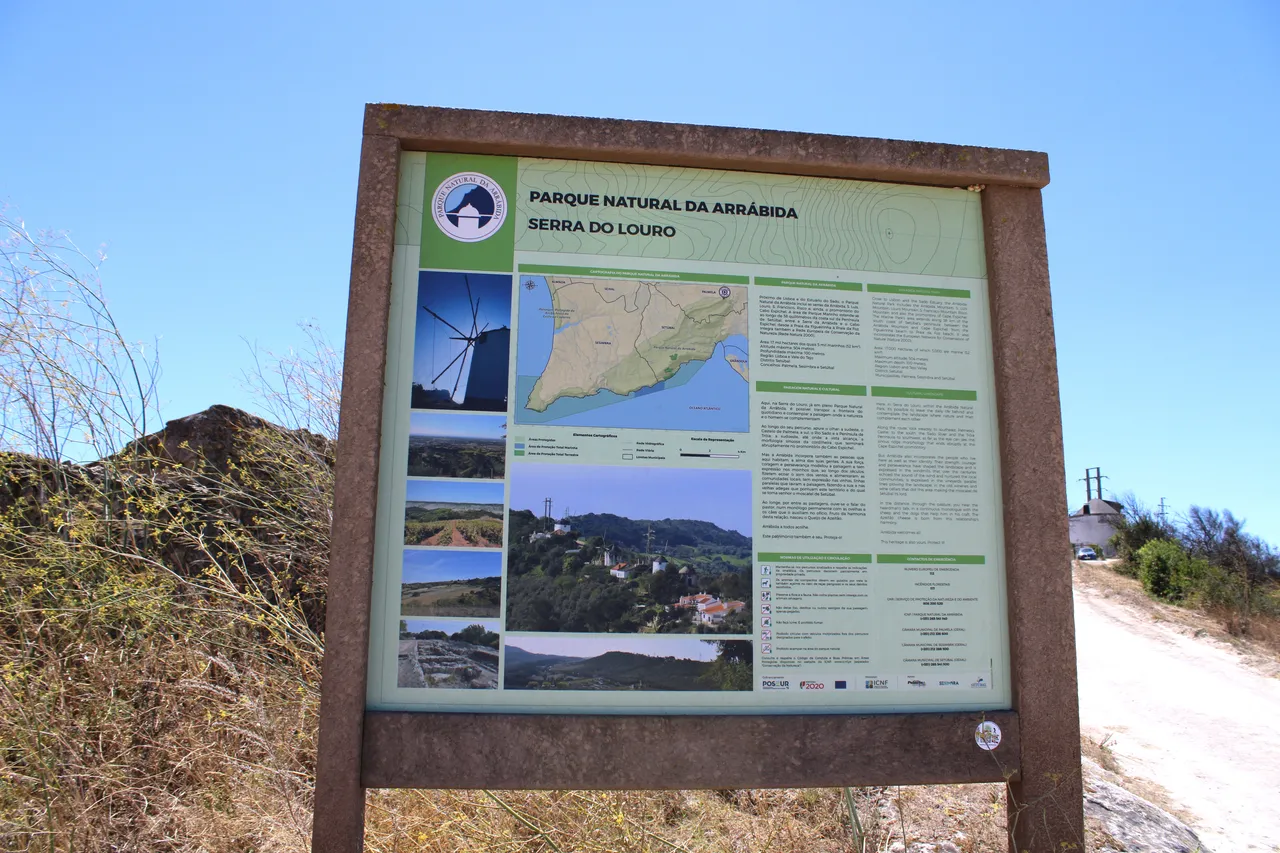
To be prepared for this beautiful trail I leave you here the map and its characteristics. First, it is a circular trail, meaning the start and end points meet. It has a total length of 10km, and depending on your pace, you can complete it in 4 to 5 hours. We will climb an average of 110 meters in height, which gives our hike a beautiful view of the surrounding valleys and in the distance you can also see the Arrabida mountain range. In summer, which for me is the best time of year to hike, you should bring a hat, sunscreen, and plenty of water. The weather here is unforgiving and you can experience temperatures of over forty degrees. Spring is also a good option, but not on a rainy day, as the trail is muddy.🚵🏻♀️🌎🧭
Para estar preparado con este hermoso sendero te dejo aqui el mapa y las caracteristicas del mismo, primero es un sendero circular osea el punto de inicio y final se juntan, tiene una extension total de 10km, dependiendo el ritmo que tengas puedes completarlo entre 4 a 5 horas. Vamos a subir una media de 110 metros de altura lo que hace que nuestra caminata tenga una vista hermosa de los valles que estan alrededor, y a lo lejos se observa tambien la sierra "da arrabida", en verano que para mi es la mejor epoca del ano para hacer el sendero debes venir con un sombrero, bloqueador solar y bastante agua el clima aqui es implacable y puedes experimentar mas de cuarenta grados. Primavera tambien es buena opcion pero no un dia con lluvia el camino es lodoso.⛰️🧭
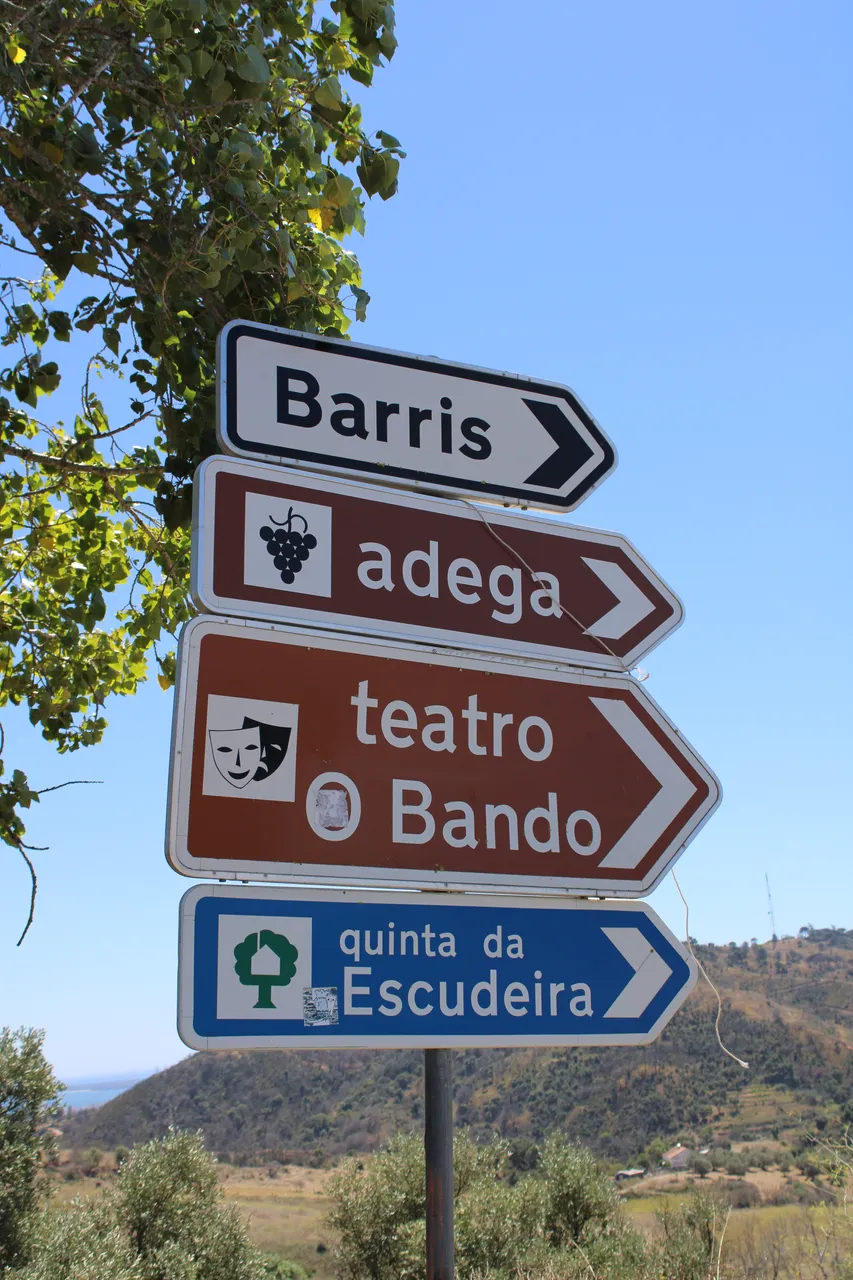
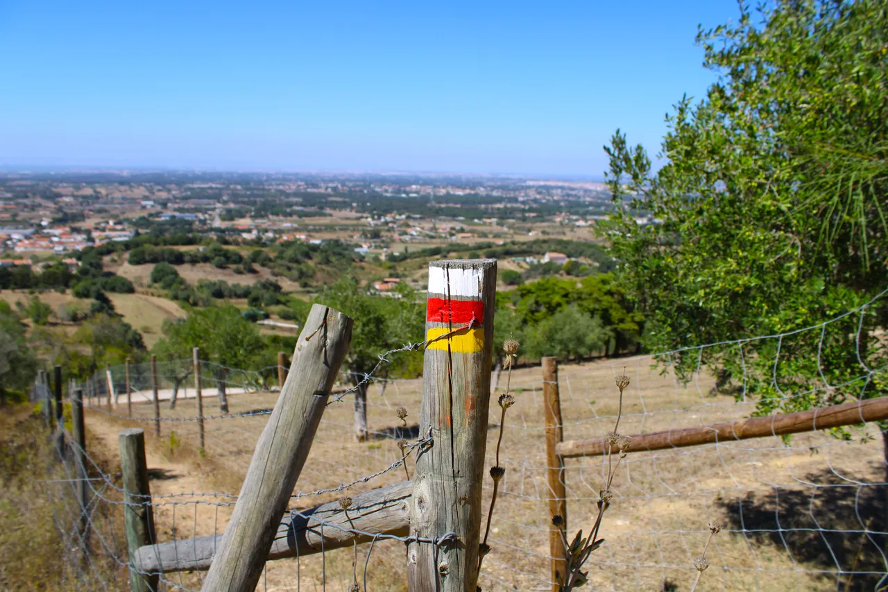
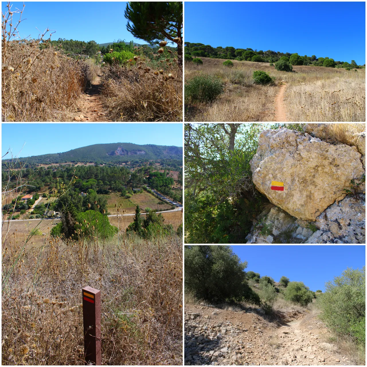
The adventure begins📸🚩 /Comienza la aventura🌎🚩

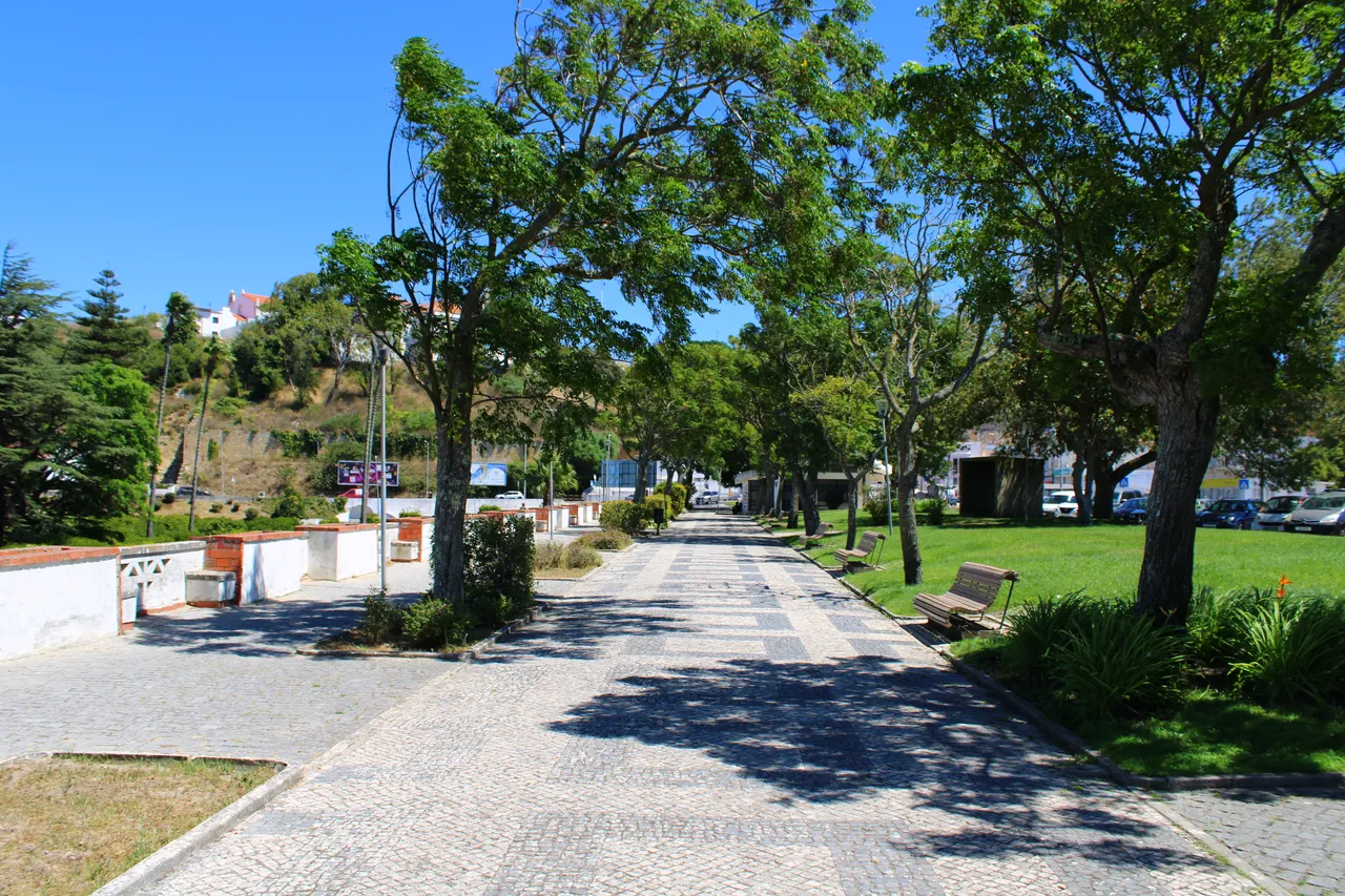
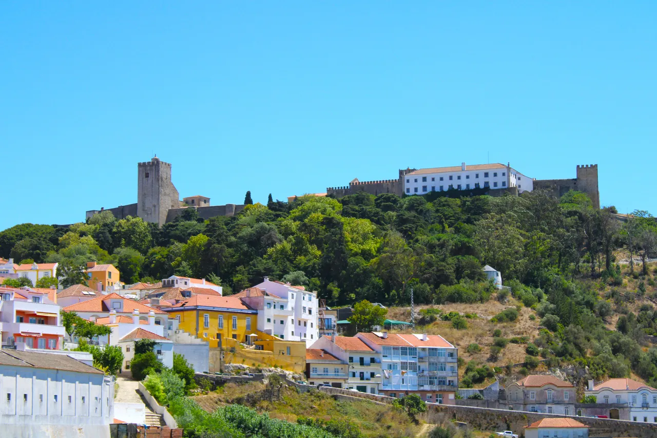
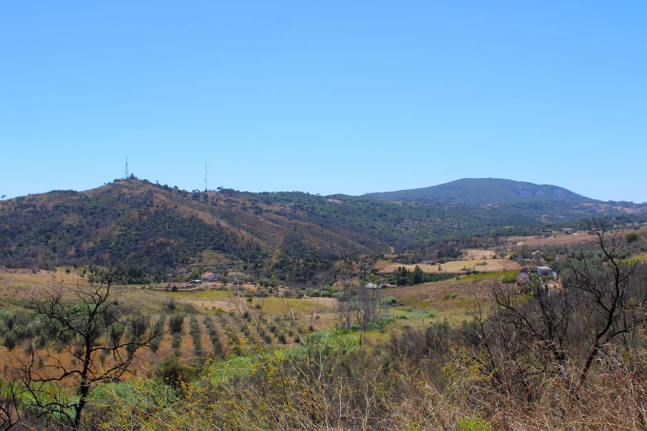
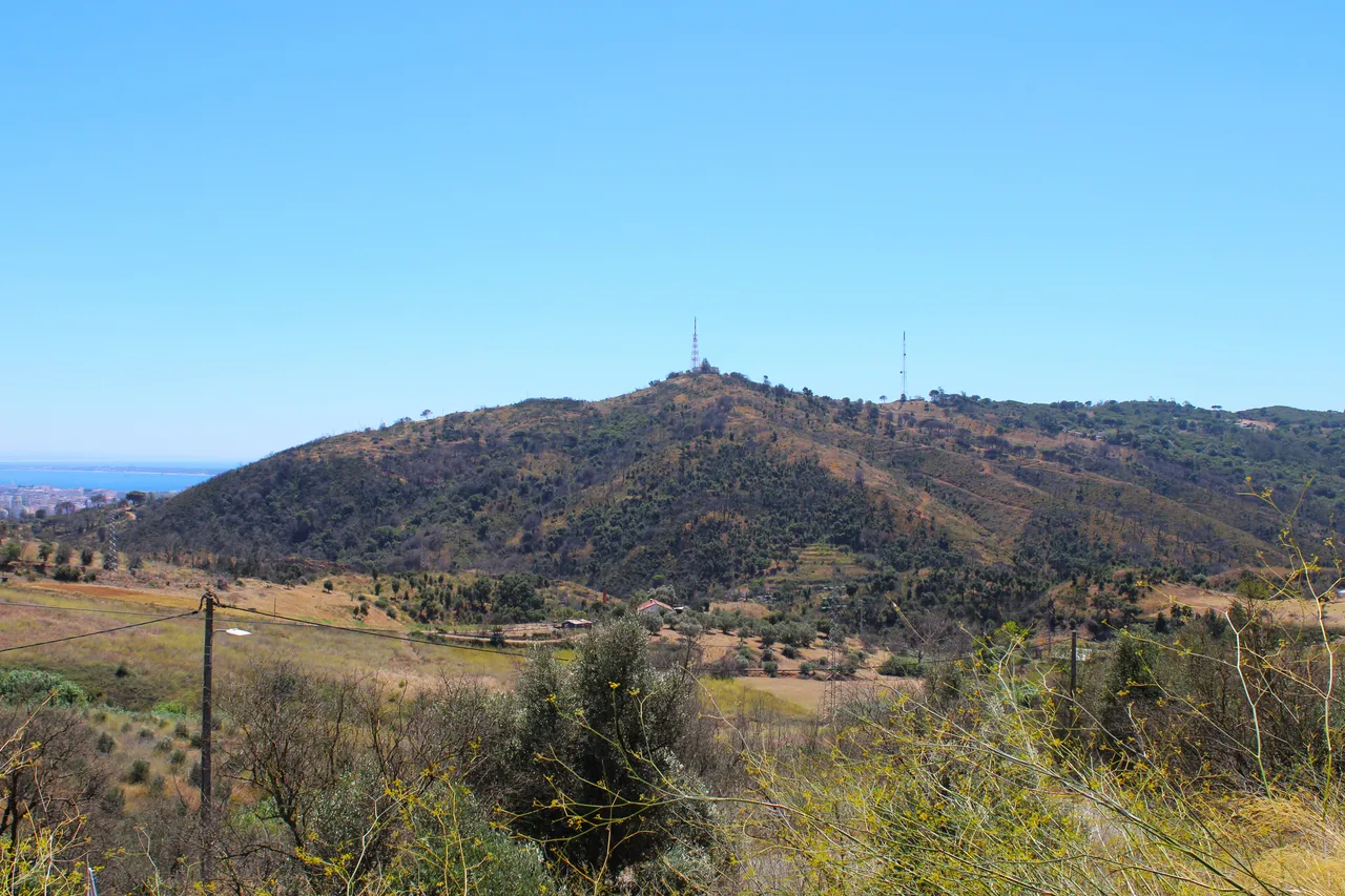
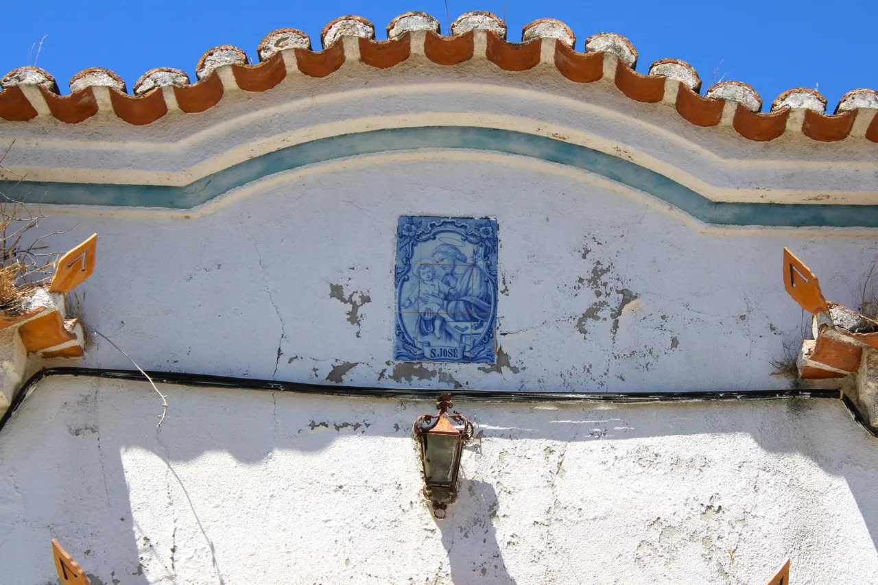
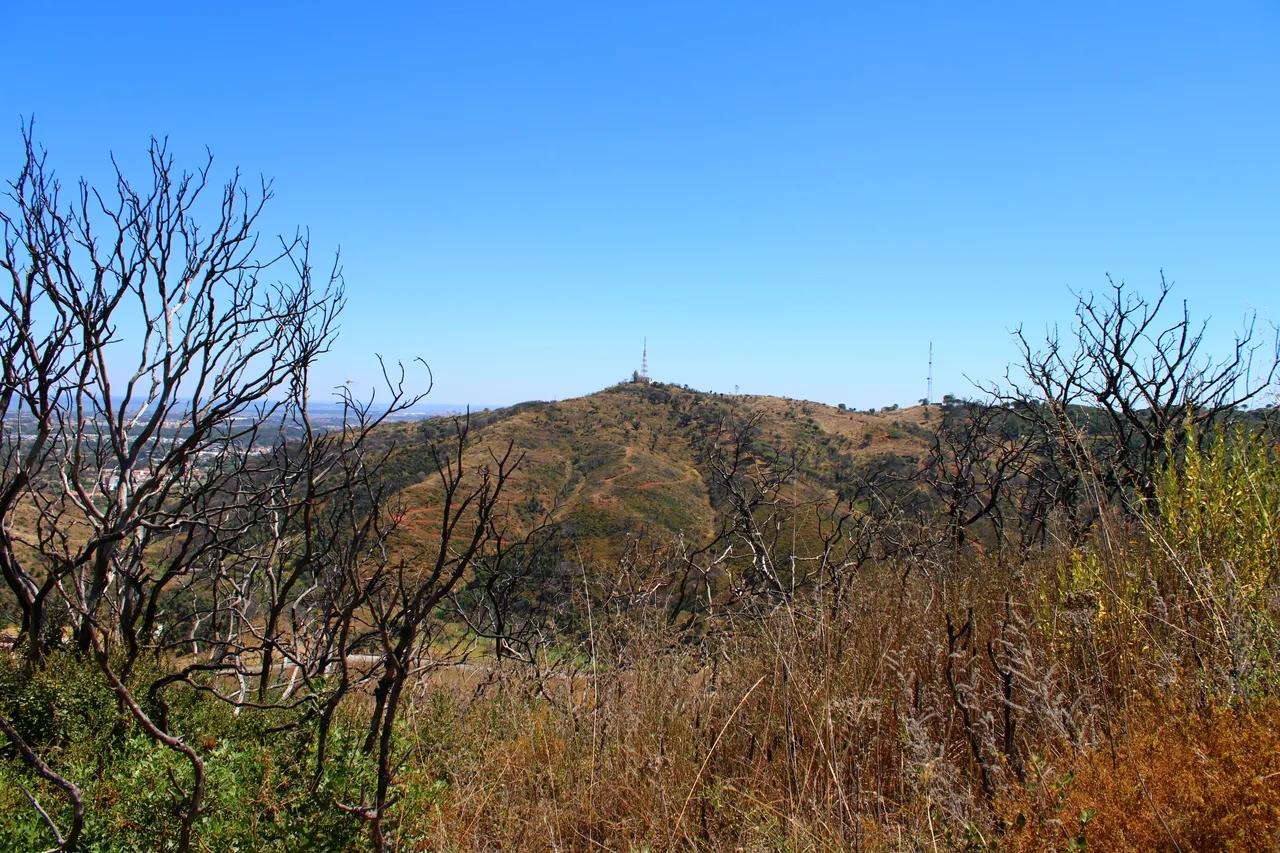
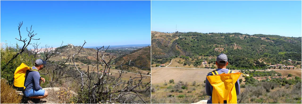
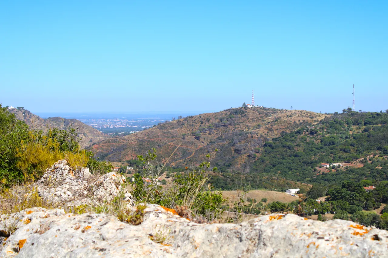
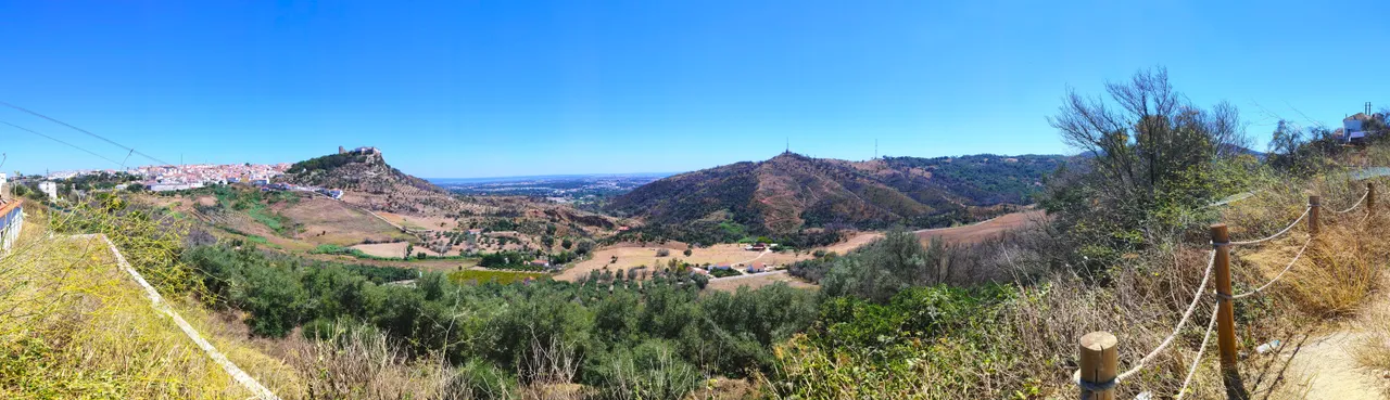
Our walk started in the "Alameda" garden which is in the centre of the city of Palmela. Here you can take the opportunity to take pictures or visit the castle before continuing the walk or enjoy the scenery as we can see the Atlantic and several mountains in the distance. We are going to climb the mountain range called (Barris) which has a maximum height of 185 metres. Palmela is a city with a lot of history. In these areas, civilizations from the third millennium BC lived, as did the Romans, the Vigoths and the Arabs! So there are millions of years of history that we can enjoy on this trail.🌎🚵🏻♀️📸
Nuestra caminata inicio en el Jardin de "alameda" que esta en el centro de la ciudad de Palmela aqui puedes aprovechar en fotografiar o visitar el castillo antes de continuar la caminata o disfrutar del paisaje ya que podemos ver a lo lejos el atlantico y varias montanas, nosotros vamos a subir por la sierra que se llama (Barris) tiene una altura maxima de 185 metros, Palmela es una ciudad con mucha historia en estas zona habitaron civilizaciones del tercer milenio antes de cristo, los romanos tambien vicigodos, arabes! por tanto hay millones de anos de historia que podemos disfrutar en este sendero.⛰️🚩

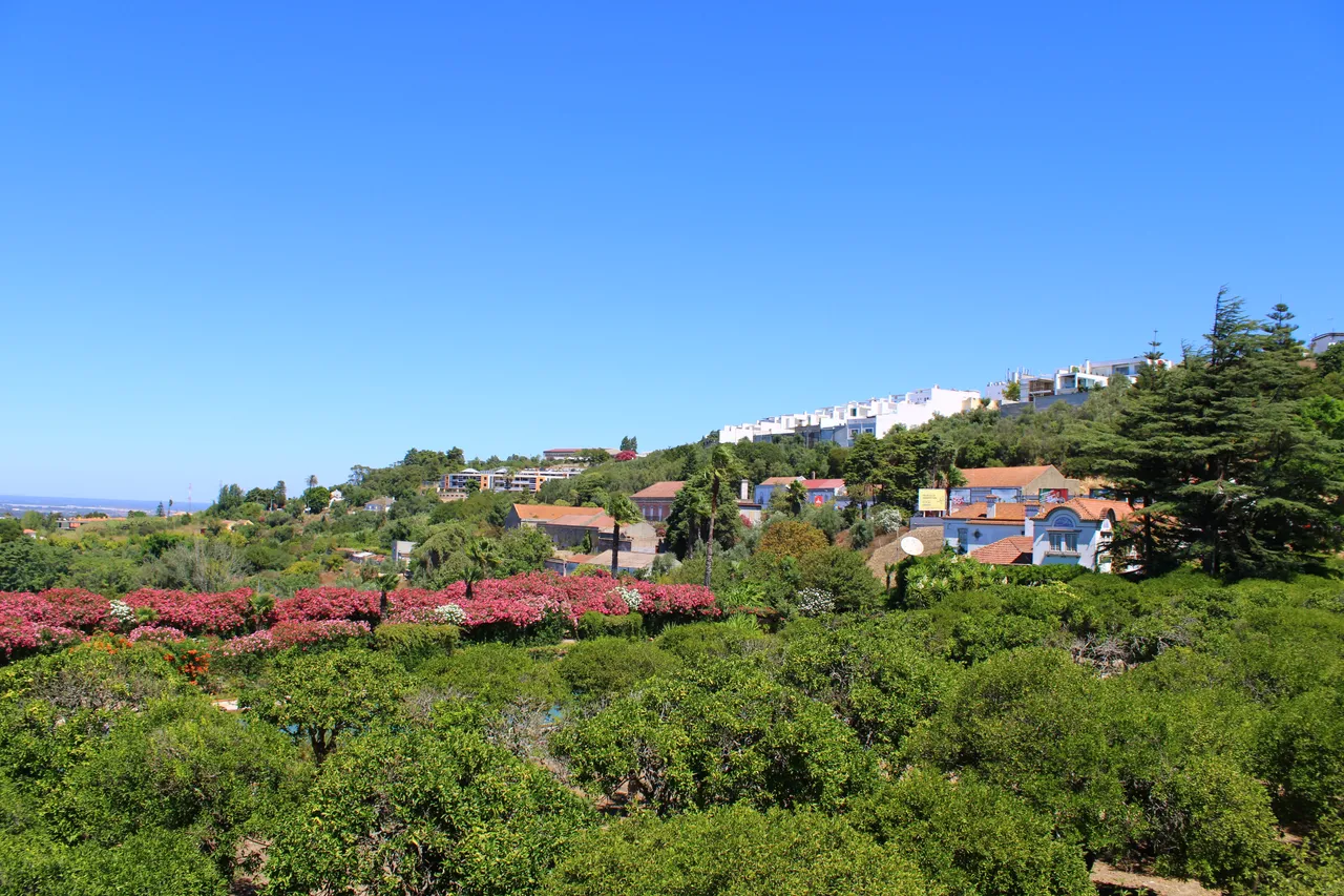

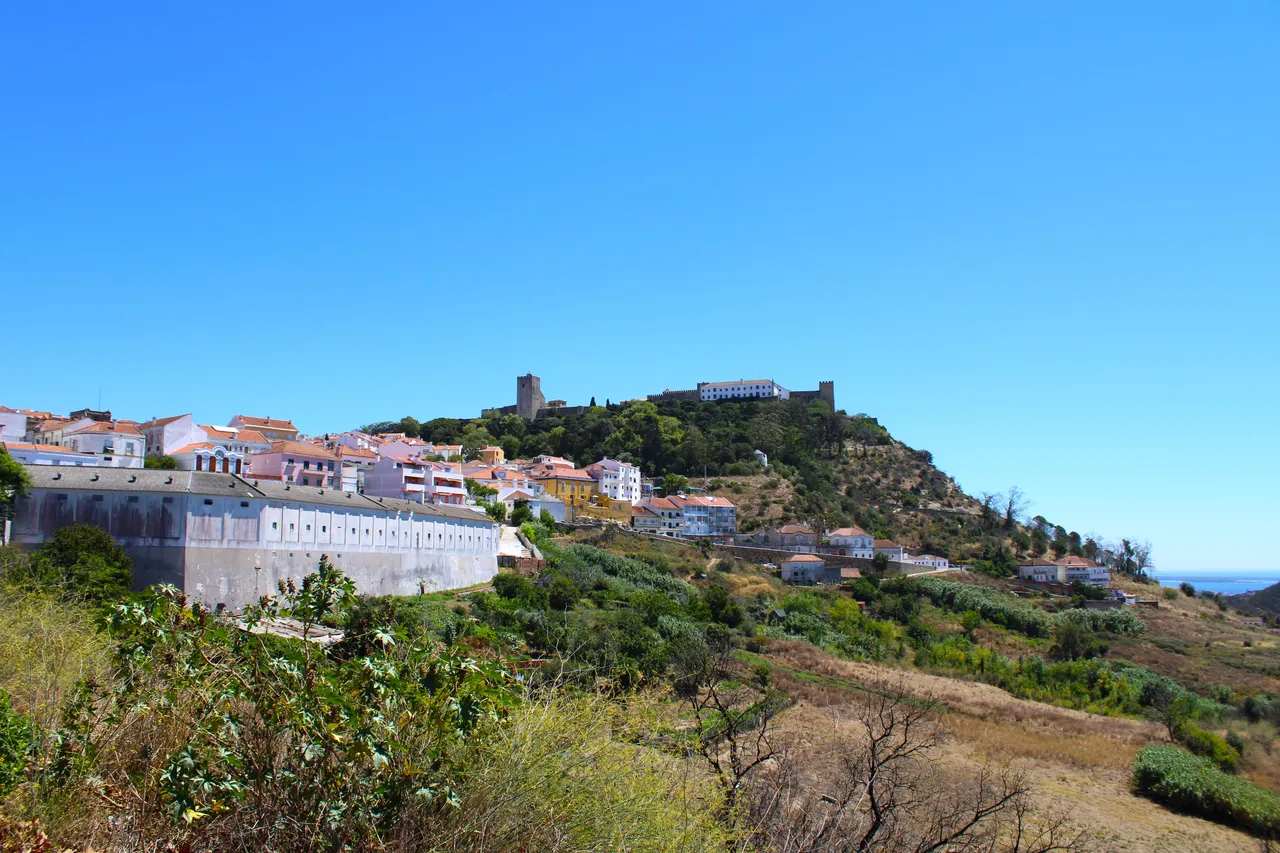
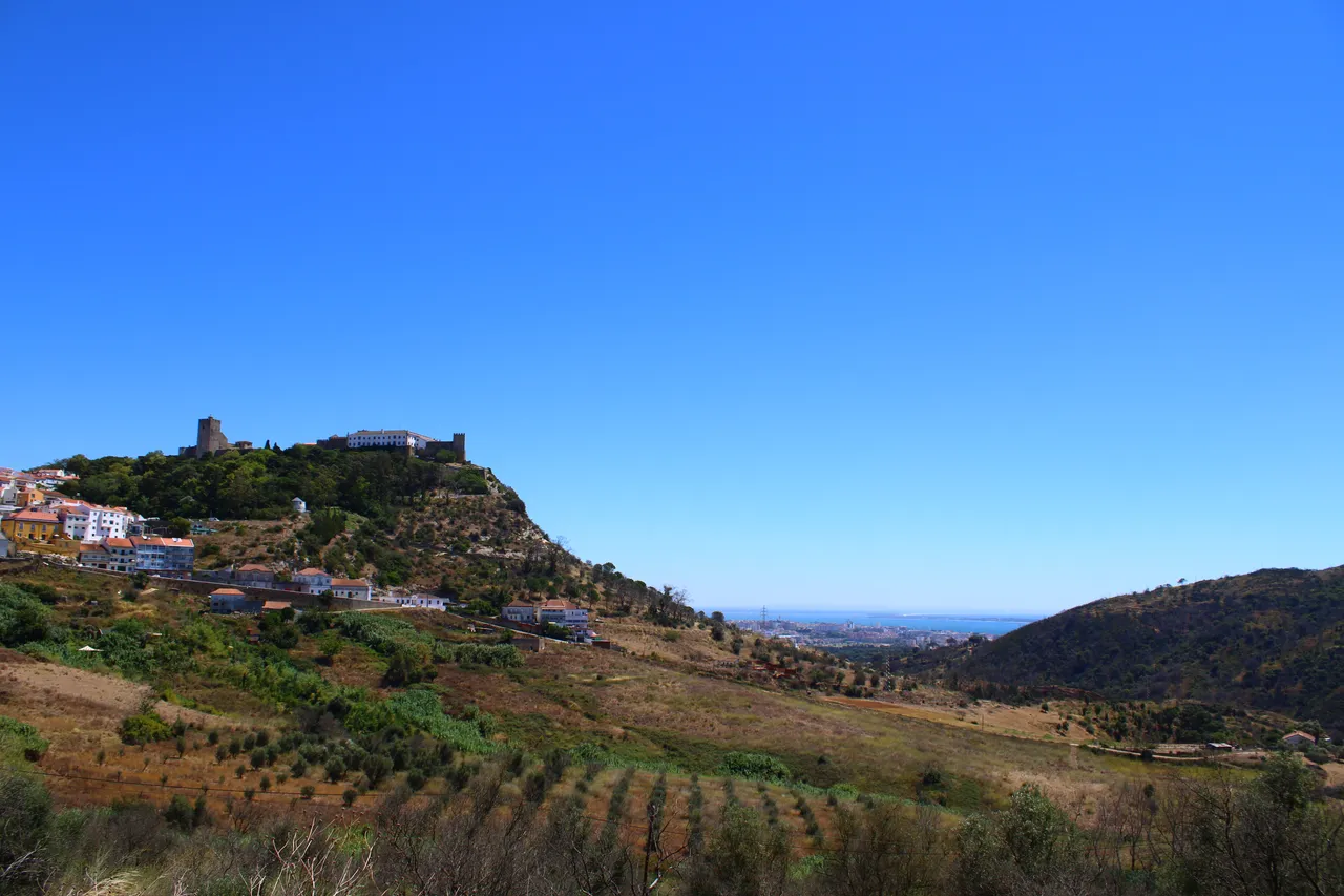
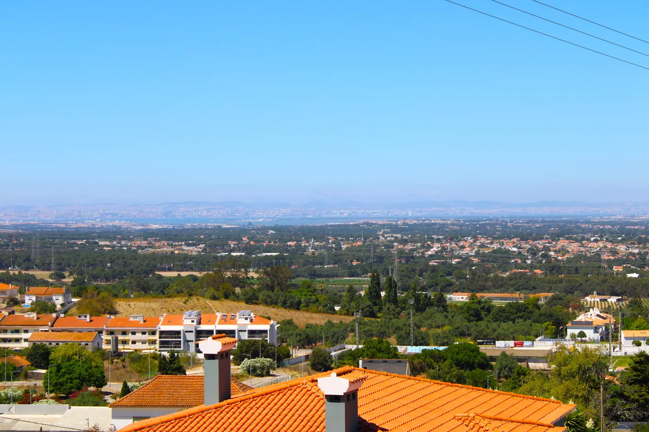
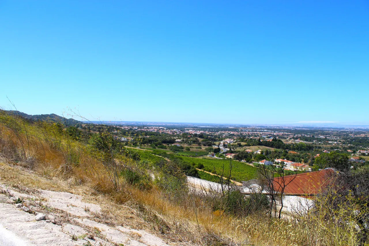
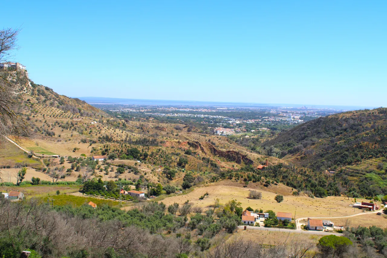
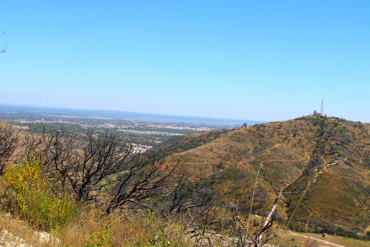
Due to the geography, the village had to be built at a height to protect it from the enemy, which is why the city is 120 meters high and the castle is at the highest point. One of my favorite parts of the walk is being able to see the north in the distance and witness Lisbon, with the Tagus River and of course the 25 de Abril Bridge. It is normal to see many wine plantations due to the climate of the area, the city lends itself to good wines.🧭🌎
Debido a la geografia se necesitaba construir la aldea en altura para protegerla del enemigo por eso la ciudad esta a 120 metros de altura y el castillo en el punto mas alto, una de mis partes favoritas de la caminata es poder ver a lo lejos el norte y presenciar lisboa, con el rio tajo y por supuesto el puente 25 de Abril. Es normal ver muchas siembras de vino por el clima de la zona la ciudad se presta para buenos vinos.📸🚵🏻♀️
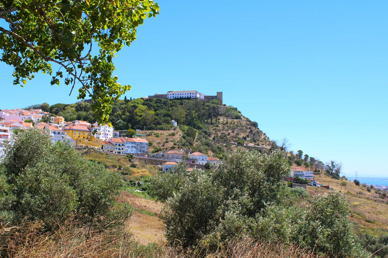
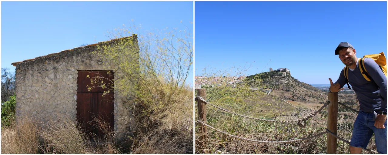
Palmela Castle📸🚩 /Castillo de palmela🌎🚩
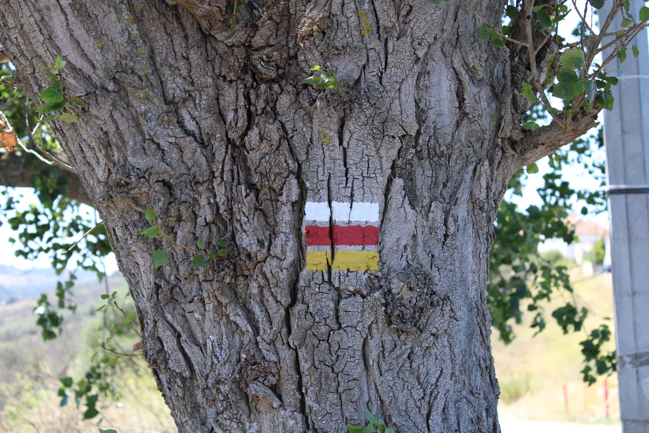
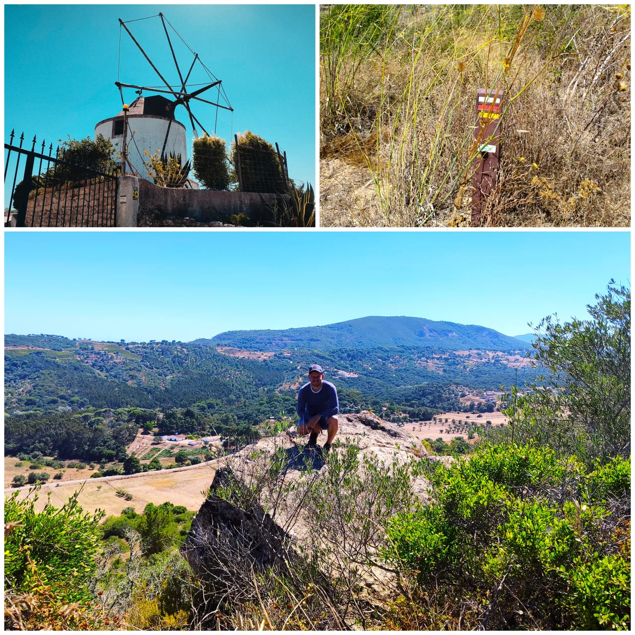
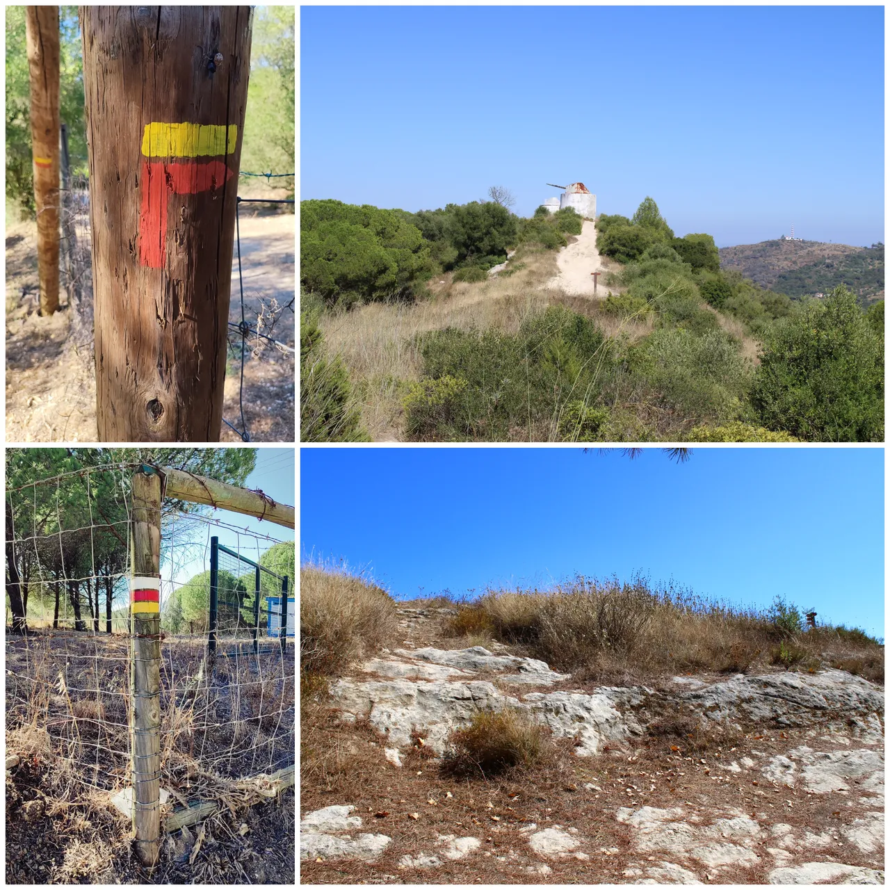
trail markings🚩
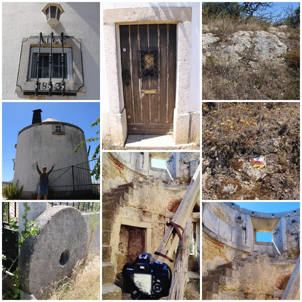
I don't want to stop to explain about the castle because I already made a post about it, but if you don't know it you can go up and take some photos! It is a fairly old 12th century castle that was conquered and reconquered by the Moors at various times in the history of Portugal. If you want to learn more about the castle I invite you to check out my post. I think the disadvantage of going to the castle is that you have to go up a fairly steep road and you will consume a lot of energy, but it is your decision.🧭📸
No quiero detenerme para explicar sobre el castillo porque ya hice un post sobre el, pero si no lo conoces puedes subir y tomarte unas fotos! es un castillo del siglo XII bastante antiguo que fue conquistado y reconquistado por los Moros en varias situaciones de la historia de Portugal, si quieres aprender mas sobre el castillo te invito a revisar mi post, creo que la desventaja de ir al castillo es que tienes que subir una carretera bastante empinada y vas a consumir mucha energia pero es tu decision. 🚩⛲
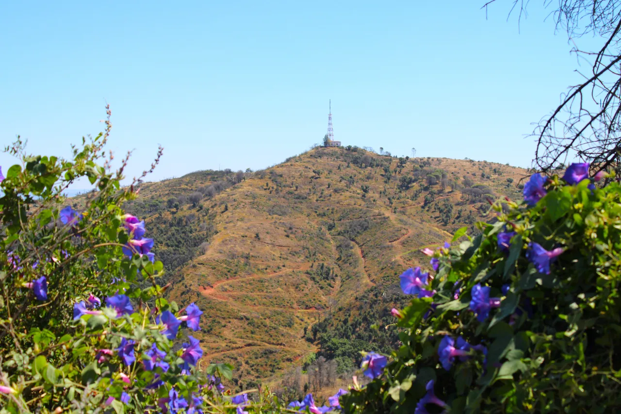
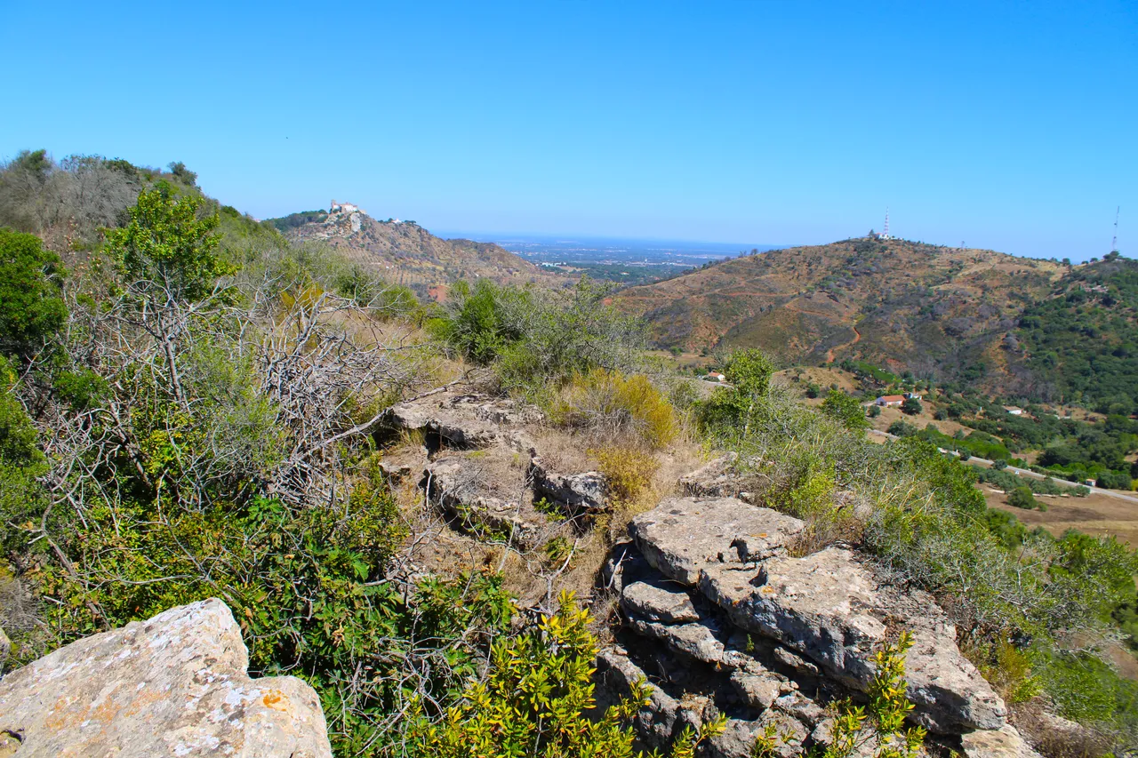
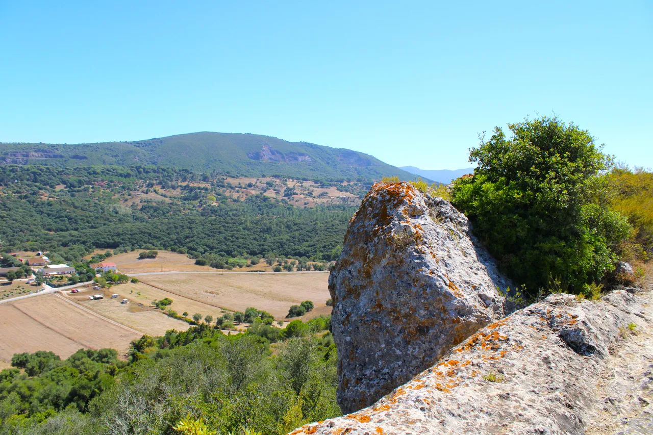
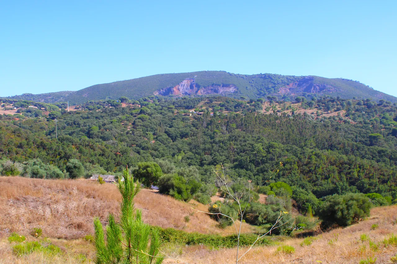
Louro mountain range📸🚩 /Sierra do louro🌎🚩
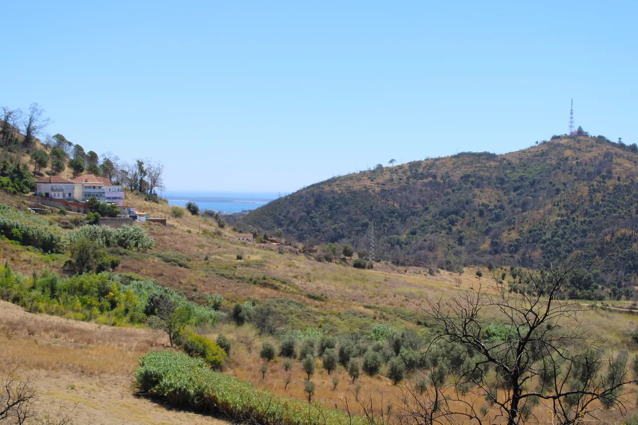
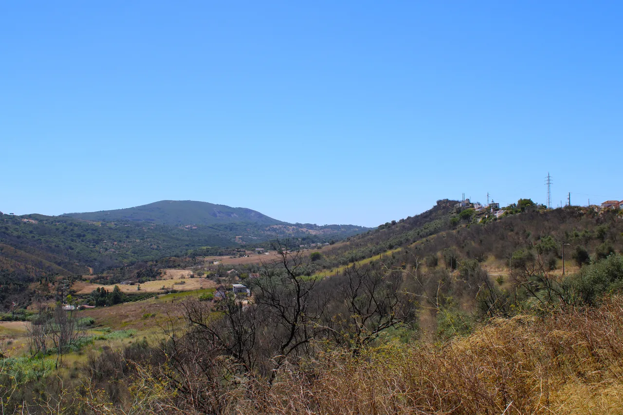

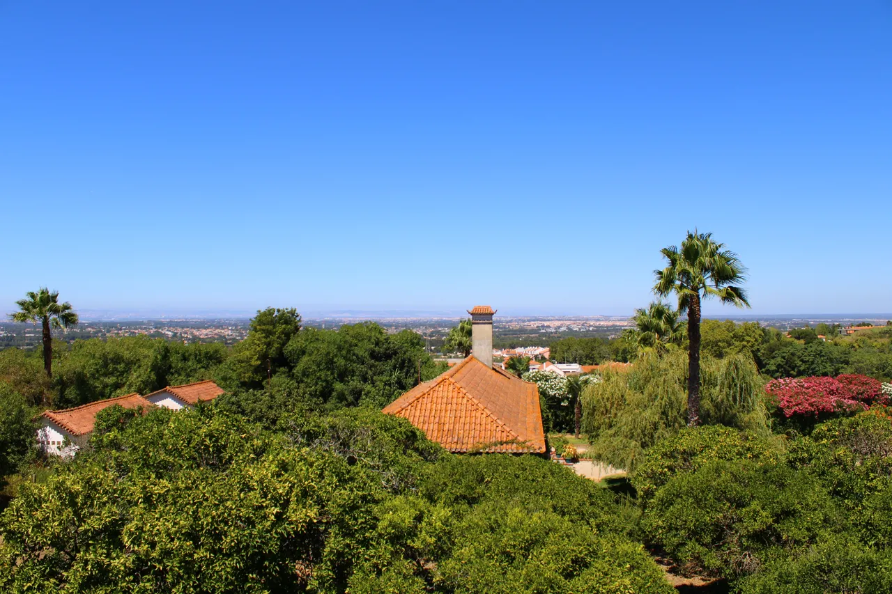
The "louro" mountain range is located in the protected park of the "da Arrabida" mountain range, it allows us to contemplate the "Tejo" river, as well as the "Sado" river to the southeast. We also have the opportunity to enjoy the famous "Troja" peninsula, the mountain range extends to the south of Sesimbra, and ends at "Cabo Espichel". The landscape denotes the man-nature relationship and we see many windmills in various parts of the mountain range which shows us how the people of the region used the force of the wind to provide food.🌎🧭
La sierra "do louro" se encuentra en el parque protegido de la sierra "da arrabida", nos permite contemplar el rio "Tejo", asi como al sudeste el rio "Sado" tambien tenemos la oportunidad de disfrutar de la famosa peninsula de "troja", la cadena montanosa se extiende hasta el sur de Sesimbra, y termina en "Cabo Espichel", el paisaje denota la relacion hombre-naturaleza y vemos muchos molinos de viento en varias partes de la sierra lo que nos indica como las personas de la region usaban la fuerza del viento para proporcionar alimentos.🚵🏻♀️📸


There is a very interesting story related to this beautiful mountain range, and it is about a shepherd who, with his sheep, was always kind to the people who lived there and to the tourists, and for that reason one of the best cheeses in the area was born called: "azeitao"🧭🌎
Hay una historia muy interesante relacionada a esta hermosa sierra, y se trata de un pastor que con sus ovejas, siempre era amable con las personas que vivian alli y con los turistas, y por esa razon nacio uno de los mejores quesos de la zona llamado: "azeitao"🚩🚵🏻♀️
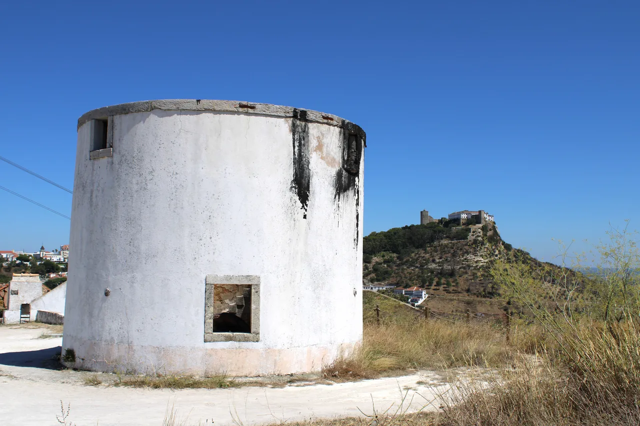
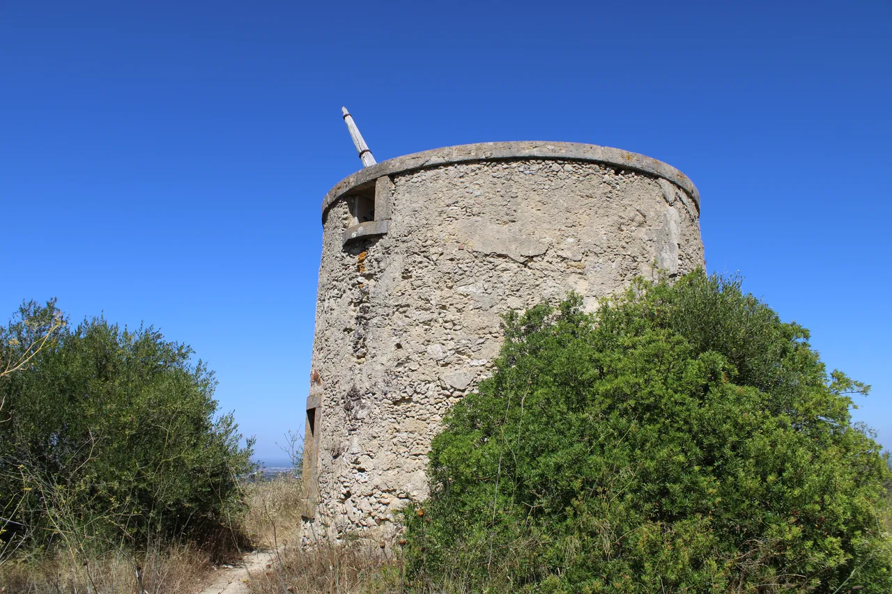
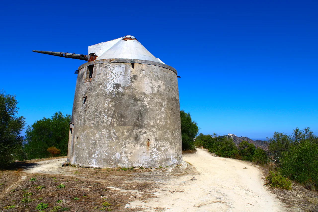
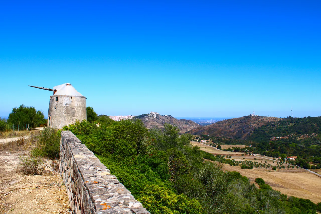
Route of the mills📸🚩 /Ruta de los molinos🌎🚩
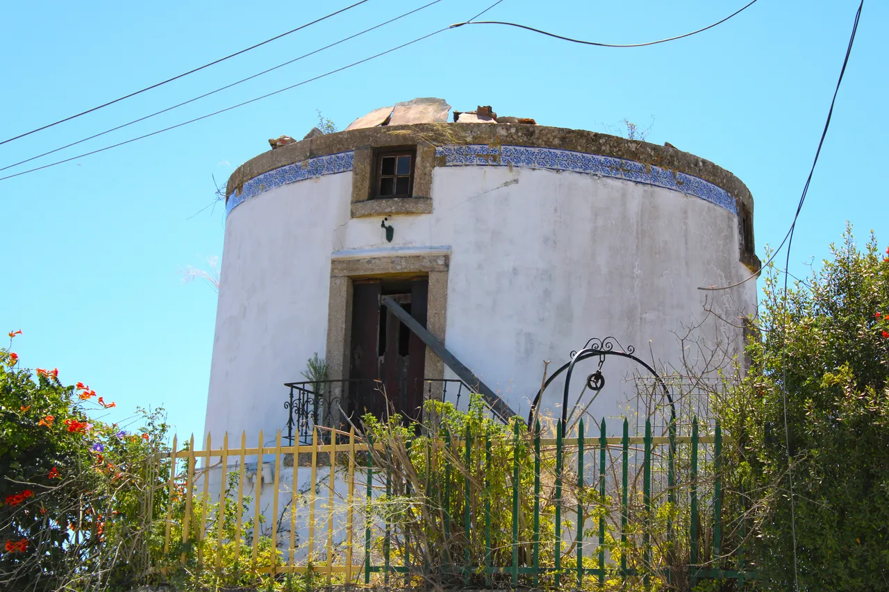


We have already begun to see and enjoy the aforementioned windmills and what better than to take a short tour in a museum called: "Moinhos vivos" there is a lot of explanation about the windmills, their history, use among others! Unfortunately it was closed when I passed by so I couldn't get in! But I did some research on the windmills so I can tell you that most of the windmills in this area, despite being invented by the Romans, many were built in the 18th century, some are in good condition and others were destroyed by some earthquakes.👨🏻🏫⛰️
Ya comenzamos a ver y disfrutar de los molinos antes mencionados y que mejor que hacer un pequeno recorrido en un museo llamado: "Moinhos vivos" alli dentro hay mucha explicacion sobre los molinos, su historia, uso entre otros! desafortunadamente estaba cerrado cuando pase asi que no consegui entrar! pero investigue sobre los molinos por tanto te puedo decir que la mayoria de los Molinos de viento de esta zona apesar que fueron inventados por los Romanos, muchos se construyeron en el siglo XVIII, algunos estan en buenas condiciones y otros se destruyeron por algunos terremotos.👨🏻🏫🚵🏻♀️


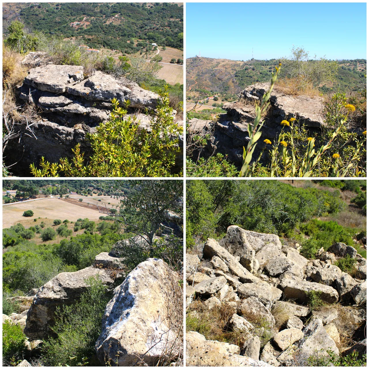
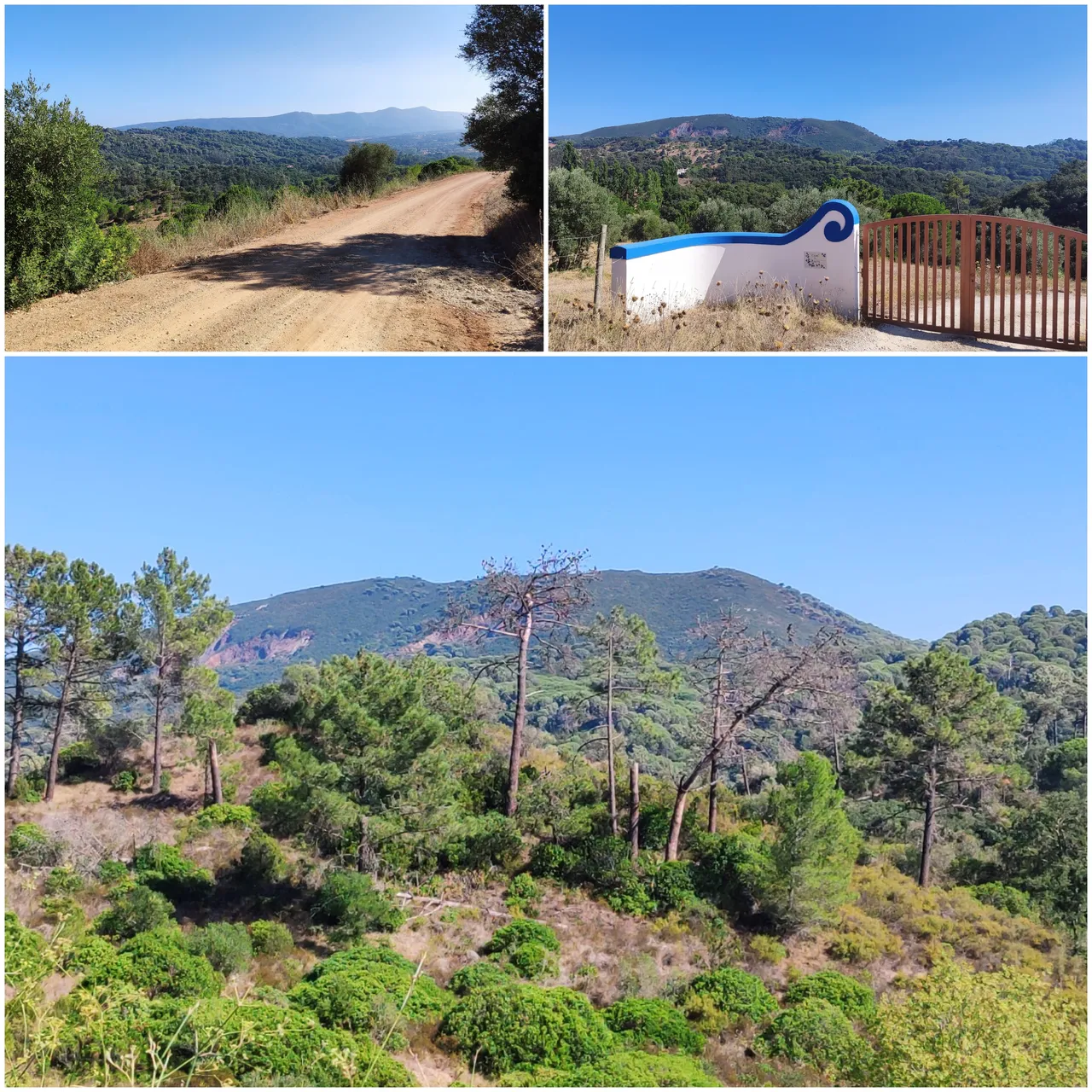
Barris Jurassic Valley📸🚩 /Valle jurasico de Barris🌎🚩
This valley, as its name indicates, was formed millions of years ago and is characterized by reddish clay-type sand. Some fossilized organisms have been found in it and are now in the science laboratory of the University of Lisbon. The vegetation is dominated by small wooded areas, areas of eucalyptus trees, grapes, among others. This part of the valley already belongs to another mountain range called: "São Francisco".⛰️🚩
Este valle como su nombre indica se formo hace millones de anos y es caracteristico de la arena tipo arcilla rojiza, en el se han localizado algunos organismos focilizados que se encuentran en el laboratorio de ciencias de la universidad de Lisboa, las caracteristicas de la vegetacion es dominante en la zona por pequenas areas boscosas, zonas de arboles de eucalipto, uvas entre otras. Esta parte del valle ya pertenece a otra sierra llamada: "São Francisco".🧭🌎
https://www.trilhosecaminhadas.com/percursos/pr1-percurso-pedestre-nos-vales-de-barris-e-alcube-plm/


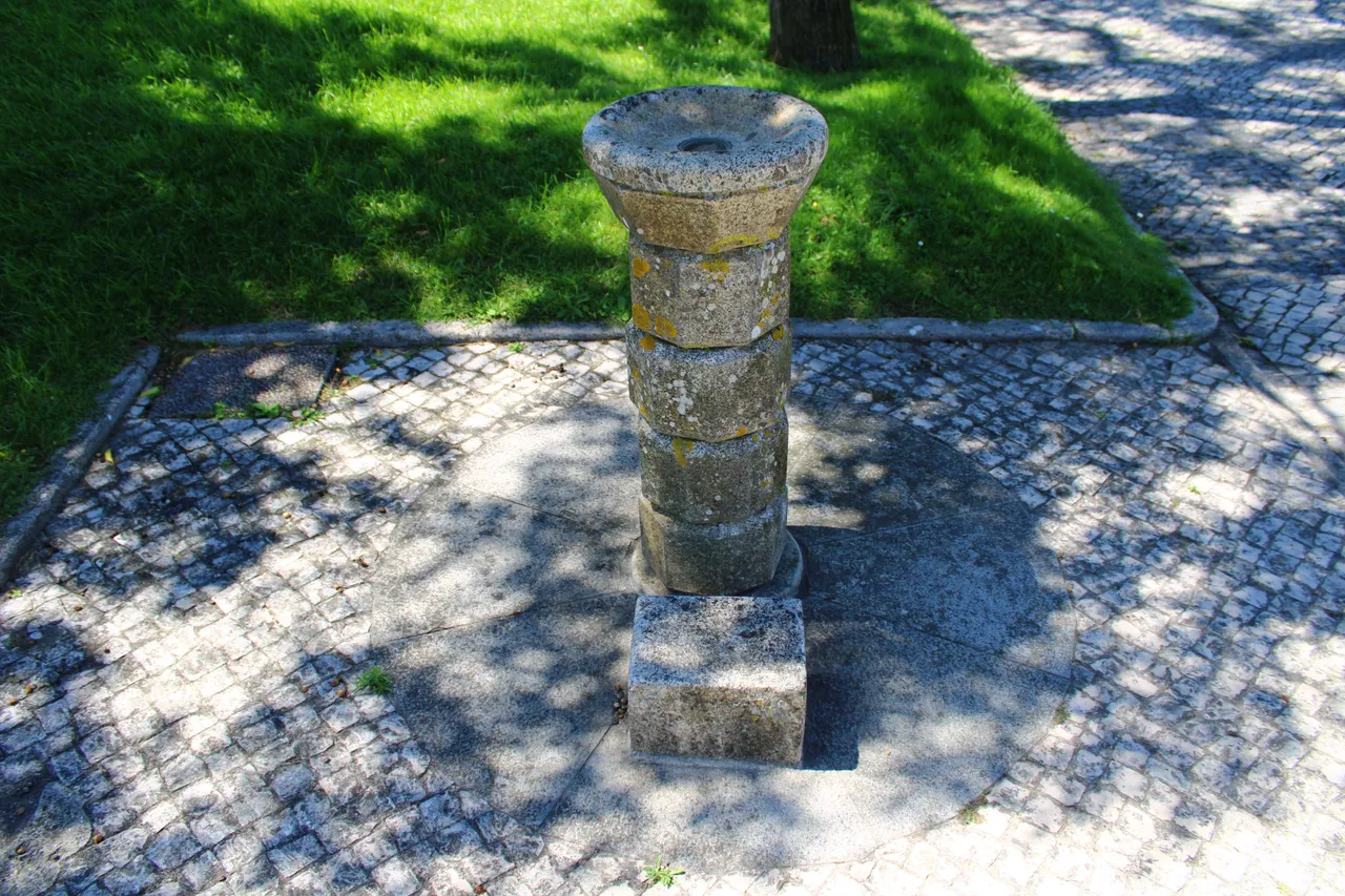
Highest point📸🚩 /Punto mas alto🌎🚩
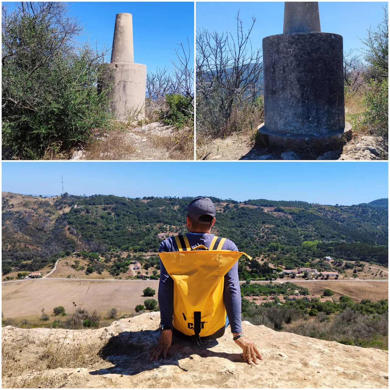
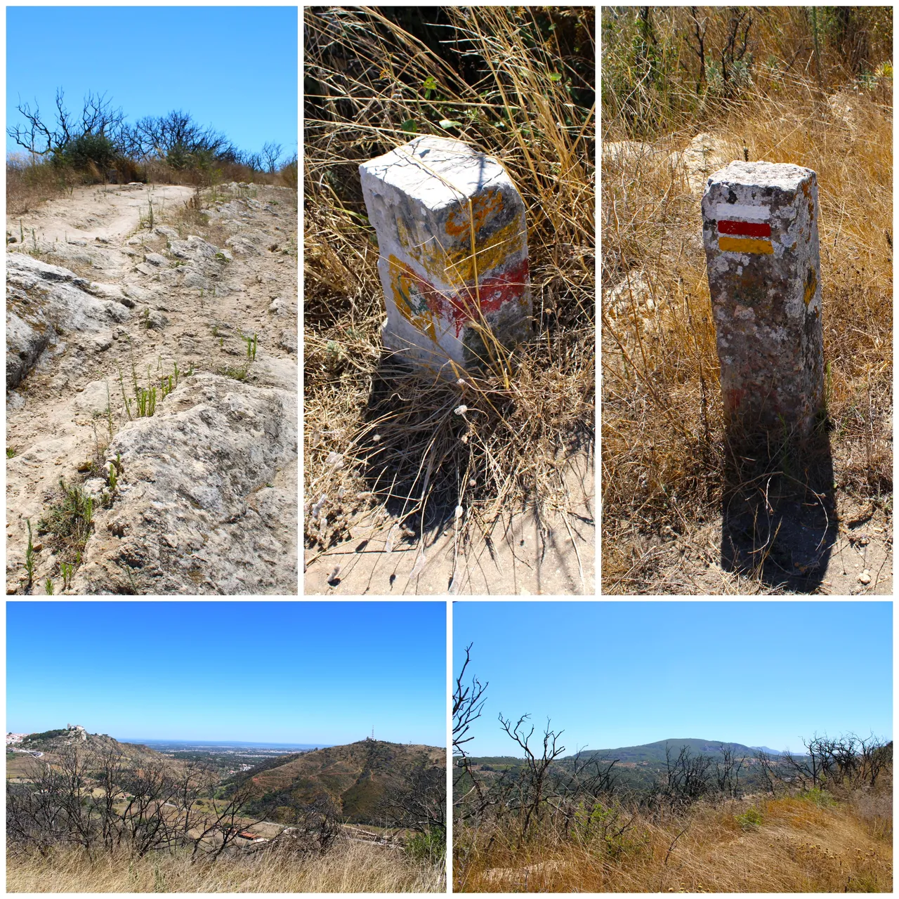
After walking approximately 4km we came across this structure called a "geodetic frame" which is a point used to measure distances between areas, in other words it is the highest point of this mountain! I think I am at about 189 meters.⛰️🚩
Cuando ya caminos unos 4km aproximadamente nos topamos con esta estructura que se llama "marco geodesico" que es un punto que se utiliza para medir distancias entre zonas, osea es el punto mas alto de esta montana! estoy a unos 189 metros creo.📸🌎


ecosystems👨🏻🏫
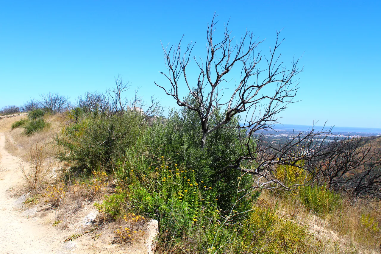
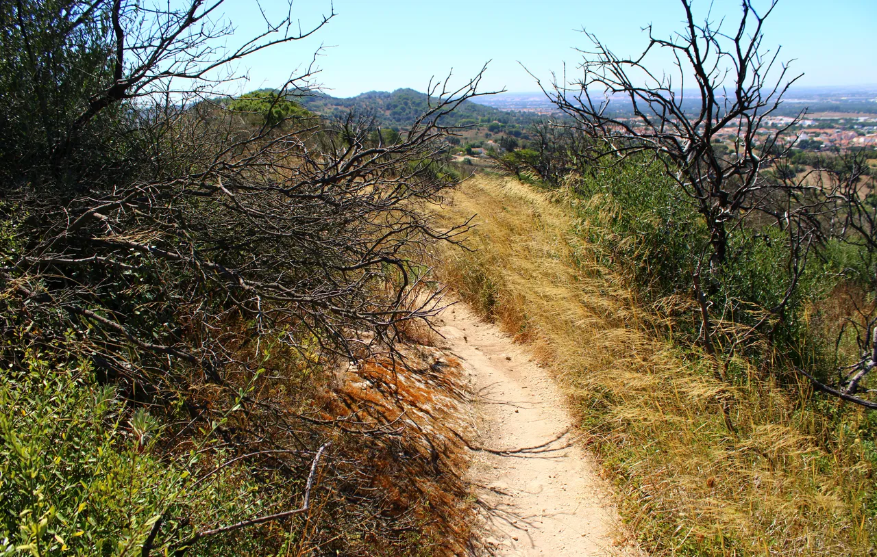
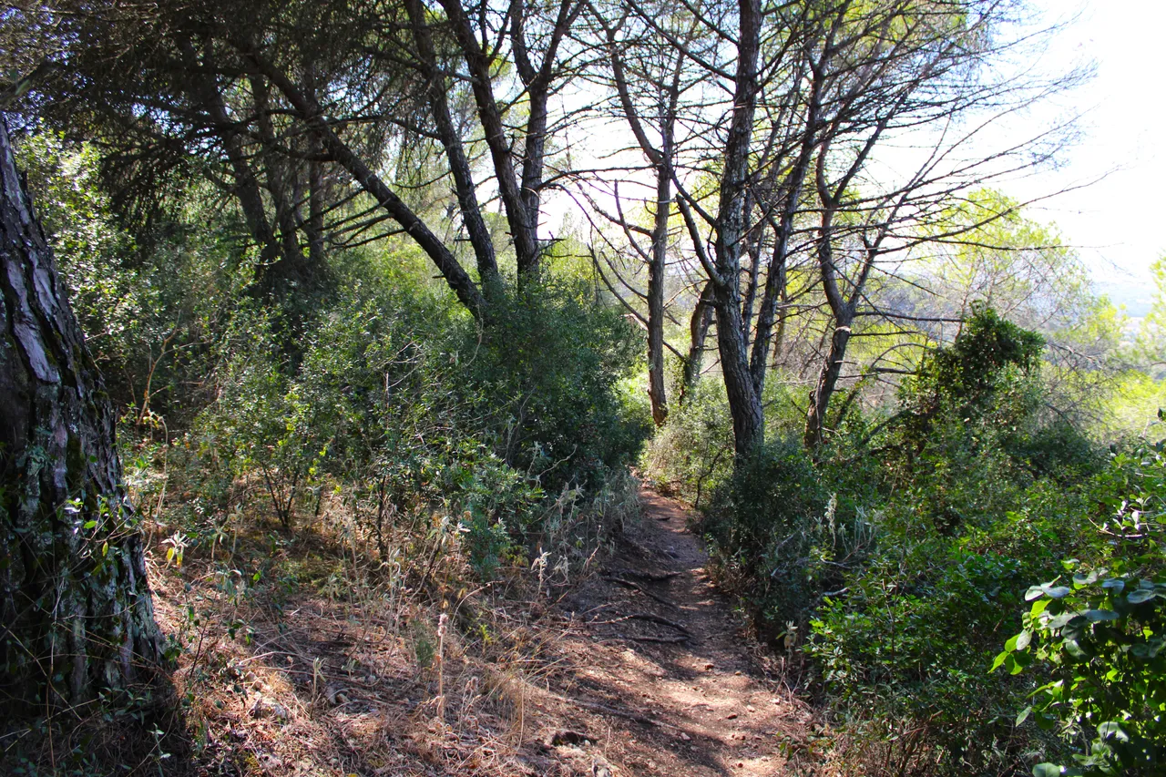
Something that caught my attention is how nature changes at different stages of the hike. Palmela is known for being an area where many fires occur and well, I don't know if you noticed, there are some photos that show that. Then we see the typical landscape of a Mediterranean forest and many stone formations that give us excellent viewpoints. Finally, we pass through a small, quite humid forest.🧭📸
Algo que capto mi atencion es como cambia la naturaleza a diferentes etapas de la caminata, Palmela es conocida por ser una zona donde ocurren muchos incendios y bueno no se si notaste hay algunas fotos que muestran eso, luego vemos el paisaje tipico de un bosque mediterranico y mucha formaciones de piedras que nos dan excelentes miradores, por ultimo pasamos por un pequeno bosque bastante humedo.🚩⛲
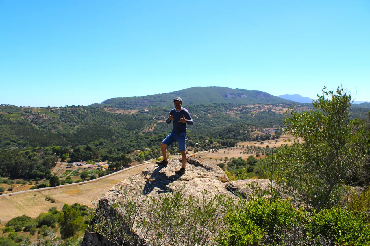


I am almost reaching the end of the route and the trail has not disappointed me. It has been a fantastic experience. I loved every landscape and it is one of those walks that are worth repeating. I did it in the summer and it would be interesting in the spring when the mountain and the area are full of flowers and vegetation.🧭⛰️
Estoy casi llegando al final del recorrido y el sendero no me ha decepcionado a sido una experiencia fantastica cada paisaje me encanto y son de aquellas caminatas que valen la pena repetir, yo la hice en verano seria interesante en primavera cuando la montana y la zona esta llena de flores y vegetacion.🚵🏻♀️🧭


DNA is an organization to foster and DENSIFY NATURE-APPRECIATION which aims to establish REPORTS OF BIODIVERSITY DATA that is contributed by all of us Hiveans and subsequently cataloged.
Therefore DNA searches for HIGH-QUALITY posts that aim to DESCRIBE and determine the BIODIVERSITY AROUND YOU with added EXPLANATIONS and INFORMATION. For these informative posts they offer a CURATION SERVICE using the @dna.org account. It is also a CURATION TRAIL. Just add the #dna TAG if you think that any of your posts is what they are looking for.
THANKS FOR READING ME (PHOTOS AND VIDEOS OF MY PROPERTY) / GRACIAS POR LEERME FOTOS Y VIDEOS DE MI PROPIEDAD🙂🧠🦾👍