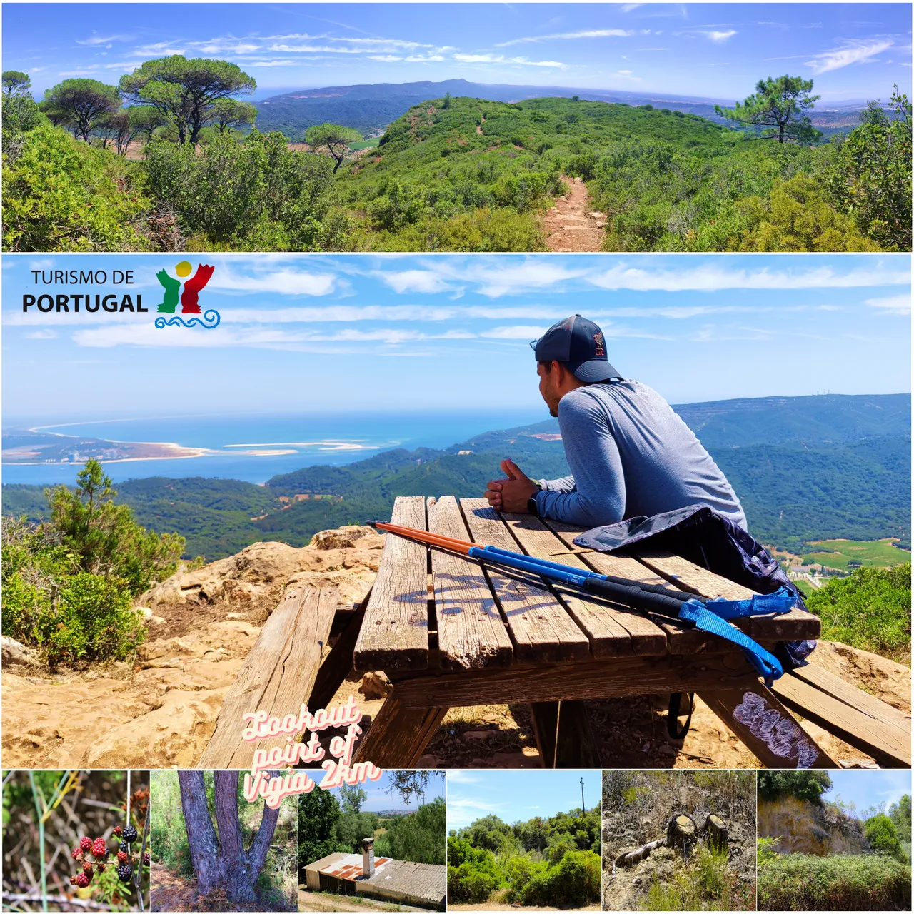
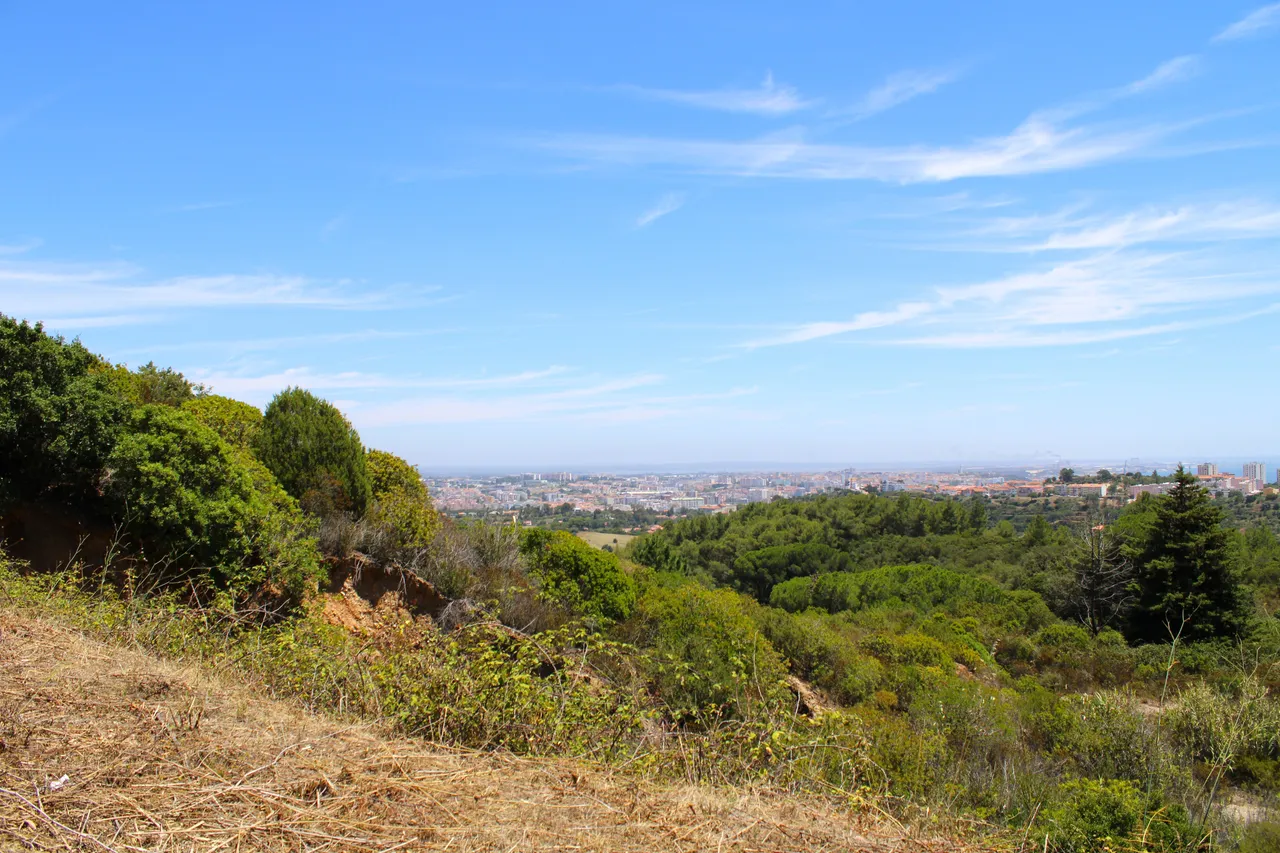
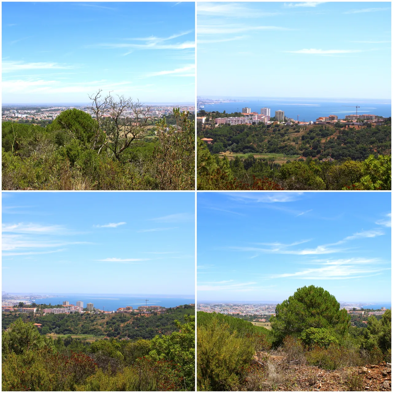
Hello fellow travelers, today I am passing through this beautiful community to bring a new experience among the Setubal mountain range, this time we are going to climb 600 meters to enjoy one of the most splendid views of Portugal and so far my favorite of the southern edge of Lisbon! It was a short 2km walk but always uphill so the path was difficult, we will be able to photograph the central part of Setubal as well as the great peninsula of Troja, and of course! Enjoy the characteristics of the Mediterranean forest!🌍📸🏔️
Hola amigos viajeros, hoy paso por esta linda comunidad para traer una nueva experiencia entre la sierra de Setubal, esta vez vamos a subir 600 metros para disfrutar de una de las vistas mas esplendidas de Portugal y hasta ahora mi favorita del margen sur de Lisboa! fue una caminata corta de 2km pero siempre en subida por eso el sendero fue dificil, vamos a poder fotografiar el casco central de Setubal al igual que la gran peninsula de Troja, y por supuesto! disfrutar de las caracteristicas del bosque mediterranico!🚴🏻♂️🧭👨🏻🦯
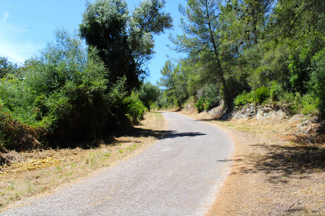
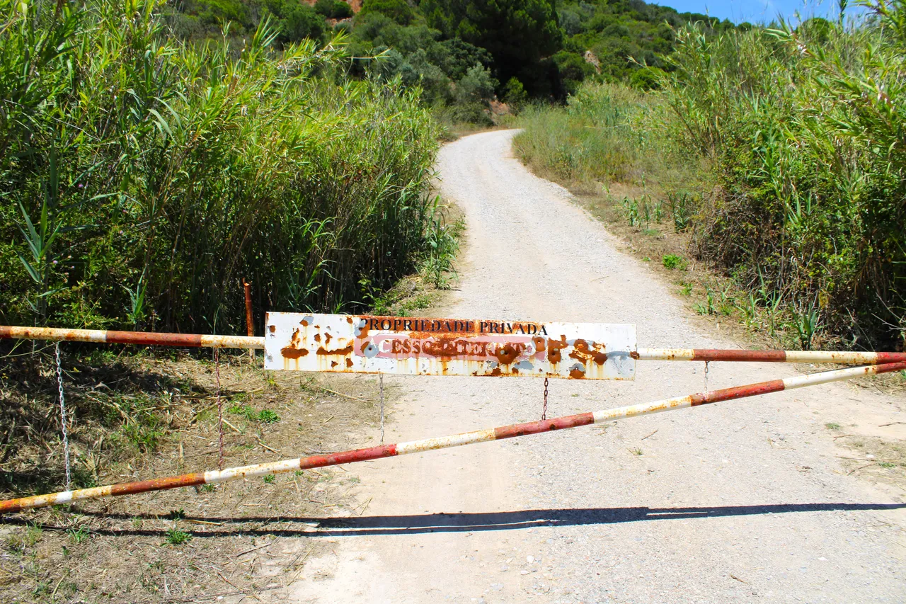
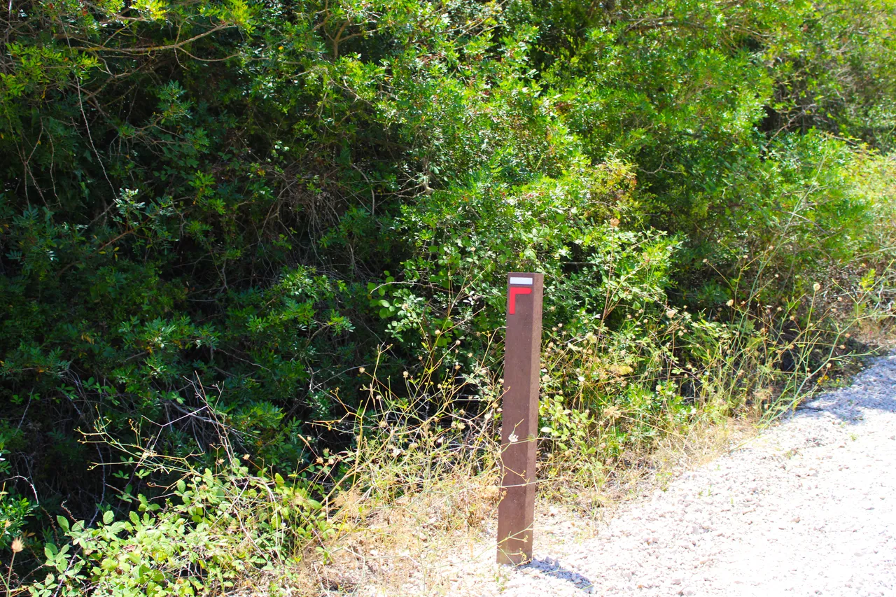
Start and characteristics of the trail🧭🚩 /Inicio y caracteristicas del sendero🗺️
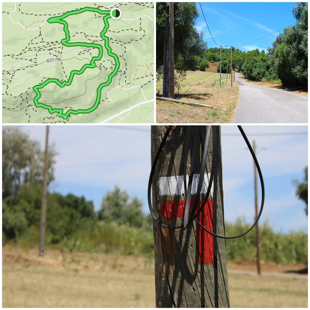
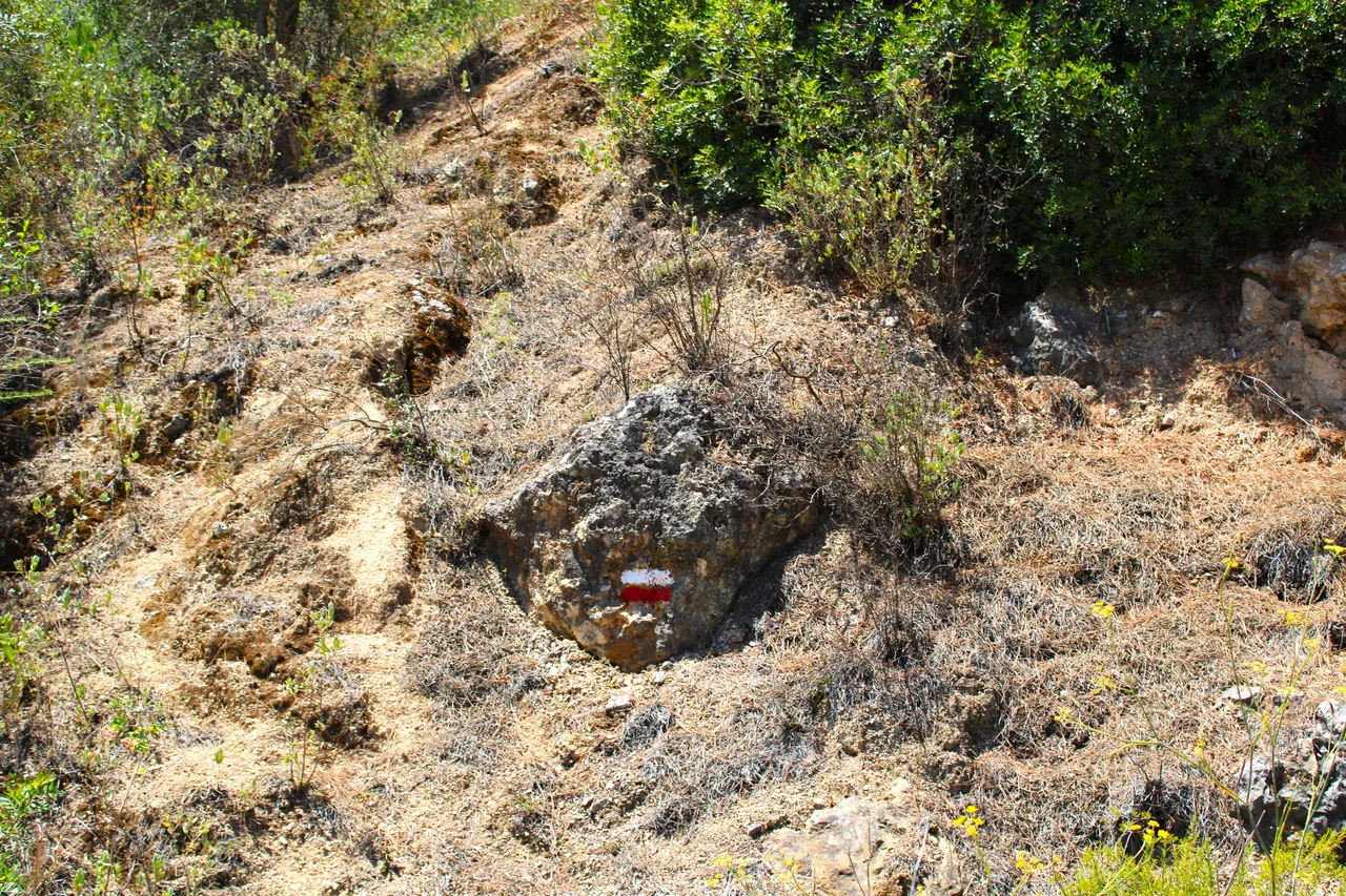
I leave you here the starting point of the trail 38.526439, -8.934936, just take the street on the left now which is signposted, the sign you must follow is one that says: (Pedreira S. Luis) and from there you must then go up the 600 meters. You will say 2km is something fast! In reality it is not, it can take more than an hour depending on your physical condition since it is almost always full of curves, and the heat of course is over 40 degrees in summer! important, sunscreen, hiking boots, climbing pole. Water... a lot of water... The path is circular, meaning you will return to the starting point.👨🏻🦯📸🗺️
Te dejo aqui el punto de partida del sendero 38.526439, -8.934936 basta con agarrar ahora la calle de la izquierda la cual esta senalizada, el letro que debes seguir es uno que dice: (Pedreira S. Luis) y de alli es luego subir los 600 metros. Diras 2km es algo rapido! en realidad no lo es, puedes demorar mas de una hora dependiendo de tu condicion fisica ya que el casi siempre esta lleno de curvas, y el calor por supuesto sobre los 40 grados en verano! importante, bloqueador solar, botas de excursion, baston de escalada. Agua... mucha agua... El sendero es circular osea volveras al punto de partida.🌍🏔️🧭

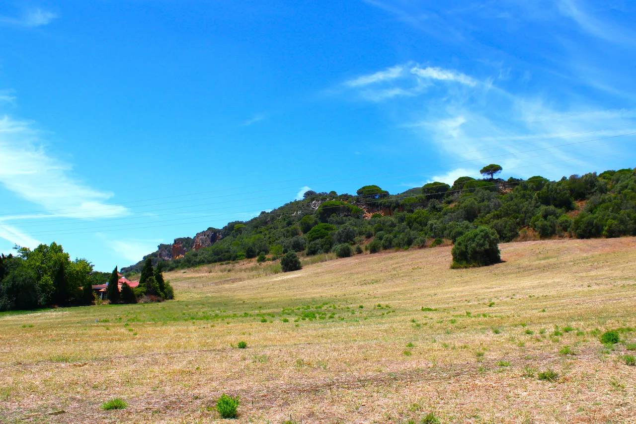
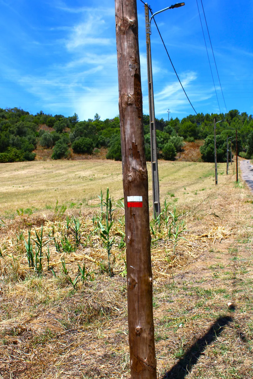
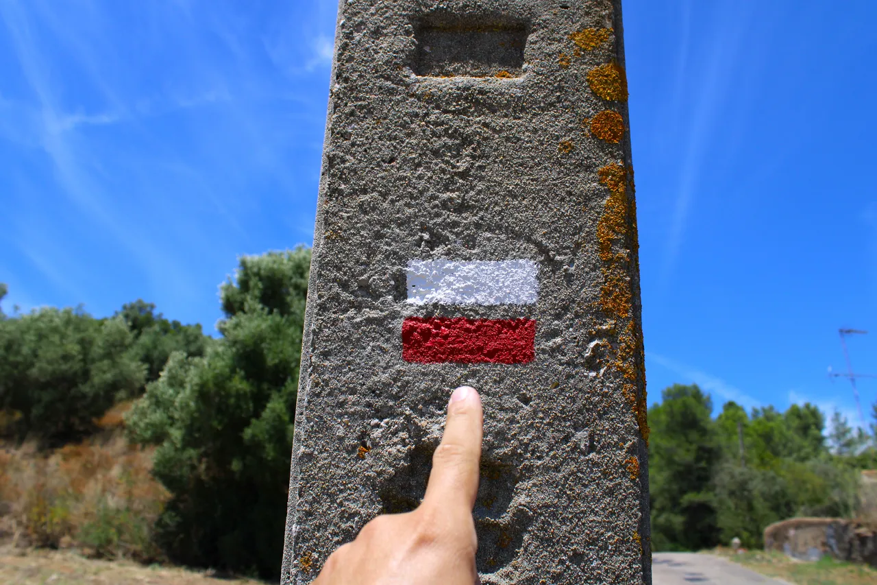
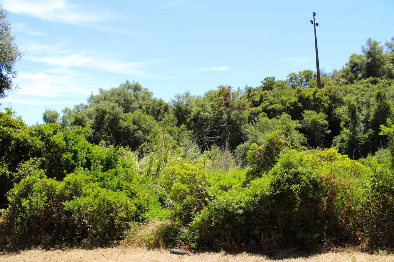
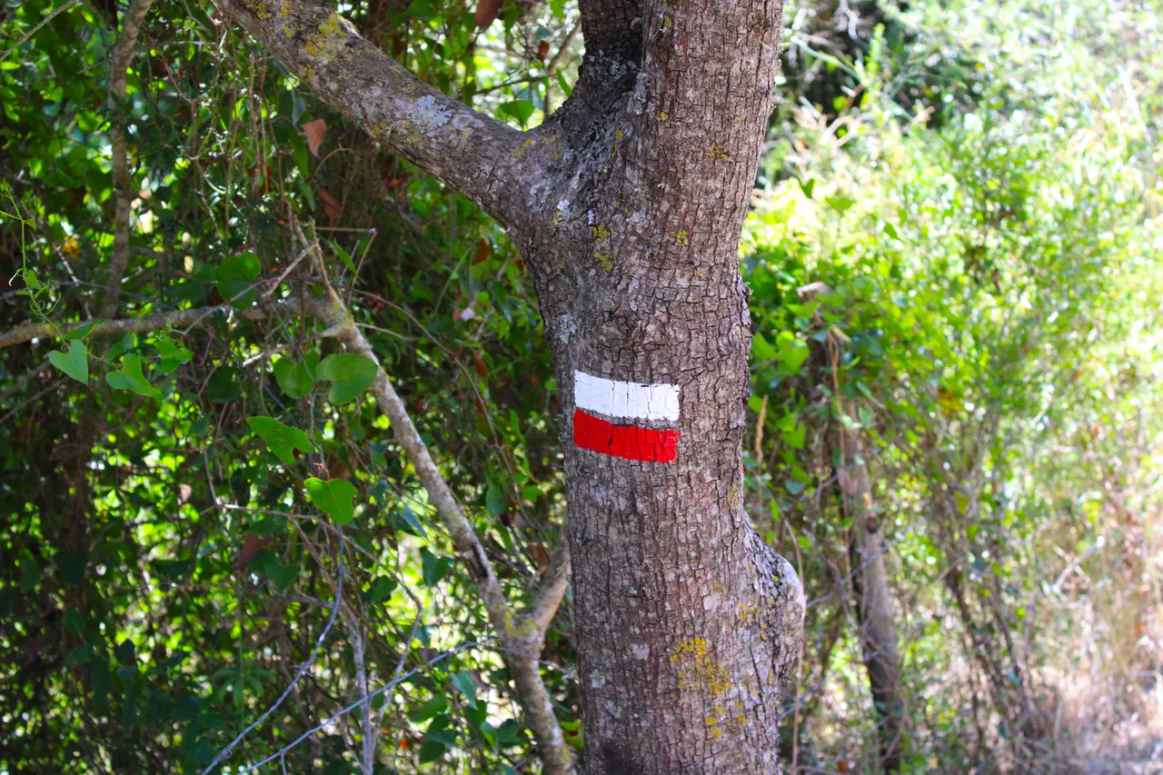
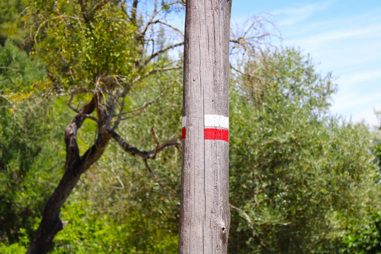
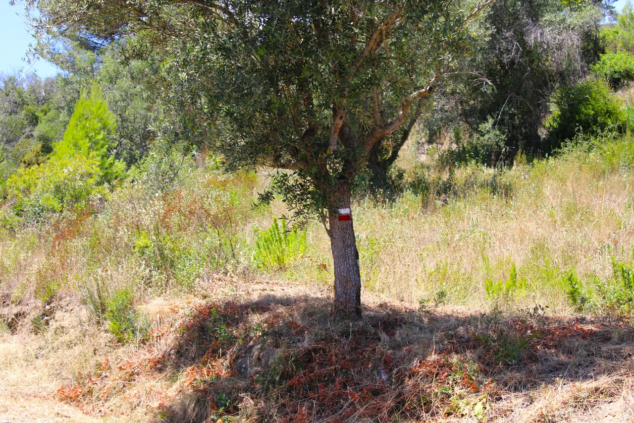
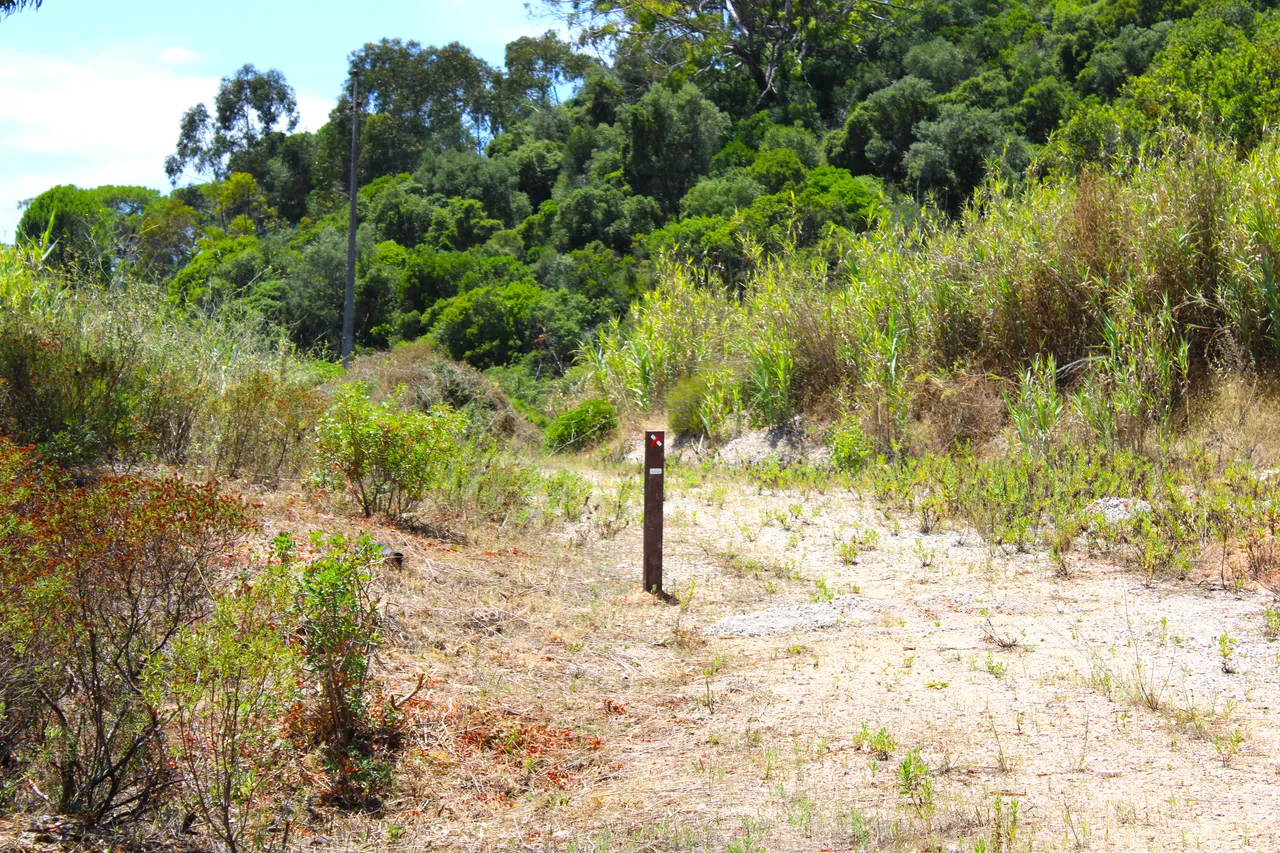
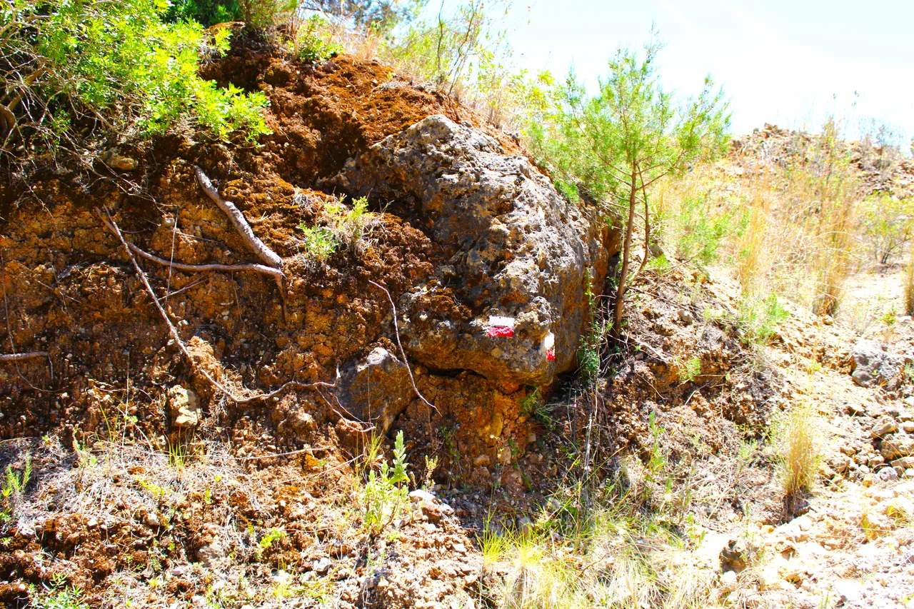
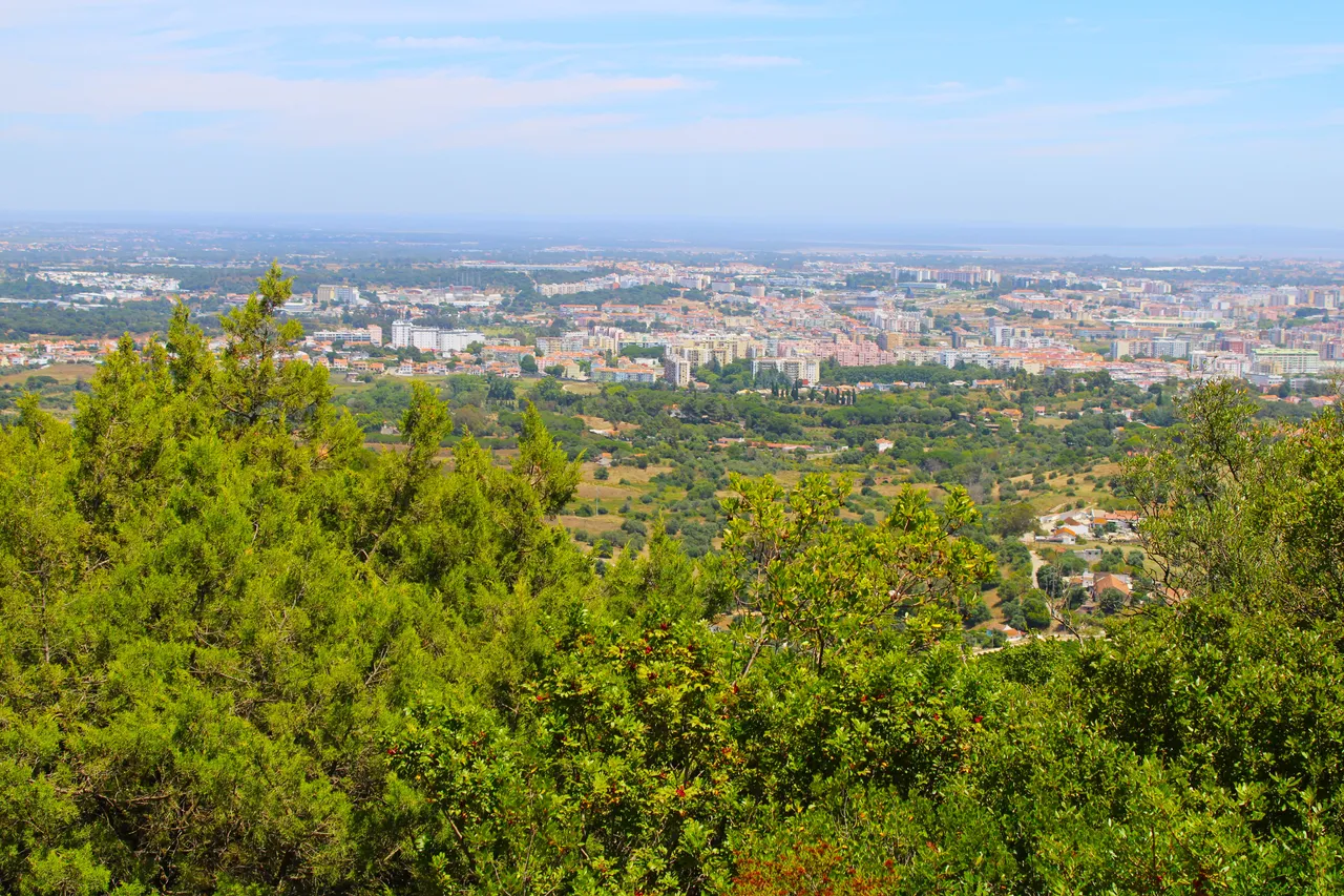
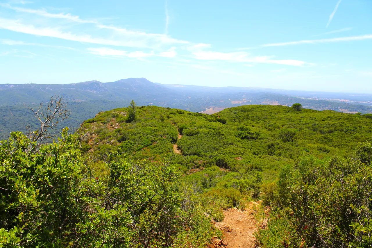
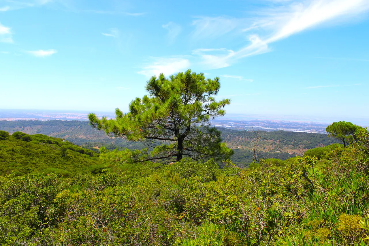
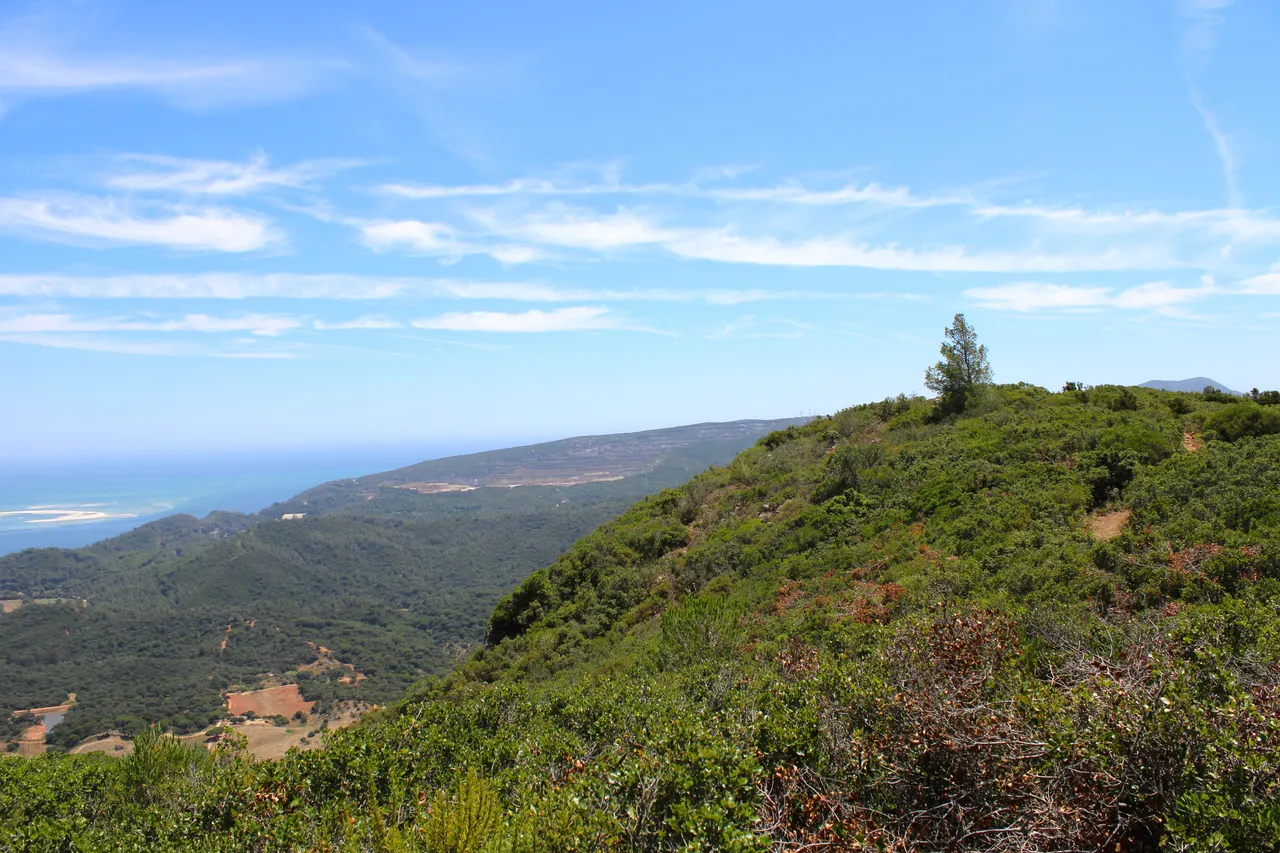
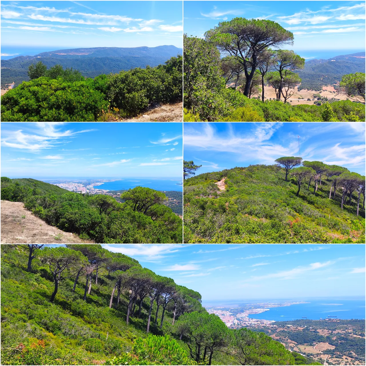
The mountains that you see in the background are one of the extensions of the "da Arrabida" mountain range, very popular mountains 30km south of Lisbon, all of this is from the municipality of Setubal, personally Setubal is one of those places where they are the best for vacations , because you have castles, beaches, mountains, better hotels, among other things! I adore this trail and I have to say that its positive point is that it is classified as a European hike par excellence, recognized at a continental level for its great historical, biological and landscape contribution! Everything is marked with the two colors white and red, always follow the lines!🏔️🚩
Las montanas que ves al fondo son una de las extensiones de la sierra "da arrabida" montanas muy populares a 30km del sur de Lisboa, todo esto es del municipio de Setubal, en lo personal Setubal es de aquellos sitios donde son los mejores para vacacionar, porque tienes castillos, playas, montanas, mejores hoteles, entre otras cosas! adore este sendero y tengo que decir que su punto positivo es que esta catalogado como caminata europea por excelencia, osea reconocida a nivel continental por su gran aporte historico, biologico y paisajista! todo esta senalizado con los dos colores blanco y rojo siempre seguir las lineas!🌎🌷🌲🌳
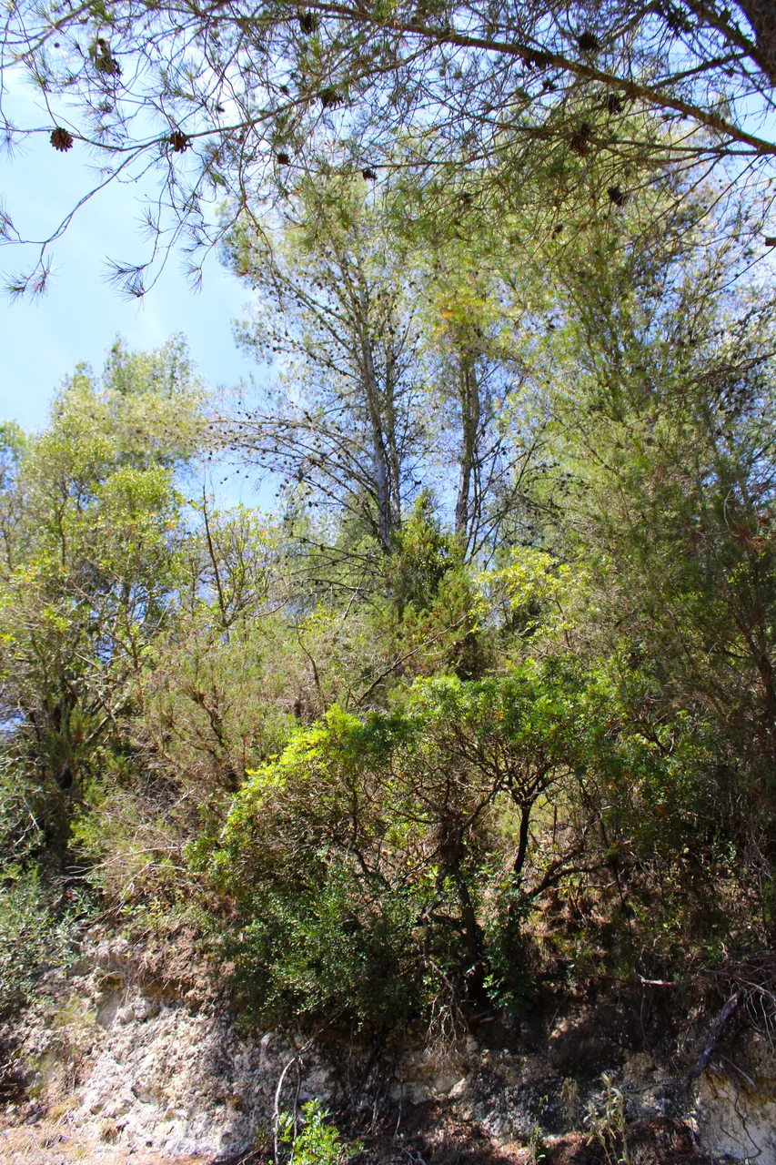
Mountain range of "Sao Luis" Quinta do Anjo🧭🚩 /Sierra montanosa de "Sao Luis" Quinta do Anjo🗺️

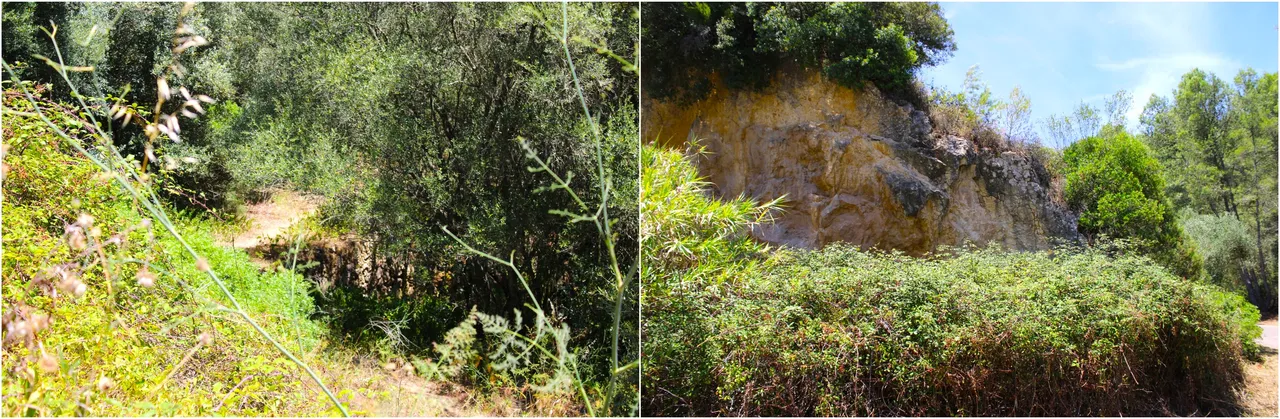
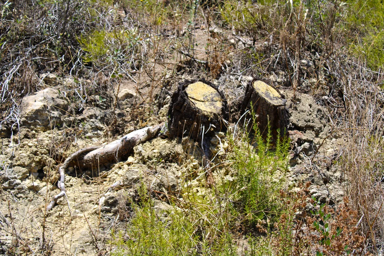
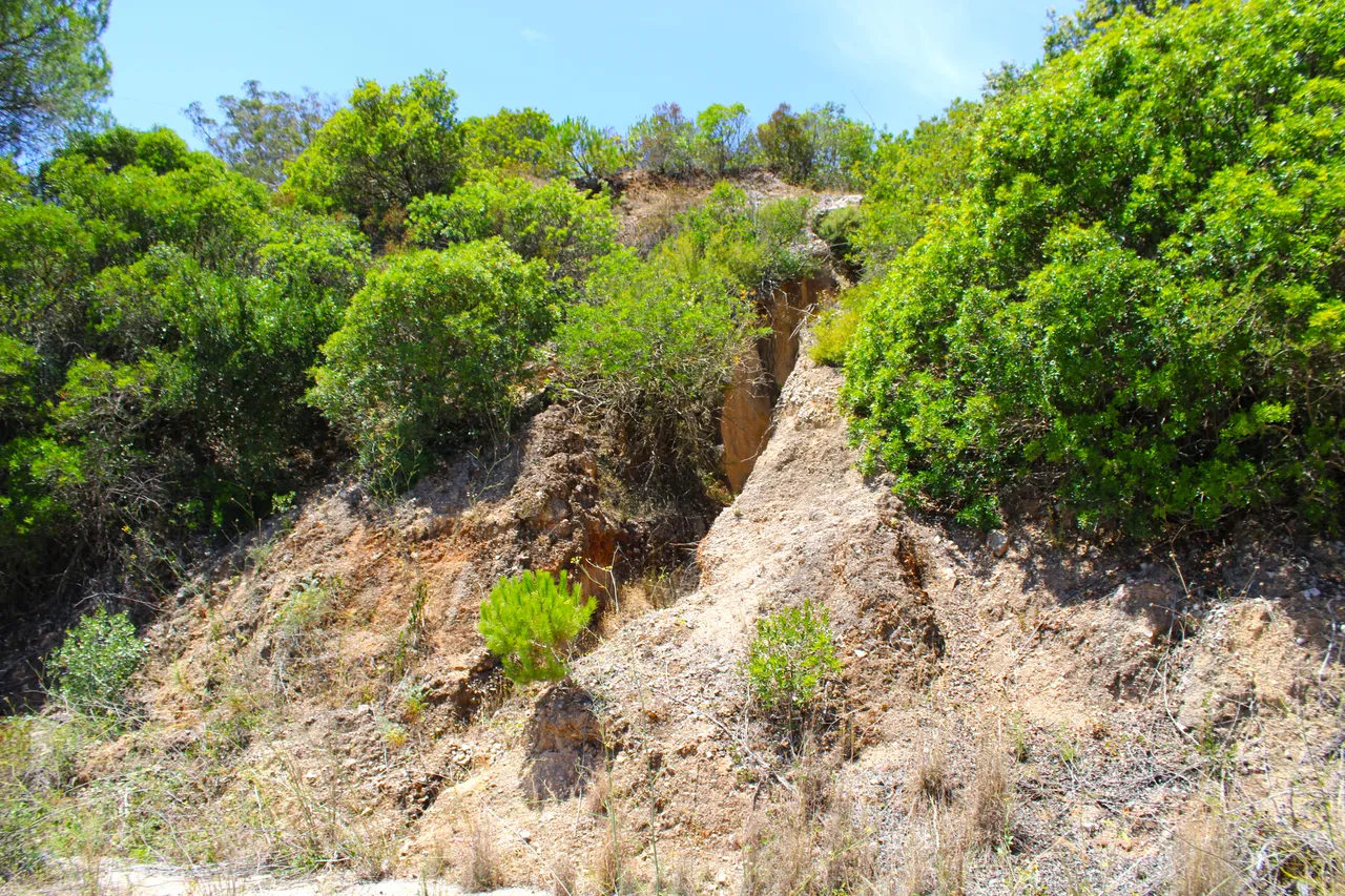
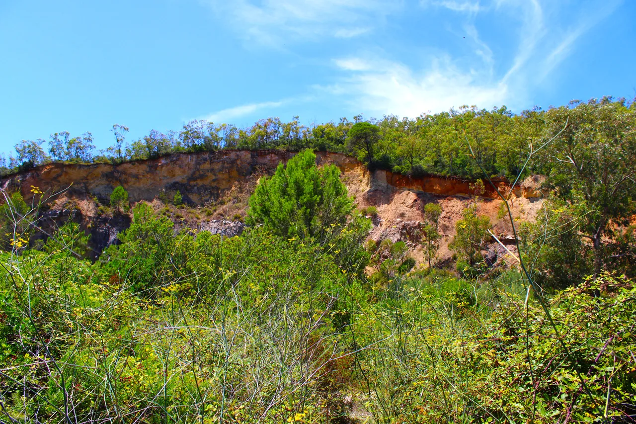
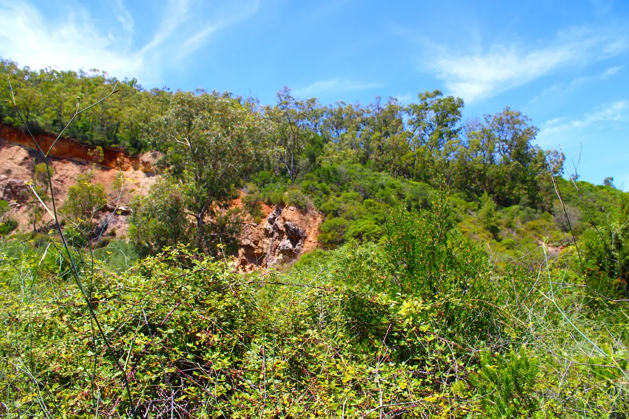
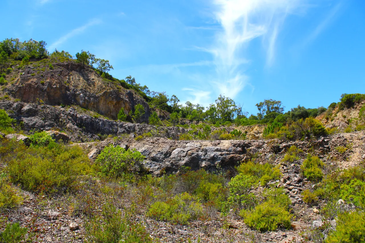
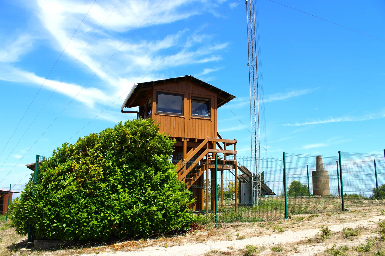
First we are going to have to climb about 226 meters in the Sierra "Dos gaiteros" which is next to "Sao Luis" which is our final destination, as a characteristic we can say that the highest point is where we are going and where the fire surveillance post, at almost 500 meters high, this mountain range is NE of the main mountain range (Arrabida). Throughout the history of Portugal the mountain range was used by humans and there are many archaeological records, for example in caves some prehistoric people possibly lived there, and well the most obvious mark is a "crack" in the mountain that is due to from the quarry to extract stones, this was greatly used by the Romans.🌲🌷🌍
Primero vamos a tener que subir unos 226metros en la Sierra "Dos gaiteros" la cual esta al lado de "Sao Luis" la que es nuestro destino final, como caracteristica podemos decir que el punto mas alto es hacia donde nosotros vamos y donde esta el puesto de vigilancia de incendios, a casi 500 metros de altura, esta sierra esta NE de la sierra principal (Arrabida). Durante toda la historia de Portugal la sierra fue utilizada por el ser humano y hay muchos registros arqueologicos por ejemplo en cuevas posiblemente habitaron alli algunas personas de la prehistoria, y bueno la marca mas evidente es una "grieta" en la montana que es por causa de la cantera para extraer piedras, esto muy aprovechado por los Romanos.👨🏻🦯📸🗺️
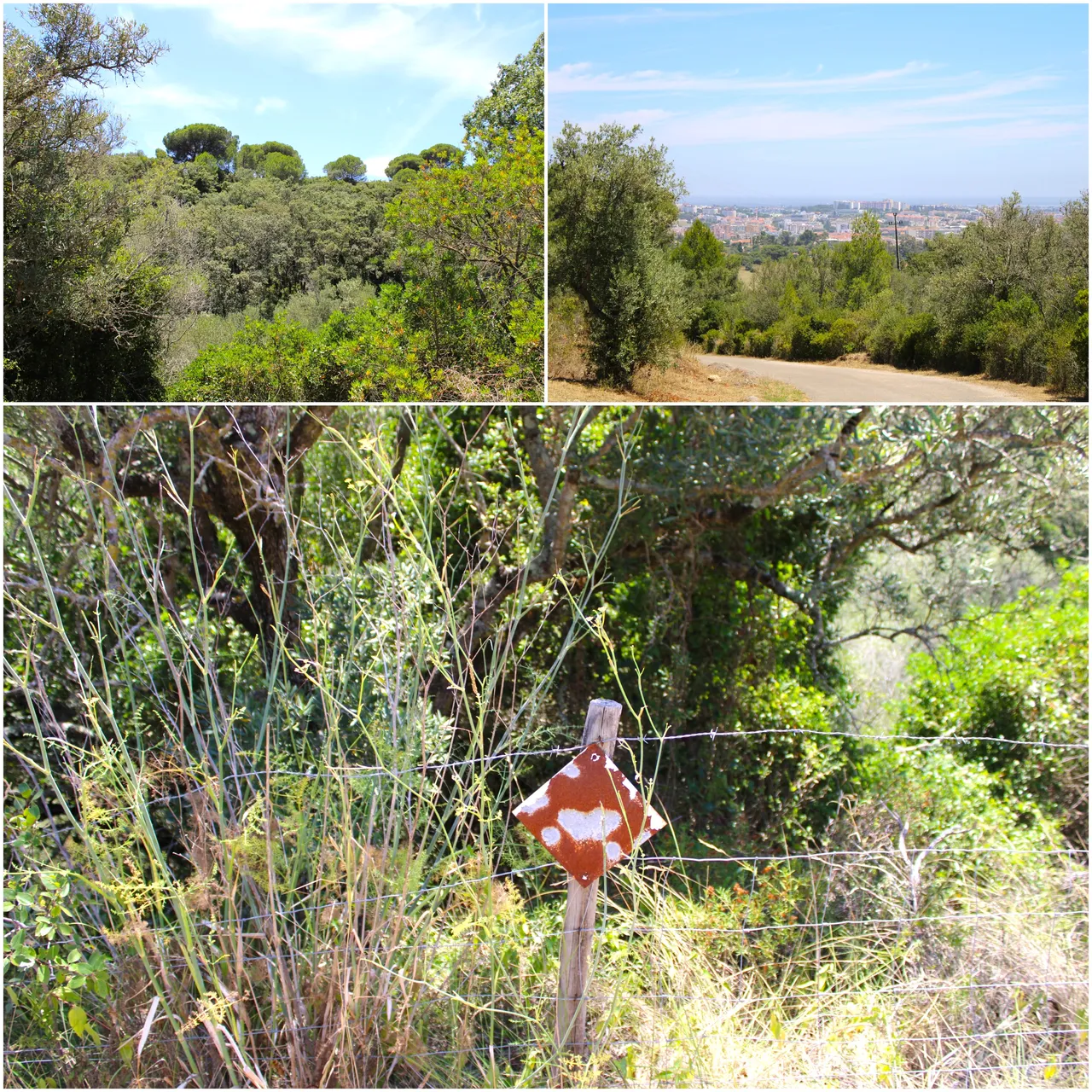
As you can see, on the side of the road there are signs that you have to follow to reach the first objective, which is an abandoned quarry. I explained to you, before the mountain was classified as a natural protection area, there were many companies, which had to close in the In the seventies, this one, for example, had to move to the outskirts of the mountains where some resources could still be extracted, literally the mountains then became only used for research and tourism purposes (hiking).🧭🌏
Como ves al lado de la carretera estan las senales que tienes que ir siguiendo para llegar al primer objetivo que es una cantera abandonada, te explico antes de la sierra ser clasificada como area de proteccion natural habian muchas empresas, la cual tuvieron que cerrar en la decada de los setenta, este por ejemplo se tuvo que mudar hacia las afueras de la sierra donde aun se podia extraer algo de recursos, literal la sierra entonces paso a ser unicamente usado con fines de investigacion y turismo (caminatas).🚩🌷
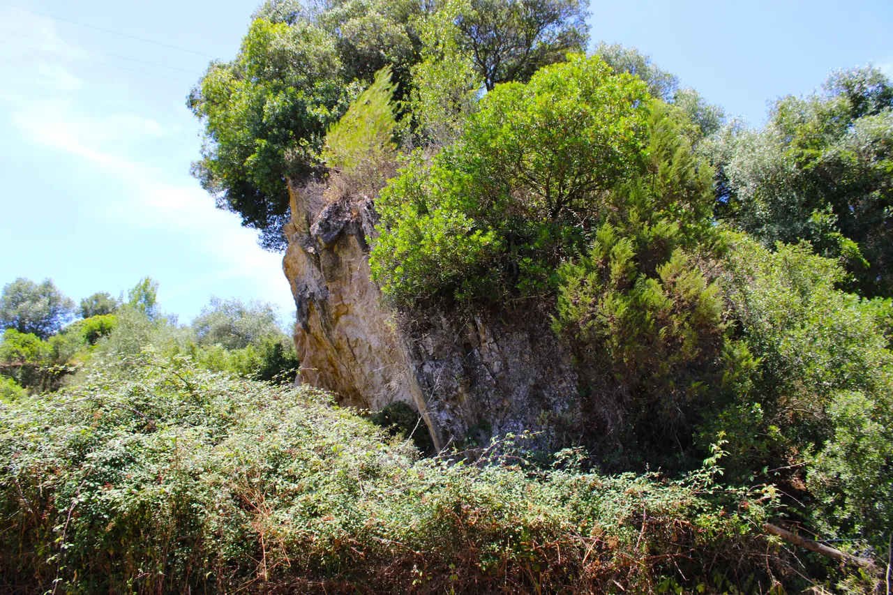
Brecha da arrabida (the special stone)🧭🚩 /Brecha da arrabida (la piedra especial)🗺️
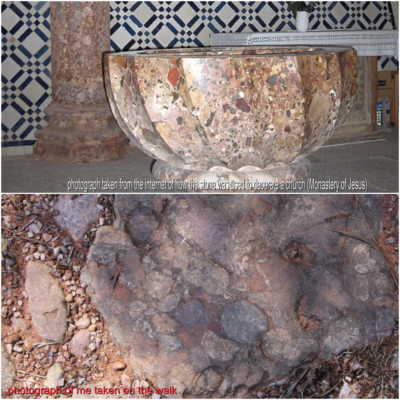
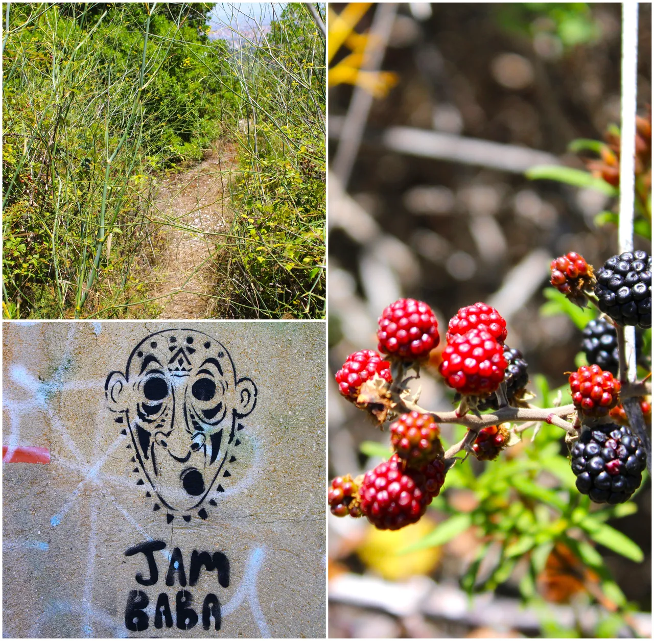
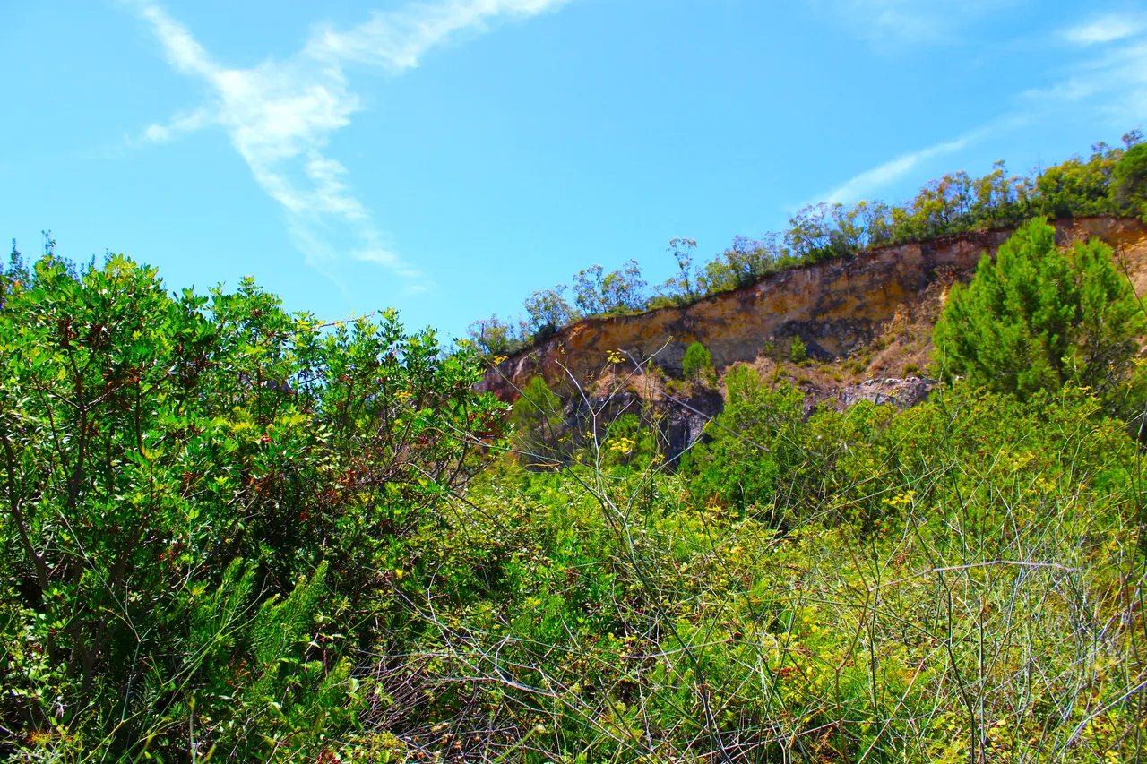
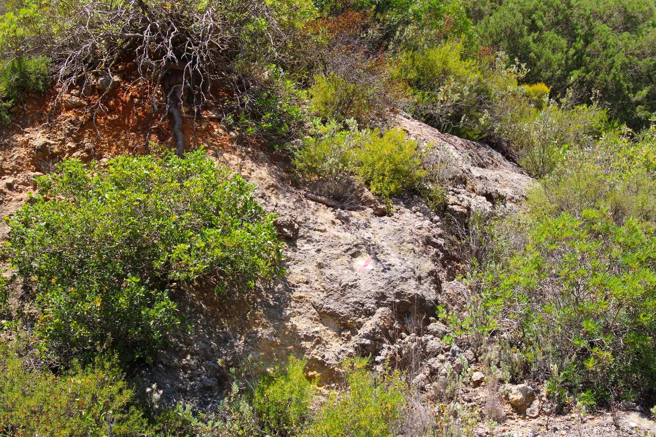
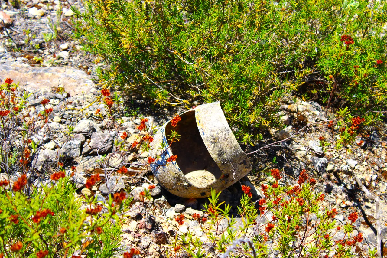
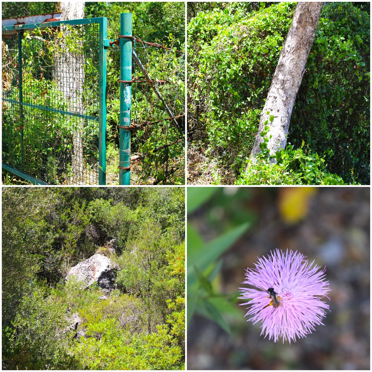
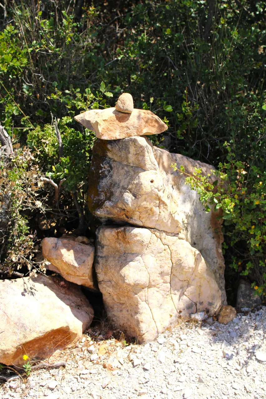
In each of my adventures I get interesting things and learn a lot, and well I always try to show you something incredible in the community! For example, these stones that you see here are unique on the planet since they are only found in the Sierra "Da Arrabida" and were highly sought after before the seventies to be used as decorative rock, today it is like a kind of "marble", and You can't extract more!🌍🚩📸
En cada una de mis aventuras me consigo cosas interesantes y aprendo mucho, y bueno siempre trato de mostrarles algo increible en la comunidad! por ejemplo estas piedras que ves aqui son unicas del planeta ya que solo se encuentran en la Sierra "Da arrabida" y era muy buscada antes de los setenta para usarse como roca decorativa, hoy en dia es como especie de "un marmol", y no se puede extraer mas!👨🏻🏫👨🏻🏫
https://pt.wikipedia.org/wiki/Brecha_da_Arr%C3%A1bida
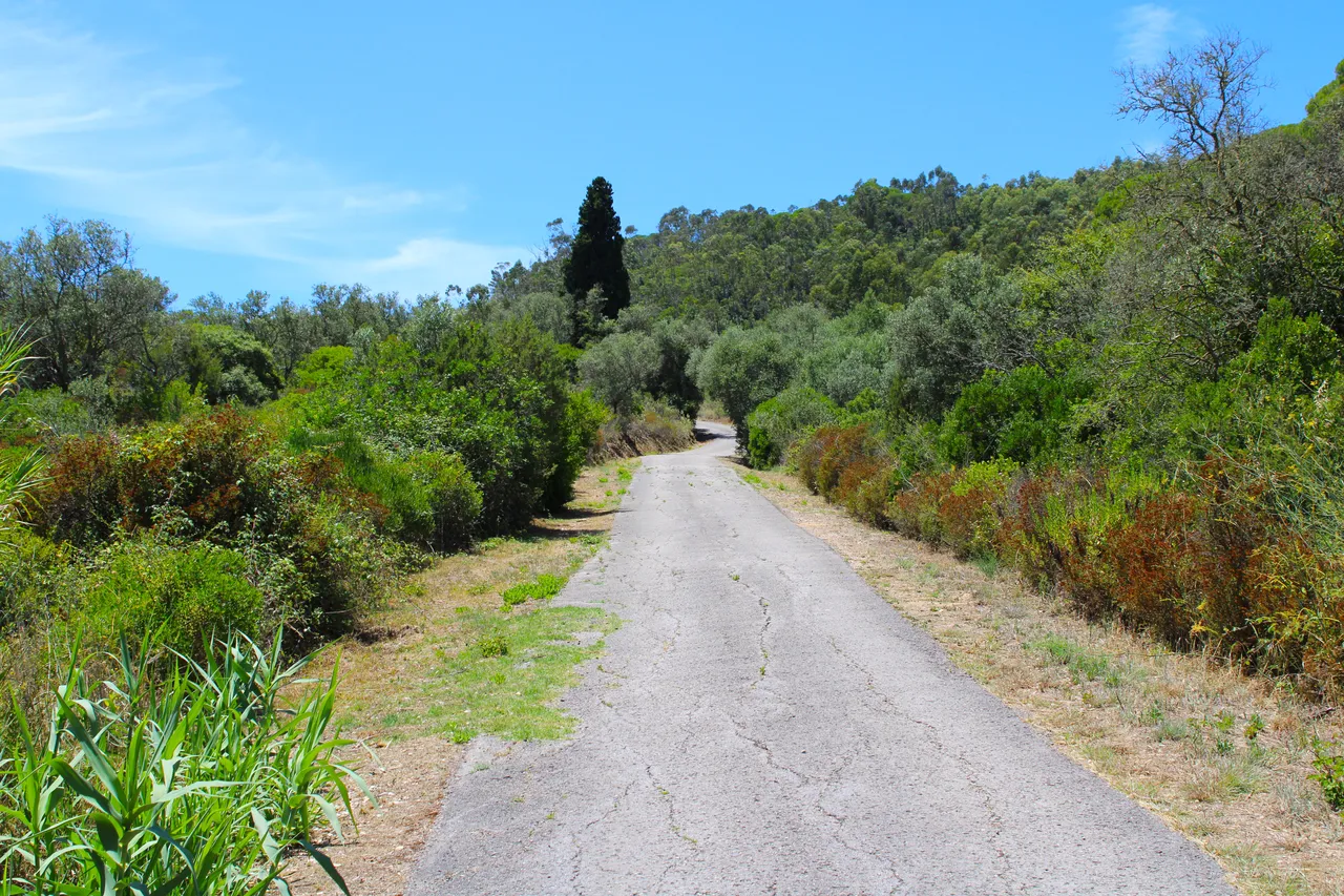
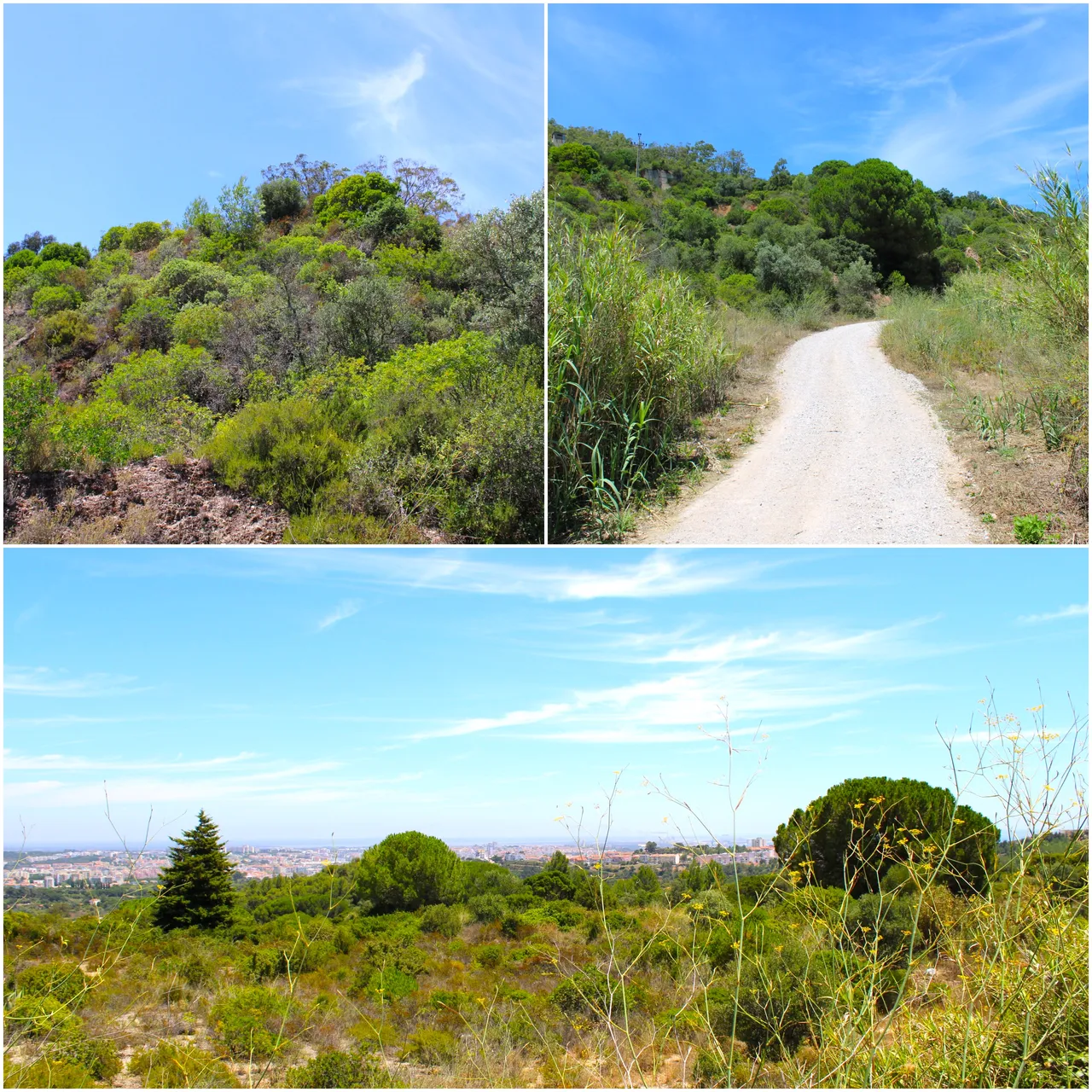
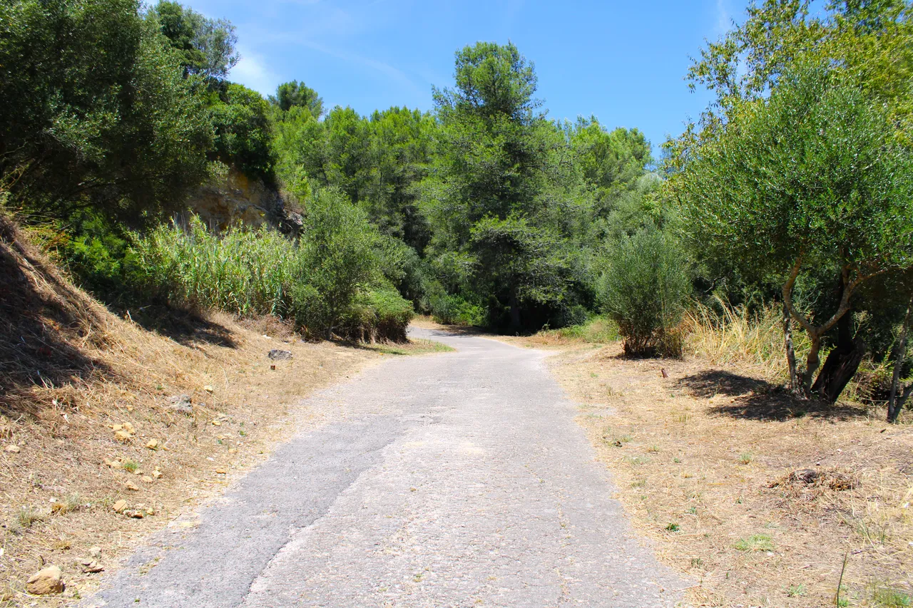
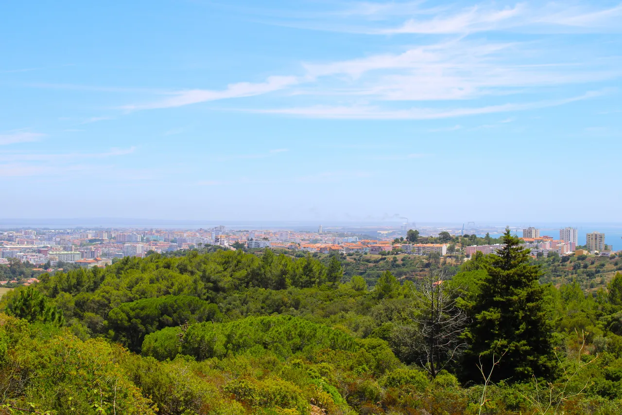
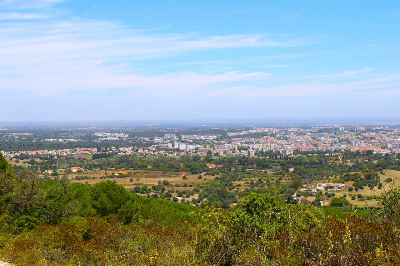
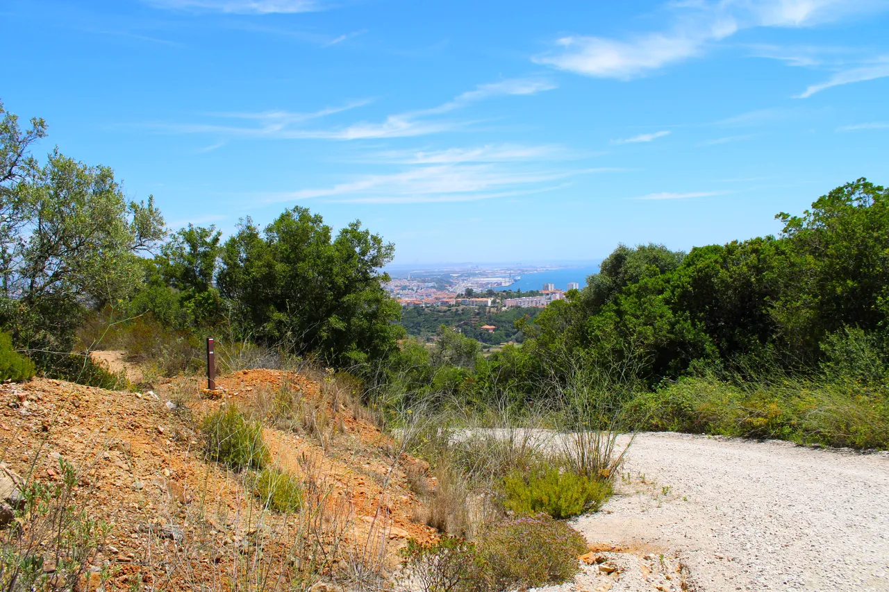
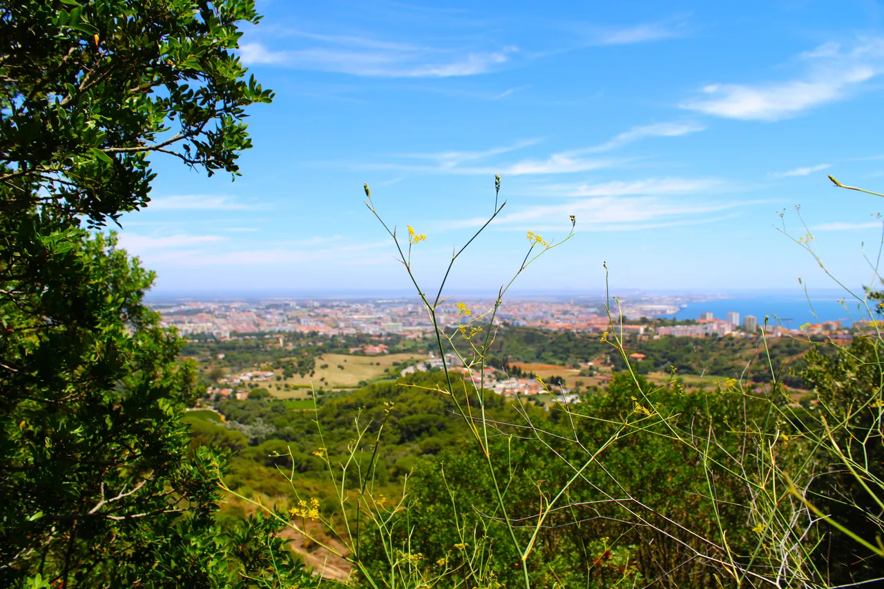
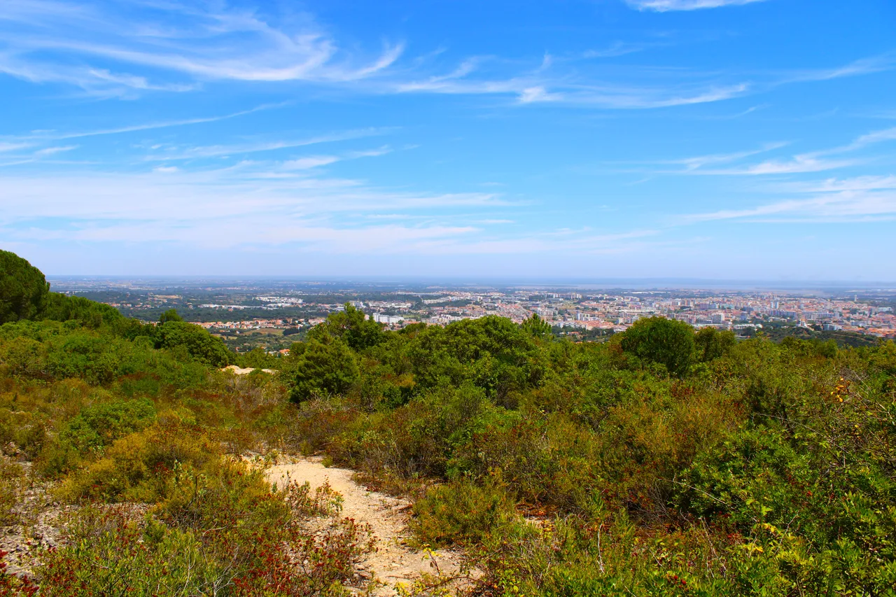
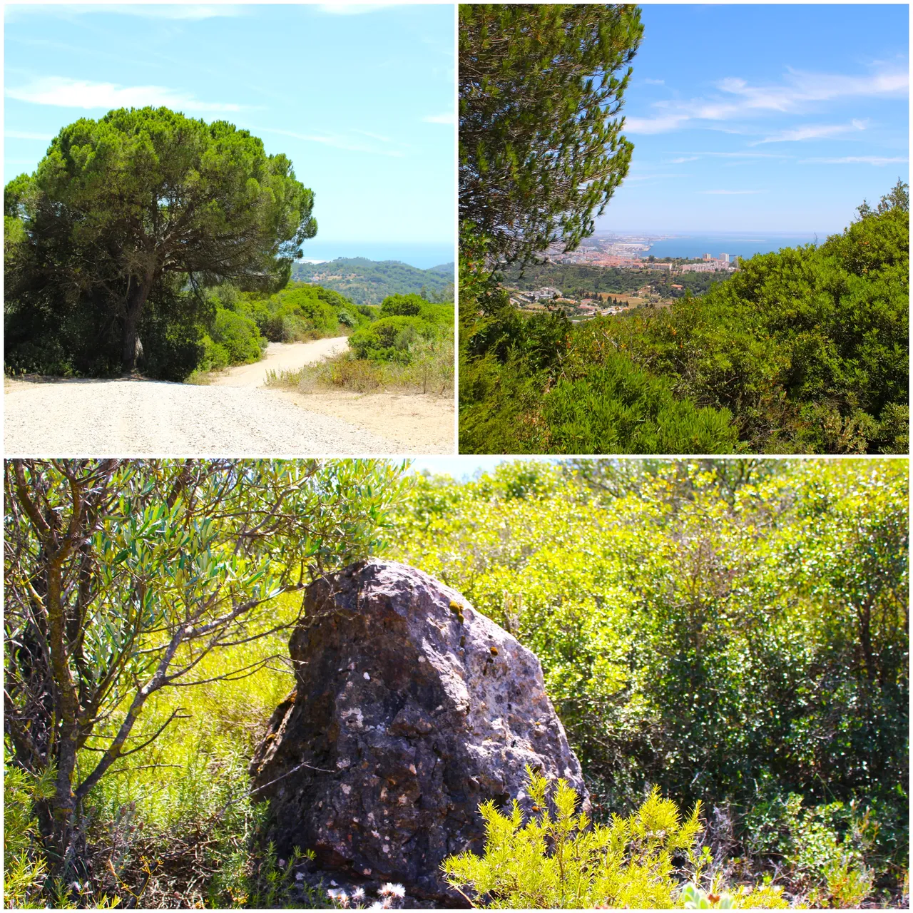
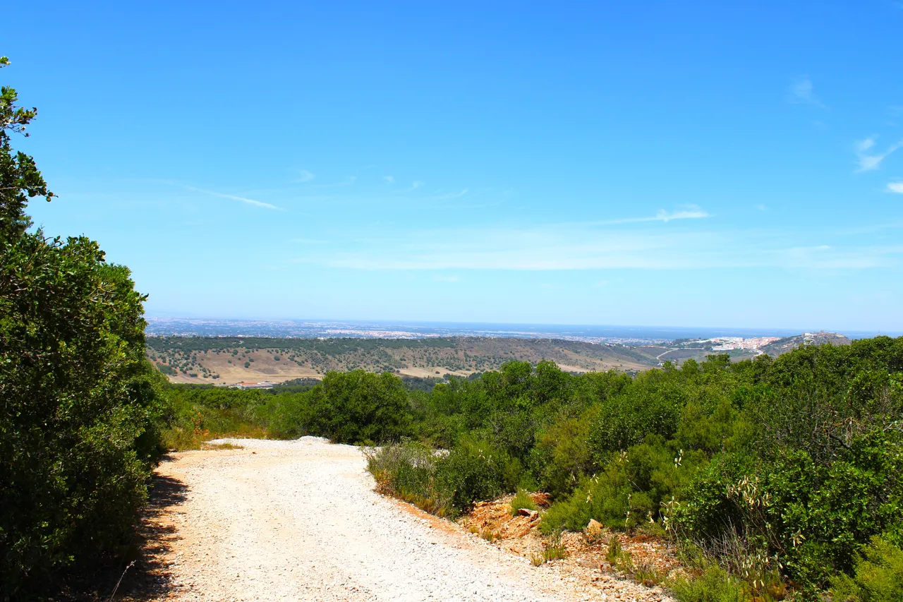
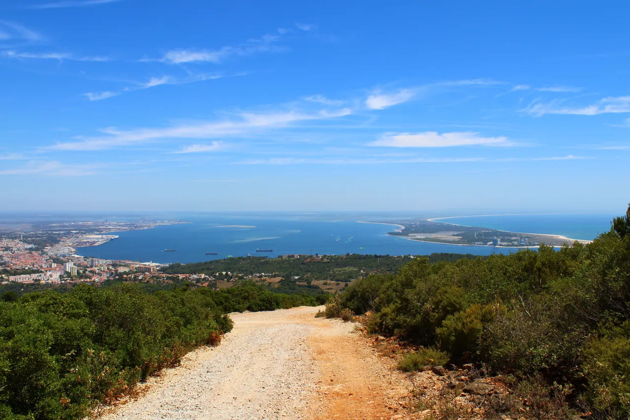
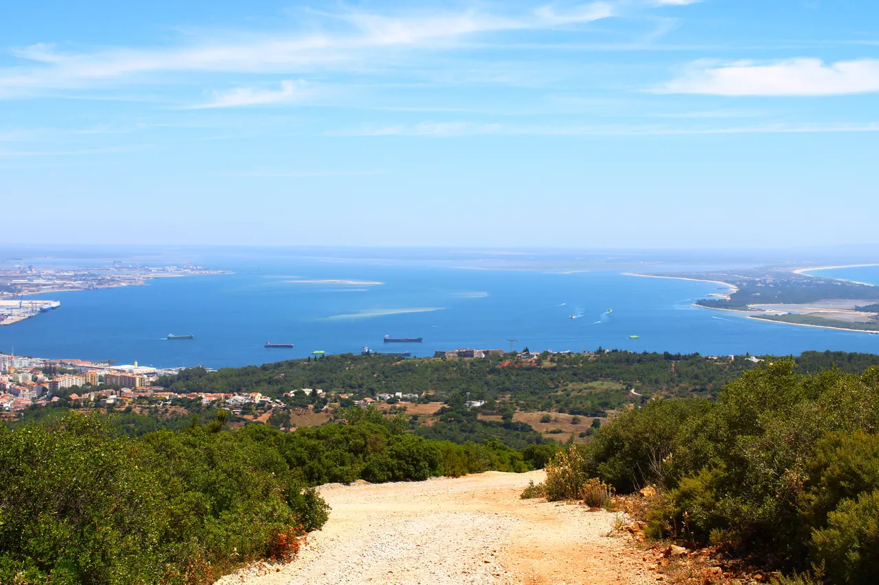
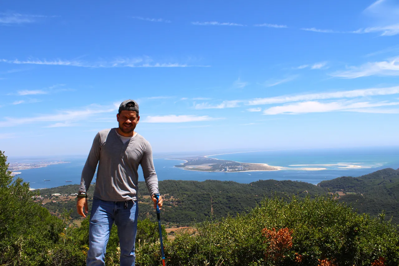
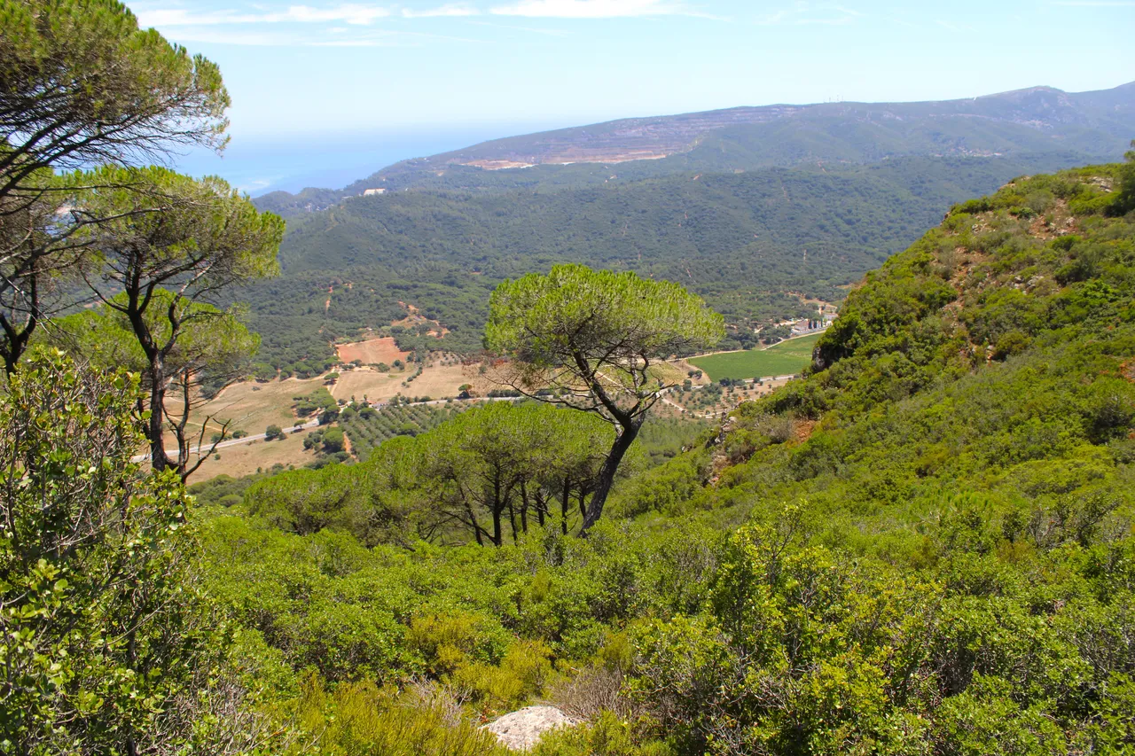
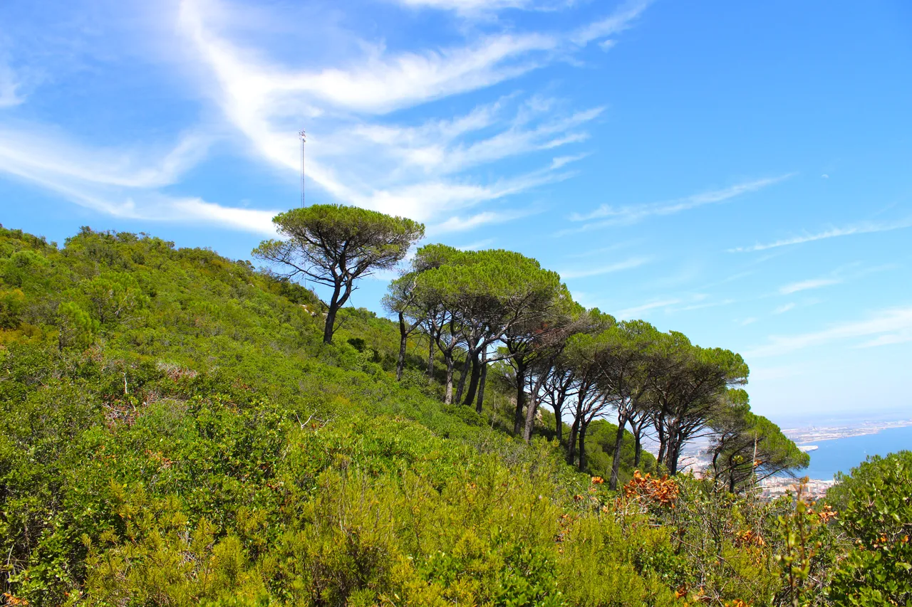
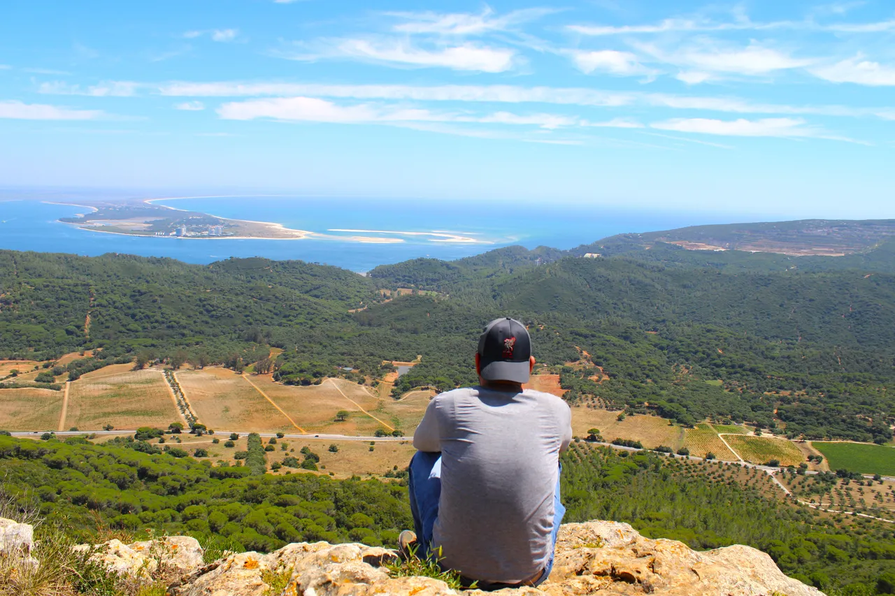
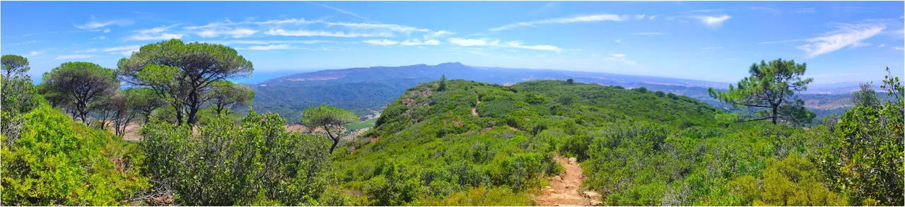
There comes a time when the road stops being asphalt and is just sand, and of course you cannot have asphalt in a natural protected area, as you can see as I go up the landscape becomes more and more beautiful and we can see much further away, On a day with clear skies you probably have here one of the most beautiful panoramic views of Portugal.🚩📸
Llega un momento donde el camino deja de ser asfalto y es solo arena, y claro no se puede tener asfalto en un espacio protegido natural, como puedes ver mientras voy subiendo el paisaje cada vez se hace mas bonito y conseguimos ver a mucha mas distancia, en un dia de cielo despejado probablemente tienes aqui una de las vistas panoramicas mas hermosas de Portugal.🗺️👨🏻🦯🧭
I read that in one of the quarries you can see an authentic dinosaur footprint! I don't know if it's marked but I'll try to show it to you! Obviously, being a protected area, nature cannot be altered much, so certain things are "word of mouth" and we have to learn to locate them! Since it's my first time here I'm a little disoriented about the interesting things! There is a viewpoint with a chapel nearby!🗺️🚩👨🏻🏫
Lei que en una de las canteras pueden ser visto una autentica huella de dinosaurio! no se si esta senalizada pero intentare mostrarsela a ustedes! obviamente al ser area protegida no se puede alterar mucho la naturaleza entonces ciertas cosas son "de boca en boca" y tenemos que aprender a localizar! como es mi primera vez aqui estoy un poco desorientado sobre las cosas interesantes! hay un mirador con una capilla cerca!🌎🏔️🌷
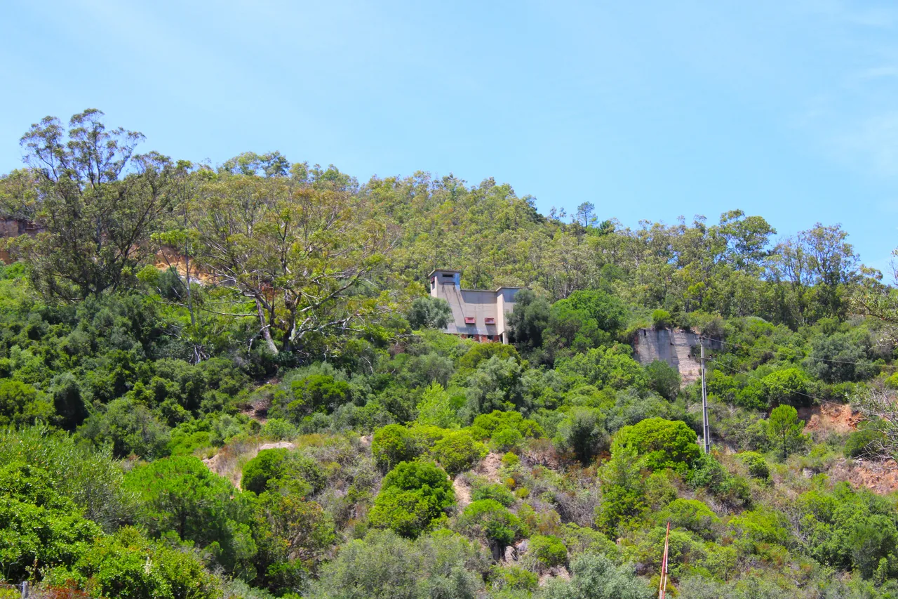
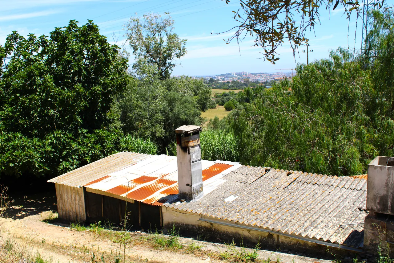
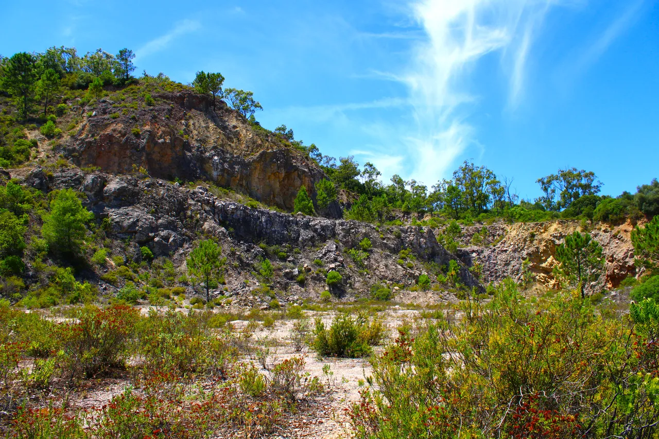
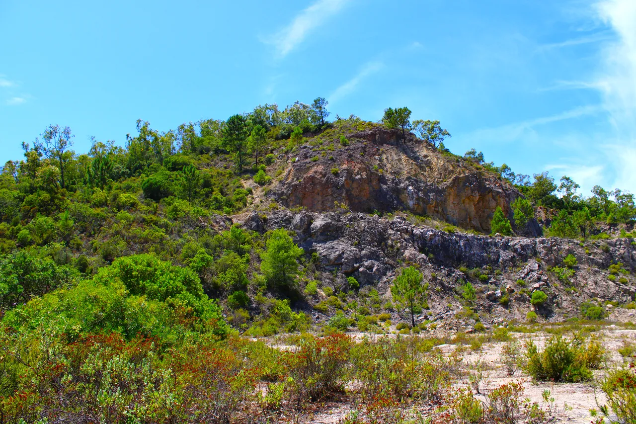
"S. Luis" quarry abandoned in the seventies, this is a reference that we have to indicate that we have already advanced 1km, even though we can enter I do not recommend it, a structure that is in poor condition may fall on you.🌎👨🏻🏫
Cantera "S. Luis" abandonada en los setenta, este es una referencia que tenemos para indicarnos que ya avanzamos 1km, apesar que podemos entrar no te recomiendo, puede caerte encima una estructura esta en malas condiciones.🚩🗺️
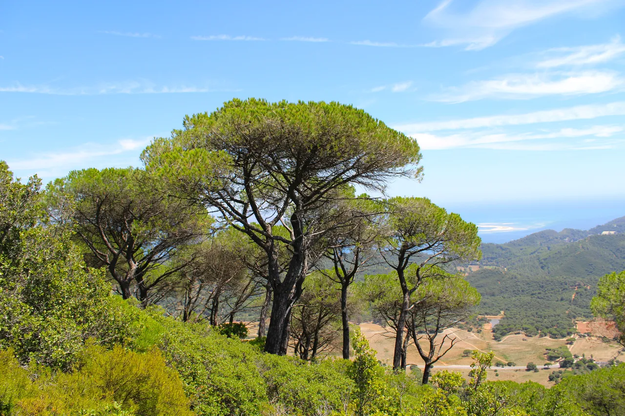
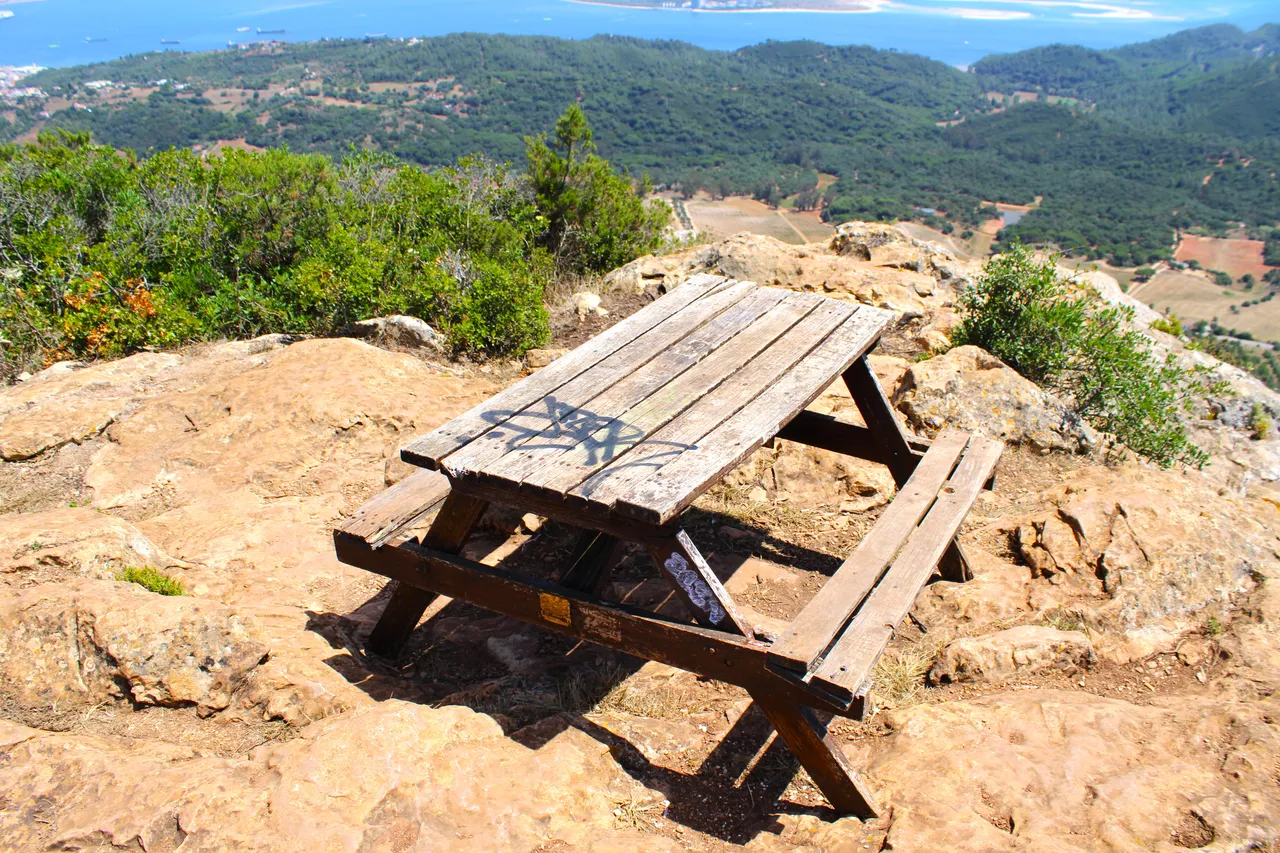
The most beautiful side of the mountain🧭🚩 /El lado mas bonito de la montana🗺️
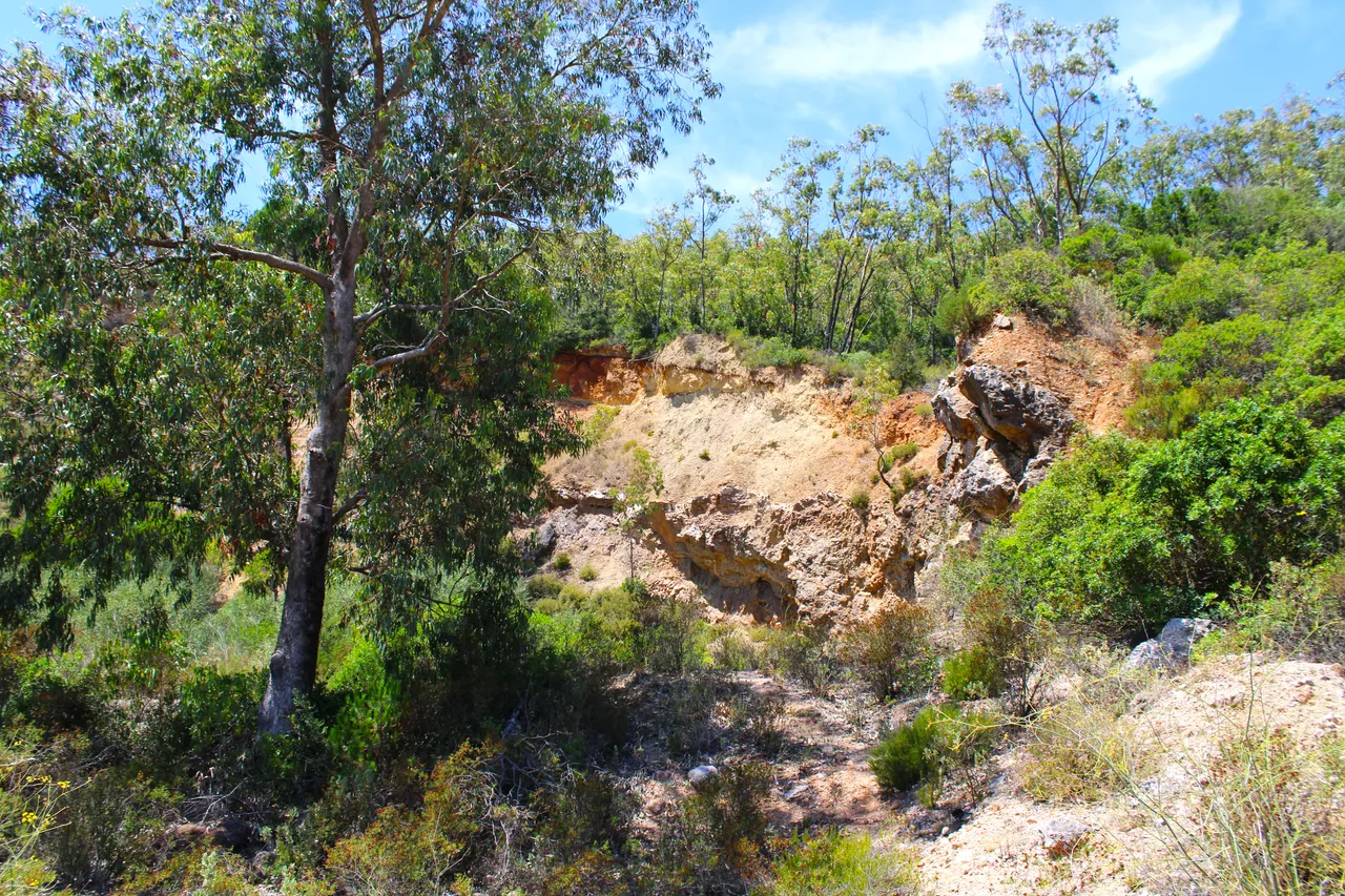
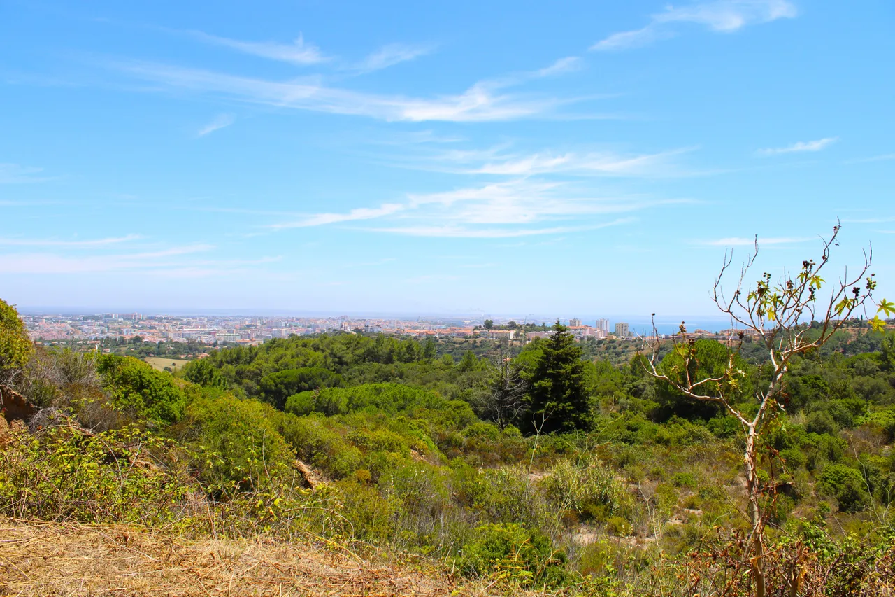
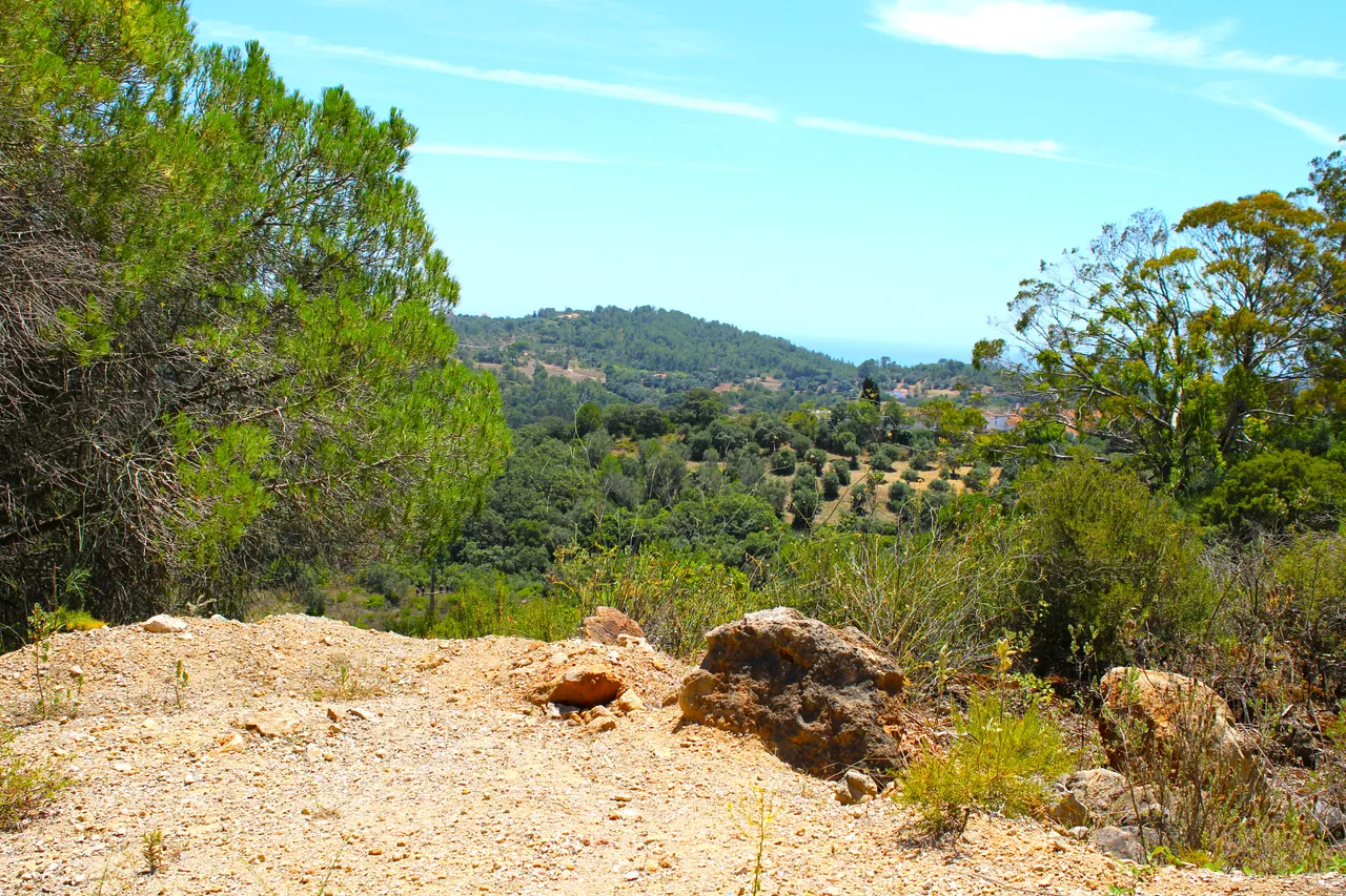
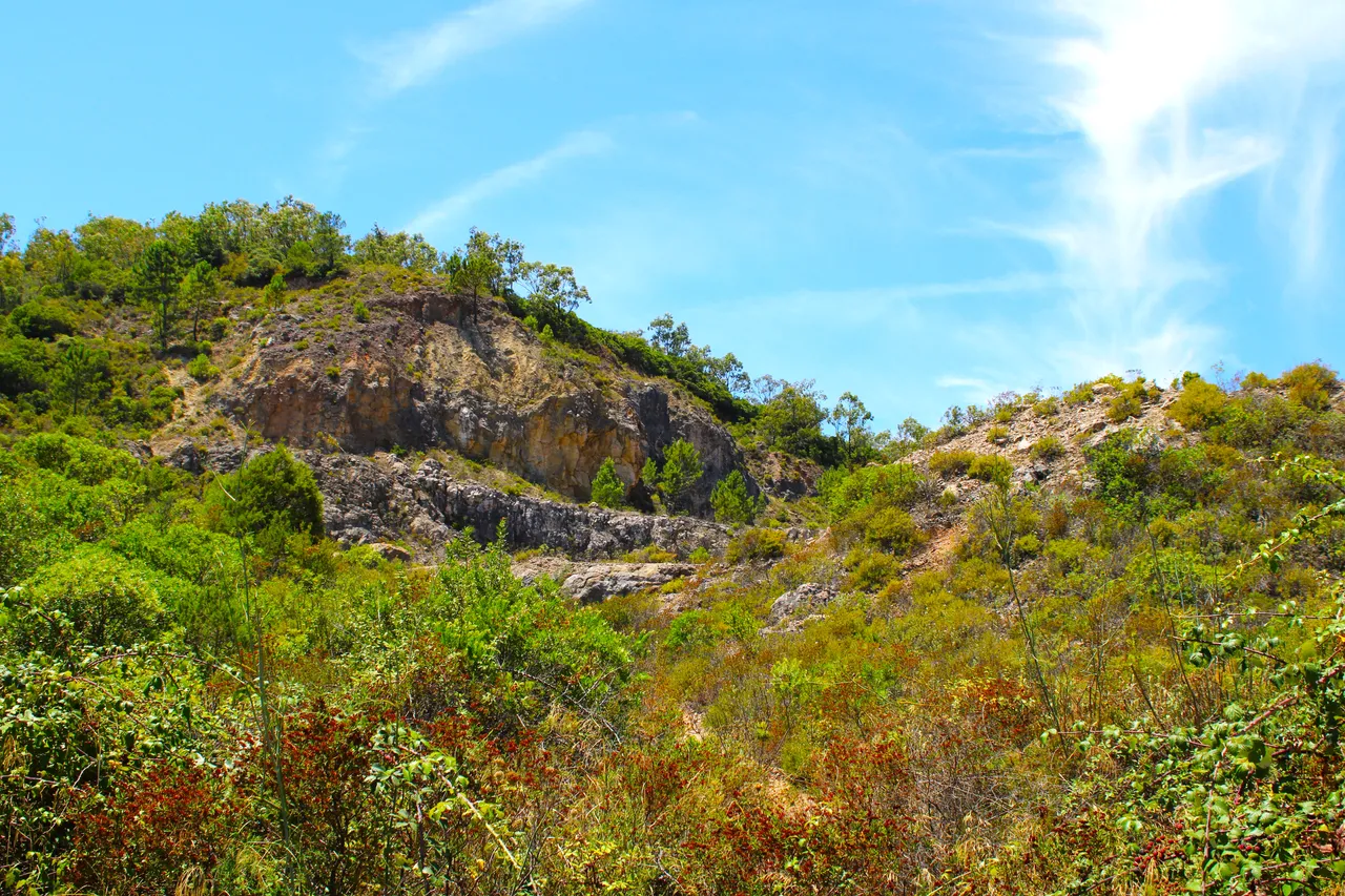
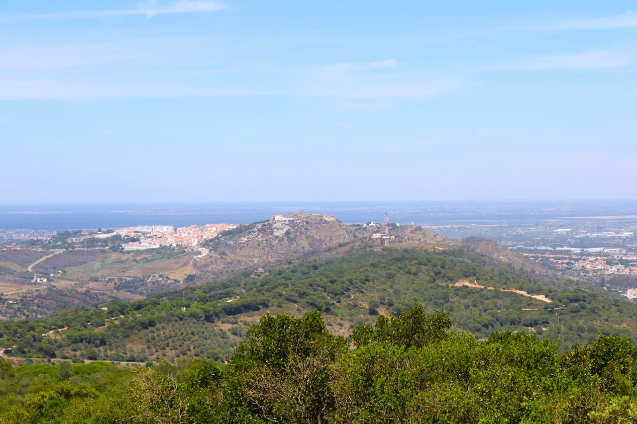
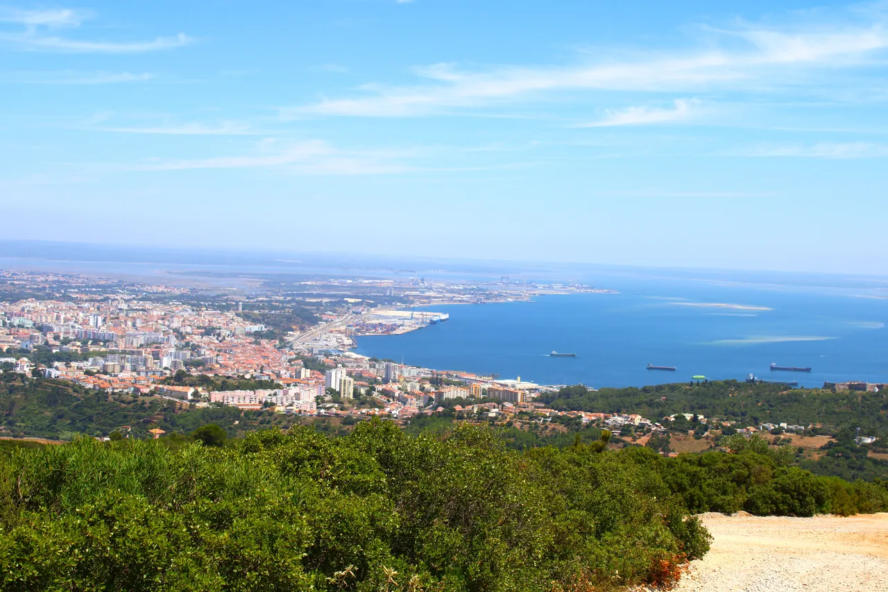
This scenario is like a demonstration of what awaits you as you go up, it is my favorite part because we can see the Sierra de "Gaiteros" from the highest point, how you can see the beautiful view of the city of Setubal and the Atlantic, in addition This was where the rock from Roman times was extracted.🌎🌷
Este escenario es como una demostracion a lo que te espera mientras vas subiendo, es mi parte favorita porque podemos ver la Sierra de "Gaiteros" desde el punto mas alto, como puedes ver la vista bonita de la ciudad de Setubal y el atlantico, ademas de aqui era donde se extraia la roca de los tiempos de los romanos.🏔️🧭
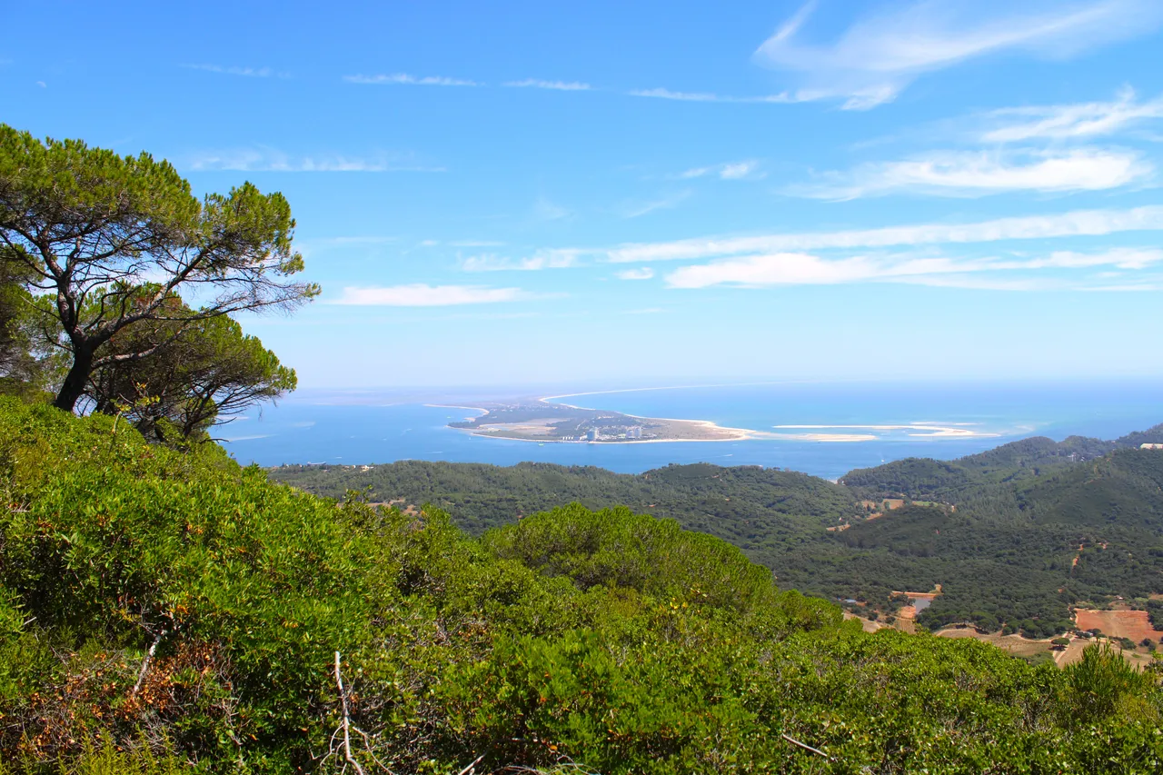
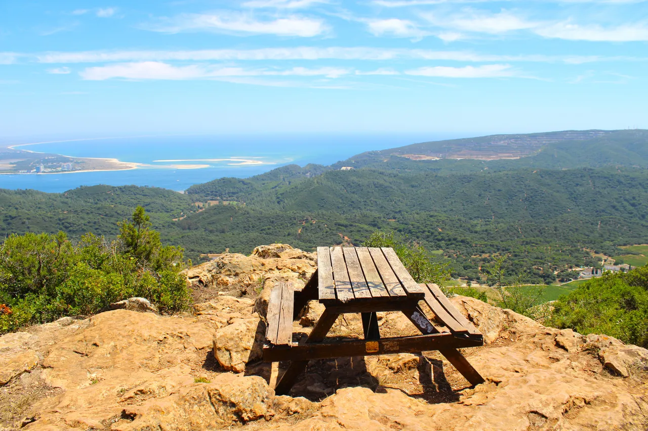
400 meters high🧭🚩 /400 metros de altura🗺️
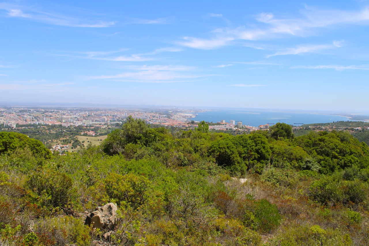
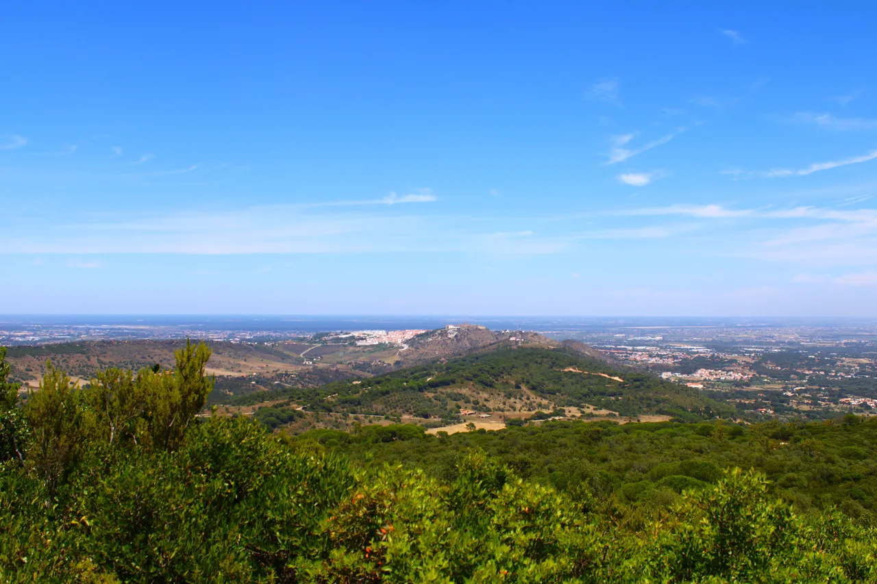
one of my favorite views today, all that is Palmela, which of course belongs to Setubal, do you remember the last castle? that city with walls from my previous post? From here you can see the castle!📸👨🏻🦯
una de mis vistas favoritas hoy, todo eso es Palmela, que claro pertenece a Setubal, recuerdas el castillo pasado? esa ciudad con murallas de mi post anterior? desde aqui se ve el castillo!🏔️🌍

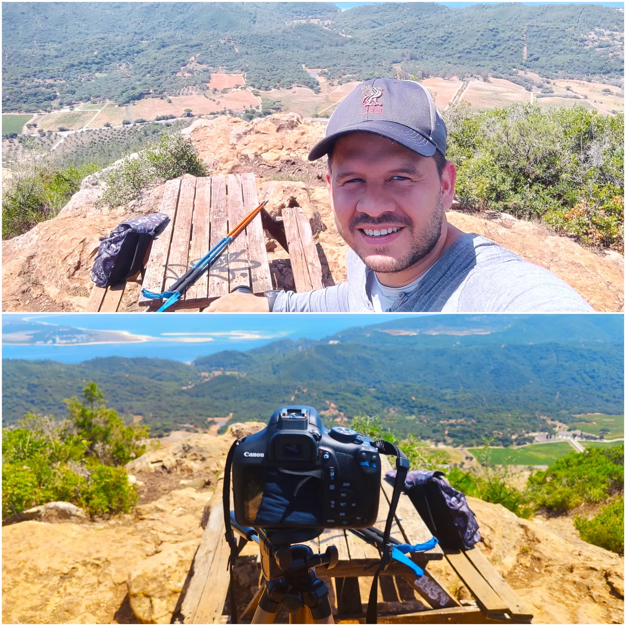
Arrival at the Viewpoint🧭🚩 /Llegada al Mirador🗺️
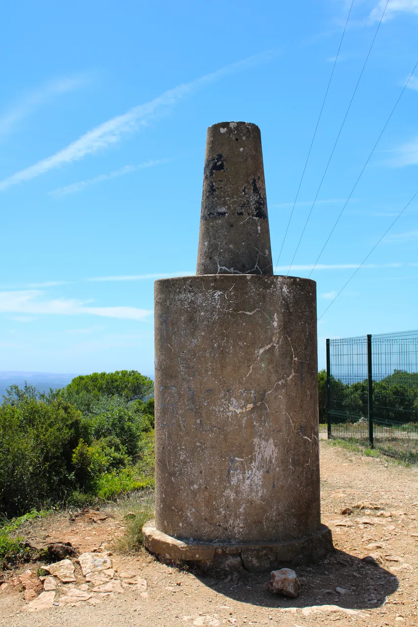
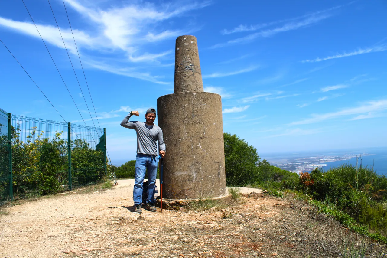
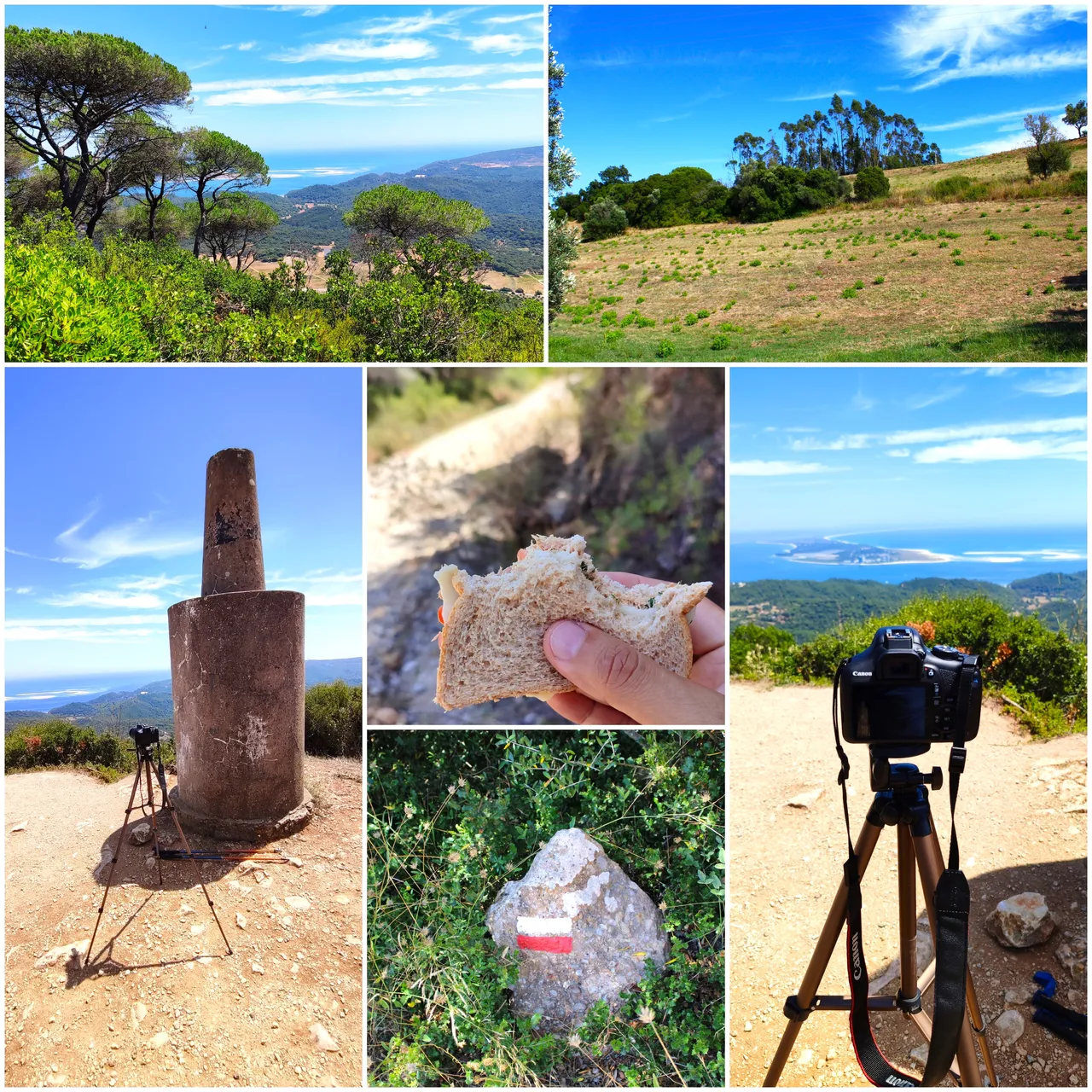
I arrived at the forest surveillance post, next to it is this stone that symbolizes the highest point of the "São Luis" mountain range, if you are lucky and do the walk in the afternoon you could come across some wild boar, sometimes they are seen here.📸🧭
Llegue al puesto de vigilancia forestal, al lado esta esta piedra que simboliza el punto mas alto de la sierra de "São Luis", si tienes suerte y haces la caminata en la tarde podrias toparte con algun jabali a veces son vistos por aqui.🌍🏔️
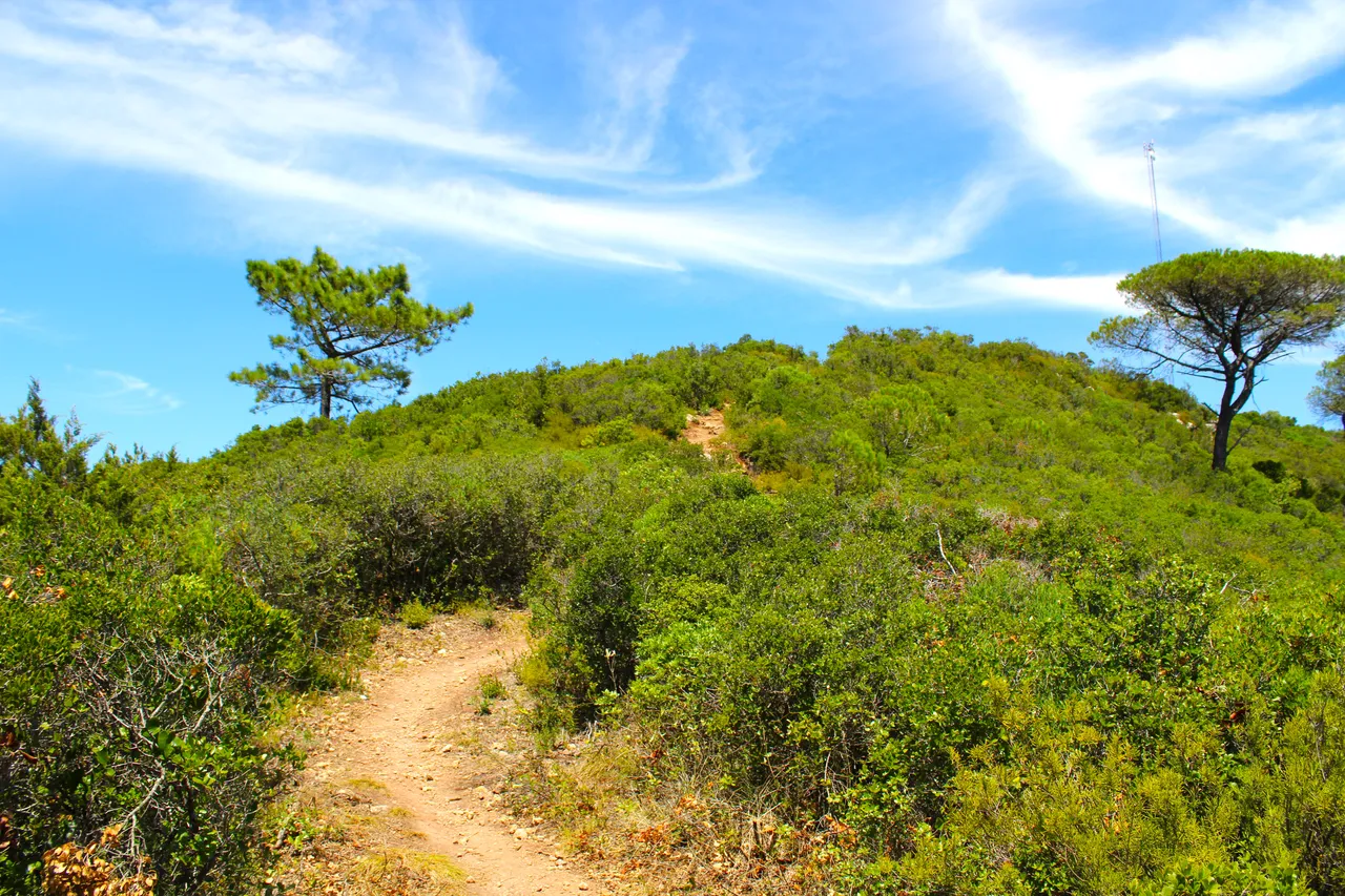
The best is yet to come...🧭🚩 /Lo mejor esta por venir...🗺️
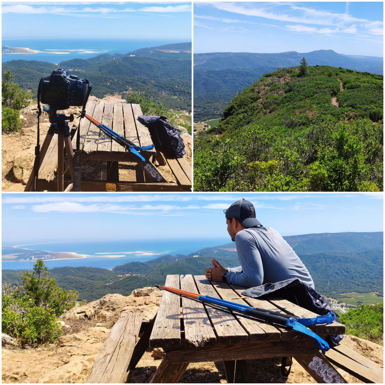
It was a hard but fantastic experience at the same time! Love the view when you reach the top of the mountain! They are one of those trails that you want to repeat.🧭🚩
Fue una experiencia dura pero fantastica a la vez! adore la vista cuando llegue al tope de la montana! son de aquellos senderos que quieres repetir.👨🏻🦯🌷

DNA is an organization to foster and DENSIFY NATURE-APPRECIATION which aims to establish REPORTS OF BIODIVERSITY DATA that is contributed by all of us Hiveans and subsequently cataloged.
Therefore DNA searches for HIGH-QUALITY posts that aim to DESCRIBE and determine the BIODIVERSITY AROUND YOU with added EXPLANATIONS and INFORMATION. For these informative posts they offer a CURATION SERVICE using the @dna.org account. It is also a CURATION TRAIL. Just add the #dna TAG if you think that any of your posts is what they are looking for.
THANKS FOR READING ME (PHOTOS AND VIDEOS OF MY PROPERTY) / GRACIAS POR LEERME FOTOS Y VIDEOS DE MI PROPIEDAD🙂🧠🦾👍