Howdy folks and greetings from the Great Plains of North Texas!
In yesterday's post about the disappearance of Emelia Earhart and her navigator in the South Pacific, we talked about the evidence that proved they crash landed on a small, uninhabited island.
Bones were found which matched her age, gender, height and weight as well as other items which added to the evidence of the island being the final destination for the pair.
Today's story
But today I wanted to explain what happened that they didn't make it to the intended target which was a little island called Howland Island. It was just a tiny speck, 2 miles long and a mile wide.
There was a ship waiting for them there named the Itasca which they were in radio contact with. It was a U.S Coast Guard Cutter which was there to signal her and guide her in.
Modifications may have done more harm than good
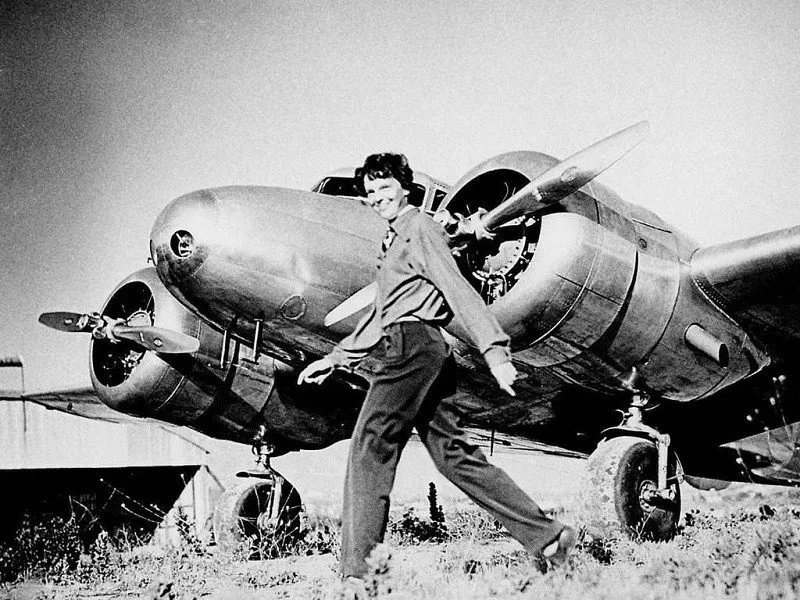
Emelia's aircraft, a Lockheed Electra 10E, had been customized for the flight including the antenna layout. This caused problems communicating with the Itasca.
Sometimes they could hear her but they couldn't respond, their frequencies were mismatched. Their last radio transmission from her was this: "We are running on line 157-337...We are running on line." source
This was normal and meant that they had taken the plane's line of position relative to the Sun's location as it rose.
Back in 1937 planes flying on long trips had to have a navigator on board to make sure they stayed on course using the constellations at night and the Sun primarily, and adjusting for wind speed and direction and the altitude of the craft, etc..it was very technical.
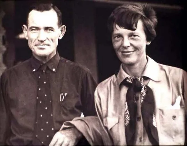
Emelia's navigator, Fred Noonan, was a top professional who was highly skilled and had tons of experience both in the air and on the ocean. He worked for and planned out the routes for Pan American Airlines.
This trip was tremendously important
To Emelia. She was fighting for women's rights and she knew that if something went wrong it would set back the movement and she'd be blamed since she was a woman.
She knew even the smallest mistake would be blown out of proportion so she planned her route with great care and tried to leave nothing to chance.
There's a great article here which goes into detail on precisely what happened to get them off course but suffice it to say that Fred made a mistake early on in their 2500 mile flight which compounded itself as the flight progressed.
Here's Fred and Emelia:
We know that because of the data that he radioed back to the island they were on when they started that last leg.
He calculated their altitude being wrong and it threw off all his calculations and by the time they got close to Howland Island they were 100 miles off course.
Another factor was that it was cloudy so he couldn't use the constellations to correct course.
When they took off the forecast was for clear weather or they may have postponed but can you imagine forecasting the weather without satellites?
Emelia would have had an alternate plan in case they couldn't find Howland Island.
When they thought they were arriving but couldn't see any island she headed to the Phoenix Islands but not knowing their own location and burning reserve fuel, she landed at the first land she saw which was Nikumaroro.
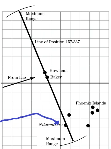
This map shows the situation well. The "From Lae" line is the planned path. The blue line is where they ended up:

So it was a combination of Fred's miscalculation, cloudy weather, and not being able to radio back and forth with the Itasca that doomed the flight.
That last message that the Itasca received was NOT the last message received from Emelia though. Incredibly, a 15 yr old girl in Florida received her last transmissions and I'll talk about that in the next post.
Thanks so much for reading folks, God bless you all!
-jonboy
Texas