Here are the final steps in mapping Kranisis which I needed for Ocean of Empathy which I managed to epublish yesterday. (Links are posted with daily chapters of Elect to Change.)
Today's steps are about adding the human-made features to the map - country boundaries, roads, cities and place names.
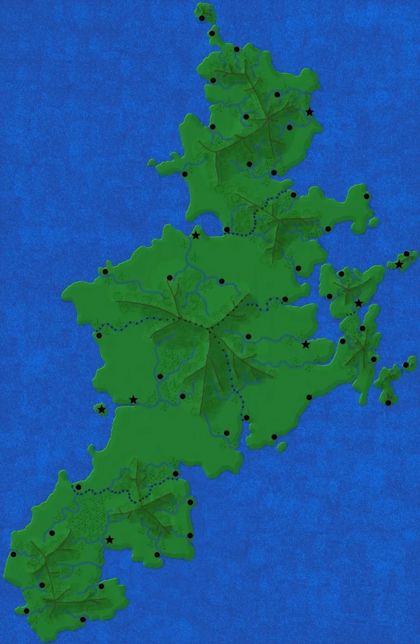
Step 10 - country boundaries and cities
I figured that this was the most important next step since where my capital cities go would depend on establishing the boundaries.
I chose to use rivers and mountain ridges to form many of my boundaries.
I created a new layer to place my country boundaries on - so that if another time period requires a different set of countries, it will be relatively easy to create a new map.
Next, I placed cities. I first chose the most prime spot I could figure for a capital city. In pre-technological times, that would most likely have been in a major port. So, my capital cities are on the coast, somewhat central to the country - a place that would have been a good defensive base. (A strong alternative would be across the river from a rival country.)
I also place cities at mouths of rivers, places where tributaries merge, other places that would be of commercial benefit to the country.
Again, I created a new layer to handle my cities - though technically speaking cities tend to stay in the same areas even if they change names a few times.
Here's my map now with country boundaries and cities marked.
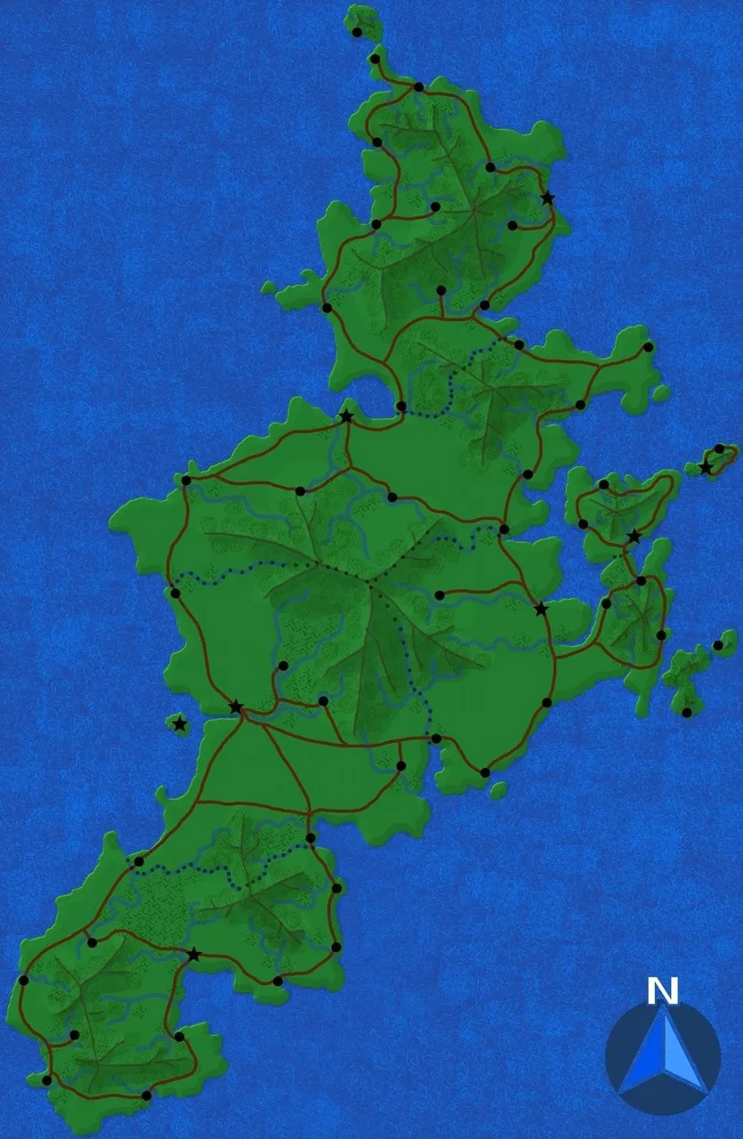
Step 11 - roads and my compass rose, if I'm using it.
For my roads, I created a new layer just below my layer for cities so that when I draw my roads on, they can go beneath the cities and not mess them up.
I start off connecting city dots. Think strategically - how would you want to go? Along the coast is an obvious choice, but people will also choose shorter routes whenever possible. Capital cities are better connected than other cities.
Don't forget that crossing country boundaries can be awkward, so a road on one side of the boundary is likely to be mirrored on the other side.
Some places are more remote if they're up a river valley from a larger city.
The compass rose was simply some freebie clipart found on Pixabay.
I pasted it as a layer first, then scaled it down, moved it to where I wanted it and fitted it to the layer ("layer to image size" when you right-click on layer name.)
When I want it again on another map, I come back, copy (control-C) the layer and paste it on my new map!
Here's the map after adding roads and the compass rose.
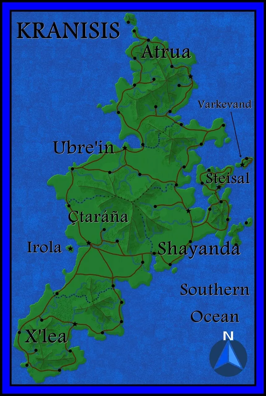
Step 12 - labels
I admit it - on this step I cheat because I hate the text tool on GIMP when compared with the simplicity of adding it on Photoscape. Unless I really need a weird angle, I run to Photoscape. (This is a FREE program, by the way and is my go-to for photo editing.)
So, I go to "file" and select "export as" and choose either a png (default) or a jpg file. This is a snapshot of whatever visible layers you have at the moment. So, "what you see is what you get."
After I put my labels on my map and give it a pretty border for use in my book, this is what it looks like:
Further steps
For this book, I actually need a blow-up of Varkevand which is very small in the map of Kranisis.
In order to do this, I started by making invisible all the layers except the land and water ones (my bottom two layers.)
I cropped the area around Varkevand, saved it as a new file and tripled its size so that I had enough to work with.
When I looked at my mountains on this little section, they were too fat and unwieldy. To fix this, I made a new layer above the old mountains and drew new, finer mountains over the existing ones - then hid the old layer.
I continued repeating every one of my layers with this refinement goal.
Because all the hard work had already been done and this piece of land was small, it took very little time to do the extra map.
Here is the result.
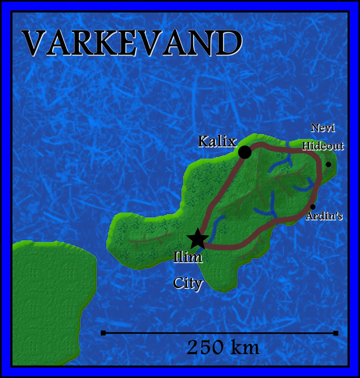
I did adjust the road a little in a couple of places to fit my geography better, but otherwise, it's the same. As this map is likely to always accompany a Kranisis map, I didn't feel the need to include the Compass Rose. However, I did put a scale to this map because it's one that I needed to figure out appropriate times of travel for Ocean of Empathy.
I hope you've enjoyed this series. I'll take you on my journey next time too as this seems to be a popular feature set. (And I have two more named continents to re-map... and feel that I will need a couple more before I'm done.)
Thanks for stopping by!

Lori – photographer at Viking Visual, author at A’mara books, student-of-the-world.
Banner by @shai-hulud