
It's been pretty awful for me and my hillwalking friends, having one of the longest, sunniest, driest spells since records began in Scotland, and not being able to enjoy it in our favourite place – the mountains.
But with the lockdown regulations having relaxed a bit recently, me and my friend Karen decided to go walking in our local hills, the Campsies, just north of Glasgow. The highest hill in the Campsies is 578m, just over half the height of a Munro.
We decided to climb Dumbreck, 508m high, because it's one of the less popular walks so we knew there would be few people there, if any. During our six-hour walk, we only passed one other person.

We started our walk at a lovely little hamlet called Clachan of Campsie. As we walked through the village, we came to a house called Faerie Knowe surrounded by little model faerie houses and toadstools. There was a brightly-painted gypsy caravan in the yard, and two black cats.
It was delightful, and seemed like an auspicious start to our walk.

Black cats and a bit of magic at the start of our walk.
There were lovely flowers along the lane.

As we walked higher, we got lovely views back to Cort-ma Law, another hill in the Campsies, a very popular one that we knew would be packed with visitors on a sunny Saturday.

Cort-ma Law in the distance.
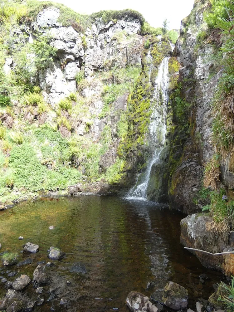
As we got to about 280m high, we passed a lovely waterfall. I climbed Dumbreck with Karen on March 22nd, the day before lockdown was imposed in the UK, as part of a huge 17km circuit. We'd just had a brief pause to look at the waterfall. This time, as we were planning a more leisurely walk, we stopped to investigate it.
It was so beautiful. If it had been a bit warmer, I might have been tempted to go in for a dip! Maybe another day.
Below: me looking at the waterfall. I was wearing a bumbag round my waist by the way! 😳😅

After the waterfall, the path climbs gently to 350m, before dipping down sharply to the river, the Finglen Burn, at 300m altitude. Having lost 50m, we then had to climb another 200m ascent up the very steep, grassy hillside to the summit of Dumbreck at 508m. It was a good workout for legs that haven't done much climbing over the past few weeks!
I recently took up running, and I think that helped a lot, as it has improved my aerobic fitness. Karen cycles every day, so she was also feeling quite fit.

The summit of Dumbreck up ahead.
The views at the top were fantastic, especially for people who have been missing the hills like mad. We were able to see many of our favourite mountains in the distance.

To the north east, Ben Vorlich and Stuc a'Chroin. Stuc a'Chroin is one of my favourite mountains, as it's very rocky and scrambly near the summit.

To the north west, the "Arrochar Alps", some of the most popular hills in the Southern Highlands.

A more close-up view of the Arrochar Alps. Left to right: Beinn an Lochain, The Cobbler, Ben Narnain and Beinn Ime.

The view south to Glasgow. The shadowy pointy peak on the horizon at the centre of the photo is Tinto hill in Ayrshire.

A highly-zoomed close-up of Goat Fell and Beinn Tarsuinn on the Isle of Arran.
After having lunch at the rather flat summit, we decided to walk back down a different way, avoiding the steep climb down the hillside and then back up to the path again. I had spotted a little dot on the 1:25000 Ordnance Survey map marked as the Clachachter Stone, lying just a short detour away from our path, and I was curious to see it. Why? Because I'm a very curious person. And I like things that link back to the distant past, even if their history is unknown.
A remnant of the ice age
I had seen a couple of photos of the Clachachter Stone, and it looked like an "erratic", a boulder that has been carried down the mountain by the gradual movement of a glacier. Eleven thousand years ago, Scotland was covered in ice, and there are many "erratics" on hillsides left from the period when the glaciers melted, some placed at very precarious angles.
I didn't have a printout of the OS 1:25000 map, as the libraries are closed and my printer is not good enough quality for maps, so I usually print them out in the library. I had a 1:50000 paper map with me, but it wasn't detailed enough to show these features. I had the 1:25K map downloaded to my phone, but the battery was almost flat (I had a charger with me, but it was also flat). So I studied the map on my phone carefully and tried to imprint it on my memory.
And then the charge ran out completely.
Luckily my map memory worked. As we walked down the hillside, I started moving out to the west, and then I spotted the Clachachter Stone in the distance.

First view of the Clachachter Stone.
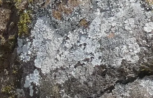
Map lichen
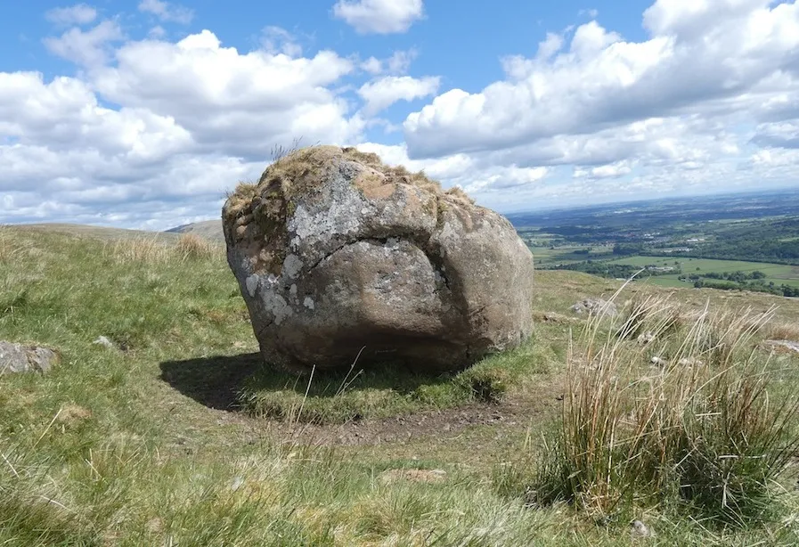
The Clachacter Stone, view to the east.
I know, it's just a rock! But I felt quite chuffed with myself for having found it, and as I approached it, I saw that it was a particularly lovely rock.
It was covered in "map lichen" (so-called because it looks like a map of the world). Map lichen grows in areas of low pollution, and it can be incredibly long-living.
The stone was lovely and warm to the touch. I wanted to sit on the top, but it wasn't as easy to climb up as it looked. Its east side had lots of ridges in it, but with my big hillwalking boots it was almost impossible to get a firm toehold.
Eventually I managed to hoist myself up, by using my knee in one of the ridges.
I don't think any lichen was harmed in the process.

It was mid-afternoon by this time, and really hot. We sat for a bit, enjoying the lovely view over the city.

View down to Dunglass, a little rocky mound, and beyond.
Then we started making our way back down the hill. We passed a ruined shieling with an old plough.

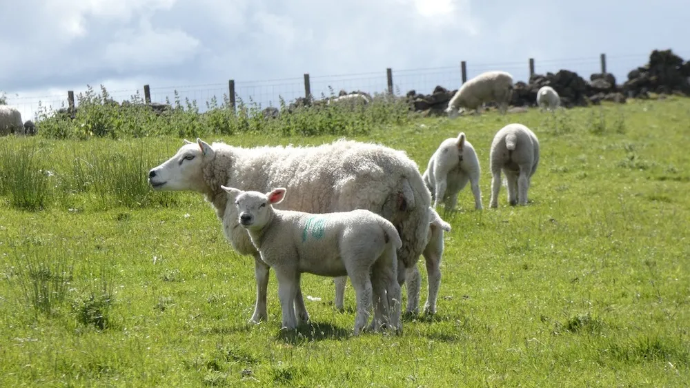
And some curious sheep.
As my phone battery had gone flat, and I only had a much less detailed paper map, I had to try and remember roughly where the bridge over the Finglen Burn was. I felt quite pleased with myself when I followed a very faint track down to where I thought the bridge might be... and there was a bridge!
It was quite a scary-looking one though. "I'm not crossing that!" said Karen.

The scary bridge, taken after we'd reached the other side.
In hindsight, I think there was probably a much better bridge a few hundred metres downstream, which would probably have led to a solid walking track.
Anyway, we put our fears aside, and walked across. It wasn't as bad as it looked, and there were big concrete supports underneath.
The real fun starts
Then the real fun began, as there was a steep embankment on the other side, with no obvious path, and lots of thistles and nettles to wade through.
When we got to the top, all we could see was dense undergrowth, although we knew the houses we'd passed on the way out were very close, along with the main track.
There was a pine forest straight ahead, with thick undergrowth full of thistles and nettles on either side of it. We both had different opinions on which way might lead to the main track. Karen said right and I said left. Right did seem more obvious, but the undergrowth to the left looked a little bit flatter and I thought it might lead to a path.
I was wrong.
Karen followed me as I waded through the stinging nettles. I was wearing long trousers, but they were made from a very thin material, and the nettles stung my legs through the trousers. The further we walked, the more forest appeared. Soon we were surrounded by forest on three sides.
"I think we should go back" I said. "I was wrong to go this way."
Neither of us fancied wading back through the thistles and nettles though. Karen was certain that we could get through the forest. I was sceptical.
We ended up crawling commando-like on our hands and knees under densely-packed pine trees. At times it felt like were swimming in pine needles.

Me crawling under a pine tree.
After what seemed like an awful long time, we emerged into a clearing. I spotted an opening through the trees. I ran for it... and found myself basically where we'd started from, looking down towards the scary bridge.
This time, I headed in the other direction. It wasn't long before the houses came into view again. We had a small but tricky burn to cross, and then we were on the solid track again! What a relief!
We had to stop and shake out all the pine needles from our clothes. Well, almost all of them.
Cake at last!
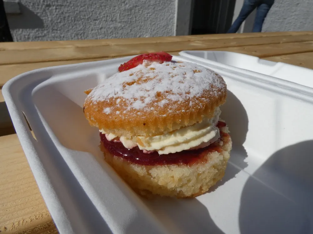
We made it back to the village café just in time. Cafés are only allowed to offer takeaways just now, and I spotted an enormous Victoria Sponge bun. I haven't been eating cakes recently, but this one was crying out to be eaten. And after all our adventures, I felt I deserved it.
It was delicious.

Me eating the enormous Victoria Sponge Bun, and looking as if I'd been dragged through a hedge backwards. Which of course, I had been.
Posted from my blog with SteemPress : http://ramblingandscrambling.co.uk/hive/a-prickly-adventure-in-the-campsies/